
High pressure will remain in control of our weather pattern through the early portions of the new week. This will supply continued dry conditions, along with plentiful sunshine. Humidity values will remain comfortable as we open the work week before turning increasingly muggy as midweek nears.
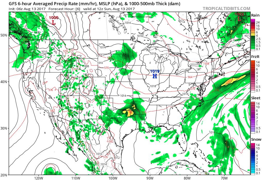
High pressure will keep us dry through early week.
As high pressure moves off to the east, a southwesterly air flow will help moisture return to the state by mid and late week. As a cold front enters the picture, overall coverage of showers and thunderstorms will increase and become scattered to numerous. We’re not expecting any sort of all-day rains, but chances of getting wet from time to time will go up Wednesday through Friday.
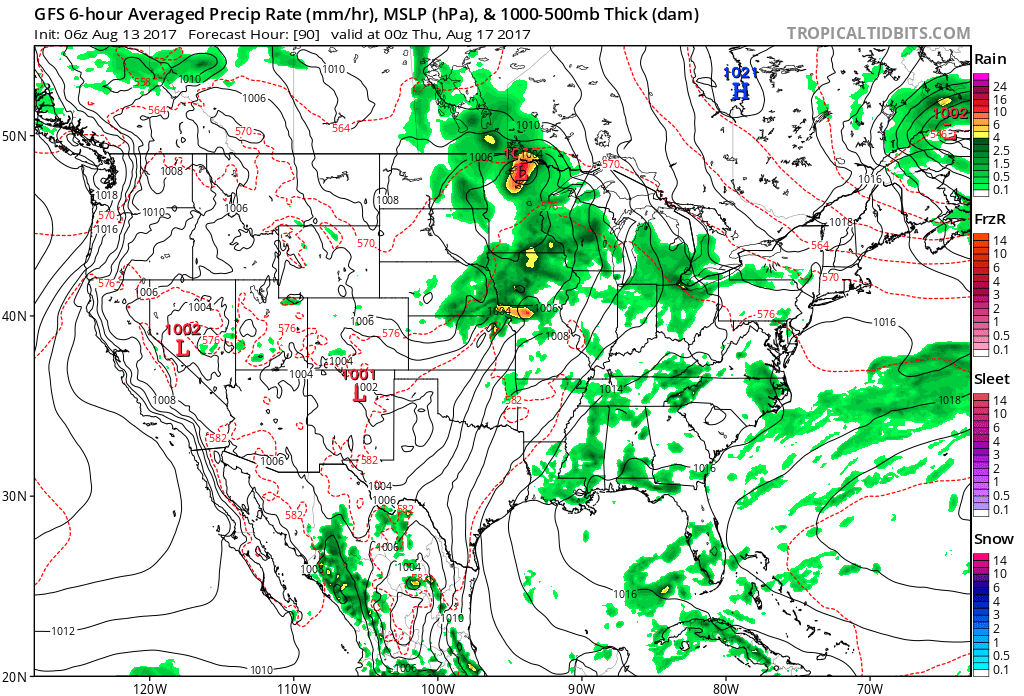
Thunderstorm coverage increases mid and late week.
Rainfall totals should fall in the 0.50″ to 1.00″ range for most, but there will be a few folks who pick up locally heavier amounts the second half of the week.
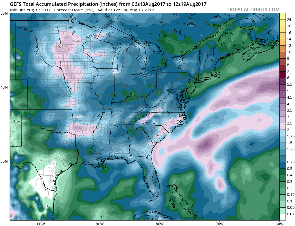 As of now, we think the cold front will pass Friday evening and set-up another pleasant weekend with seasonable temperatures. The stretch of gorgeous August weekends’ appears to roll along.
What else we’re working on: With us about to flip the page to the second half of August, thoughts continue to shift to the upcoming meteorological fall and winter seasons ahead. Early data paints an “intriguing” look, complete with high latitude blocking and neutral ENSO look. Winter enthusiasts should like the look overall as this will have an impact on the prospects of cold getting going earlier than recent years past. Much more on fall and winter in the weeks ahead… The other big item of interest has to do with the tropics. A new disturbance will traverse the MDR (Main Development Region) this week and given the overall upper level pattern over the CONUS, we’ll have to keep an eye on the East Coast Weeks 2-3.
 Week 2:
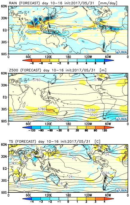 Weeks 3-4
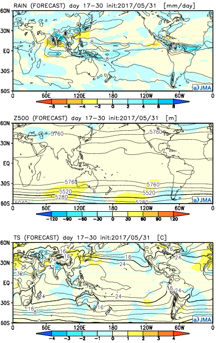
 Week 2:
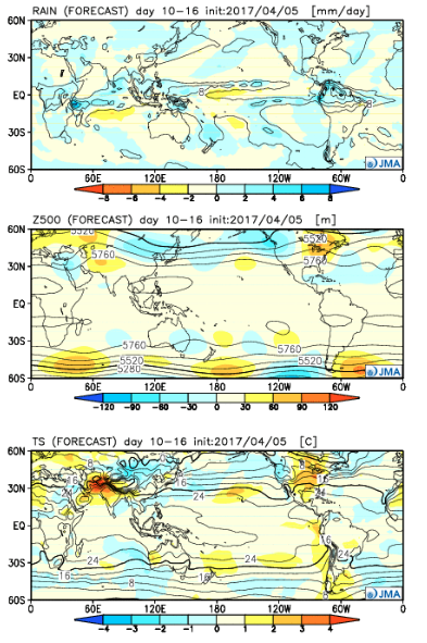 Weeks 3-4:
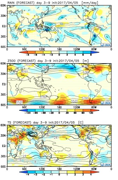
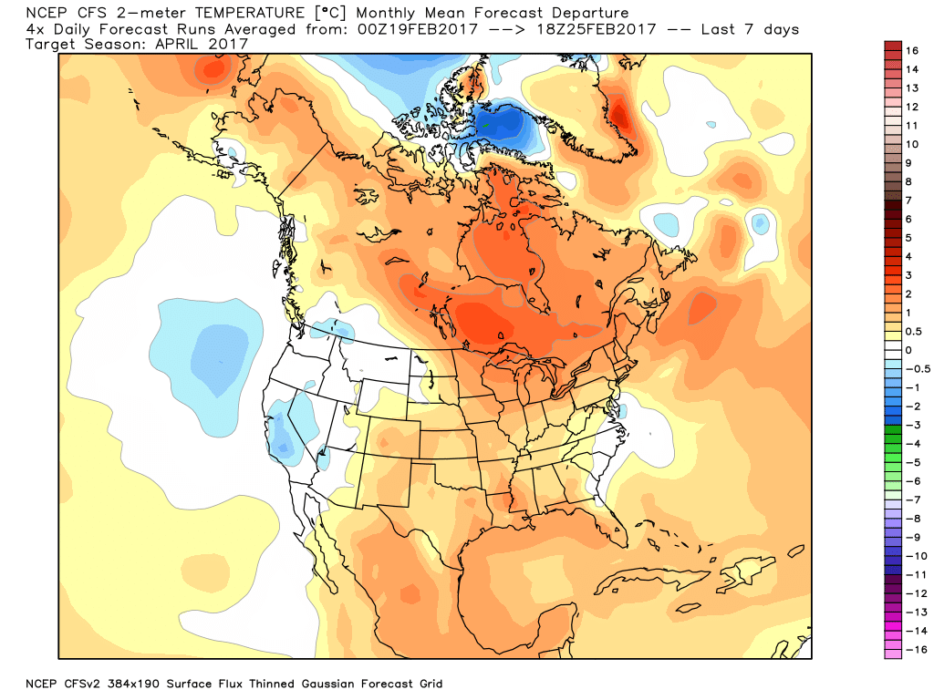
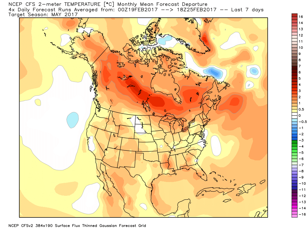
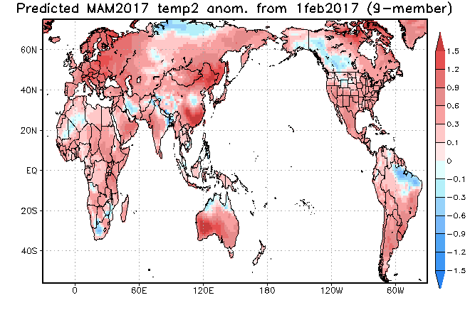
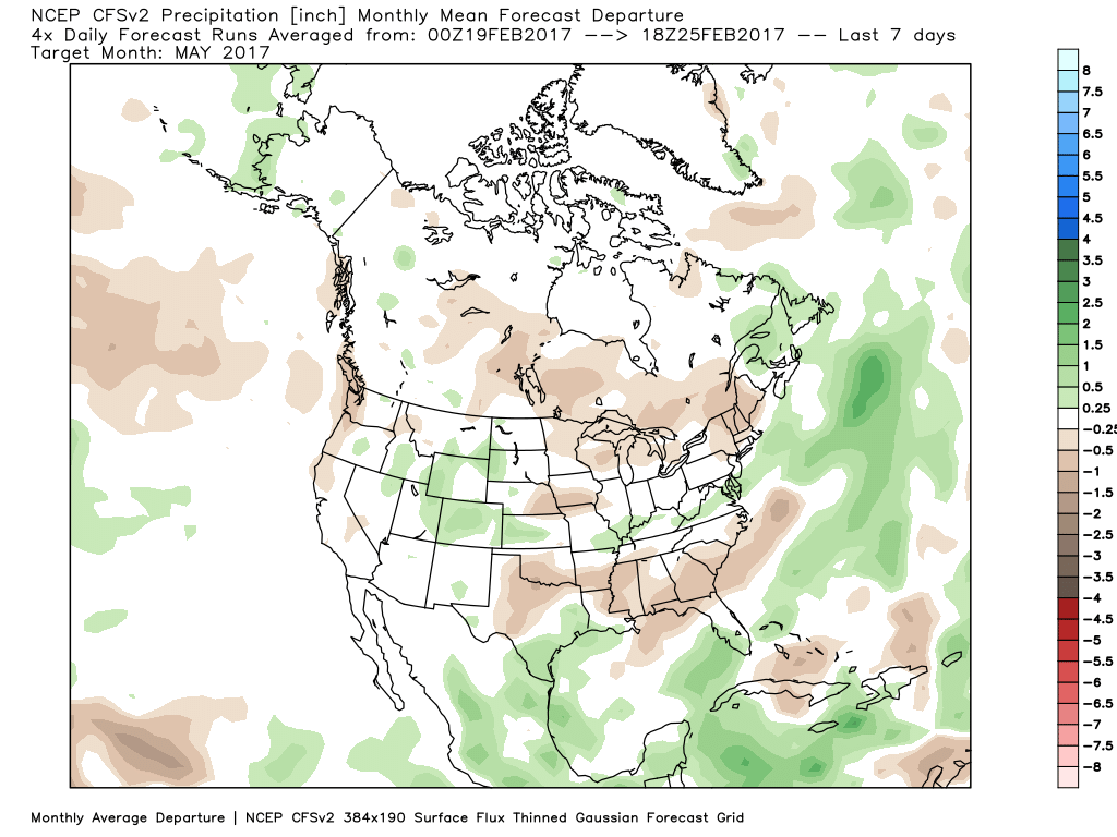
 The big picture is one that shows a drier pattern developing across the East during Week 1, but we caution that this drier regime doesn’t look to “lock” in. Data suggests we get back to an active pattern between Week’s 2-4, biased wetter than normal in the Mid West and Plains. The other screaming message is that a busy severe season should continue through the period. Cold sets up across the Pacific Northwest, associated with the “mean” trough position, while spring-like warmth continues to build across our region in overall terms. We know what that means as storms eject off the Rockies and track east…
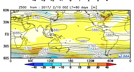


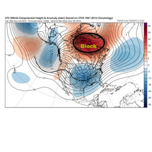
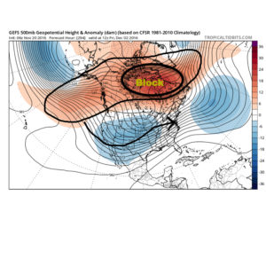
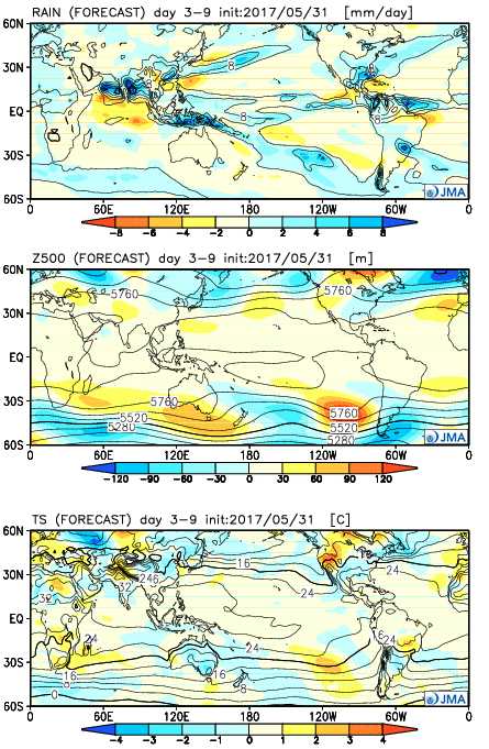
 The Weeklies also show this pattern in the longer-term. While we can’t show the European data here (due to licensing), we can show the JMAs. Again, note the high-latitude blocking.
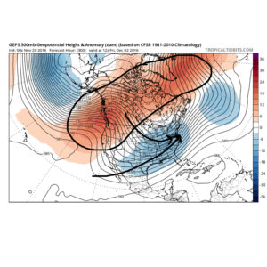
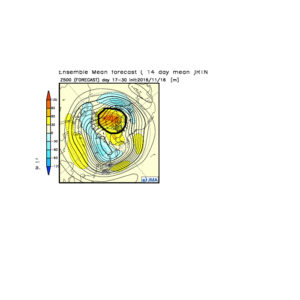 Active times are ahead as a busy storm track develops. Perhaps the scene for many will look a little something like this as we push into the Christmas season…
 In the meantime, gas up the snow blower and sharpen the snow shovel. If our idea is correct, a snowier than average December will come out of this blocky pattern.