Category: Labor Day Weekend

Strong Cold Front Delivers Storms And Another Surge Of October-Like Air…

Today will be dry and pleasant and most of Labor Day, itself, will follow suit.  We’ll notice an increasingly gusty southwest wind by afternoon and this will help boost temperatures into the upper 80s Monday afternoon.

However, once to Labor Day evening, attention will shift off to our north as a line of thunderstorms approaches.  A few embedded storms within this line may reach strong-to-severe levels.  Damaging straight line winds are of greatest concern with the stronger storms.  The Storm Prediction Center has included the region in a Slight Risk of severe weather Monday evening.

After a mostly dry and warm Labor Day, we’ll focus on the evening hours (bracketing 6p-10p) for storms to rumble in.  As mentioned, a couple of these could reach strong to severe levels.

6p forecast radar

8p forecast radar

9p forecast radar

10p forecast radar

Once the front blows through, our winds will shift to the northwest and help usher in a much cooler air mass.  Average highs in the upper 60s and lows in the upper 40s don’t occur until early-October.  We’ll be around 30 days ahead of schedule throughout the majority of the upcoming week, as overnight lows in the upper 40s to around 50 and highs in the upper 60s to around 70 will be common.


Permanent link to this article: https://indywx.com/2017/09/03/strong-cold-front-delivers-storms-and-another-surge-of-october-like-air/

Pleasant Labor Day Weekend; Another Cool Shot Next Week…

Highlights:

  • Dry Labor Day weekend
  • Cold front arrives early Tuesday
  • Another cool shot next week

Improving Skies West To East Today…The remnants of Harvey led to heavy, wind-whipped, rain across southern and southeastern portions of the state Friday.  Appropriately, today is the “transition day” towards brighter and briefly warmer times as Labor Day approaches.  We’ll notice improving sky conditions from west to east today as the remnants of Harvey continue to track east.  Today also won’t be nearly as windy as Friday.  We awoke to temperatures at mid-October levels, including many in the 40s across central Indiana this morning.  Despite the increasing sunshine, temperatures will run around 10° below average this afternoon.

A cold front will approach late Labor Day night and early Tuesday.  Sunshine will dominate Monday, but we will note an increasingly gusty SW breeze by afternoon as the cold front draws closer.  That front will slide through Tuesday and could have a scattered shower or thunderstorm with it as it passes (best chances of storms will be across the southern half of the state).  Behind the frontal boundary, another shot of well below normal air (October-like) will descend into the region.  With cold air aloft and just enough upper level energy around, widely scattered showers are possible during the afternoon hours Wednesday and Thursday.

Tropics:  Irma will dominate weather headlines during the upcoming week.  It’s far too early to know precisely where Irma will track, but folks with interests along the East Coast (from the southern FL peninsula all the way up to the north Atlantic coast) should monitor the progress of Irma closely.  In addition to the likelihood of a major hurricane, the overall size of Irma will become larger as the week progresses.

Upcoming 7-Day Precipitation Forecast:

  • Snowfall: 0.00″
  • Rainfall:  0.10″ – 0.25″

Permanent link to this article: https://indywx.com/2017/09/02/pleasant-labor-day-weekend-another-cool-shot-next-week/

VIDEO: Windy & Unseasonably Cool Close To The Work Week…

You must be logged in to view this content. Click Here to become a member of IndyWX.com for full access.  Already a member of IndyWx.com All-Access?  Log-in here.

Permanent link to this article: https://indywx.com/2017/08/31/video-windy-unseasonably-cool-close-to-the-work-week/

Pleasant Now; Very Cool, Wet (For Some), And Windy Close To The Week…

Highlights:

  • Pleasant stretch of midweek weather
  • Harvey’s remnants impact the region
  • Gearing up for a strong cold front just after Labor Day

Calm Before The Storm…Weak high pressure will control our midweek weather.  Patchy fog will eventually burn off to partly cloudy conditions this afternoon.  A backdoor cold front will, uneventfully, slip through the state Thursday.  An isolated shower or thunderstorm is possible Thursday afternoon, but most neighborhoods should remain rain-free.

Then our attention turns to Harvey’s remnants.  The greatest impact on central Indiana will be unseasonably cool temperatures and strong and gusty easterly winds.  While the precipitation shield should encompass all of central Indiana, we still believe this will be more “showery” in nature for the city and points north, including north-central parts of the state.  Steadier and heavier rains are likely across southern and southeastern portions of the state (where the axis of 2″+ totals will be likely).  The combination of high pressure located to our northeast and Harvey’s circulation passing along the Ohio River will result in a very stiff easterly flow Friday.  Expect temperatures in the 50s most of the day with gusts over 30 MPH at times.  Have the jackets and sweaters ready.

Moisture will begin to pull east of the region Saturday, but we’ll include the chance of morning showers.

We’ll be in between storms Sunday and Labor Day, itself.  Dry and pleasant conditions can be expected before a strong cold front moves through the state Tuesday.  Scattered showers and a possible thunderstorm will accompany this frontal passage, followed by the coolest air since last spring by the middle of next week.  Get set for an October-like feel…

Upcoming 7-Day Precipitation Forecast:

  • Snowfall: 0.00″
  • Rainfall:  0.30″ – 1.00″

Permanent link to this article: https://indywx.com/2017/08/30/pleasant-now-very-cool-wet-for-some-and-windy-close-to-the-week/

Tuesday Morning Rambles…

I.)  Overnight rain and storms impacted central Indiana during the overnight.  Some of the slow moving storms dumped a quick 2″ of rain in isolated areas, but most ended up…

You must be logged in to view this content. Click Here to become a member of IndyWX.com for full access.  Already a member of IndyWx.com All-Access?  Log-in here.

Permanent link to this article: https://indywx.com/2017/08/29/tuesday-morning-rambles-4/

Warmth Next Week Gives Way To A Cool Mid Month…

The refreshingly cool couple days we’ve recently enjoyed will begin to give way to moderating temperatures today.  Humidity levels will remain pleasant and it’ll be a great Labor Day weekend to spend time outdoors.  Highs will top out around 80 today and into the middle 80s Sunday.  Labor Day will feature the mercury climbing closer to the 90 degree mark.  – Fitting, I suppose, for the unofficial end to summer.

Humidity levels will be on the uptick come Monday evening and Tuesday as Gulf moisture is transported northward.

GulfMoistureIt’ll be a downright hot week, as well.  Temperatures will top out around 90 through the end of the short work week.

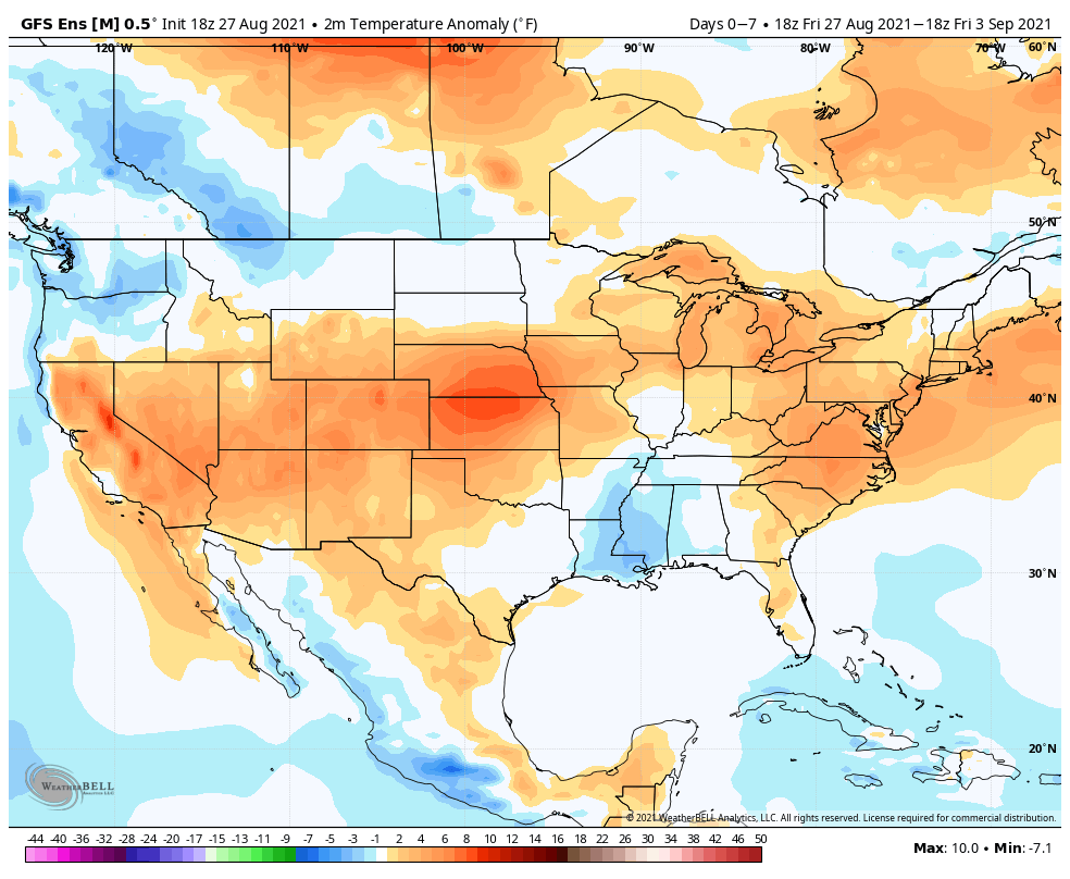
gfs-ens_T2maMean_us_4As we rumble into next weekend and the following week indications continue to point towards wetter and cooler times.

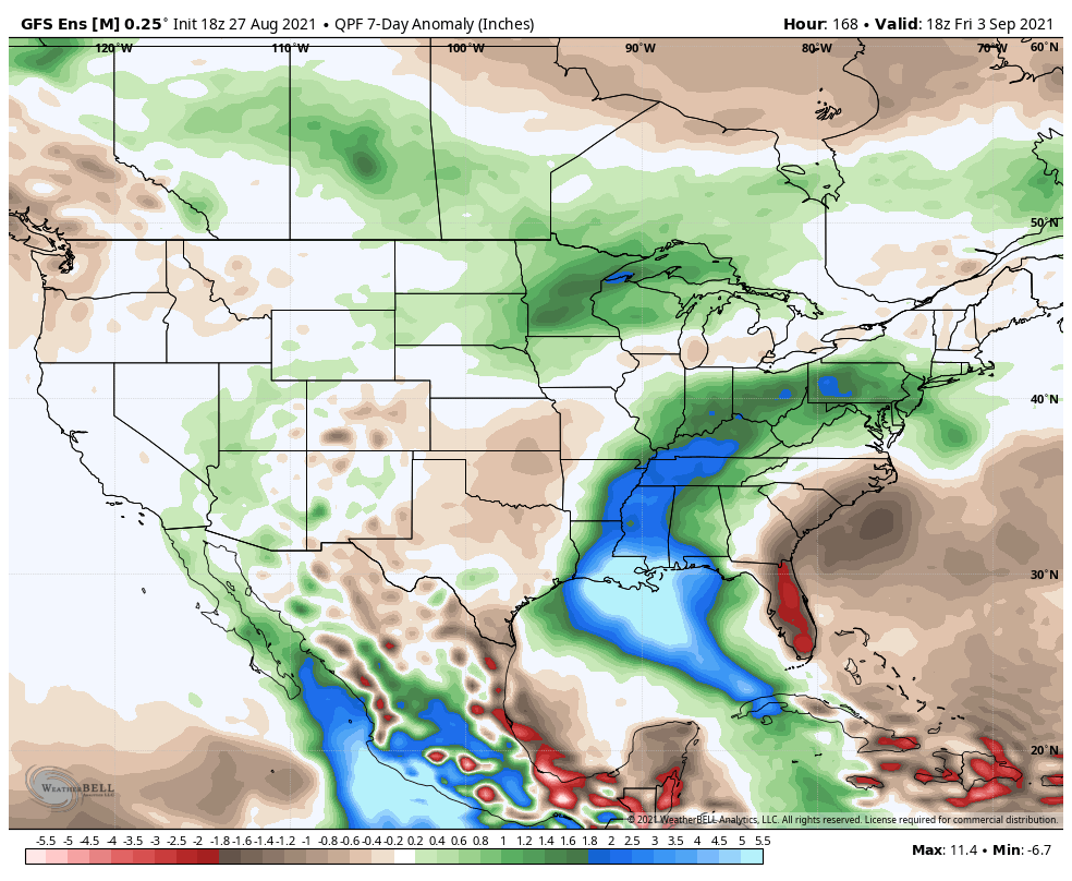
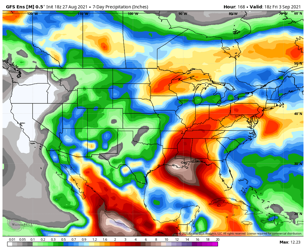
After a dry week ahead, rain and storms will come with that increased humidity next weekend.

gfs-ens_apcpna_us_7Early numbers off the press suggest 1″-2″ rains possible next weekend.

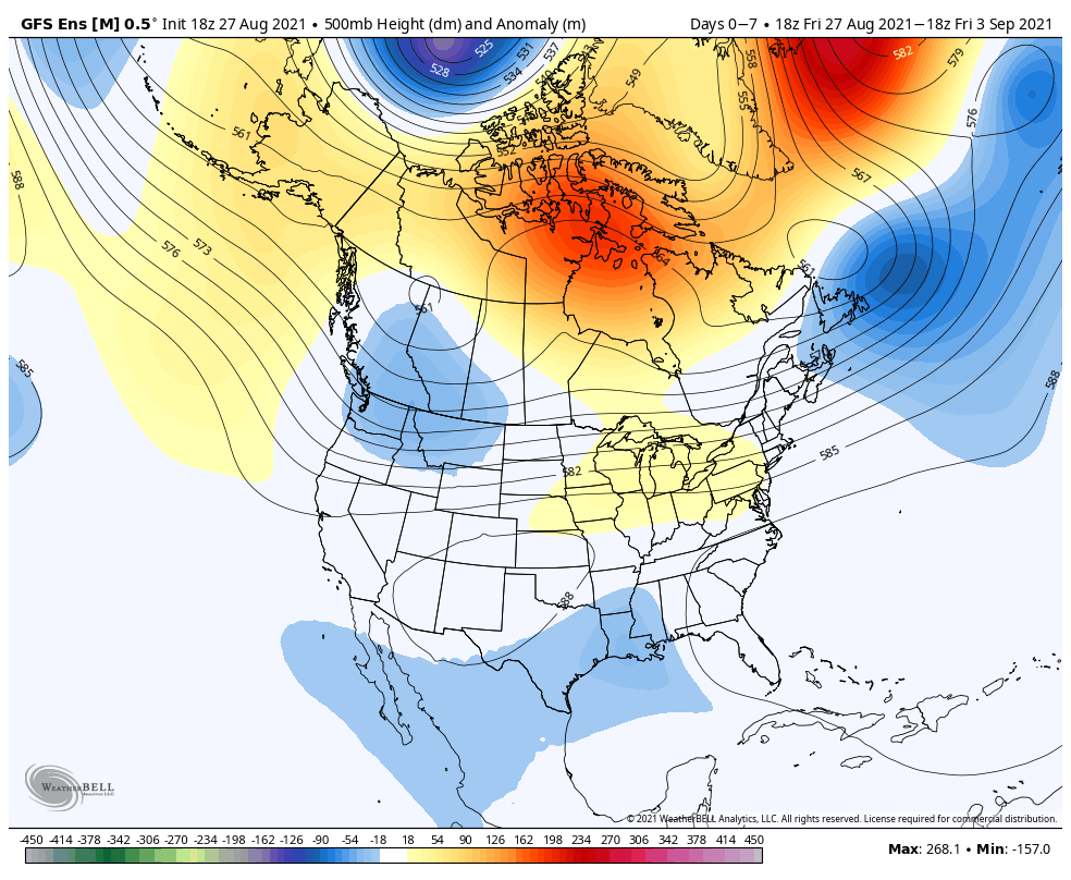
The increased rain and storm chances signal another shift in the pattern towards a cooler one just beyond the Day 10 period.  From experience, I would look for this trough around mid month to trend deeper (more significant) as time draws closer.

gfs-ens_z500a_us_47It’s possible the first push of widespread 40s loom around the middle of the month.  Time will tell…

Permanent link to this article: https://indywx.com/2016/09/03/warmth-next-week-gives-way-to-a-cool-mid-month/

Hot Weather Returns…

Screen Shot 2016-09-02 at 7.24.49 AMHighlights:

  • Sun-filled days
  • Turning hot
  • Storm chances return by mid week

Refreshing Temperatures (For Now)…High pressure and a dry northeast flow will continue to support refreshing conditions across the region.  Plentiful sunshine along with low humidity values will create ideal weather to spend time outdoors as we go into the long Labor Day weekend.  Perhaps a bonfire is in order this evening?

Eventually, our air flow will back around to the southwest and this will allow a much warmer and increasingly humid air mass to return.  Sunday will be noticeably hotter, but the true push of humidity will arrive Labor Day into Tuesday.  It’ll, officially, feel “oppressive” by mid week.  That increased moisture will also help ignite scattered storm chances Wednesday into Thursday.

Looking just beyond the (7) day period shows the potential of a cooler period building back in next weekend…

Upcoming 7-Day Precipitation Forecast:

  • Snowfall: 0.00″
  • Rainfall: 0.25″-0.50″

Permanent link to this article: https://indywx.com/2016/09/02/hot-weather-returns/

VIDEO: More on Hermine and the Labor Day Weekend…


You must be logged in to view this content. Click Here to become a member of IndyWX.com for full access.  Already a member of IndyWx.com All-Access?  Log-in here.

Permanent link to this article: https://indywx.com/2016/09/01/video-more-on-hermine-and-the-labor-day-weekend/

Meteorological Fall Begins With A Fall-Like Feel…

Meteorological fall runs from Sept. 1st through Nov. 30th. With that said, it’s only fitting we feel more fall-like on this the first day of meteorological fall.  We note 24 hour dew point changes below.  The browns indicate much drier air pressing south over the next 24-36 hours.

DryAirYou’ll definitely notice the drier, crisp feel to the air upon stepping outside this morning.  If you try hard enough, you can almost smell fall!  🙂

That drier air will support multiple nights with low temperatures into the lower and middle 50s tonight through Sunday morning.  We may even have a few neighborhoods dip into the upper 40s Friday or Saturday morning.

hires_t2m_indy_55We know this is the beginning of the transitional time of the year.  Eventually, these cold fronts will back more and more of a punch as we rumble deeper into fall.  On the flip side, summer isn’t ready to go away without a fight.  In fact, temperatures well above normal will return for Labor Day, itself, and continue into the majority of next week.  A string of highs in the upper 80s to lower 90s will be common next week.

gfs-ens_T2maMean_us_6Longer term, there are indications that continue to support the idea of a potentially more significant cool down around mid September.  Stay tuned…

Permanent link to this article: https://indywx.com/2016/09/01/meteorological-fall-begins-with-a-fall-like-feel/

Refreshing Times Ahead…

Screen Shot 2016-08-31 at 7.16.54 AMHighlights:

  • Scattered afternoon storms
  • Turning much drier and cooler tonight
  • Refreshing into the weekend

Cold Front Inbound…We’re getting to that time of the year where cold fronts will begin to pack more and more of a punch, offering up increasingly cool to, eventually, cold air…  An early fall-like front will surge south this evening.  Ahead of the boundary, scattered thunderstorms will develop this afternoon into the evening- particularly from central into southern portions of the state.  Storms will be moving relatively quickly this evening so flash flood concerns are limited.

Behind the front, much drier and cooler air will ooze into the region tonight and set us up for an absolutely delightful few days of weather, complete with dry skies and low humidity.  Temperatures into the upper 40s wouldn’t surprise us Saturday morning for outlying communities.

Eventually the heat will return from Labor Day into most of next week.  As moisture surges north, scattered storm chances will also return to our forecast by Tuesday.

Upcoming 7-Day Precipitation Forecast:

  • Snowfall: 0.00″
  • Rainfall: 0.50″-0.75″

Permanent link to this article: https://indywx.com/2016/08/31/refreshing-times-ahead/

IndyWx.com