Long Range Report: Looking Ahead To May…

Updated 04.25.24 @ 7:15a

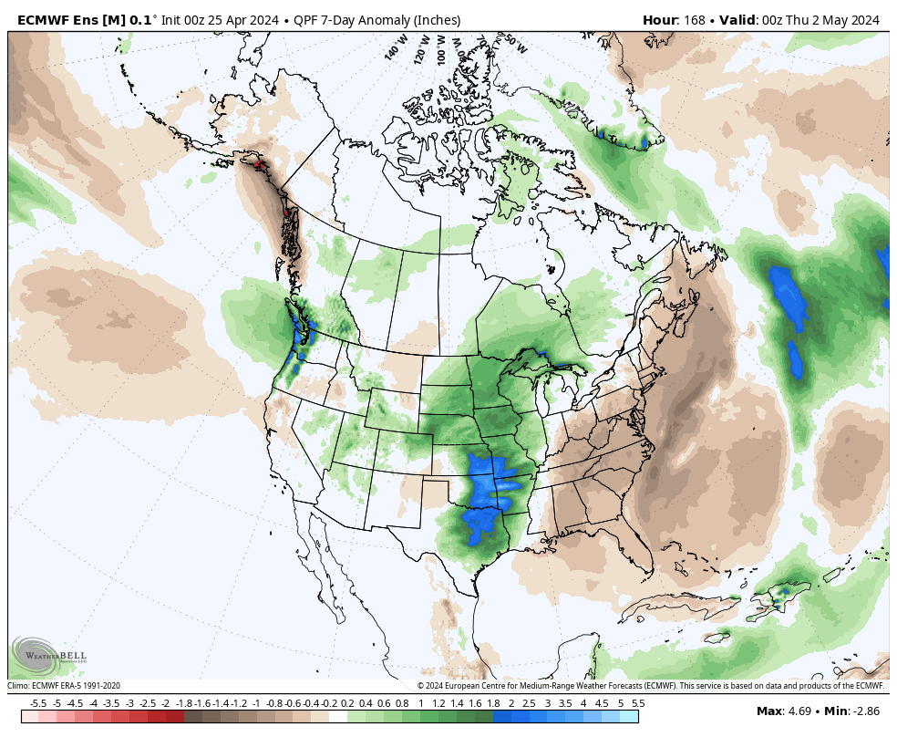
While we have a couple of storm systems to track in the upcoming week, the majority of the heavy rain and severe weather will remain confined to areas west of here- mostly throughout the Plains and into the upper Mid West. In short, the immediate-term has “more bark than bite.”

The overall long range look reflects a lack of any sort of stagnant regime, locally, and it also doesn’t show that we’ll have to endure much in the way of “extremes” over the upcoming 3-4 week period from a temperature or precipitation perspective. – A good sign as Plant24 hits its true stride.

Week 1

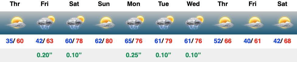
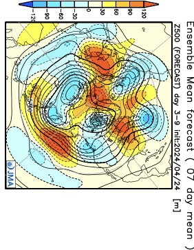
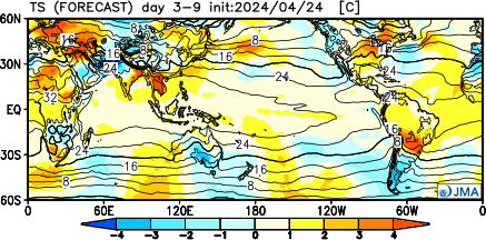
The JMA and European are in agreement that this period will feature warmer than normal temperatures and near average rainfall. Of note, we’re tracking storm systems that will impact our weather Friday, Saturday, and again Monday and Tuesday.
Week 2

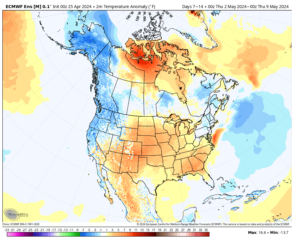
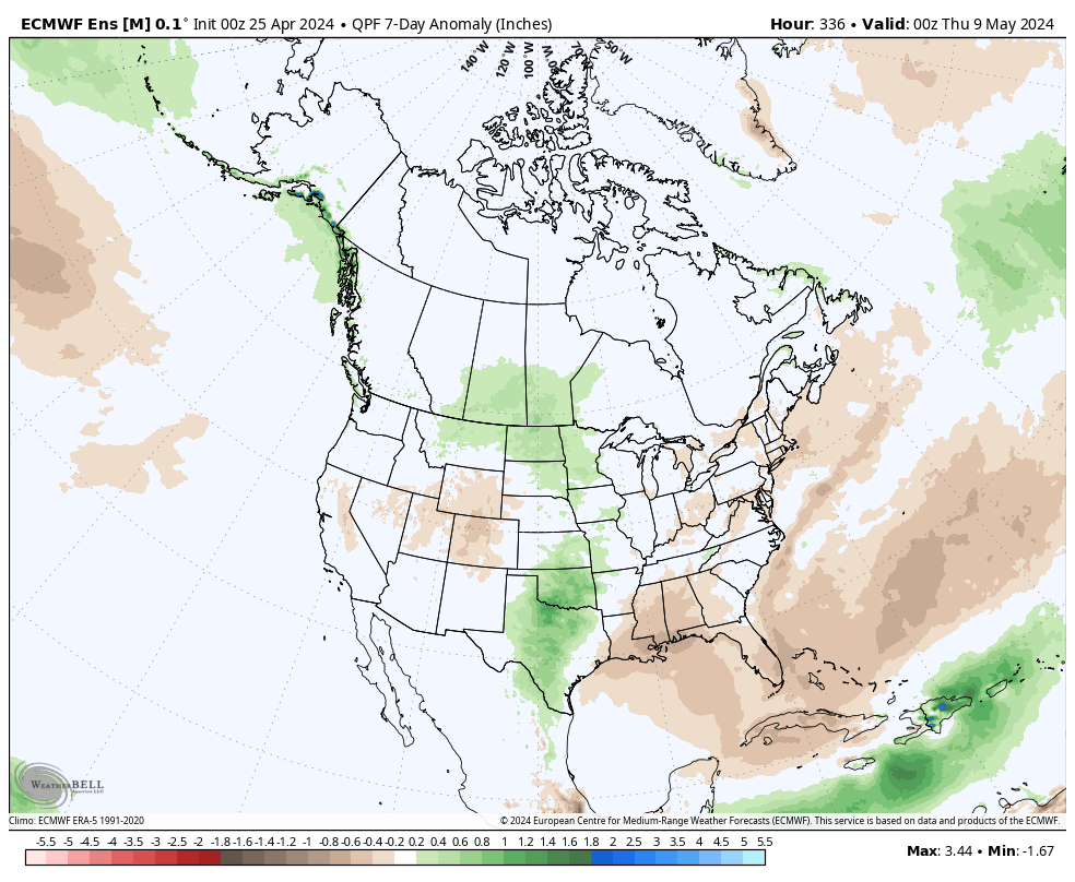
We note guidance getting more bullish on an East Coast trough beginning to develop during this time period. While likely averaging out slightly above normal as a whole in Week 2, I’d also plan on a few days of cooler air (type of stuff that could send us to around 40° at night and low-mid 60s during the day) around the Day 8 – 10 time frame. The period should once again feature timely rains, but nothing far off from the average.
Weeks 3-4

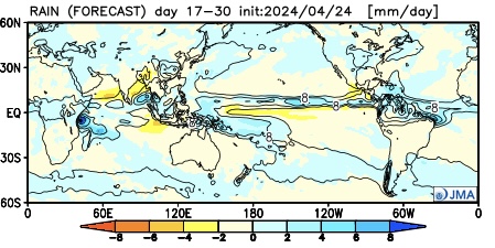
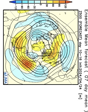
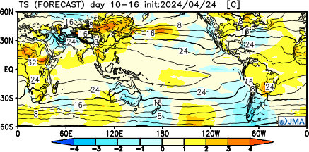
It’ll be interesting to watch what the European Weeklies do later today during this time frame, but the JMA is highlighting a more unsettled (wetter) pattern for now in the middle to latter part of May. Near to slightly below average temperatures and widespread above normal rains are being shown. (We’ll update this period after reviewing today’s European Weeklies).

VIDEO: Hang In There- Brighter Open To The Weekend Coming; Long Range Thoughts Into Late Month…

Updated 04.11.24 @ 7:39a Masters Thursday will be a wash-out up this way. Thankfully, down at Augusta, GA we’re talking about better weather- at least relatively speaking. 🙂 Additional showers…

You must be logged in to view this content. Click Here to become a member of IndyWX.com for full access.  Already a member of IndyWx.com All-Access?  Log-in here.

VIDEO: Light Rain Returns Friday; Cooler, Wetter Than Normal Pattern Anticipated O/ The Next 2 – 3 Weeks…

Updated 03.21.24 @ 7a The area will receive a glancing blow from our late week low pressure “tag team” that will deliver light rain Friday (most areas will be under…

You must be logged in to view this content. Click Here to become a member of IndyWX.com for full access.  Already a member of IndyWx.com All-Access?  Log-in here.

VIDEO: Snow Overspreads The Region Friday; Fresh Medium-Long Range Thoughts…

Updated 02.15.24 @ 9:42p

Evening update: Looks like we’ll need to “beef” totals up a bit tmrw. We’ll watch overnight guidance but wouldn’t be surprised if we need to build in banding potential that may generate local 3”-4” amounts by Friday evening with tomorrow morning’s update.


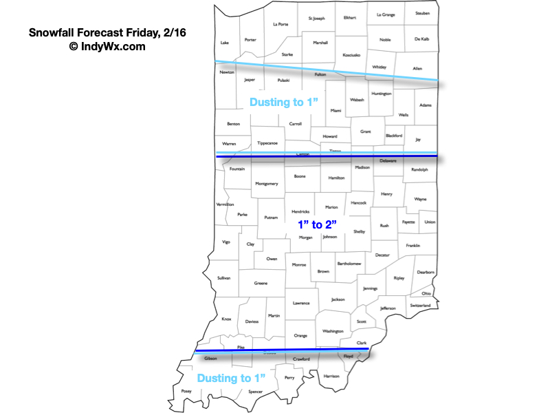
A fast moving band of light rain will scoot across central IN mid-morning, but the bigger deal today will be the strong and gusty winds. Gusts upwards of 40 MPH can be expected at times. Hold onto your hats! Attention then will quickly shift to an area of light snow that will overspread the region Friday morning. While the unseasonably mild surface temperatures of late will prevent some of this snow from accumulating, a general 0.50″ to 2″ area-wide snow is expected.

More on the snow, a brief “jab” of arctic air and a look into the updated long range guidance in this morning’s Client video below:

Spring; #Plant24 Outlook…

Updated 02.10.24 @ 7:20a

Though we still have a few weeks left of meteorological winter, spring and the #Plant24 season will be here before we know it! The headlines that we anticipate to claim the coming months include the following:

  • El Niño likely continues to collapse; La Niña state by late spring/ early summer
  • Widespread wetter than average conditions anticipated for a large chunk of the country, including central Indiana. Opportunity for above average severe weather episodes during the March through May (meteorological spring) time period.
  • Time to prep for a hyper active hurricane season along the Gulf and Southeast US coastlines.

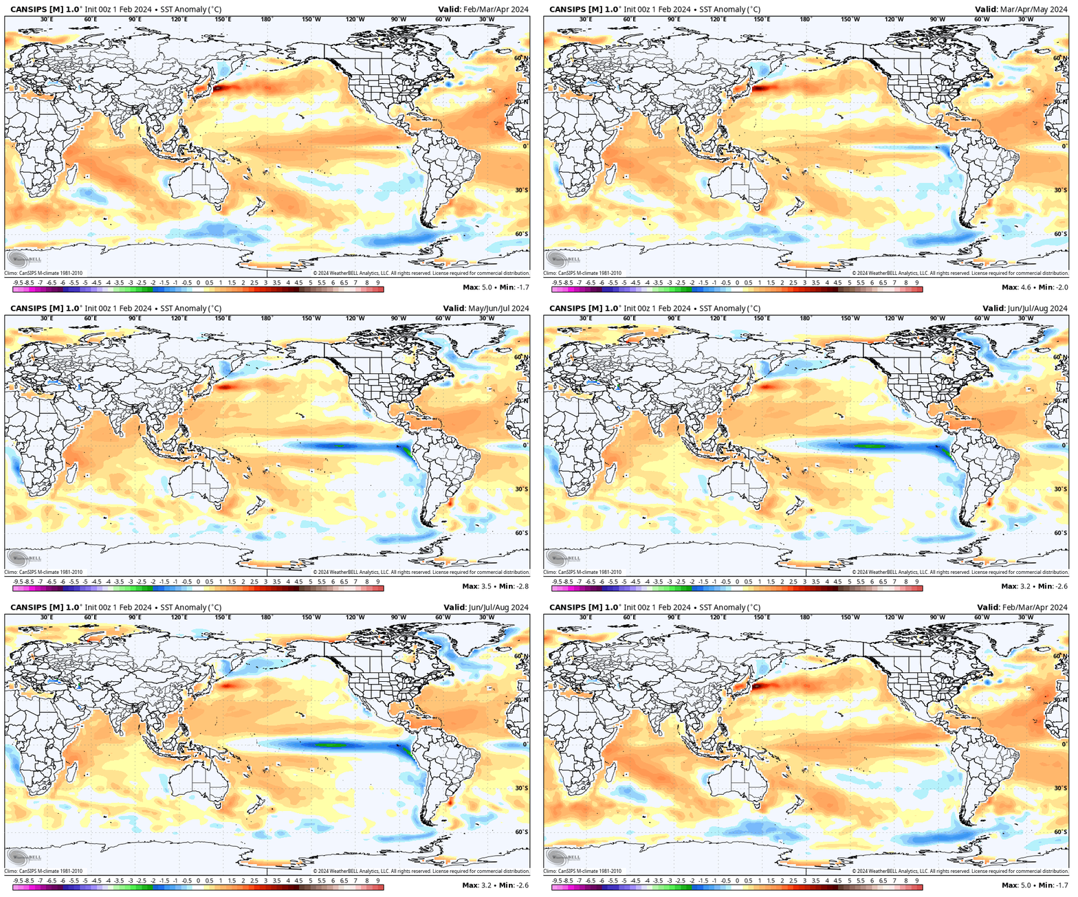
Long range, seasonal forecast models, continue to show the current El Niño collapsing and moving swiftly towards a La Niña late spring and early summer.

This transition will certainly have impacts on the anticipated precipitation and potential of a busier severe weather season this spring. We forecast a rather swift Nino collapse and subsequent onset of La Niña, which ups the ante for a wet spring, not only locally, but across a widespread chunk of the country. Undoubtedly, this could lead to plant24 impacts (delays) at times.

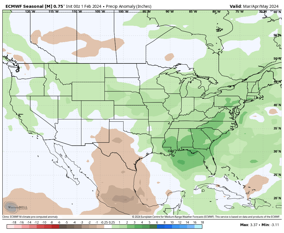
Seasonal products see the above average rain expected for spring 24.

European Seasonal Precipitation Anomalies March through May
JMA Precipitation Anomalies March through May

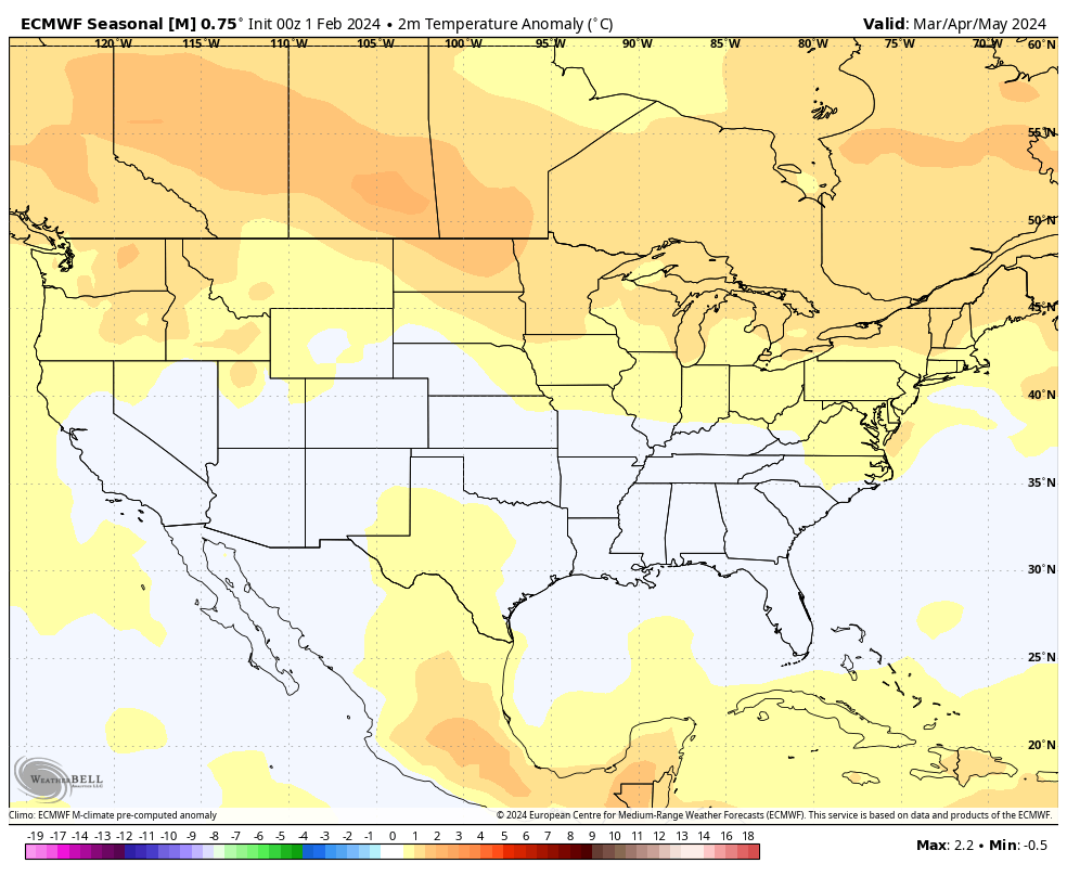
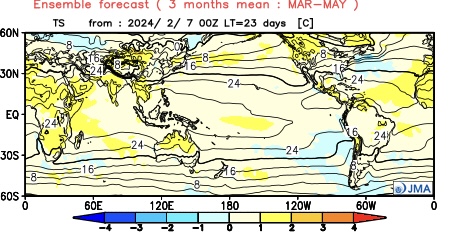
From a temperature perspective, we forecast widespread milder than normal temperatures as a whole for the season across the northern tier, including central Indiana. We caution though that the way we get to slightly (1° to 2° above normal on the season) milder overall may include wild swings through the season. For example, we forecast a colder than normal 1st half of March, the potential of a significant flip to warmer the 2nd half and a cooler pattern to return for the bulk of April.

European seasonal temperature anomalies March through May
JMA temperature anomalies March through May

IndyWx.com Spring/ #Plant24 Outlook for central Indiana:

  • Temperatures that average 1° to 2° above normal overall for the March-May period.
  • Precipitation that runs 125% to 130% of normal during meteorological spring.

Wishing the best of luck and positive vibes to all in the months ahead, especially our #AGwx partners. Happy spring!