Updated 02.08.24 @ 6a A weak frontal boundary will limp into the state later this evening. Ahead of the front, anticipate unseasonably mild air and a gusty day. A few…
You must be logged in to view this content. Click Here to become a member of IndyWX.com for full access. Already a member of IndyWx.com All-Access? Log-in here.
Updated 02.01.24 @ 7:45a Aside from a dry back door cold front overnight, all is quiet in the weather world, locally, but changes are on the horizon around the 10th…
You must be logged in to view this content. Click Here to become a member of IndyWX.com for full access. Already a member of IndyWx.com All-Access? Log-in here.
Updated 01.25.24 @ 7:36a Dense fog is present yet again this morning, but at least we’re not dealing with heavy rain. That changes later this evening as a slug of…
You must be logged in to view this content. Click Here to become a member of IndyWX.com for full access. Already a member of IndyWx.com All-Access? Log-in here.
Updated with European Weekly thoughts 12/29/23 @ 7:09a
There’s no reason to change any of our thoughts concerning how things play out over the next 24 hours with our upper level low pressure system. That idea from yesterday is available here. In short, it still appears as if parts of west-central Indiana are still greatest at risk of seeing light wet snow accumulation (of course some of our friends in southwest Indiana are already enjoying waking up to snow on the ground this morning).
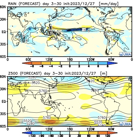
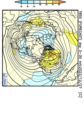
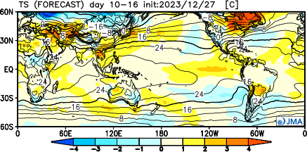
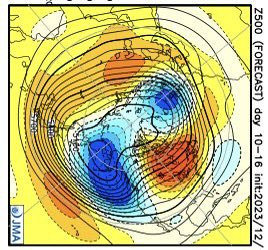
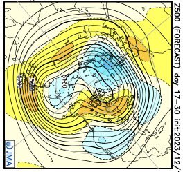
As we look ahead to the upcoming 3-4 weeks (will add to this post later tonight after having a chance to see the updated Euro Weekly teleconnections), it appears as if we’re heading right towards more of a predominant El Niño regime with an active southern storm track and most persistent cold, relative to average, taking up residence across the southern tier. The updated JMA Weekly model portrays this best over the course of the upcoming 28 days:
Modeling continues to struggle with the MJO evolution over the upcoming 2 week period. While this doesn’t impact the idea of colder times in the short-term period, it does have great implications beyond mid-January. The kind of amplitude shown off the American guidance (image 1 below) would threaten to deliver a much warmer than average period, locally, beyond mid-month. Meanwhile, the European (image 2 below) continues to suggest a collapse into the neutral phase.
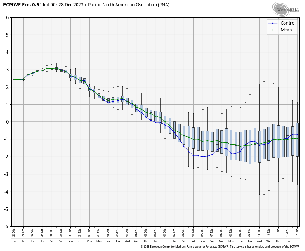
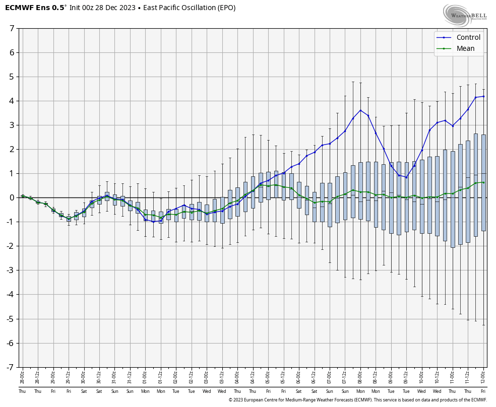
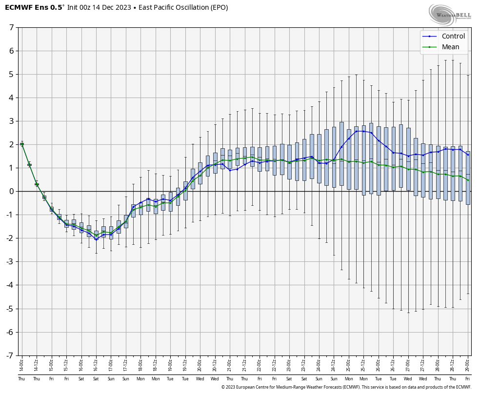
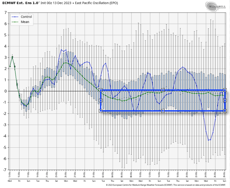
The 2 primary other pattern drivers include the PNA and EPO through mid-January. Beyond this point, we’ll start to incorporate the likes of the NAO and AO into our forecast (hence another reason why we’re interested in seeing how the Euro Weeklies show this later today).
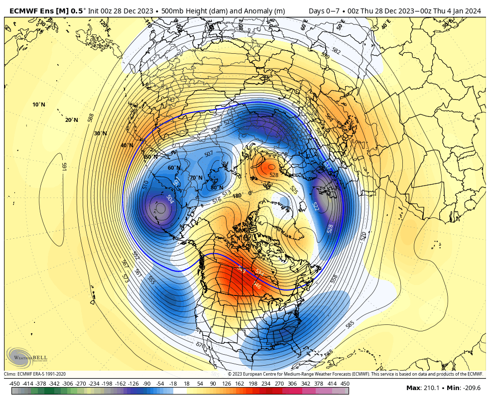
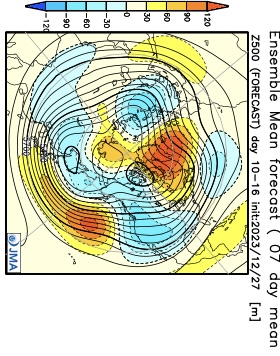
Simply based on how the PNA/ EPO combo is forecast, the first week would open with cooler temperatures transitioning into the region and then we would likely see moderation in the week 2 to early week 3 timeframe.
Week 1
Week 2
While we’re certainly transitioning to a cooler and more active pattern over the upcoming couple weeks, compared to where we’ve been to this point in meteorological winter, it’s not yet to a point where anything looks excessively cold or, for that matter, snowy.
That doesn’t mean that there won’t be a couple storms to track that could offer up some meaningful winter weather potential here, but I just don’t see a sustained cold, snowy pattern taking foot through mid-January. Beyond that point, we’ll have to monitor which more extreme solution plays out. Based on everything going on by that point, it’s still likely to be a situation where either more persistent (and significant) cold or warmth develops.
European Weekly update 12/29/23
The new European Weeklies show a warmer option for the 2nd half of January, but contradict their own teleconnections during this time frame. The model goes to a strong negative AO, positive PNA, negative NAO, and a neutral EPO. Of course we’ll have to see what the MJO ultimately ends up doing but that combo strongly argues for the colder option for the 2nd half of January.
Right out of the gate, let’s look at the pattern drivers over the course of the next couple of weeks. By now, you know this starts with the MJO. One has to love the alignment of at least quickly moving out of the current warm phases and into the colder phases. By the 28th, both the GFS and European show us emerging into those colder phases.
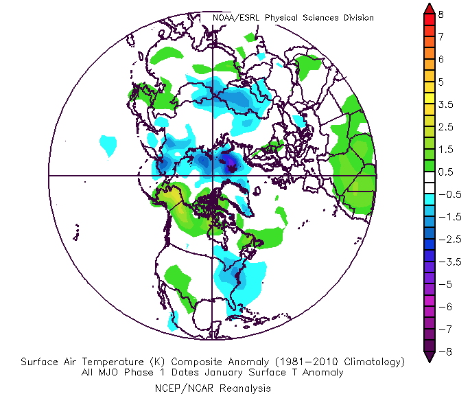
The thought here is that we sneak into Phase 8 prior to month’s end and then roll into Phase 1 as we get into early January. The respective temperature composites are below.
MJO: Phase 8 December
MJO: Phase 1 January
That leads us to the PNA and EPO. (Remember, we’ll put more weight into the influence the NAO and AO can have on the regime after mid-January).
The PNA, or Pacific North American pattern, remains in a favorable state for eastern cold.
“Positive” PNA composite pattern
However, the EPO doesn’t want to play nice and will put pressure on any sort of sustained, meaningful cold getting involved over the next 10 days- that is until the MJO gets into the cold phases.
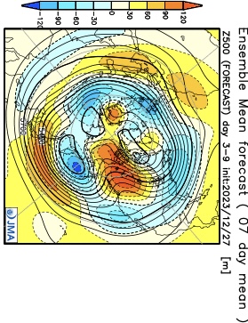
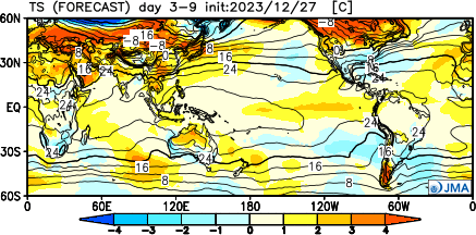
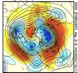
The JMA Weeklies show the progression of the upper pattern best, in my opinion, from any of the long range data that’s currently available for the late December-1st half of January timeframe.
Week 1
Week 2
Weeks 3-4
We’ve had several new subscribers of IndyWx.com All-Access over the past couple of weeks so I wanted to take time to drop a direct link to our annual Winter Outlook. As we get set to put a bow on the first month of meteorological winter, there’s no change to our ongoing idea of the winter as a whole here.
I originally thought the shift to a colder pattern would take shape around 12/20 (give or take a couple of days). While that idea appears to be too aggressive, there’s certainly no backing away from the colder pattern progression as a whole, at least from my perspective. The expectation is that we do, indeed, get into the colder phases of the MJO and that sets off the larger global signal that will likely shift the EPO into a colder phase. It’s interesting that the European Weeklies show this exact thing taking shape down the road (once past 1/1).
While we’re not of the thought this evolves into anything frigid (some sort of overwhelming arctic air mass, for example), we do want to double down on the idea of a slightly colder than normal regime taking hold as we get into the new year. The thought here is that this slightly colder than normal pattern will also have staying power through a good chunk of January, given where I believe the MJO will spend the majority of time. What’s also of interest is the energized southern stream beginning to show itself (going to be one heck of a storm roaring out of the Gulf this weekend). I’d imagine we’re only just beginning to see the active pattern take hold and it won’t take much to get a storm or two to try and phase with northern stream energy if we see the evolution take hold that I envision down the road. At the very least, it’s certainly not a boring pattern.
We’ll have more detailed thoughts on the weekend and next week’s pattern in our updated Client video that will be posted a bit later today!