Category: Heavy Rain

Burst Of Snow This Afternoon; Storms And “Rumors” Of Storms This Upcoming Week…

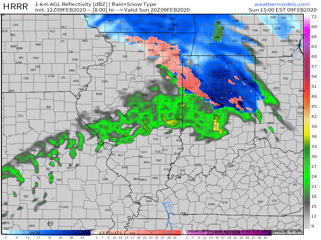
The day is starting off on a cold note with some fog and low clouds around, but at least we’re dry (for now). That will begin to change here in a few hours as a burst of snow moves into the city around lunchtime. A brief period of moderate to heavy snow may whiten the ground just north of the city before a transition to a cold rain for the better part of the afternoon.
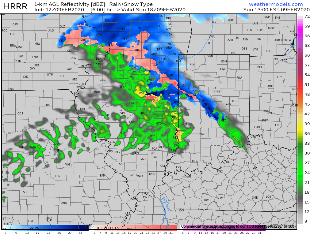
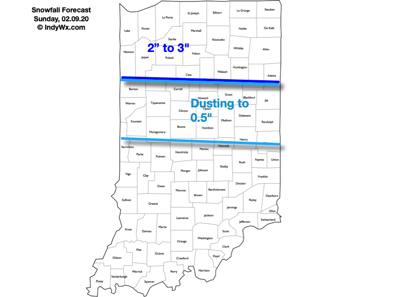
Further north, cold air will hang on longer and a more significant period of snow is expected through the afternoon and early evening. In fact, periods of heavy snow can be expected, including snowfall rates up to 1″ per hour at times. If you have travel plans to places such as Ft. Wayne, South Bend, or Logansport, we’d recommend preparing for slick travel and snow covered roads can be expected. This will be a wet and heavy snow. Pavement impacts will require salting and plowing across the northern 1/3 of the state this afternoon into the evening.
Here’s our snowfall forecast today:
The attention will then shift to a period of moderate to heavy rain through the evening and into the overnight across the I-70 corridor. By the time all is said and done Monday morning, widespread 1″ to 1.5″ is expected with the passage of this storm system. Good news? Most of the rain should be south of our area by the morning rush Monday.
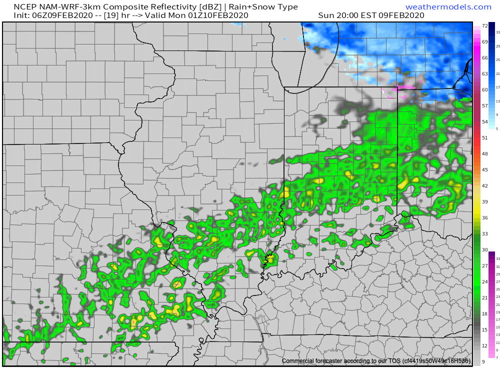
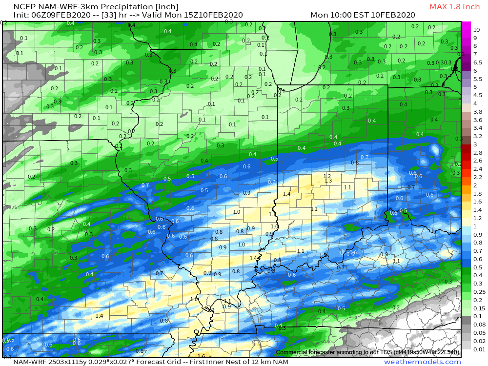
High pressure will then settle into the Ohio Valley as we move into Monday evening and Tuesday, allowing a briefly quieter period of weather to arrive on the scene.
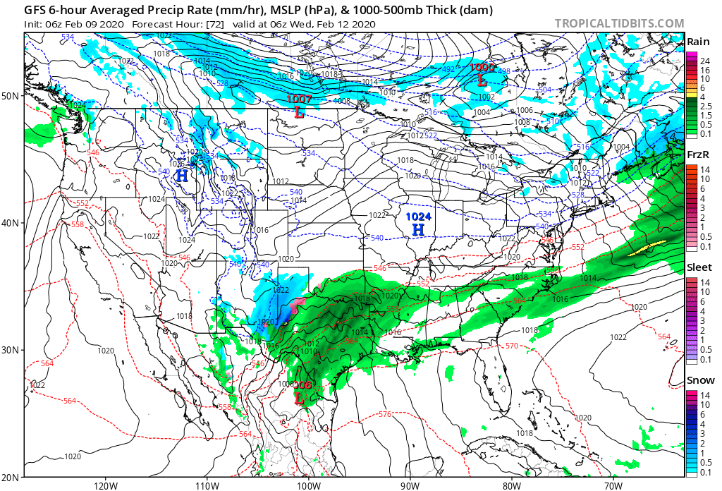
By this time, however, all eyes will shift to the southwest and our next storm system that should be brewing. While models differ on the specifics with this storm, the overall upper pattern suggests we need to remain on our toes with respect for the potential of additional winter weather stretching from the mid-MS Valley Wednesday, Ohio Valley Wednesday night into Thursday, and interior Northeast Thursday into Thursday night. A brief, but potent shot of arctic air would follow to close the work week- especially if we can get some snow down.
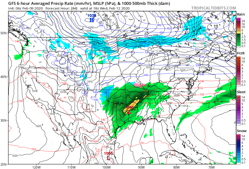
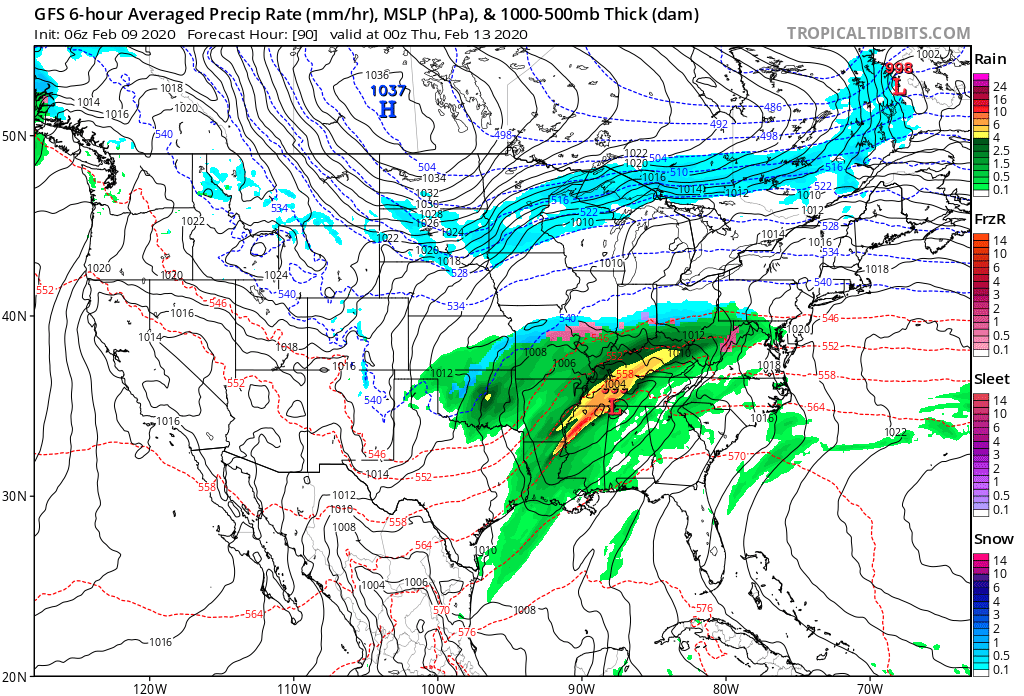
Should snow get laid down with this system across the OHV region, a cold arctic high would be capable of sending temperatures into the single digits to close the work week.

Stay tuned…

Permanent link to this article: https://indywx.com/2020/02/09/burst-of-snow-this-afternoon-storms-and-rumors-of-storms-this-upcoming-week/

February 2020 Outlook: Watching The Battle Play Out…

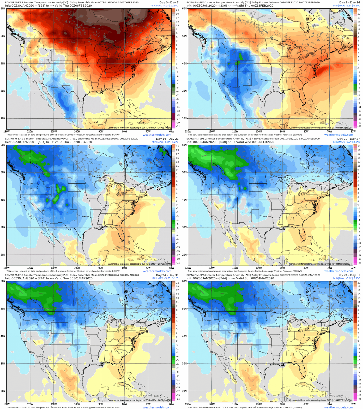
Before we dig into the reasoning behind our February forecast, here’s what a few of the longer range models are suggesting the month will provide:

JMA

The JMA keeps the most persistent warmth confined to the southern and southeastern regions. The model would suggest our immediate area will be in a “battle zone,” including heavier than normal precipitation for the month.

CFSv2

The CFSv2 is bullish on a warm eastern half of the country with cold confined to the west. The modeled mean southwesterly air flow would result in well above average precipitation across our region, including an active storm track.

European Weeklies

Similar to the data above, the new European Weeklies show the most persistent cold west with warmth dominating the southeast and at times into the Ohio Valley for the month of February.

February features “average” temperatures rising from a high of 37° on the 1st to 45° on the 29th. Average lows rise from 21° to 28° by the end of the month. IND averages 2.32″ of rainfall and 6.5″ of snow during the month.

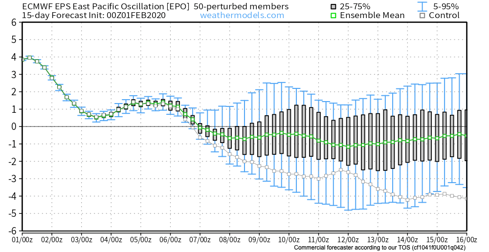
As we look at February 2020, we have an interesting battle on our hands. Latest EPO trends are negative and that is a cold signal, potentially significantly so if the current trends continue. That said, it’s also important to note that many times throughout January, medium to long range negative EPO trends didn’t materialize, and, accordingly, warmth dominated.

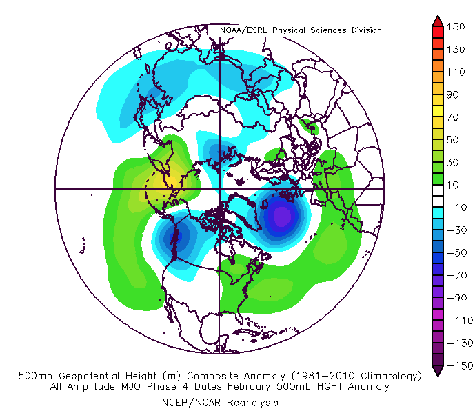
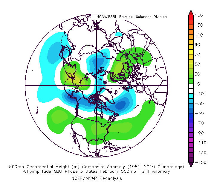
To make things more complicated, the latest MJO plots are bullish on warmth persisting, overall, for the the better part of the month. Note the trends to take things back into Phases 4-5. This would promote the tendency towards more of a persistent eastern ridge (similar to what the European and CFSv2 show above).

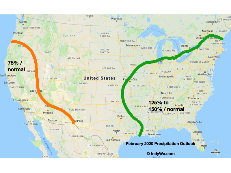
While our forecast will show a significantly warmer than average month, we also believe snowfall will run near average. The reason has to do with a battle ground that we anticipate sets up across the Ohio Valley throughout the majority of the month. At times, even marginally cold air will create challenges. Case in point will be the middle and latter part of this upcoming week. This will likely set the tone for the month ahead: warmer than average with well above average precipitation/ near normal snowfall. The other concern has to do with the threat of sleet/ freezing rain events. Late winter and early spring can prove to be troublesome with the kind of ‘mean’ pattern that lies ahead as shallow cold air at the surface undercuts. This will be something to keep close tabs on moving forward.

IndyWx.com February Outlook…

Permanent link to this article: https://indywx.com/2020/02/01/february-2020-outlook-watching-the-battle-play-out/

VIDEO: Week-Ahead Outlook And More On The Pending Pattern Change…

You must be logged in to view this content. Click Here to become a member of IndyWX.com for full access.  Already a member of IndyWx.com All-Access?  Log-in here.

Permanent link to this article: https://indywx.com/2020/01/12/video-week-ahead-outlook-and-more-on-the-pending-pattern-change/

VIDEO: Short-Term Update And More On Winter’s Return…

You must be logged in to view this content. Click Here to become a member of IndyWX.com for full access.  Already a member of IndyWx.com All-Access?  Log-in here.

Permanent link to this article: https://indywx.com/2020/01/11/video-short-term-update-and-more-on-winters-return/

Client Brief: Heavy Rain Increases Flood Potential Into The Weekend; Strong Wind Also A Concern…

Type: Heavy Rain & Strong Winds

What: Localized flood potential 

When: Friday and Saturday

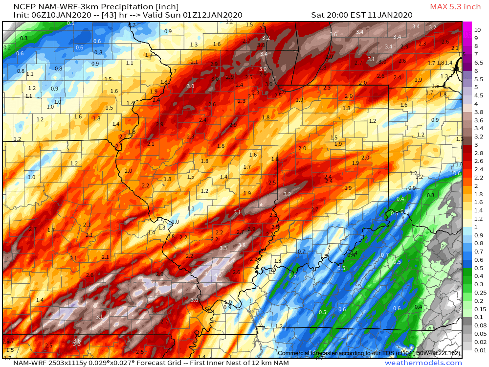
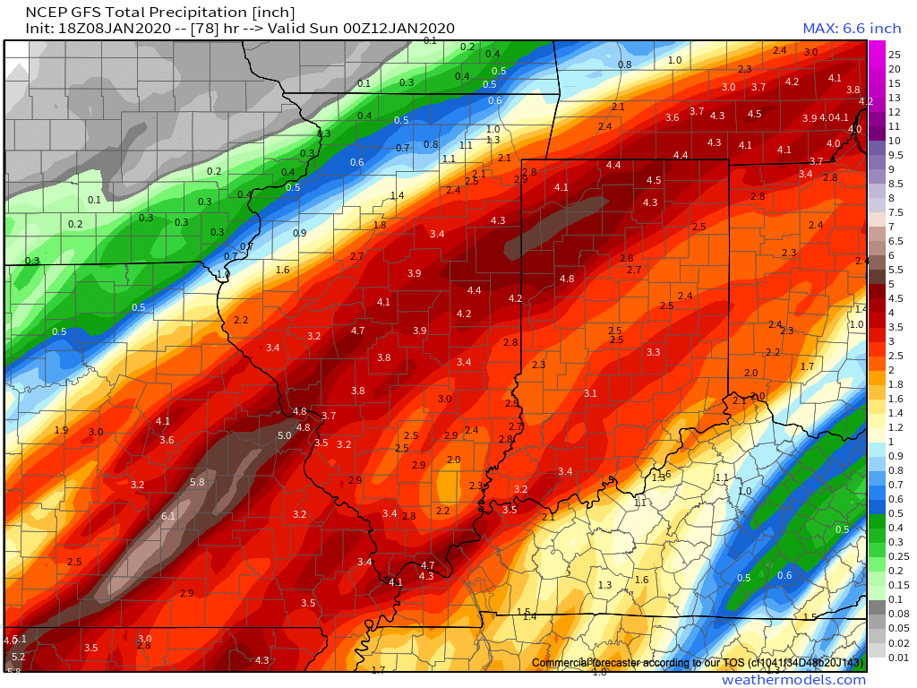
Rain Amounts: 2.5″ to 3.5″ (localized heavier totals)

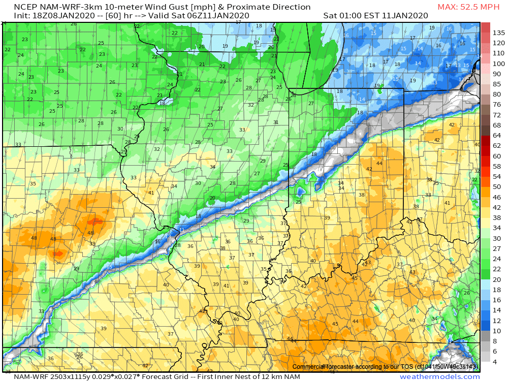
Wind: Variable 20-30 MPH with gusts to 50 MPH+ Saturday

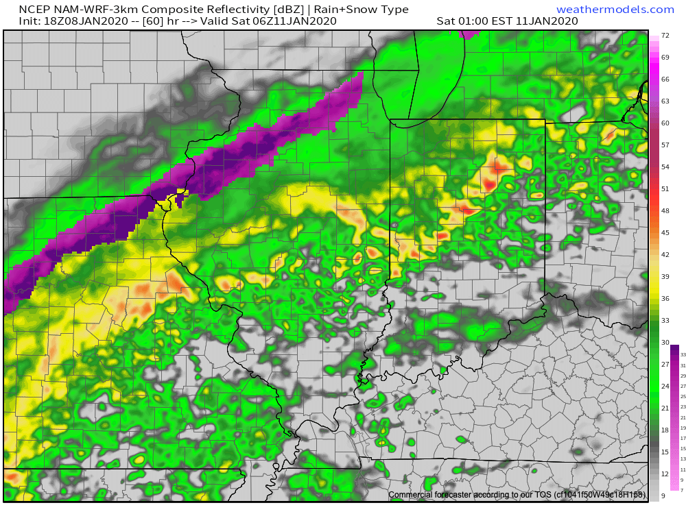
Periods of moderate to heavy rain developed during the overnight and continue as we type this client brief this morning. Rain will continue for a good portion of today into tonight (locally heavy at times) before we likely go through a break in the rain early Saturday morning. That lull in the action won’t last long as rain is quickly expected to return by late morning and continue through the afternoon, into the early evening hours. What will already be a windy day today (30-40 MPH gusts) will only grow worse Saturday with some 50 MPH gusts a good bet.

As the surface low moves to our northeast, a cold front will sweep through the state Saturday evening and shut off the rain. Cooler air will move in to close the weekend.

Modeled forecast rainfall totals by 8p Saturday

Confidence: High

Next Update: Friday evening

Permanent link to this article: https://indywx.com/2020/01/10/client-brief-heavy-rain-increases-flood-concerns-into-the-weekend-strong-wind-also-a-concern/

VIDEO: Walking Through The Specific Details Of Our Incoming Strong Storm…

A strong winter storm system will impact a good chunk of the country between today and Sunday morning. More specific to Indiana, rain will begin to overspread the region (initially…

You must be logged in to view this content. Click Here to become a member of IndyWX.com for full access.  Already a member of IndyWx.com All-Access?  Log-in here.

Permanent link to this article: https://indywx.com/2020/01/09/video-walking-through-the-specific-details-of-our-incoming-strong-storm/

Client Brief: Heavy Rain Arrives Friday Into Saturday…

Type: Heavy Rain

What: Localized flood potential

When: Friday into Saturday

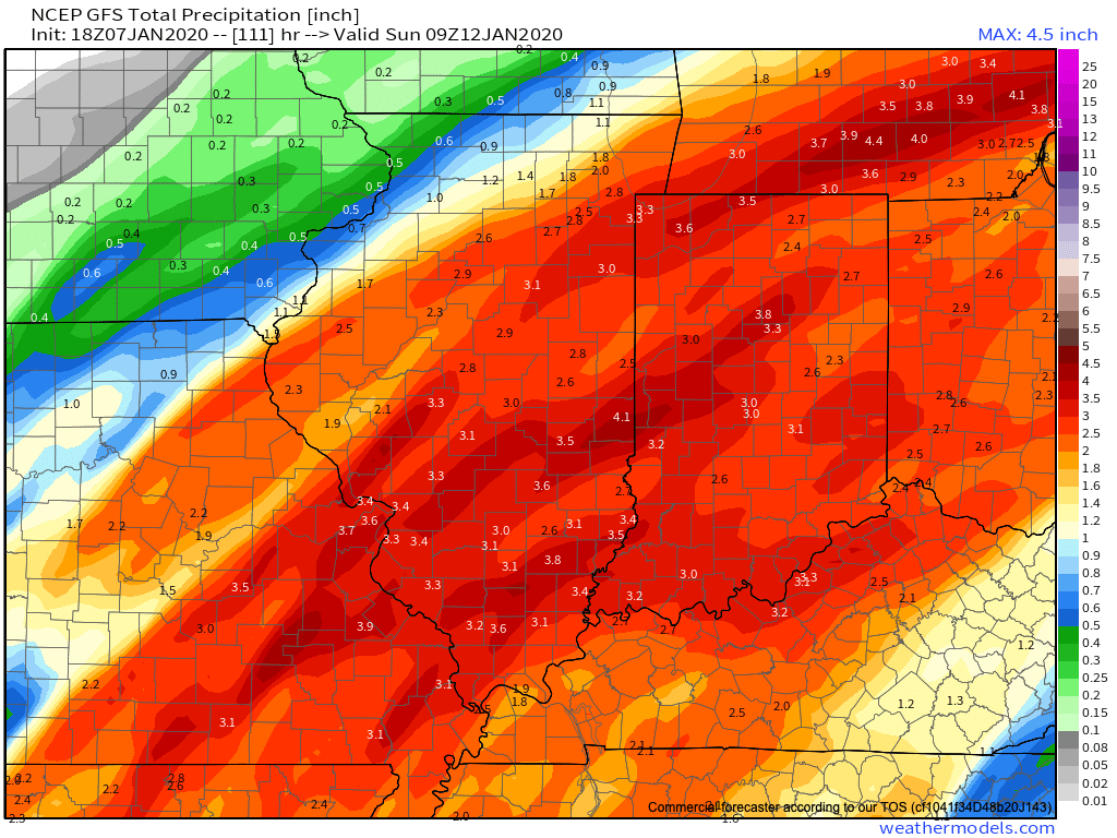
Rain Amounts: 2.5″ to 3.5″ (localized heavier totals)

Wind: Variable 20-30 MPH with gusts to 40 MPH+

The National Weather Service has hoisted Flood Watches across central Indiana in advance of an approaching strong storm system that will present the greatest impacts, locally, in the Friday evening through Saturday morning time period.

Clouds will increase through the day tomorrow (after a sunny start) and light rain will likely follow by evening. Rain will increase in overall coverage and intensity and become heavy at times across central IN Friday morning. We may see a “lull” in the heavy rain Friday evening before widespread moderate to heavy rain returns overnight into Saturday. As things stand this evening, it appears as if the heaviest rainfall amounts will fall from Indianapolis and points west (and north) and the GFS forecast storm total rainfall amounts is our preferred solution this evening- including widespread 2.5″ to 3.5″ totals (locally heavier amounts possible) with this system. Localized flooding will likely result.

Precipitation will exit off to the northeast Saturday afternoon-evening and may end as a “touch” of wet snow across central Indiana (no significant impacts expected from a wintry precipitation standpoint). If traveling north, greater impacts from wintry precipitation can be expected across northern Indiana from a combination of sleet, freezing rain, and snow.

Confidence: High

Next Update: 7a Thursday

Permanent link to this article: https://indywx.com/2020/01/08/client-brief-heavy-rain-arrives-friday-into-saturday/

Big Late Week Storm; Monitoring Prospects Of Much Colder Temperatures In the 8-10 Day…

You must be logged in to view this content. Click Here to become a member of IndyWX.com for full access.  Already a member of IndyWx.com All-Access?  Log-in here.

Permanent link to this article: https://indywx.com/2020/01/08/big-late-week-storm-monitoring-prospects-of-much-colder-temperatures-in-the-8-10-day/

Dinnertime Rambles: Stage Set For The Next Couple Weeks…

The storm system that will impact the region late this week will really be a precursor of what lies ahead over the upcoming 10-14 days.

Here’s how we envision the ‘mean’ pattern shaping up through the January 20th time period:

This pattern is driven by Phase 5 of the Madden Julian Oscillation (MJO) and, secondarily, by a positive EPO.

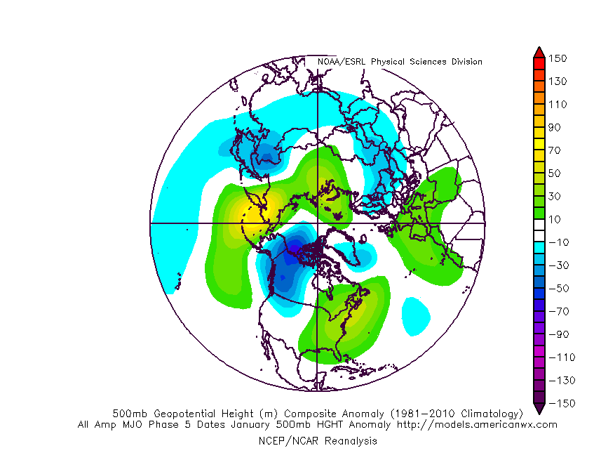
Upper air patterns in January typically look like this during MJO Phase 5:

The analog composite above isn’t as strong compared to reality with the northern Plains/ Rockies cold and that’s where things could potentially turn a bit more interesting, locally, once out of Phase 5 (more on this a bit later in the week). As it is, this cold will try to press and as this takes place, resistance from the East Coast ridge will put up a fight. The battle ground will set-up over our neck of the woods and the end result will be an active/ stormy pattern that features “transitional” cold shots. This time of year, even warmest of patterns can present wintry challenges, however. Case in point is this weekend. Personally, I think what will actually take place with respect to the strength and track of the low pressure system will end up being a blend of the intense European and more progressive GFS. It’s going to be mighty tough to drive such an intense low so far northwest, per the Euro- especially considering the placement/ strength of the high to the north.

With that said, this continues to place northern parts of the state under the threat of a wintry mix of snow and freezing rain/ sleet, while central and southern areas deal with flooding rain. If traveling the state Saturday, expect a significant temperature gradient that will result in a difference of as much as 20° within 10 miles in some cases, especially across north-central parts of the state. I think there’s still the chance rain could end as wet snow across central Indiana Saturday PM, but the better chances of accumulating wintry precipitation will likely be to our north.

Locally, the bigger concern at this point has to do with the potential of 2.5″ to 3.5″ of rain with locally heavier amounts. The bulk of this likely falls late Friday night into Saturday morning. Localized flooding is possible and we’ll likely have to begin issuing storm briefs this time tomorrow.

Next up will come storm threats in the 1/14 and 1/16-1/17 time frame…

Stay tuned, friends.

Permanent link to this article: https://indywx.com/2020/01/07/dinnertime-rambles-stage-set-for-the-next-couple-weeks/

VIDEO: Quiet Times Give Way To Heavy Rain Friday Into Saturday…

You must be logged in to view this content. Click Here to become a member of IndyWX.com for full access.  Already a member of IndyWx.com All-Access?  Log-in here.

Permanent link to this article: https://indywx.com/2020/01/07/video-quiet-times-give-way-to-heavy-rain-friday-into-saturday/

IndyWx.com