Weekly #AGwx And #Severe Weather Outlook…
Updated 03.31.24 @ 7:26a
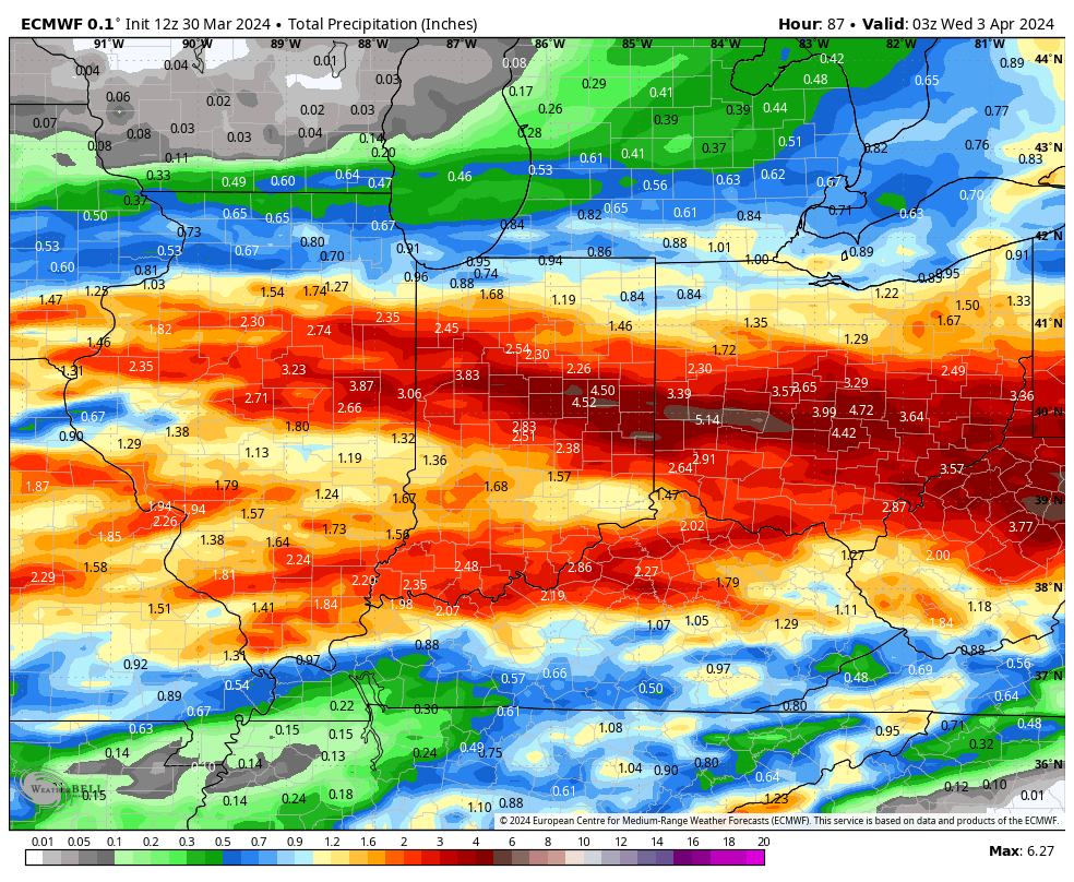
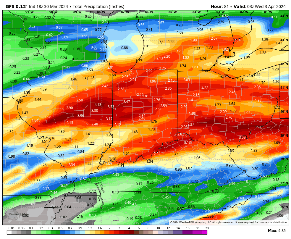
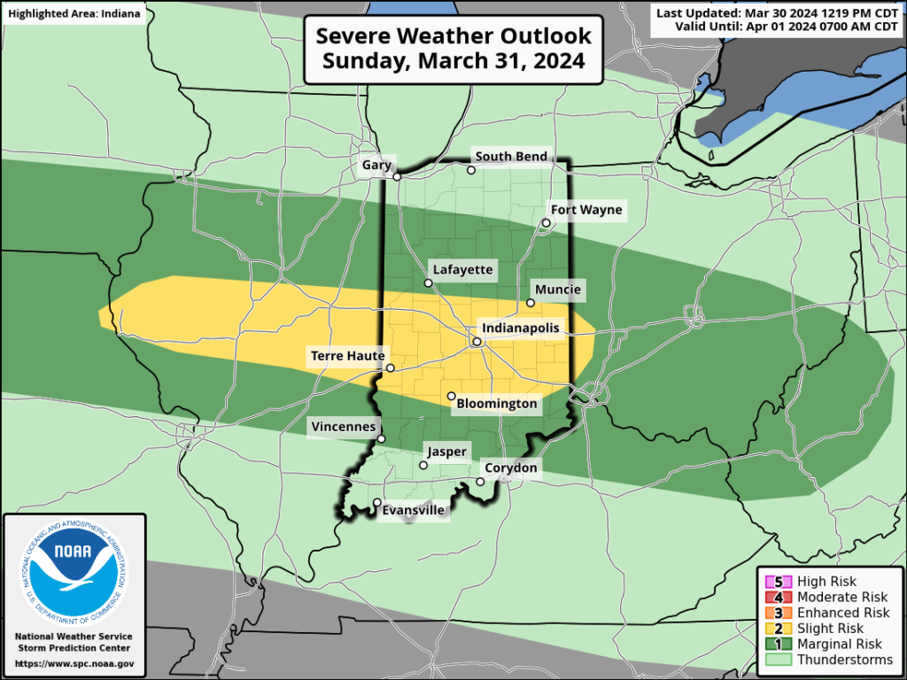
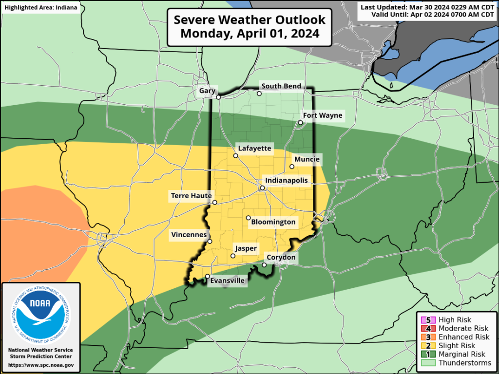
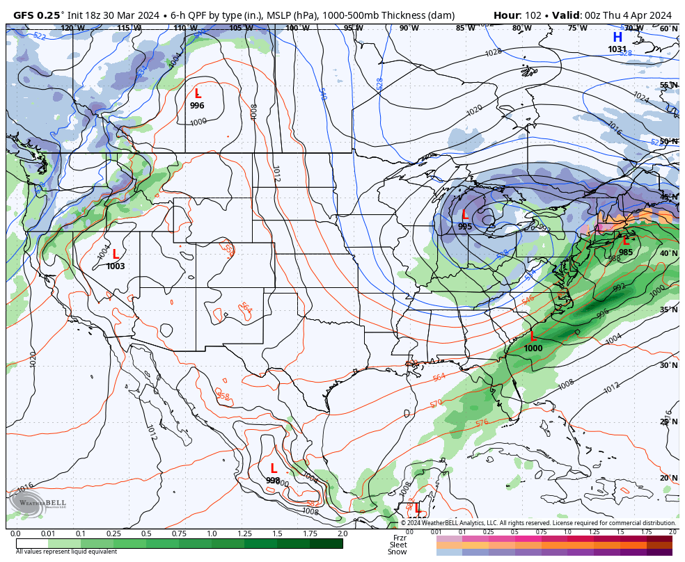
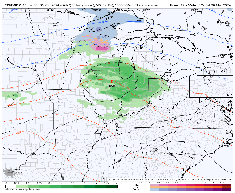
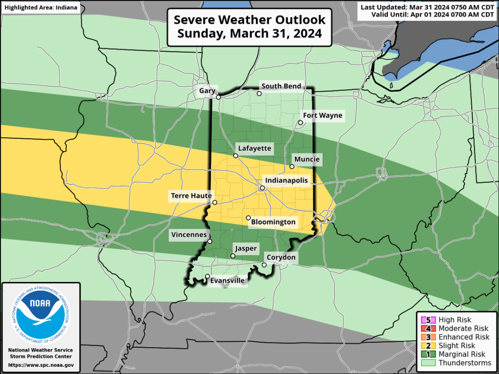
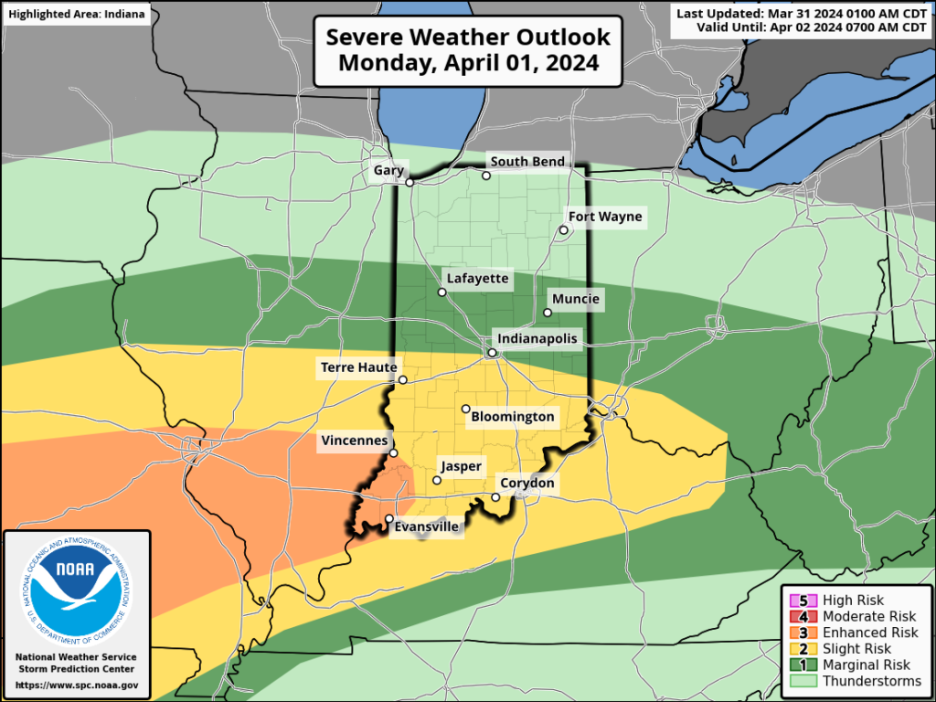
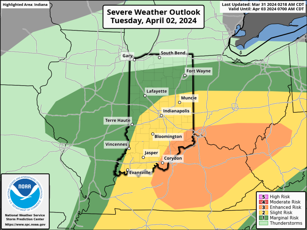
The upcoming immediate term will be headlined by a multi day heavy rain and severe weather episode. A stalled frontal boundary will serve as the pathway for multiple waves of low pressure to ride along through Tuesday. In addition to a heavy rain and flooding threat (primarily targeting immediate central and north-central Indiana), we’ll also likely have to deal with (3) rounds of severe storms. We’ll allow our short-term products to handle those severe threats, but just know all modes of severe are on the table with the greatest emphasis being on large hail with this setup. Should a couple discrete cells develop near or just south of the boundary then an elevated tornado threat would ensue. Again, we’ll have a fresh post hoisted later this afternoon or evening on that.
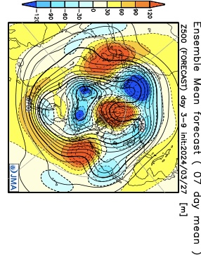
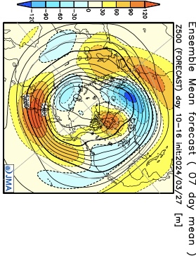
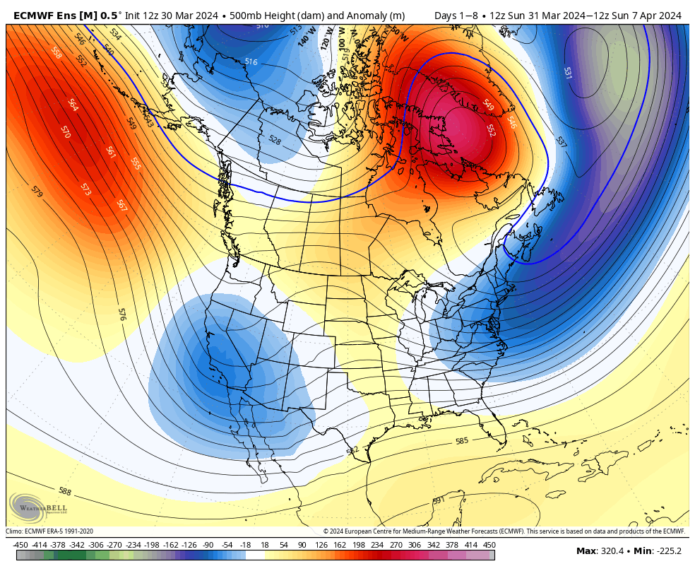
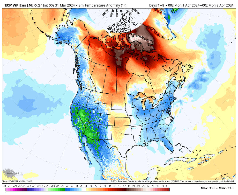
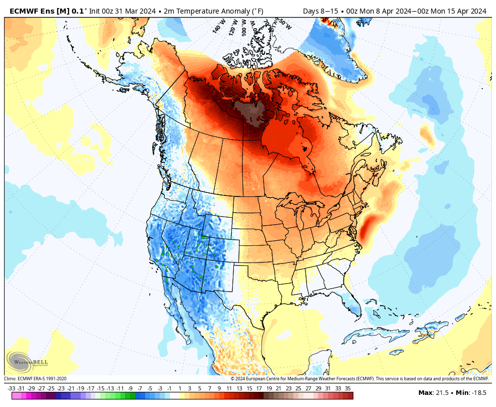
Overall, there’s no change in the idea of an active pattern continuing from Week 1 (image 1 below) into Week 2 (image 2 below).
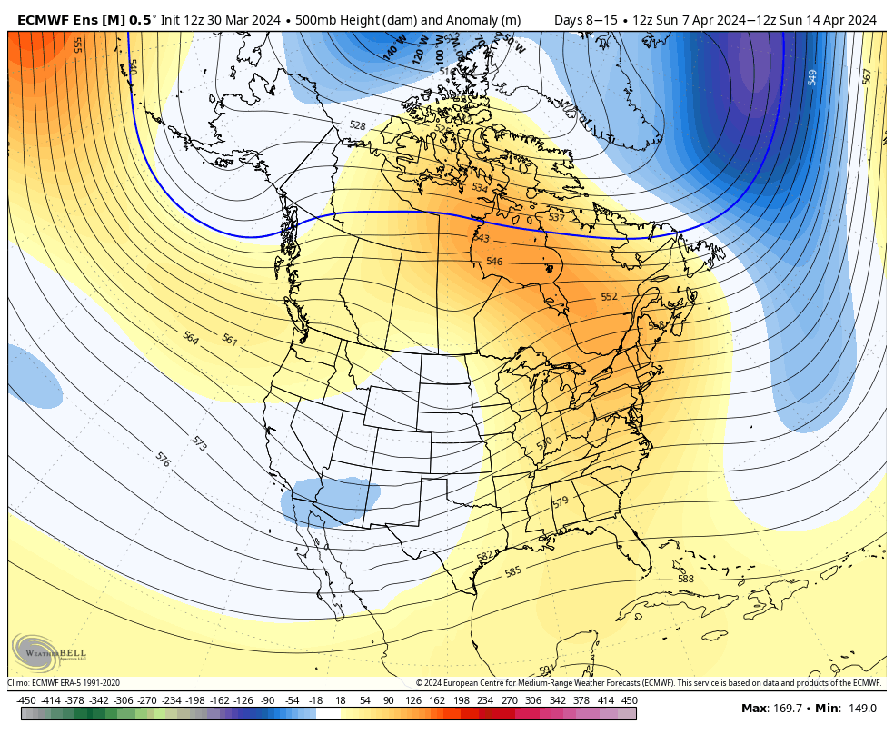
The cooler pattern behind our early week storm system will reverse in significant fashion Week 2. – Transitional regime at its finest.
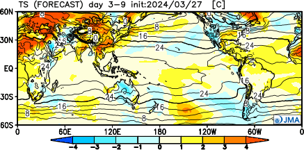
Week 1 temperature anomalies
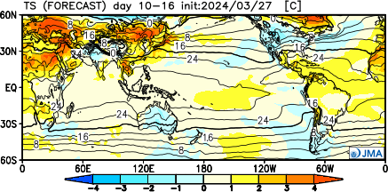
Week 2 temperature anomalies
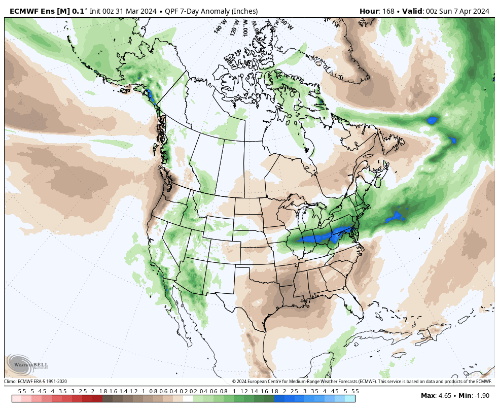
The busy nature of the pattern is reflected in the upcoming 2 week precipitation anomalies.
Severe weather will be possible at least across a portion of our immediate viewing area starting this evening and continuing daily through Tuesday.
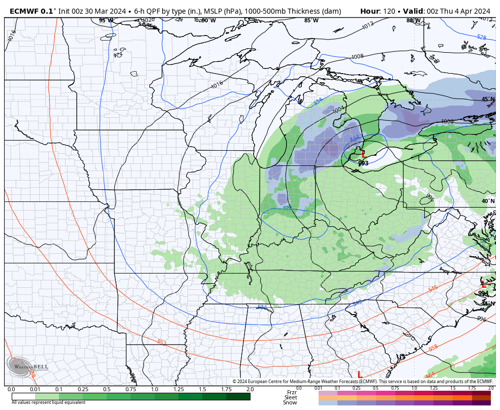
Colder air will crash in here Wednesday and as an upper low swirls overhead, wet snow will develop. Snow may even fall heavily enough to accumulate on grassy surfaces in spots Wednesday night into Thursday morning.
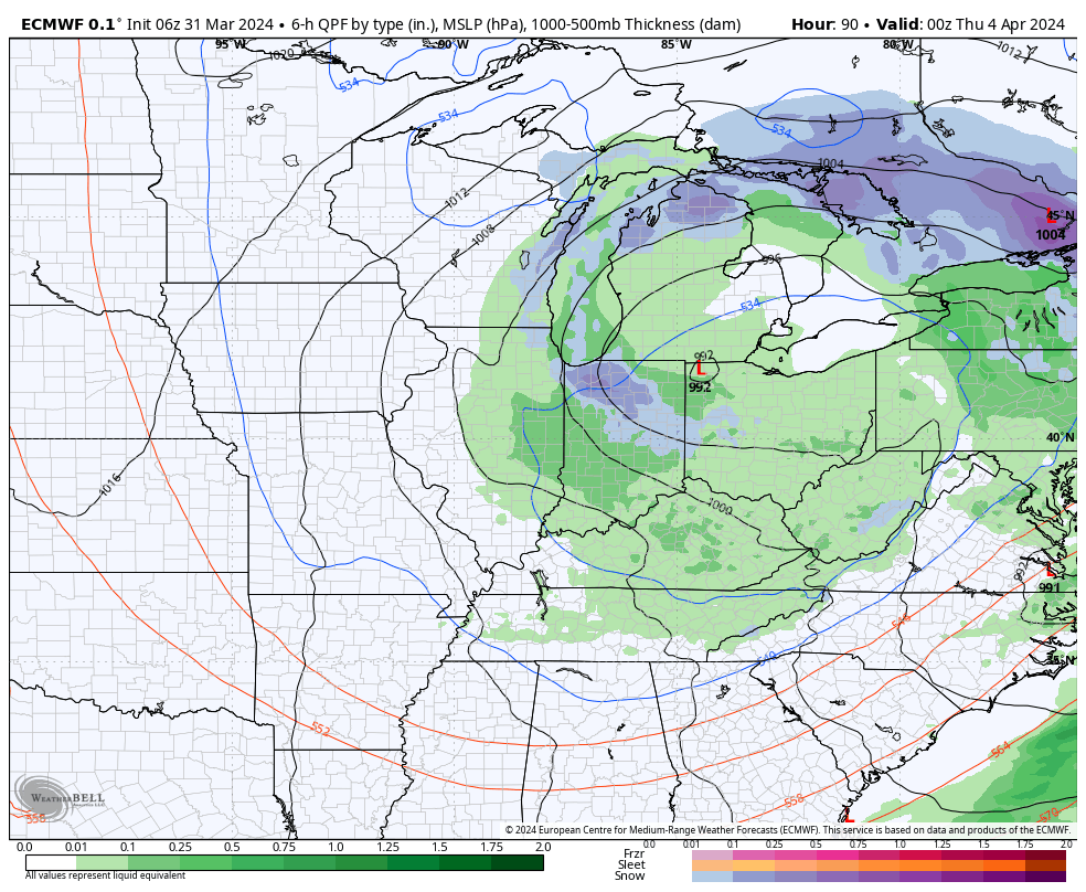
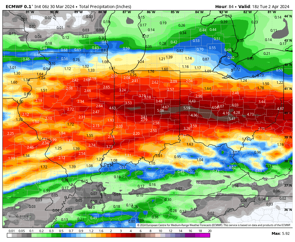
*Upcoming 10-Day Rainfall Projection: 3” to 4”+