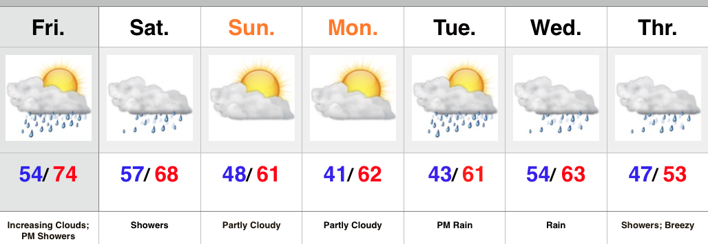
Heavy Rain Then Colder…
Today can be labeled as the so called “calm before the storm,” as sunny skies greet us out the door. It’ll be a very pleasant Monday with highs in the middle 60s. Sunny skies this morning will turn increasingly cloudy later in the day as moisture continues to stream north associated with Patricia’s remnants.
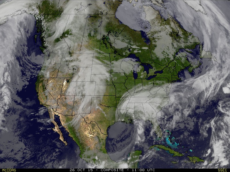
This morning’s satellite picture:
 When we look at the weather picture tomorrow we note the remnant moisture of Patricia continuing to lift north while a cold front approaches from the west. The “squeeze play” that will ensue over the region will be just what the doctor ordered as widespread rain develops during the daytime Tuesday before growing heavy Tuesday night.
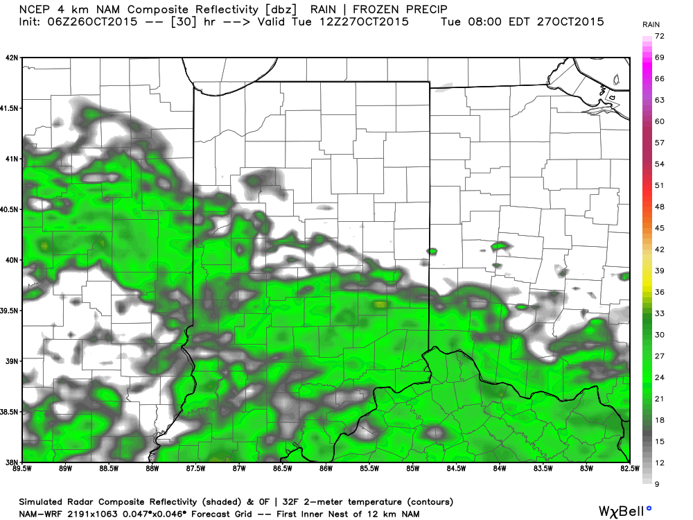
8a Tuesday Futurecast
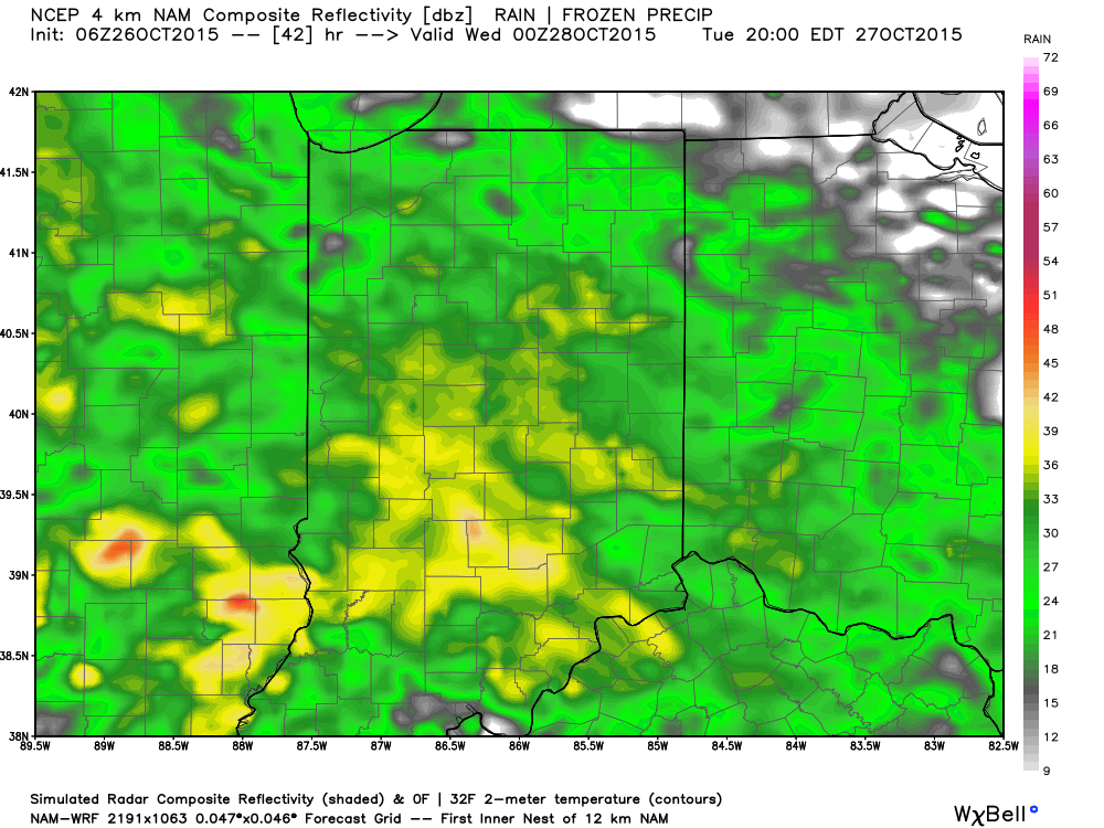
8p Tuesday Futurecast
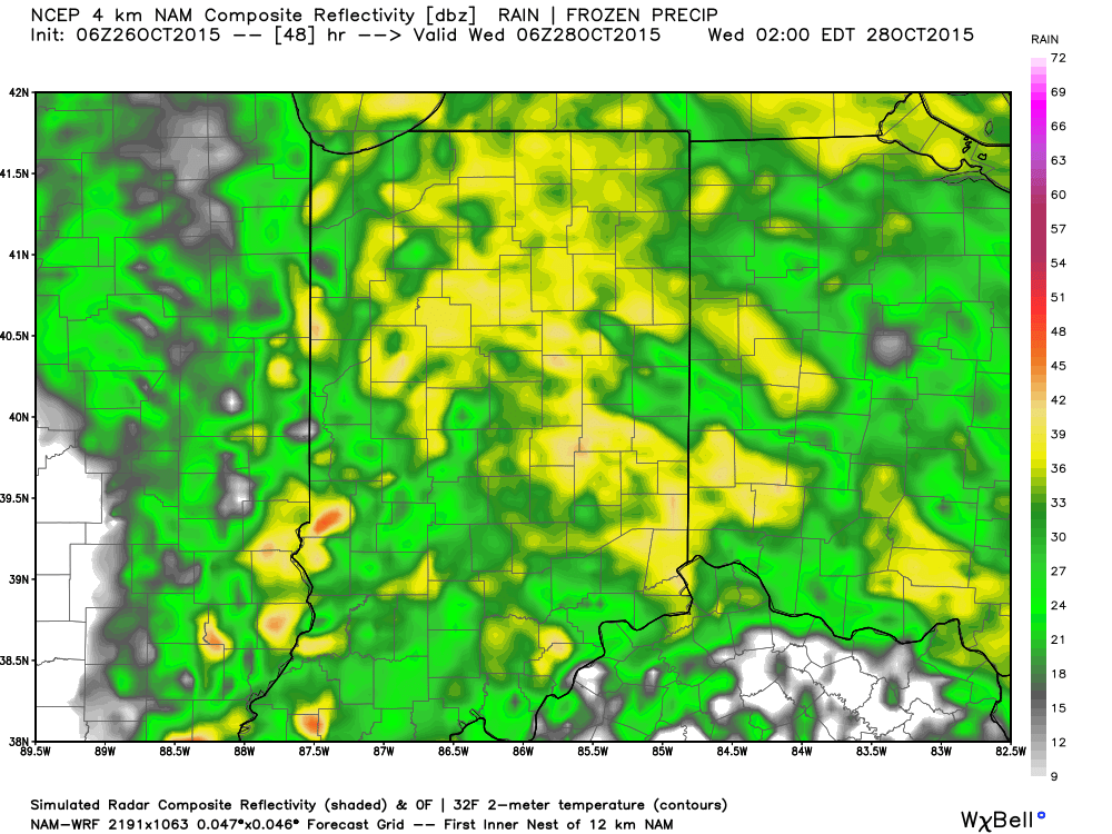
 Overnight Tuesday-Wednesday morning Futurecast
 Locally heavy rainfall can be expected. When you average (5) computer models at this point then you get the idea rainfall totals will be somewhere in the range of 1.5″-2″ inches, with locally heavier totals.
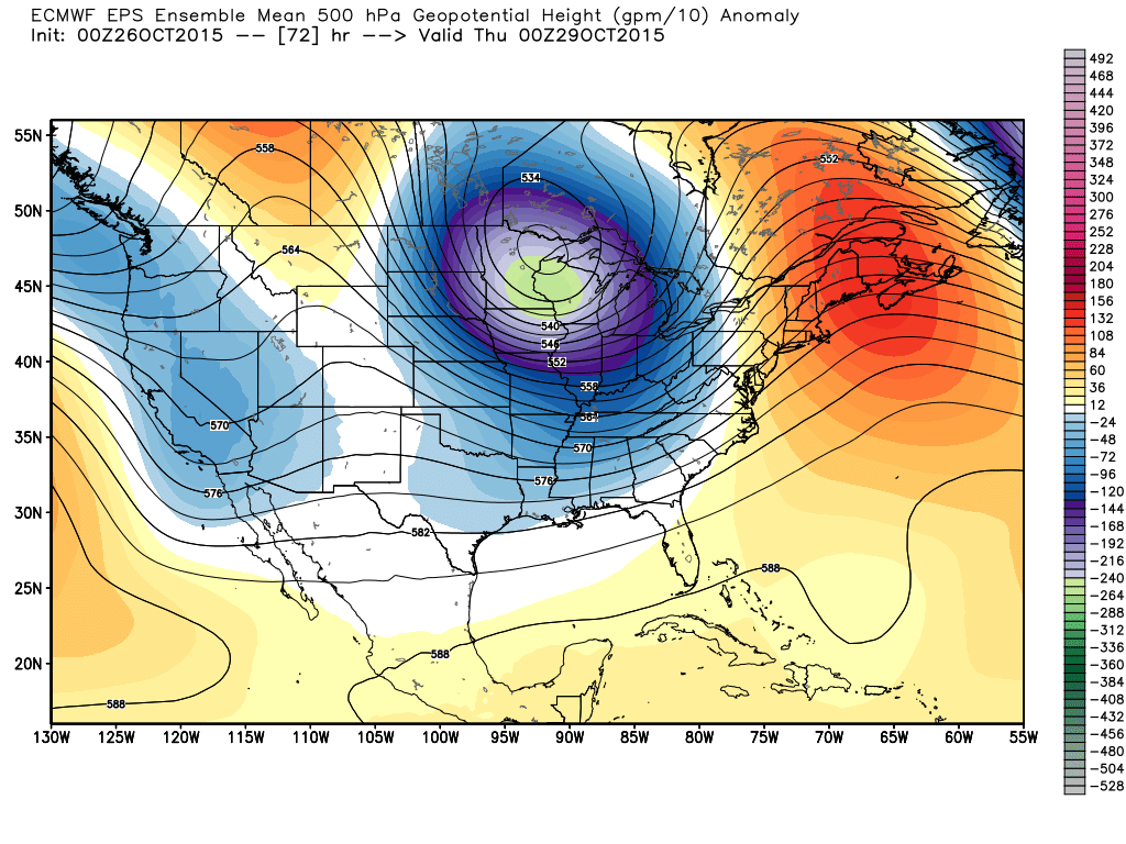
Modeled rainfall totals by Wednesday morning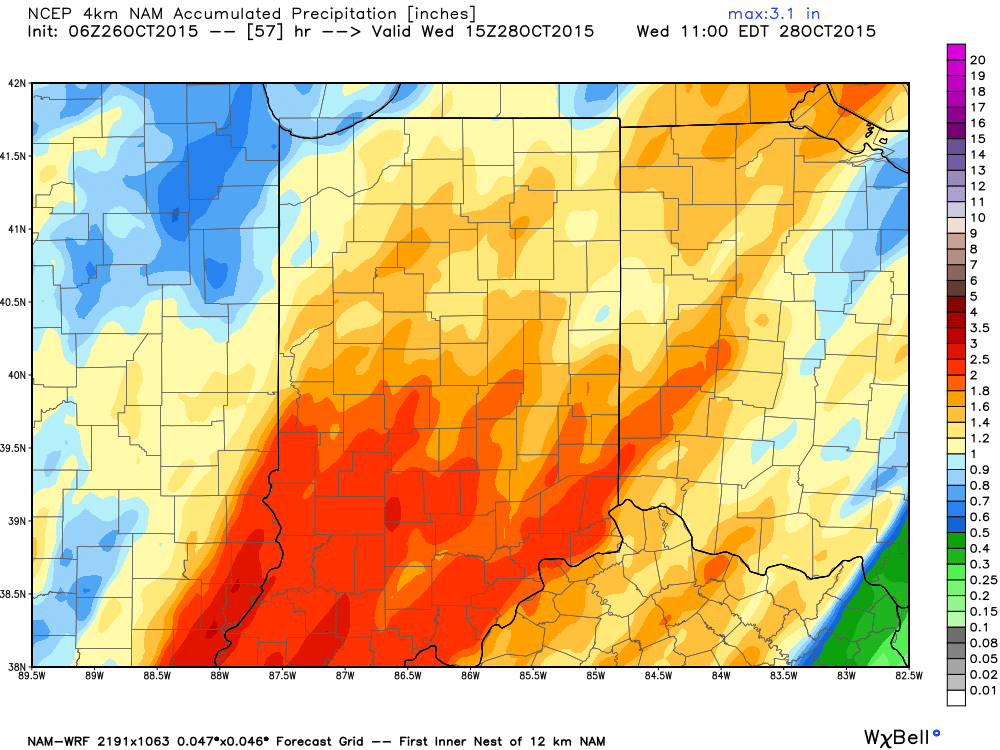 The story after the big rain storm moves away? A very windy and much cooler feel as a strong trough moves into the eastern portion of the country. This will keep temperatures significantly below normal for the 2nd half of the week on into the weekend.