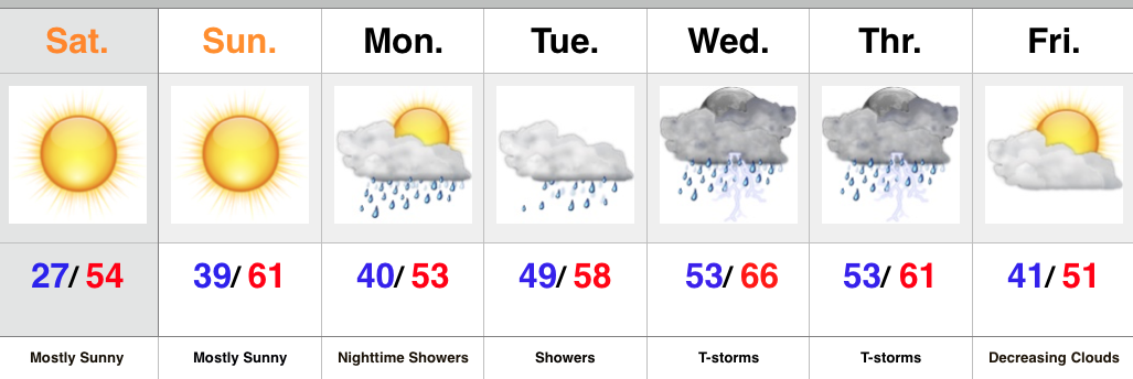
Enjoy the weekend, my friends, as a big and wet storm system awaits on deck to impact early to mid week across the region.
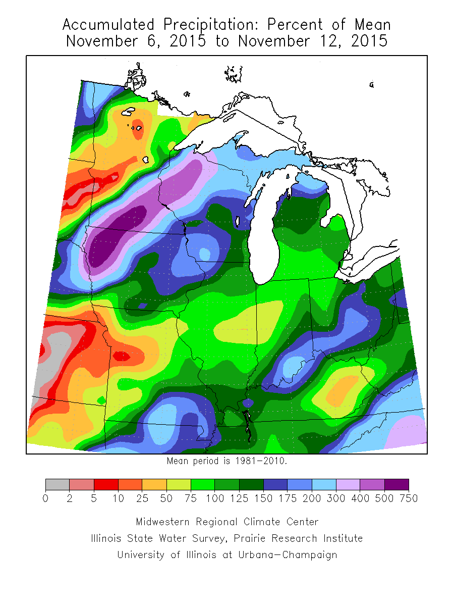
November, so far, has followed suit of the past few months in a much drier than normal regime. Over the past (7) days heaviest rains fell across SE portions of the state. On the month so far, IND sits around 1″ below normal.
Past 7 day precipitation anomalies, courtesy of the MidWest Climate Watch.
That rainfall deficit may be eaten up over the course of a couple days as our next storm system rolls off the Rockies and into the Plains. (Track sound familiar)?
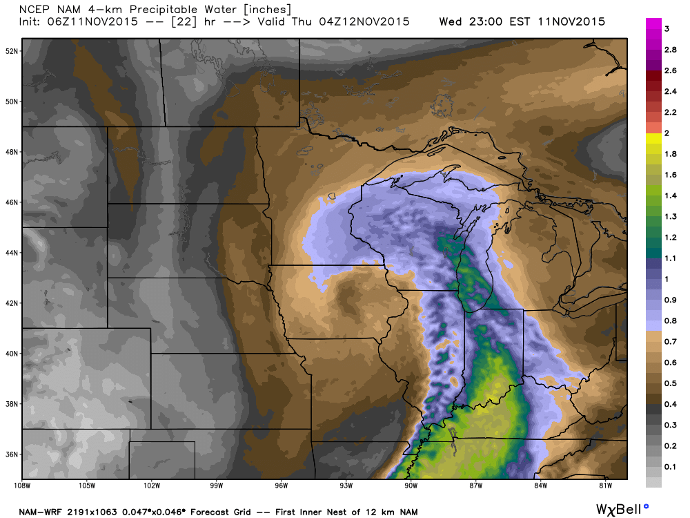
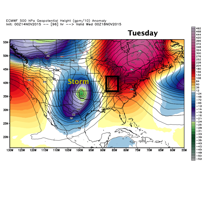
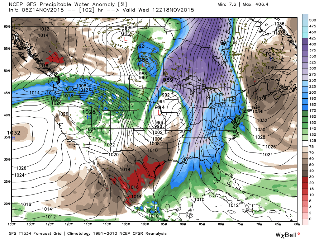
The storm will tap into the Gulf of Mexico and include a deep southerly flow plenty capable of producing a heavy rain event across the region. Note PWATs (precipitable water) nearly 300% of normal.
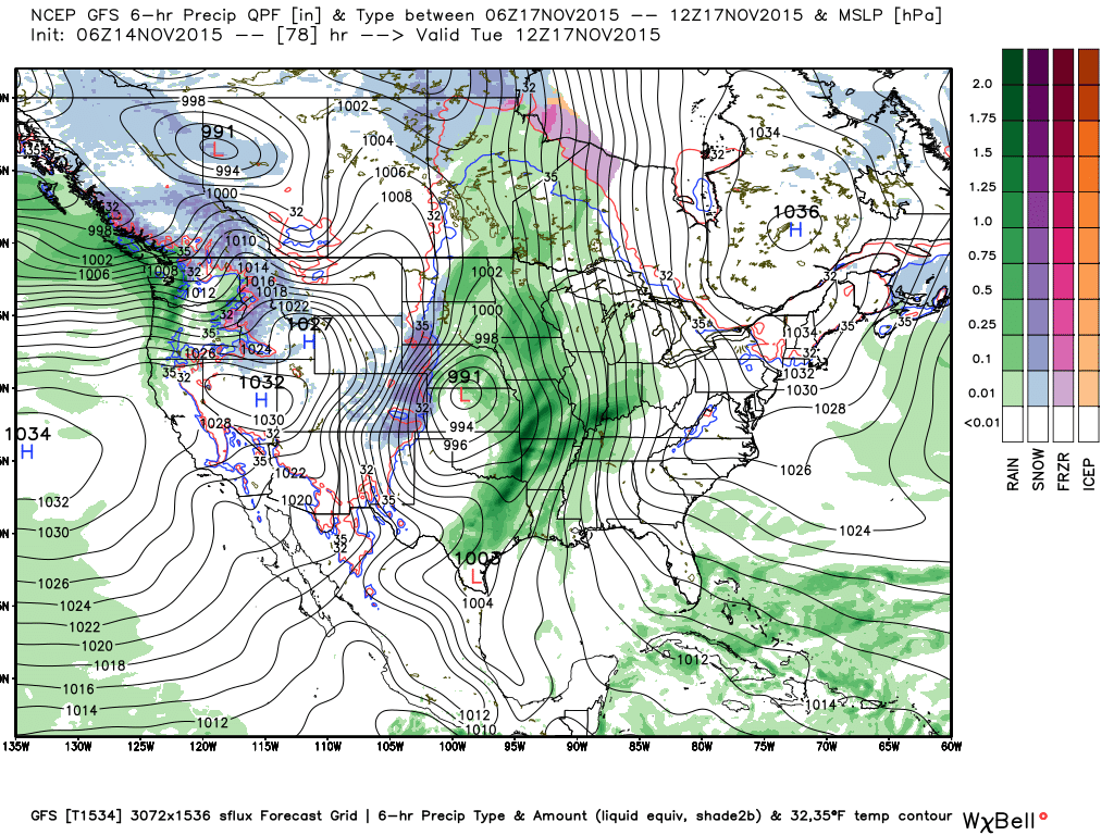
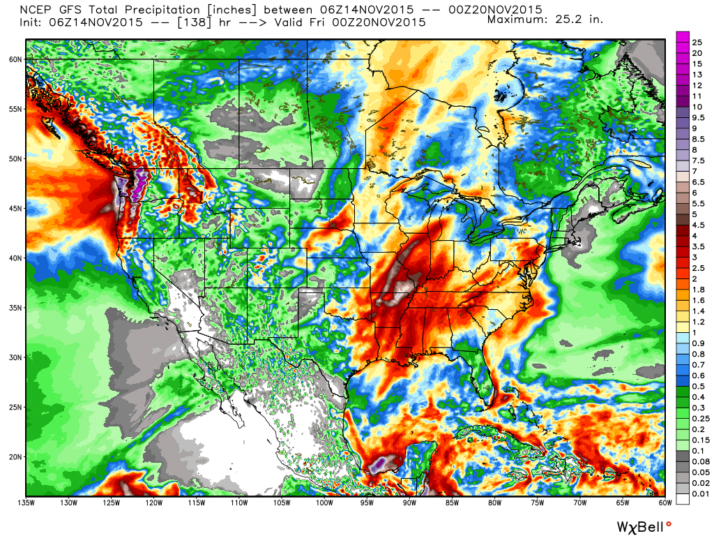
We target Tuesday night-Wednesday as the focal point for heaviest rain potential and model data remains firm on general consensus of 2″-3″ falling with this next storm system, including locally heavier totals.
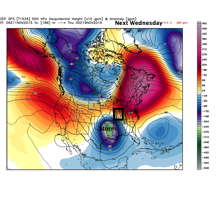
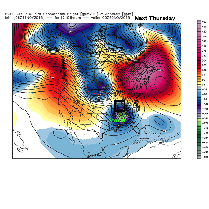
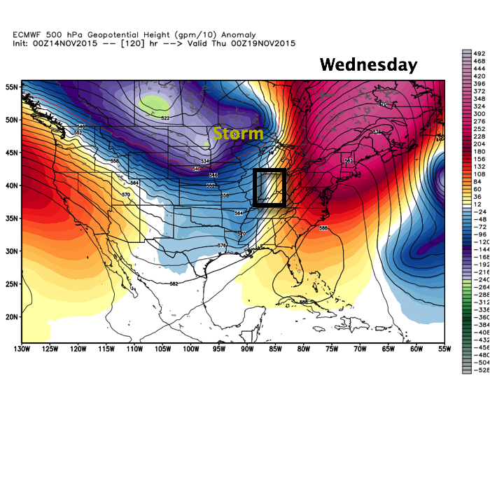
After this next storm, attention will begin to shift towards a colder pattern setting up for late November, including Thanksgiving…
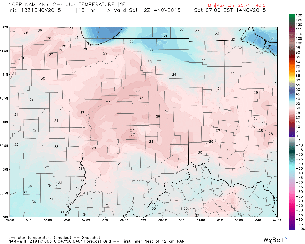
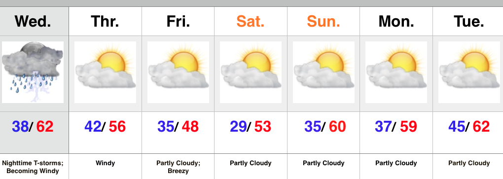
Today has featured wall-to-wall sunshine and while it’s looked great from the inside looking out, that wind is still whipping! Gusts have reached 40 MPH in spots across central and northern parts of the state.
Winds will finally die down tonight and with clear skies in place a hard freeze awaits for central IN. The latest high resolution data, courtesy of Weatherbell.com, suggests mid to upper 20s tonight and we agree.
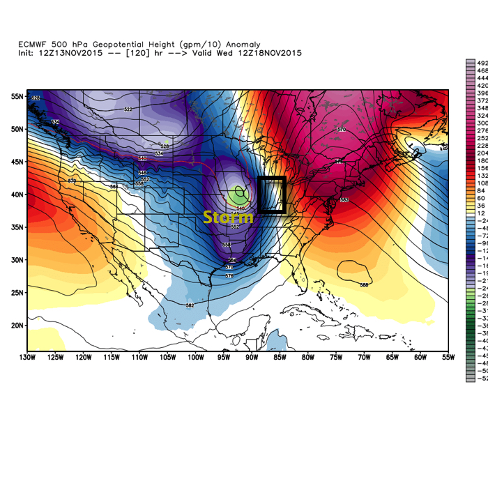
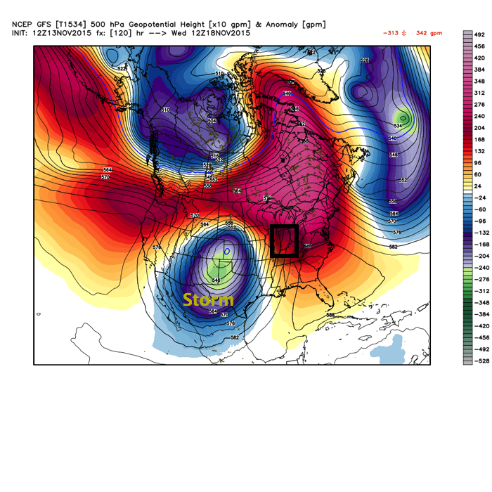
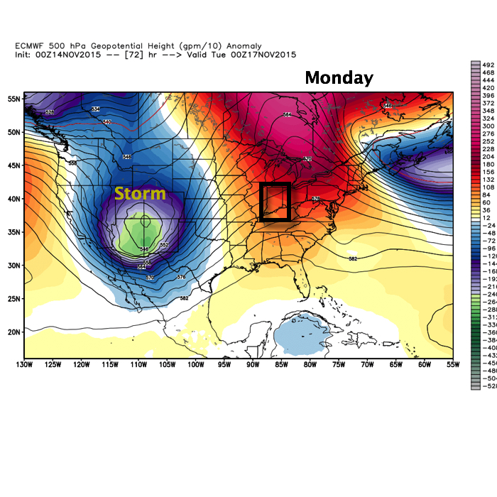
Our next big autumn storm awaits for the early and middle portions of next week. Questions remain concerning severe weather across our area, but as of now it appears the dynamics needed for severe weather, locally, will remain too far to our west. We’ll continue to monitor. Latest forecast models (Euro top and GFS bottom) have some differences with the track of our next storm- both centered on Tuesday night.
The differences with timing and track are significant and we’ll continue to keep a close eye on things.
We remain very confident on heavy rainfall potential as a prolonged southerly fetch off the GOM (Gulf of Mexico) will transport copious moisture northbound. Widespread 2″-3″ type rainfall totals are a good bet with this set up.
Longer term, we remain confident on a pattern change towards colder than normal conditions to wrap up November. Additionally, a storm system will likely cross the country Thanksgiving week and could offer up the season’s first widespread wintry “fun.”
You must be logged in to view this content. Click Here to become a member of IndyWX.com for full access. Already a member of IndyWx.com All-Access? Log-in here.
The morning has dawned with mid and high level clouds painting the back drop as the sun rises. We’ve shared several photos on our Twitter page (@IndyWx) of the beautiful sun rise. Thank you and keep ’em coming!
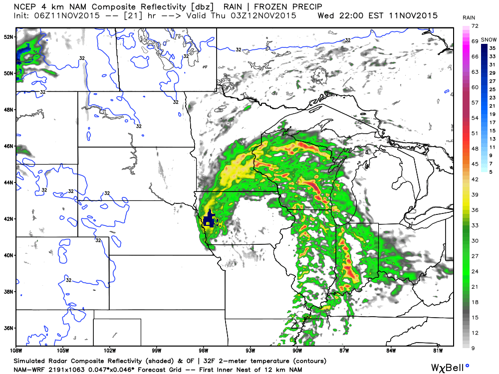
Low pressure is moving off the Rockies this morning (where another hefty snow dump took place overnight) and into the Plains. The low will then track into the Great Lakes Thursday. As the low moves northeast, it’ll swing a cold front through our neck of the woods Thursday morning. We still bracket tonight into the wee morning hours Thursday for thunderstorm potential. See the simulated radar valid at 10p this evening, courtesy of Weatherbell.com.
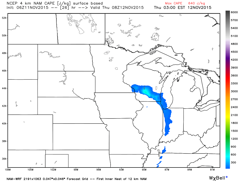
CAPE (Convective Available Potential Energy) is lacking with this storm and moisture return isn’t impressive. This is good news as it will reduce the amount of severe weather we’ll see. However, it should be noted that it won’t take much to bring down a severe wind report or two and that is our primary concern tonight with any storm.
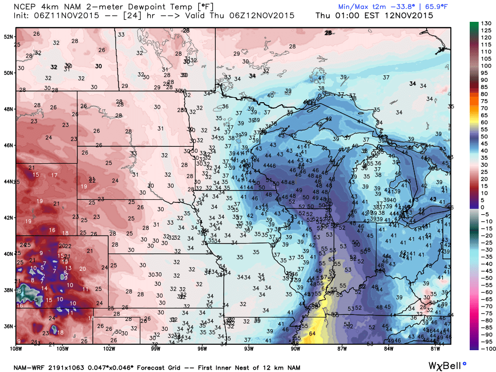
CAPE- courtesy of Weatherbell.comSurface Dew Points- courtesy of Weatherbell.comPrecipitable Water- courtesy of Weatherbell.com
Because of the lack of moisture return and the overall speed of the system, rainfall tonight won’t be impressive for most (0.25″-0.50″ on average) with the exception of localized stronger storms.
What will be impressive is the wind, even without storms. A Wind Advisory has been issued for late tonight and Thursday, via the National Weather Service out of Indianapolis, and rightfully so. We wouldn’t be surprised if a portion of this is upgraded to a High Wind Warning later today or tonight as gusts of 50 MPH+ will be a concern through the day Thursday as our low occludes over the Lakes.
A period of drier air will return to wrap up the week and head into early next week, but we eye another big storm system for the middle of next week. Forecast models differ on precise details, as you’d expect at this juncture.
The GFS (above) isn’t shying away from another significant impact event. The European isn’t as bullish early on. All mid range models do produce moderate to heavy rains over the region. Stay tuned as we continue to monitor.
Please excuse the lighting in this video. (Still trying to get the new office set up)! https://youtu.be/l15pHYwTq_I
You must be logged in to view this content. Click Here to become a member of IndyWX.com for full access. Already a member of IndyWx.com All-Access? Log-in here.
 The storm will tap into the Gulf of Mexico and include a deep southerly flow plenty capable of producing a heavy rain event across the region. Note PWATs (precipitable water) nearly 300% of normal.
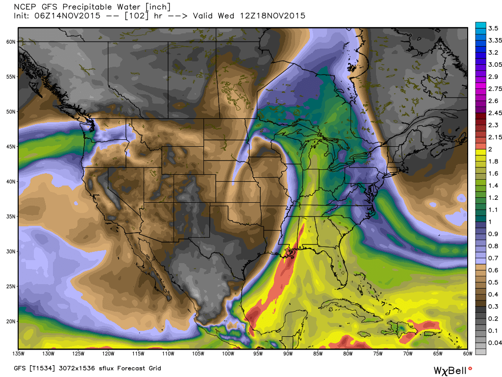
 After this next storm, attention will begin to shift towards a colder pattern setting up for late November, including Thanksgiving…