Stormy For Some This Morning; Transient Pattern Into August…
You must be logged in to view this content. Click Here to become a member of IndyWX.com for full access. Already a member of IndyWx.com All-Access? Log-in here.
You must be logged in to view this content. Click Here to become a member of IndyWX.com for full access. Already a member of IndyWx.com All-Access? Log-in here.
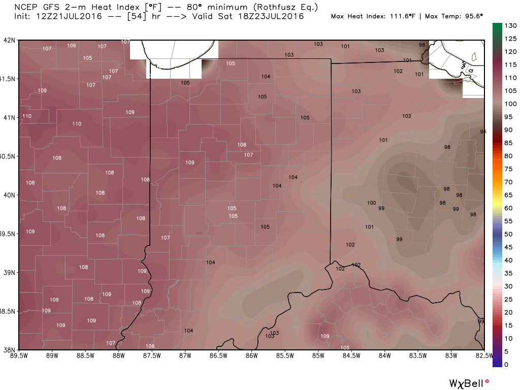
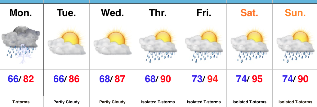
1.) A big ole ridge will supply oppressive heat and humidity across the Mid West this weekend. Unseasonably hot temperatures will combine with downright “soupy” air to create heat indices between 105-110 degrees across central IN this weekend. Take it easy and implement frequent breaks if your plans take you outdoors.
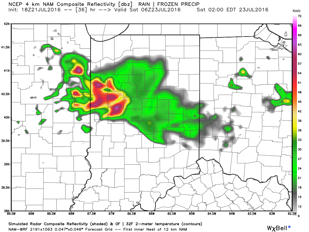
2.) Similar to what we’re seeing on radar this evening, thunderstorms will also make an appearance from time to time for some. With an atmosphere loaded with moisture, any storm that develops will be plenty capable of producing “frog straggler” type rainfall rates. Perhaps there will be a couple periods of more concentrated storm activity, focused on late tomorrow night and early Saturday, and again late Saturday night-Sunday morning. We’ll keep an eye on things.
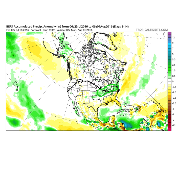
3.) The pattern is one (as has been the case all summer) that’s transient and the situation that develops to wrap up July and open August is an all-too-familiar look around these parts: NW flow aloft that offers storm potential, along with seasonal to slightly warmer than average. It’s a wet look, overall.
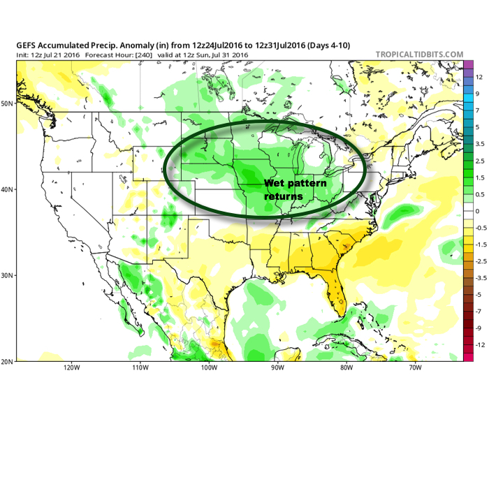
This is what the upper air pattern should look like as we close July- 10 days from now (hard to believe)!
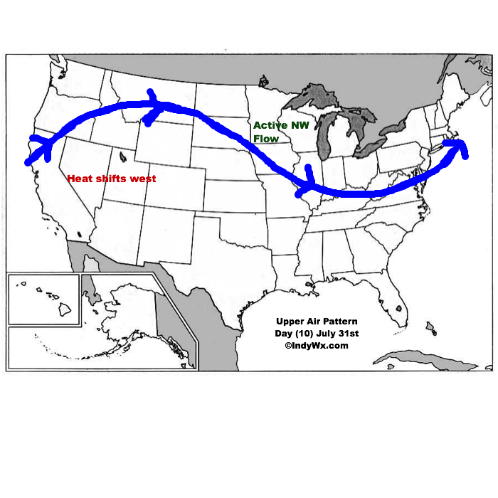
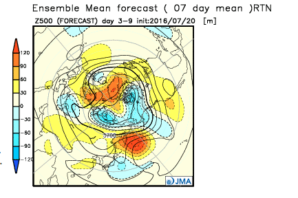
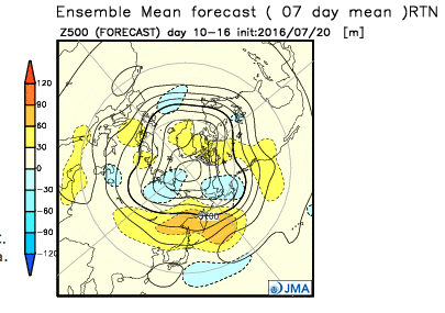
4.) Looking further ahead, the latest JMA Weeklies continue to suggest the most sustained hot pattern should remain across the west as we rumble deeper into August. That’s not to say we won’t deal with periods of hot weather here at times, but sustained heat will be hard to come by with such a pattern…
 Highlights:
Renewed Storm Chances Later Today…Alarm clocks weren’t needed today as a big complex of storms and heavy rain rumbled through the state during the pre-dawn hours. Many neighborhoods received a quick 2.5″+ during the overnight and predawn hours. As we write this, renewed thunderstorms are firing to our west and will impact portions of the state later this afternoon. Additional hefty rains are a good bet for some.
We’ll dry things out as we rumble through the mid week stretch and while isolated storms are possible to close the week, most folks should remain dry as a big ole’ upper ridge builds over the mid west. The big story will be intensifying hot, humid weather- centered on Friday-Saturday. Heat indices will approach 100-105 degrees during this time frame, as well. The good news is that forecast data points to the associated hot dome backing west and setting up shop over the Rockies to close the month and open August. Accordingly, the hottest anomalies will shift west, as well. We’ll be left with a NW flow aloft providing a cooler and unsettled stretch to close the month of July and open August.
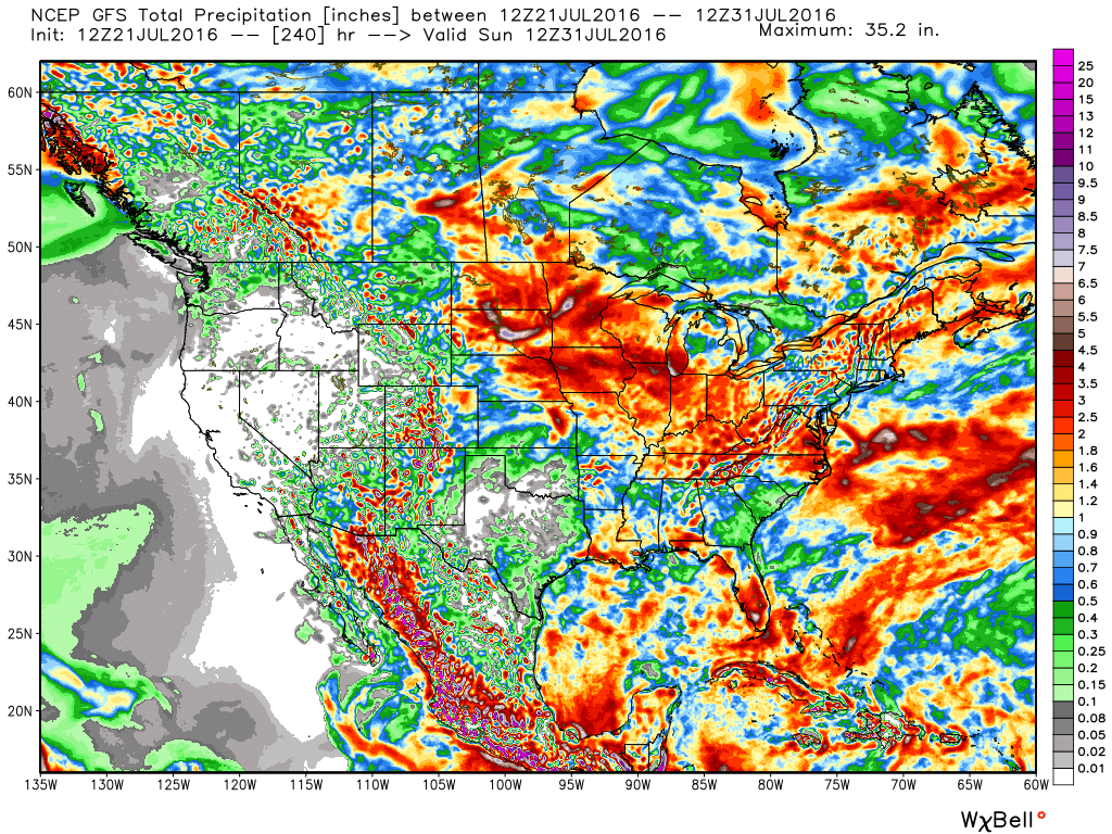
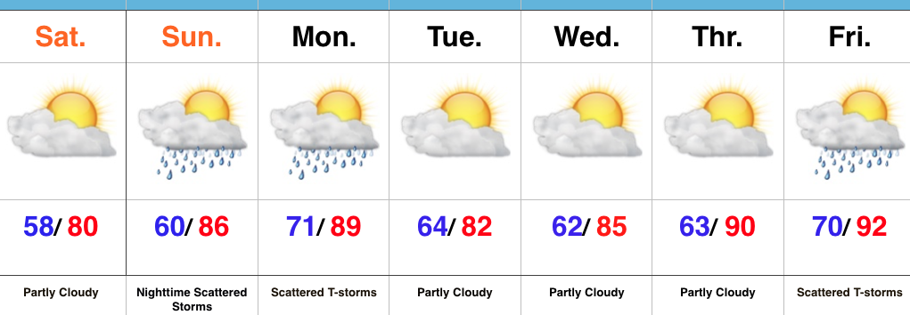
Upcoming 7-Day Precipitation Forecast:
 Highlights:
Refreshing Feel…A weak disturbance is tracking through central IN this morning with a band of clouds and a couple sprinkles. That said, sunshine will quickly return late morning into the afternoon and set up a beautiful day, along with pleasant temperatures and low humidity.
Our next round of storms will arrive from the NW late Sunday night into Monday. A few of these storms could be strong to severe and also include locally heavy rain.
Modeling disagrees on the magnitude of cooling and drier weather behind Monday’s front. The more aggressive GFS would imply another push of pleasant air for a couple days Tuesday-Wednesday, while the European isn’t as bullish. For now, we’ll split the difference and revisit tomorrow.
One thing that modeling does agree on is building late week heat. Expect a hot, humid close to the work week.
Upcoming 7-Day Precipitation Forecast:
You must be logged in to view this content. Click Here to become a member of IndyWX.com for full access. Already a member of IndyWx.com All-Access? Log-in here.