Another Stormy Day, But Relief Is Coming…
 Highlights:
- Storms increase in coverage and intensity this afternoon
- More refreshing air arrives for the weekend
- Quiet start to next week
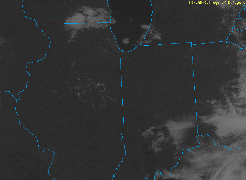
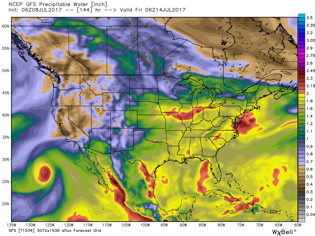
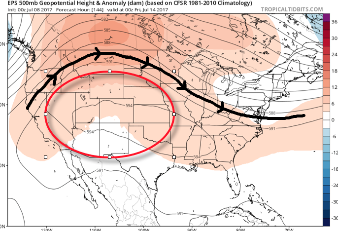
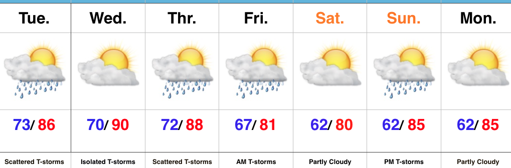
Stormy Afternoon On Deck…A frontal boundary will slip into the state today and slowly push south over the next 24 hours, eventually making it out of the state Friday. The combination of this trigger (front) along with a genuinely “soupy” air mass (precipitable water values will be north of 2″ and dew points will remain in the low-mid 70s) will result in increasing storm coverage this afternoon into the evening hours. Some of the storms may become severe and it also won’t take much for flash flooding to develop where storms train. In some cases, these storms will dump rainfall rates of 2″-3″/ hour. From a severe stand point, we’re most concerned for the potential of damaging straight line winds.
Thankfully, we’ll clear things out in time for the upcoming weekend. With the exception of a few morning thunderstorms downstate Friday, the trend will be a drier one and that will continue into Saturday. Along with the drier air, we’ll also note slightly cooler temperatures. It’ll feel much more refreshing than the past couple days.
A weak reinforcing cold front will sweep through the state Sunday evening and this boundary could kick-up a scattered thunderstorm or two Sunday afternoon-evening before we return to dry times Monday and Tuesday. Moisture (and heat) will return by the middle of next week.
Upcoming 7-Day Precipitation Forecast:
- Snowfall: 0.00″
- Rainfall: 1″-2″ (locally heavier totals)
 Highlights:
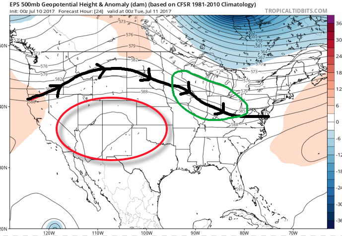 A quick step outside this morning will tell the story on just how different it feels. Gone is the refreshing air mass we enjoyed over the weekend and in return we’ve transitioned to an oppressive, tropical feel. Dew points will remain in the 70s through the majority of the work week and precipitable water values will reach 2″+ at times. With such a moisture laden air mass in place, flash flooding will likely result for some communities as the storms continue to track over the same areas this week.
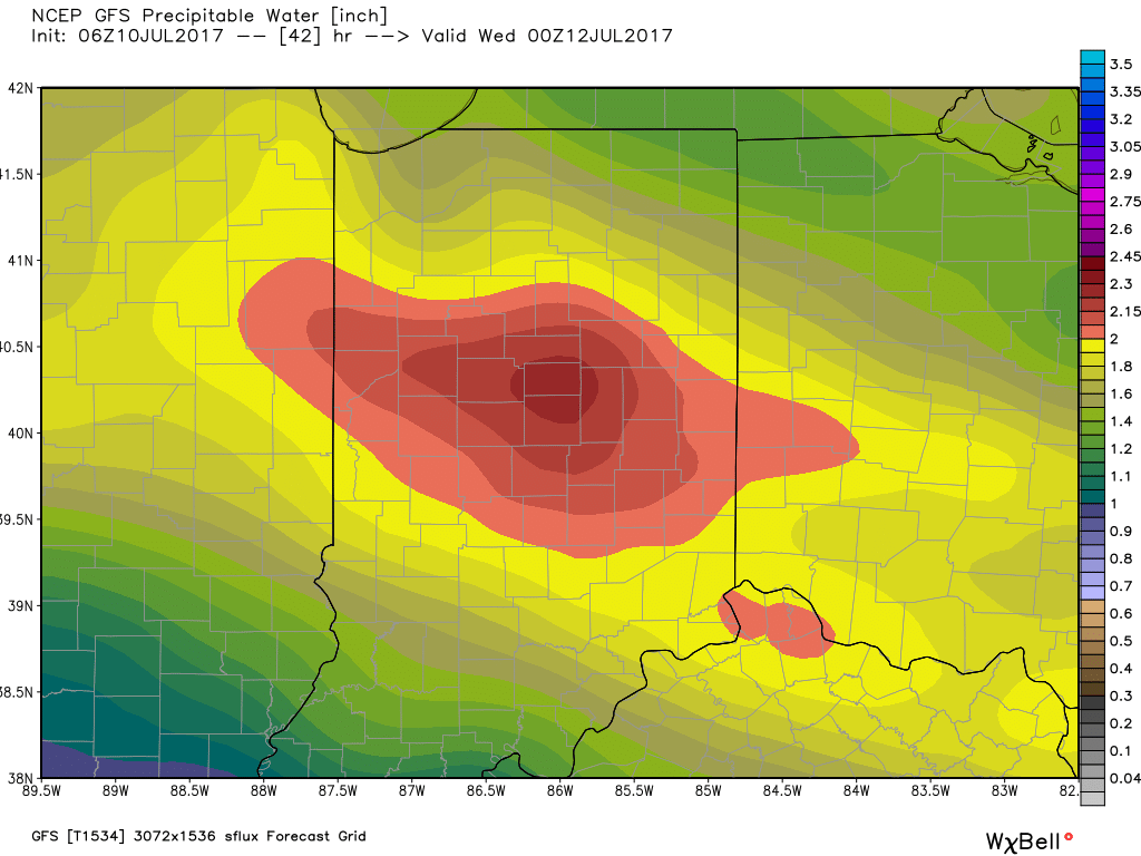 Additional waves of thunderstorms will impact the region through mid-and-late week before we advect some drier air into the state Friday evening into the weekend. Despite the lower dew points and cooler air, we still can’t rule out a shower or thunderstorm this weekend as a secondary front settles south.
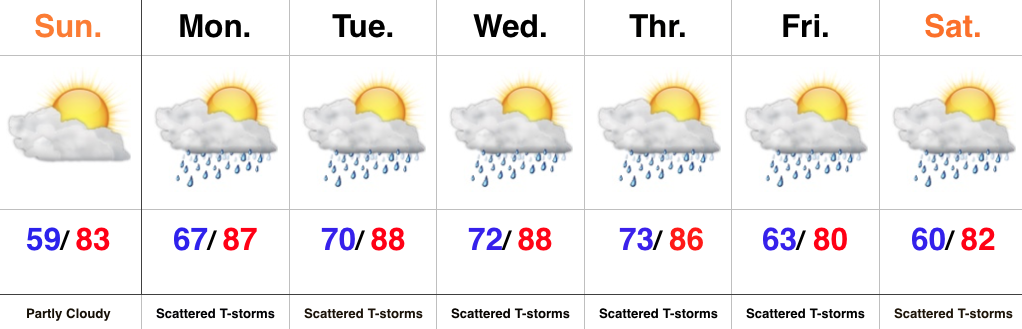 Highlights: