Burst Of Snow Transitions To Sleet & Freezing Rain Before Ending…
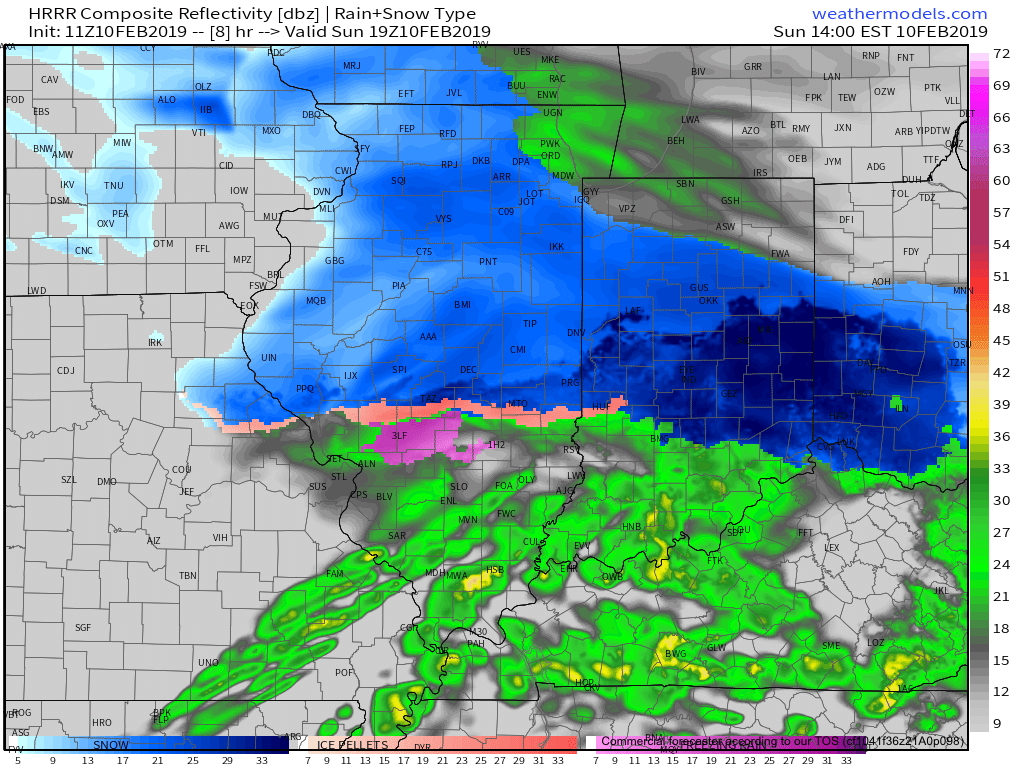
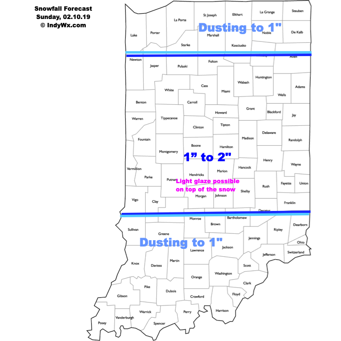
A burst of snow will move across central Indiana during the predawn hours (a few hours earlier than guidance suggested). Precipitation will become more widespread late morning into the early afternoon hours and as milder air aloft arrives on the scene, light snow will transition to sleet and freezing rain before ending. Further north (Kokomo to Ft. Wayne), precipitation is expected to remain all snow where 1”-3” will fall today before ending. Highs will top out around the freezing mark later this afternoon before falling into the middle 20s tonight. A few slick spots may develop on area roadways.
Much more later this morning on the week ahead and what looms further down the road as we wrap up the month.