Client Brief: Wintry Mix Arrives This Evening; Slick Travel Expected Across A Portion Of The Region…
Type: Impactful Wintry Weather
What: Coating of snow and light glaze of ice
When: This evening into tonight
Temperatures: Upper 20s to around 30° before rising into the upper 30s after sunrise
Wind: Southeast tonight 20-30 MPH, shifting to the south Saturday morning and gusting to 40 MPH before shifting to the west behind the cold front Saturday evening.
Blowing/ Drifting: Non-existent
Pavement Impacts: Salting will be required today.

An area of low pressure will track across the central Plains today into the lower Great Lakes and into New England Saturday into Sunday. An associated cold front will sweep through the region Saturday PM resulting in a return of very cold air Saturday night into early next week.
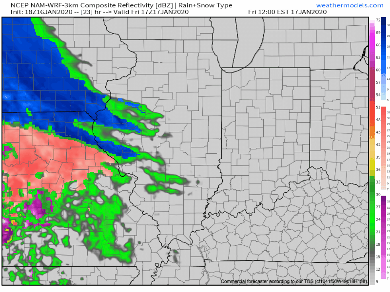
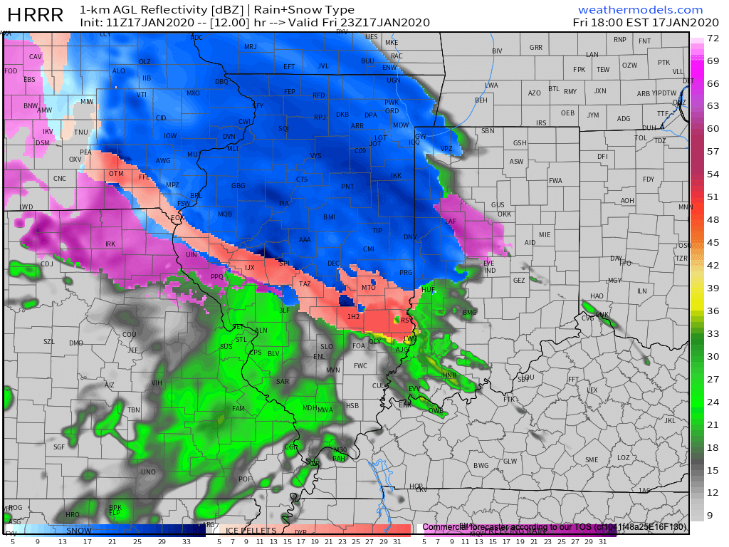
The majority of the day will remain precipitation-free across the state with a lowering and thickening cloud deck by afternoon. As our attention shifts to late afternoon and evening, an initial burst of snow will make it’s way into west-central Indiana (around Terre Haute) before arriving into the city, itself, towards 6p to 7p. For a good chunk of central Indiana, this snow will transition rather quickly to a mix of sleet and freezing rain as evening gives way to nighttime. In and around Indianapolis and northern suburbs, expect a snow/ sleet accumulation of up to 1″ followed by a light glaze of ice. Further north, snow will hang on longer as the predominant precipitation type, resulting in accumulations of 2″ to 4″. If traveling this evening into tonight, icy roads are likely across central Indiana. Temperatures will warm above freezing prior to sunrise Saturday with significant improvement expected on area roadways. This will help precipitation transition to a cold rain Saturday morning before a cold front whips across the state and sends temperatures into a nose dive Saturday evening. Gusty winds will accompany this frontal passage (40 MPH gusts) and any leftover moisture will refreeze Saturday evening resulting in patchy black ice issues on untreated surfaces.
Confidence: High
Next Update: Tonight