Grab The Jacket…
 Highlights:
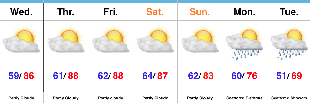
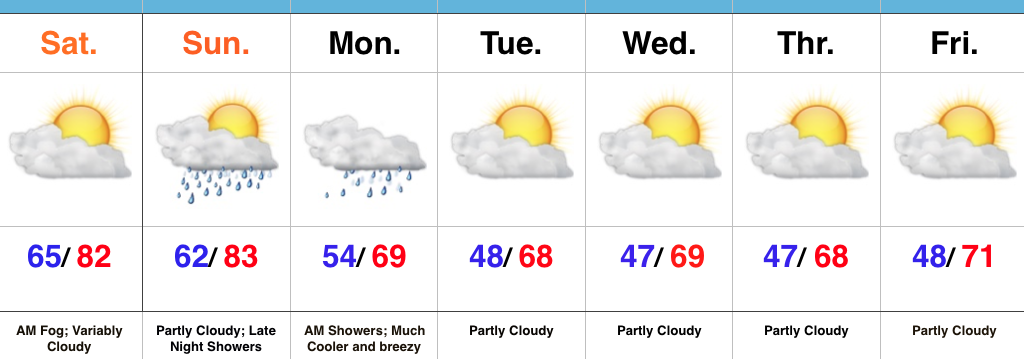
- Tuesday sunshine gives way to increasing clouds
- Unsettled, unseasonably cool stretch of weather ahead
- Beginning to dry things out late in the weekend
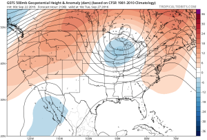
Prolonged Stretch Of Unseasonably Cool; Unsettled Weather…A cold front swept through the region this morning with a round of showers and thunderstorms followed by a push of drastically drier and cooler air for the PM. The coolest night since spring is dialed up with a mostly clear sky. Many central IN neighborhoods should be in the mid/ upper 40s Tuesday morning.
Enjoy the sunshine Tuesday as clouds being to increase during the second half of the day. A cut off upper level low will drop south and “meander” around our neck of the woods for mid and late week. This will supply considerable cloudiness, periods of scattered showers, and unseasonably cool temperatures. Even some small hail is possible (with the stronger showers) during the afternoon hours, thanks to the cold air aloft.
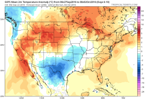
We’ll slowly begin to dry things out and allow temperatures to moderate heading through the back half of the weekend, continuing into early next week.
Upcoming 7-Day Precipitation Forecast:
- Snowfall: 0.00″
- Rainfall: 0.25″ – 0.75″
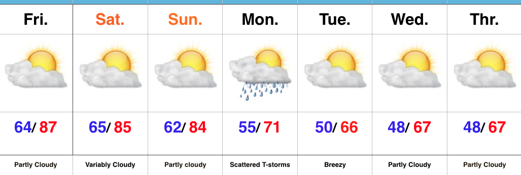
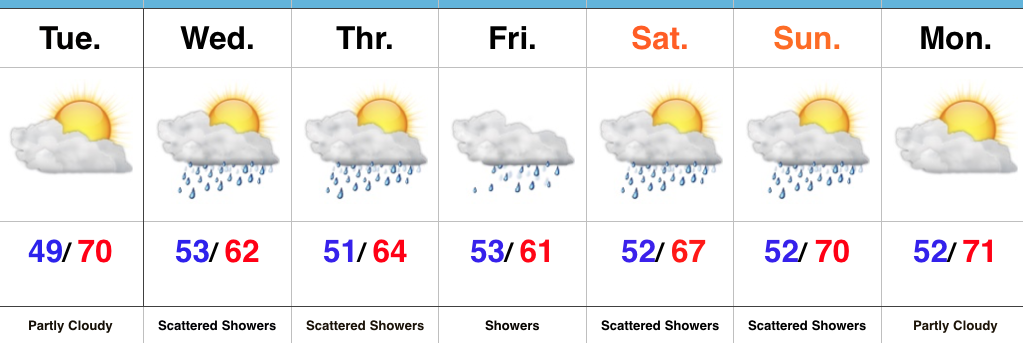
 A “backdoor” cold front will approach the region from the northeast late in the weekend, but won’t have enough “umph” to push the drier, cooler air our friends across the northeast and mid Atlantic will enjoy our way.
 The evolution of the pattern from an unseasonably warm, dry regime to a much cooler, autumnal feel will, undoubtedly, feature showers and thunderstorms as we transition. Modeling continues to waffle back and forth in regards to rainfall totals. As of now, we’ll highlight Monday-Wednesday with increased rain chances.
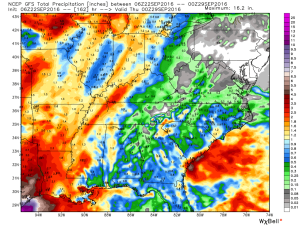 Thereafter, we turn MUCH cooler. Data suggests Tuesday-Friday features temperatures much more like we’d expect for late September. Lows in the 45-50 degree range, along with highs between 65-70 can be expected.