Incredible February Warmth Continues Until This Weekend…
 Highlights:
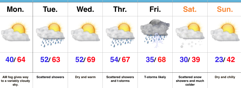
- Unseasonably warm conditions continue
- Strong-severe t-storm potential Friday PM
- Much colder this weekend
Spring-Like Weather Continues…A weak weather system will create the chance of showers into this afternoon, but many more dry hours can be expected than wet. In fact, some neighborhoods won’t even see a drop of rain today. The bigger news? A continuation of unseasonably warm, April-like, temperatures. In fact, we’ll turn even warmer for the second half of the work week and get back to dry time Wednesday and most of Thursday.
A strong cold front will sweep through the state Friday night. Ahead of this front, shower and thunderstorm coverage will increase Friday afternoon into the evening hours. Some of these storms may become strong to severe and include damaging straight line winds and hail.
We’ll then turn much colder Friday night and that will set the stage for a more seasonable weekend. Snow flurries may fly in the blustery northwest flow Saturday. A fast-moving weather maker will then spread a mixture of rain and wet snow across the state Sunday evening into early Monday. Confidence is low on timing of this late weekend system and fine tuning will be required moving forward.
Upcoming 7-Day Precipitation Forecast:
- Snowfall: Trace – Dusting
- Rainfall: 0.25″ – 0.75″
 Highlights:
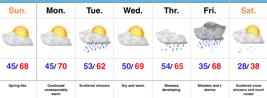 Highlights:
 Highlights:
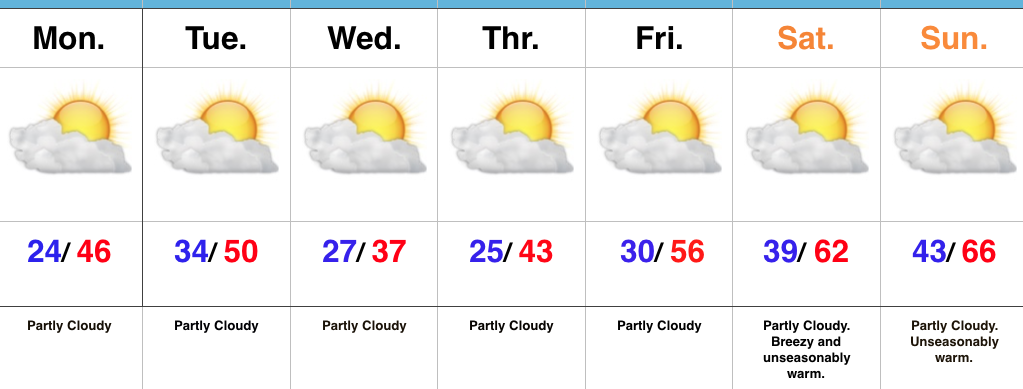 Highlights: