VIDEO: Weekend Heavy Rain Threat…
You must be logged in to view this content. Click Here to become a member of IndyWX.com for full access. Already a member of IndyWx.com All-Access? Log-in here.
You must be logged in to view this content. Click Here to become a member of IndyWX.com for full access. Already a member of IndyWx.com All-Access? Log-in here.
A combination of ingredients are coming together to offer up the potential of heavy rain for portions of the region this weekend.
An approaching cold front will drop slowly southeast out of the Plains while a tropical low moves inland from the central Gulf Coast.
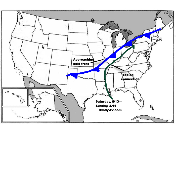 The precise placement of the front will serve as the focal point for heavy weekend rains. As we’d expect from this distance, modeling disagrees on the all-important specifics. Using a model blend, central Indiana is on the table for heavy late week-weekend rain as of now. Precipitable water values (PWATs) will be above 2″ and suggest the threat of torrential downpours, including localized flash flooding across the Ohio Valley. Eventually, the cold front will sweep the tropical-rich moisture away from the region and cooler, much less humid air will press in by this time next week.
We still have time to watch the evolution of things play out as we progress through mid week. Stay tuned as we “sure-up” the details and hone in on the area where heavy rain is likely.
 Highlights:
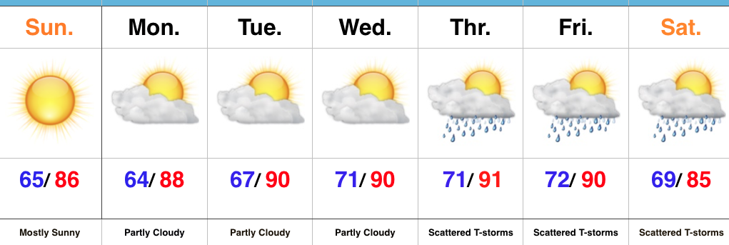
Turning Up The Heat…After a refreshing weekend, the heat returns later this week. Look for highs in the lower 90s with an oppressive feel to the air, as humidity builds. “Air you can wear” will be an appropriate forecast title come mid week. The forecast is easy through the midweek stretch with sunshine as the rule.
Things become more unclear as we approach the back half of the week and the weekend. We note the GFS is rather progressive in swinging a cold front through here with scattered showers and thunderstorms, followed by a significantly cooler/ drier air mass a week from today. On the other hand, the European solution is drastically different as it slows the front to a “crawl” coming through the Ohio Valley and also entrains GOM (Gulf of Mexico) moisture from the serious rain/ flood maker later this week across the Gulf states. It’s a significantly wetter look, locally, and a situation we’ll continue to keep a close eye on in the coming day, or two.
Upcoming 7-Day Precipitation Forecast:
You must be logged in to view this content. Click Here to become a member of IndyWX.com for full access. Already a member of IndyWx.com All-Access? Log-in here.
You must be logged in to view this content. Click Here to become a member of IndyWX.com for full access. Already a member of IndyWx.com All-Access? Log-in here.