1.) Humidity is on the rise this morning and scattered showers and thunderstorms will follow late morning into the early afternoon.
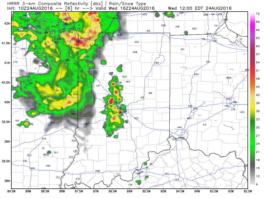
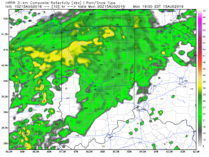
 2.) HRRR futurecast radar delivers thunderstorms into central IN around the lunchtime hour.
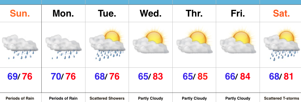
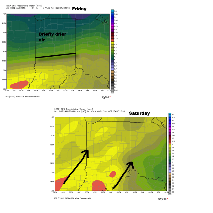
 3.) Scattered thunderstorms remain Thursday (some strong to severe), but drier air will briefly push in across the northern half of the region Friday. We think from Indianapolis and points north, it’ll be a very pleasant end to the work week. That said, “briefly” is the key word. Moisture will surge north again Saturday and Sunday and isolated to scattered storms will follow suit.
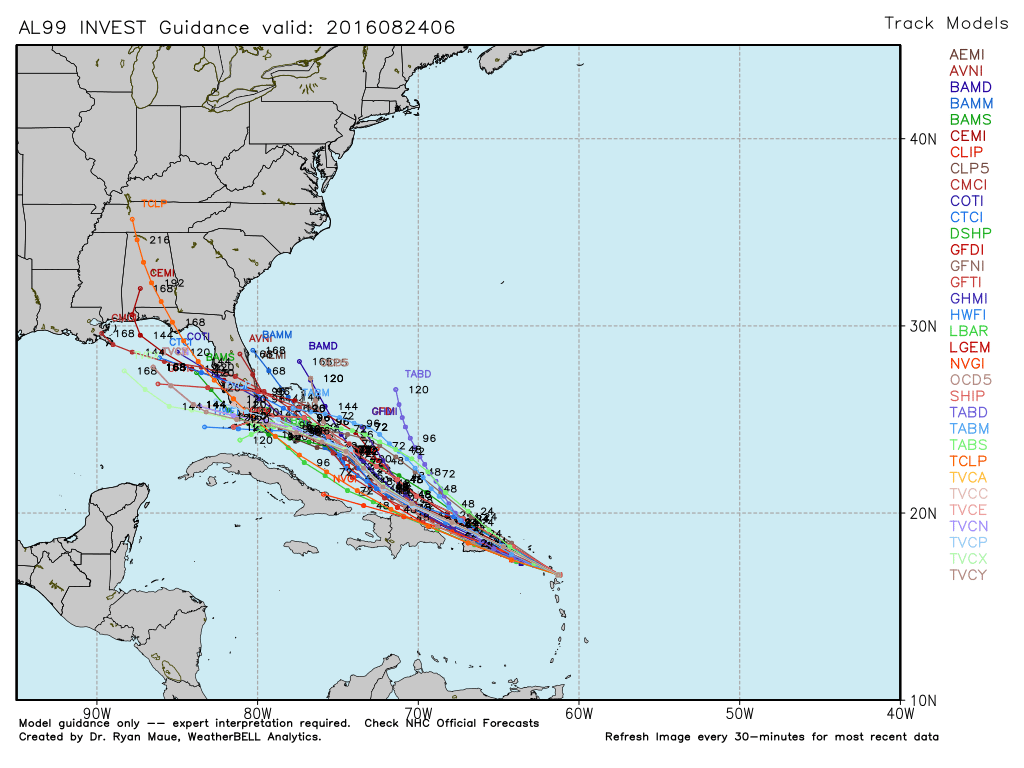
 4.) Attention next week will shift to the tropics. There are many more questions than answers at this point, but understand the potential is there for significant tropical troubles next week. Intensity and track are far from etched in stone, but if your travels take you to the Gulf Coast, we suggest you remain abreast of the latest developments- particularly the southeastern FL coast and the north-central Gulf Coast.
Here on the home front, it’s not entirely out of the equation our region deals with tropical remnants in the Week 2 time period.
Patience is required as we sort through the data in the coming days…
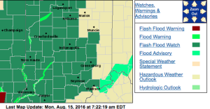 No doubt about it, today will be very wet across the entire region, including periods of heavy rain- especially across the western half of the state.
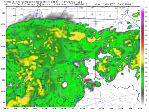
 Tropical moisture will continue to stream into the state tonight into Tuesday. In fact, most intense rains will likely set up tonight and may feature “banding” signatures that would train over the same areas. Within these intense rain bands, prolific rainfall rates can be expected, enhancing the flash flood risk. Latest short-term model data shows this threat, and would place a premium focus on areas generally west of US-31. We’ll have to keep a close eye on things.
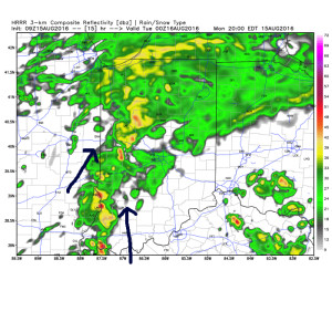 Plenty of “juice” is available to tap into across western sections tonight. Precipitable water values (PWATs) of 2″-2.5″ will be more than enough to fuel torrential rainfall.
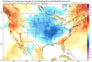
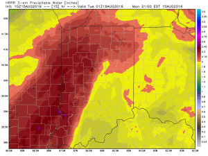 Eventually (mid and late week), we’ll dry things out and a significant cool down is still in store developing this weekend into early next week. Lows will fall deep into the 50s with highs only in the 70s. Talk about an early taste of fall…