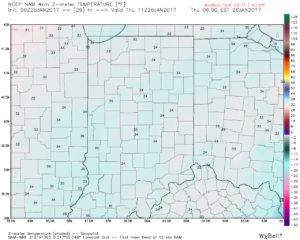
1.) Our fast-moving NW flow continues today. Snow showers and localized heavier squalls will increase later this afternoon and evening as another upper level disturbance moves through. This won’t be a “uniform” event, but if driving please plan on rapidly reduced visibilities within the heavier squalls.


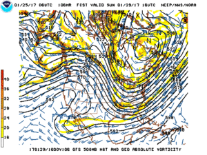
2.) Overall, the upcoming week looks chilly, but relatively dry. Fast-moving disturbances can be a pain for modeling and “last minute” corrections can take place, but consistency on the next storm system tracking north of the region Monday evening and Tuesday morning continues. We’ll note a gusty wind during this time frame (30-40 MPH gusts), but don’t foresee significant precipitation across central parts of the state.

3.) There’s the chance for snow showers midweek, but our attention will shift to the prospects of a “more meaningful” event next weekend. With this being a storm we’re watching for the day 7 period, confidence is low and specifics vary greatly. Stay tuned this week as we fine tune the details. Just know from this distance, an accumulating event is possible.

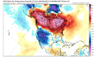
4.) The last couple of weeks has featured an impressive January “thaw.” We note the blow torch regime of the past week across the central and east below.

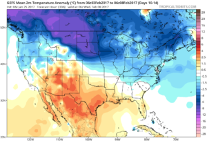
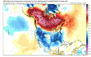
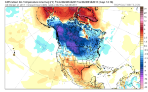
See the shift back to winter, especially across the northern tier as we close January and flip the calendar into February.

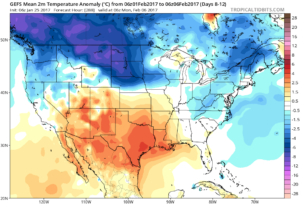
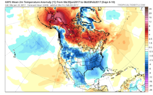
The GEFS is bullish on the cold growing stronger as we progress through the first half of February.


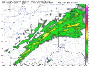
 Showers will expand in overall coverage as we progress through the late morning hours, but shouldn’t amount to much (0.10″ for a few neighborhoods). We return to a drier theme this afternoon.
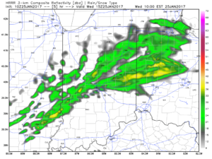
 Longer term, the GFS ensemble continues to show the cold growing deeper and stronger for the region as we progress into early February. Winter is far from over.
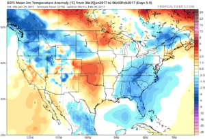
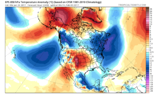
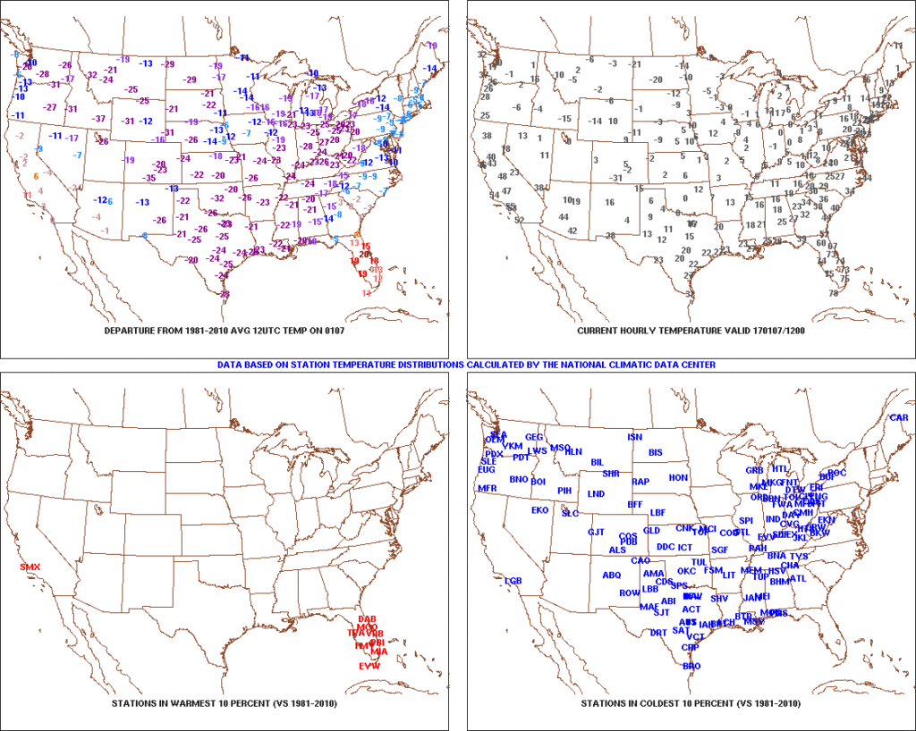 After the past week to ten days, that frigid open to the month seems like forever ago! The past 7-10 days has featured a significant January thaw, and temperatures now, MTD, are warmer than average across the Ohio Valley. Warmest anomalies can be found across the southeast region.
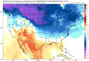
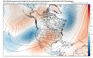
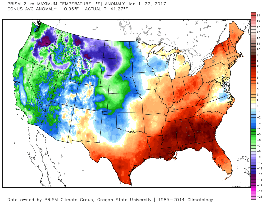 That said, the pattern is shifting back to winter for the last week of the month and while the duration, longer-term, can be argued, the next 2-3 weeks appear to offer an opportunity to play “catch up” in both the snow and cold departments. Note the developing eastern troughiness. This will bring colder air back into the east as we close January and open February. The GFS ensembles, courtesy of Tropicaltidbits.com, also develops an interesting “blocky” look towards the end of the period in Week 2. Should this verify, it would lead to a better chance of the cold, active pattern locking in.
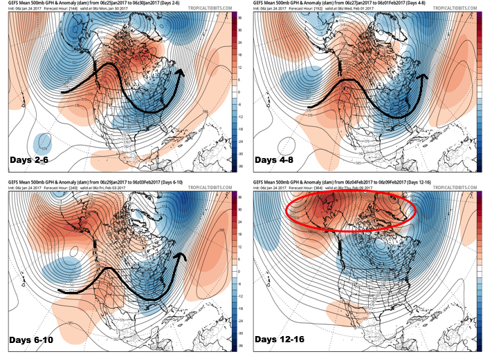
 Thinking here at IndyWx.com believes the European is likely rushing the warmer central look. Time will tell…