
For a change, the past (7) days has been generous to central Indiana from a precipitation perspective. As we’ll discuss, a new rain maker awaits this week.
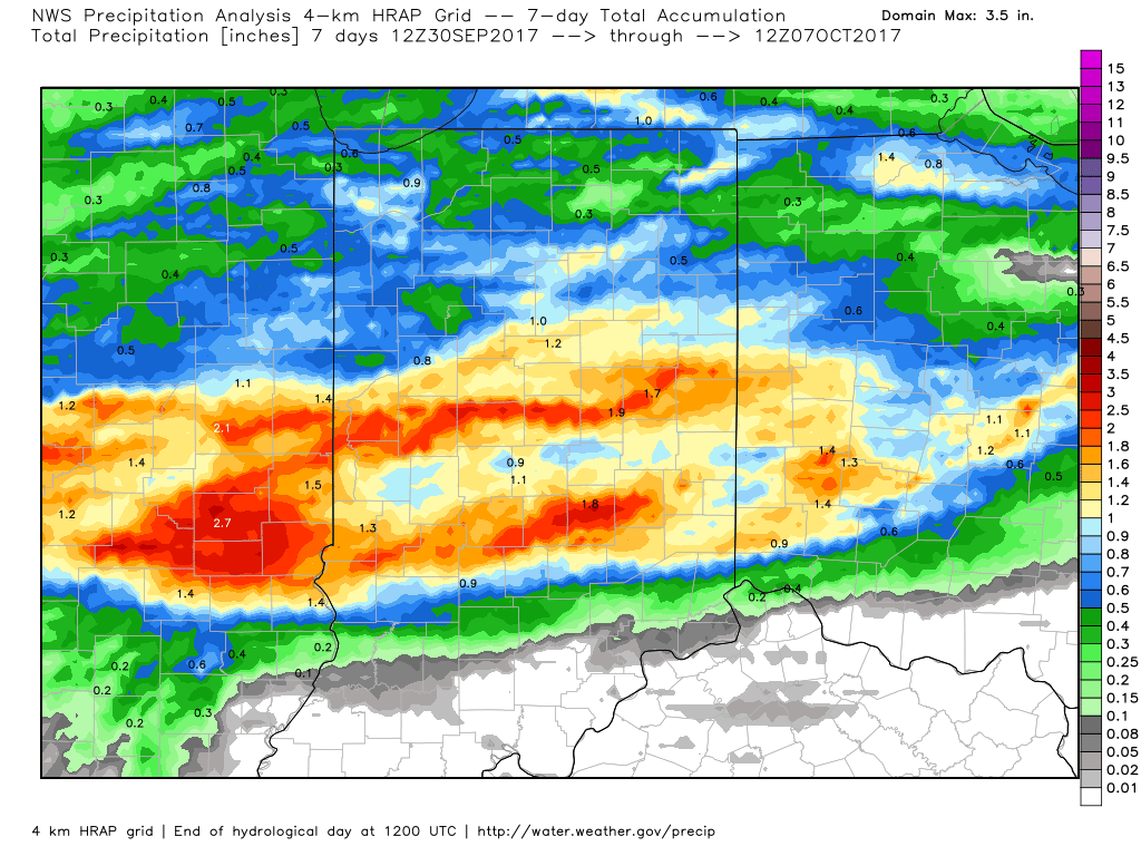
A look at rainfall totals over the past 7 days, courtesy of weatherbell.com.
Officially, IND sits at 0.26″ above normal, month-to-date.
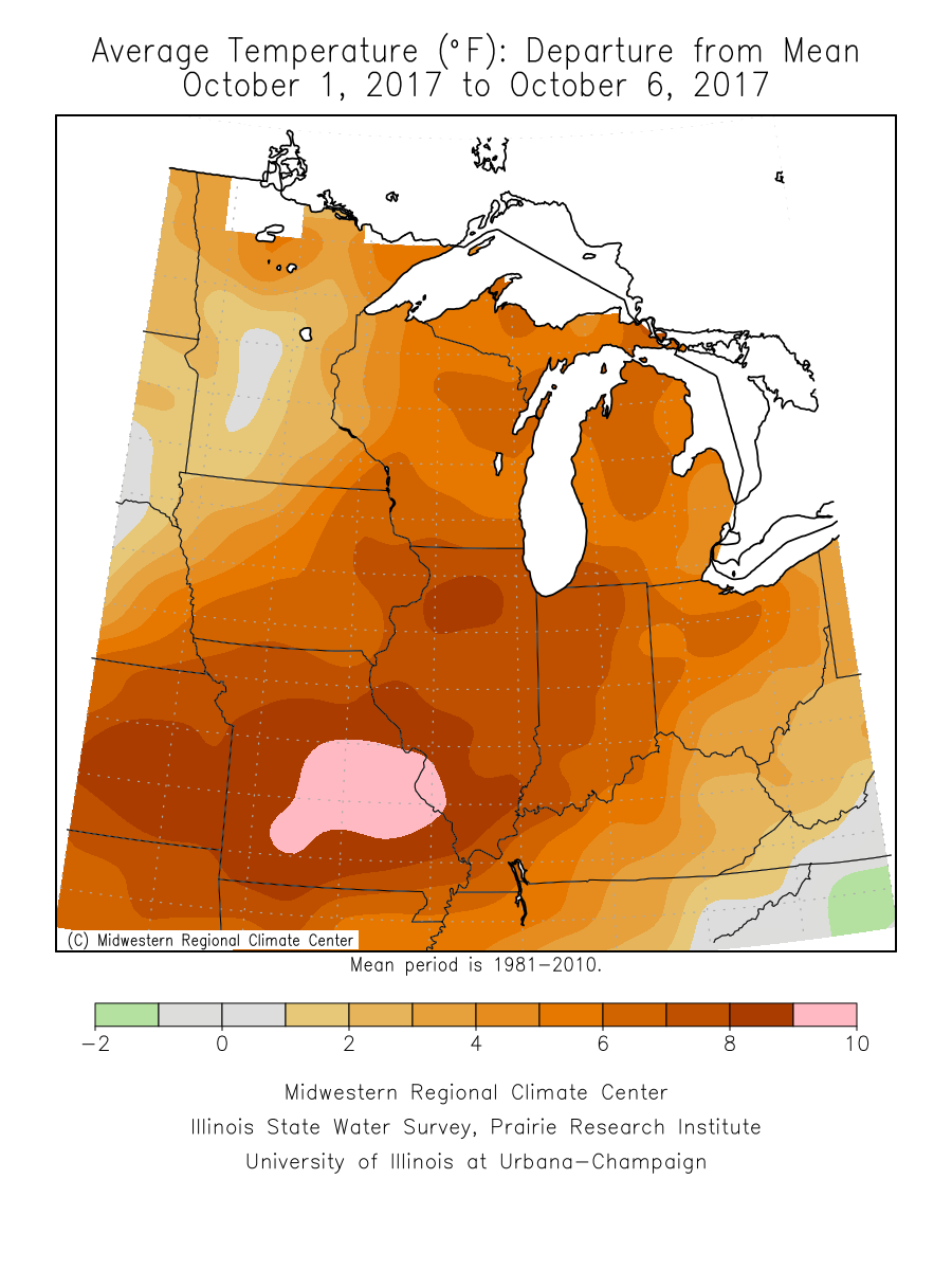
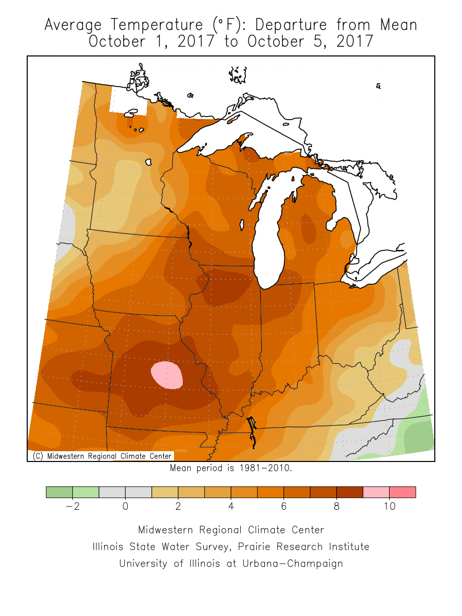
It’s also been an incredibly warm start to the month (IND is running 10° above normal, month-to-date) and that warm theme won’t change through the near-term.
 An all-too-familiar pattern engulfs the country late week. This will showcase more “bonus” summer-like conditions, locally, that will include highs approaching 80° next weekend with a strong southerly flow in place. Additionally, early winter-like conditions will continue to impact the western high ground. The pattern definitely represents a Nina look.
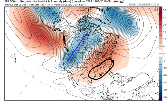
The southeast ridge will provide more bonus summer-like conditions next weekend across the eastern half of the country.
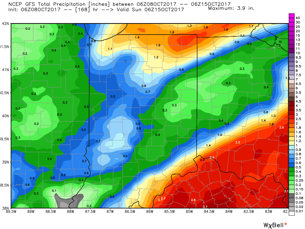
In the shorter-term, a new rainmaker will move across the Ohio Valley Tuesday into Wednesday. This will spread showers and embedded thunder across the state Tuesday PM into Wednesday. In general, this storm system should deliver 0.50″ – 1″ of rain, but there will be locally heavier amounts.
 Thereafter, dry times will settle in along with slightly cooler temperatures. Let’s remember it was only a few days ago where modeling suggested a “pop” of the season’s coldest air thus far. No longer is that the case, and while it will turn briefly cooler, temperatures will still remain above average.
A southerly air flow will return late week and help boost temperatures next weekend, along with continued dry times through the balance of the weekend. From this distance, our next storm system should arrive late Sunday or early Monday in the form of a cold front.
Looking longer-term, there are indications that colder conditions loom as we wrap up October and head into November and we’ll discuss this in more detail later this week…
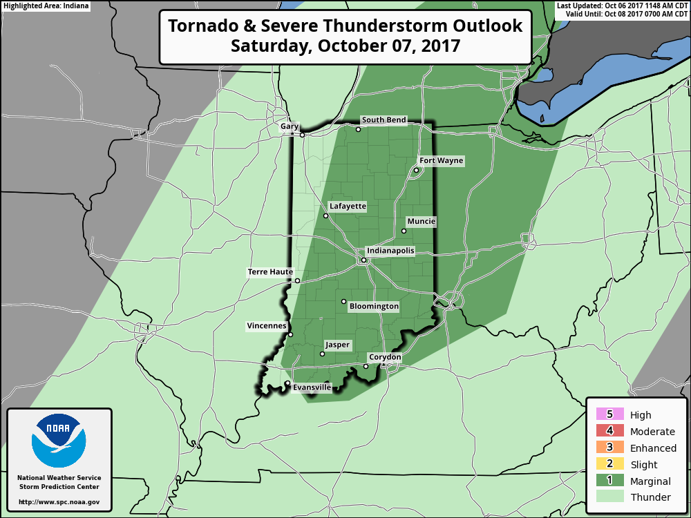 The biggest concern with stronger storms is gusty straight line winds. While the line of storms should be relatively “skinny,” don’t be surprised if one or two of the storms requires a warning. Here’s an idea of what the radar may look like around 9p Saturday.
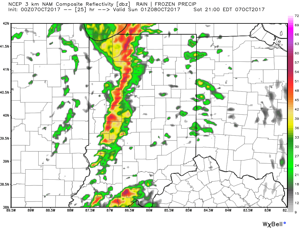 We’ll turn less humid and slightly cooler for the second half of the weekend!