
In general, northern ‘burbs picked up between 1″ to 3″ of wet snow earlier this morning before drier conditions arrived for the afternoon hours. A couple of reports include Whitestown with 1.6″, Carmel with 2″, and Lebanon with 2.5″. A sharp cut-off with slushy coatings to less than 1″ made it as far south as the city, itself. Today’s event will be viewed as the “appetizer” to Christmas Eve’s “main course.”
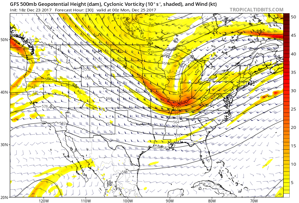
Vigorous upper level energy will track through the Ohio Valley Christmas Eve afternoon into the evening, itself.
 Snow will begin to overspread the state, especially north of the I-70 corridor during the mid-to-late morning hours and we expect a steady snow to fall across the northern half of the state throughout the majority of the day. A period of moderate to heavy snow should develop during the mid-to-late afternoon, continuing into the evening hours across central Indiana. Road conditions will begin to really deteriorate during this time frame as surface temperatures fall into the 20s.
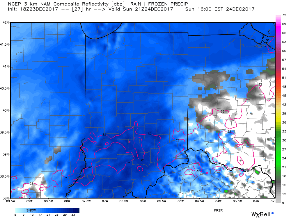 Eventually, snow will end from west (around 8p) to east (around midnight) tomorrow night, but not before depositing a widespread swath of 3″-5″ for areas generally north of I-70. For the city, itself, we think 2″ to 3″ is a good call, with generally an inch, or less across far southern portions of the state.
 Don’t be surprised if enough Christmas “magic” results in localized heavier totals with potential banding that develops tomorrow afternoon into the evening hours. All in all, this will be a classic, picturesque snow event for Christmas Eve. Hoosiers will wake up Christmas morning with a fresh blanket of white.
We have additional wintry fun and games to track later next week!
 II.) Additional upper level energy will rotate across the Ohio Valley Christmas Eve and this, combined with arctic air pushing into the region, should maximize moisture production and lead to a period of snow and snow showers Christmas Eve afternoon into early Christmas Day. This energy should feature some Christmas “magic” and be enough to provide a more widespread light accumulation across the region (when compared to Saturday).
 III.) As we look forward to middle and latter parts of next week, the pattern screams potential is on the table for a more widespread, significant winter storm (Plains to the Northeast). While obviously early on in the game, the overall pattern does back up the idea presented by modeling.
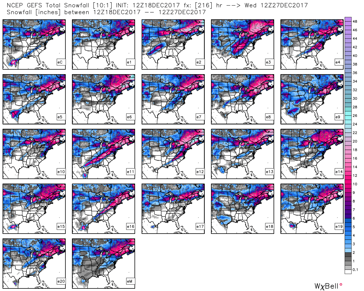 Hang in there as we continue to sort through the data over the next few days. Once confidence increases (for or against an event), you’ll be the first to know! 🙂
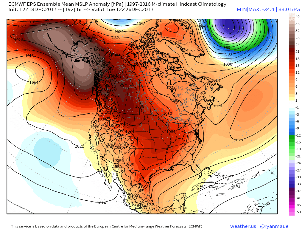 Recent operational data (GFS and Canadian included) has suggested a sprawling high in the range of 1050mb+ descending into the eastern slopes of the northern Rockies. Such a regime would be plenty capable of spreading sub-zero temperatures east into the Ohio Valley (with or without snow on the ground). Add in a biting north wind and wind chill values would drop to levels of dangerous and deadly levels if any length of time was spent outdoors. Some of the latest data paints a picture similar to shades of the famous ’13-14 winter (20° to 30° below zero chill factor). If you have travel plans over the Christmas holiday, please plan in advance to have a winter survival kit packed and loaded. It absolutely never hurts to be prepared.