
You must be logged in to view this content. Click Here to become a member of IndyWX.com for full access. Already a member of IndyWx.com All-Access? Log-in here.
Category: Forecast Models
Permanent link to this article: https://indywx.com/video-wintry-threats-on-deck-looking-deeper-into-january/
Jan 02
VIDEO: Bitter Cold Gives Way To A Messy Late Weekend Storm…
You must be logged in to view this content. Click Here to become a member of IndyWX.com for full access. Already a member of IndyWx.com All-Access? Log-in here.
Permanent link to this article: https://indywx.com/video-bitter-cold-gives-way-to-a-messy-late-weekend-storm/
Dec 30
VIDEO: Accumulating Snow For Some Overnight; Bitter Open To 2018…
Quick video update from the road this evening discussing another round of snow inbound tonight and a frigid open to 2018:
You must be logged in to view this content. Click Here to become a member of IndyWX.com for full access. Already a member of IndyWx.com All-Access? Log-in here.
Permanent link to this article: https://indywx.com/video-accumulating-snow-for-some-overnight-bitter-open-to-2018/
Dec 29
Plowable Snow Event Gives Way To Dangerous Cold…
A quick-moving, but efficient clipper system will scoot across the Ohio Valley as we wrap up the work week and head into the weekend. This will spread a swath of accumulating snow through central and northern IN this afternoon into early Saturday morning.
We forecast snow to start flying for the city, itself, around 1p to 2p.
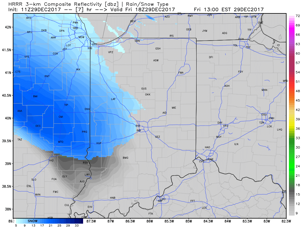 Snow will then encompass most of the state as we progress into the late afternoon and evening hours.
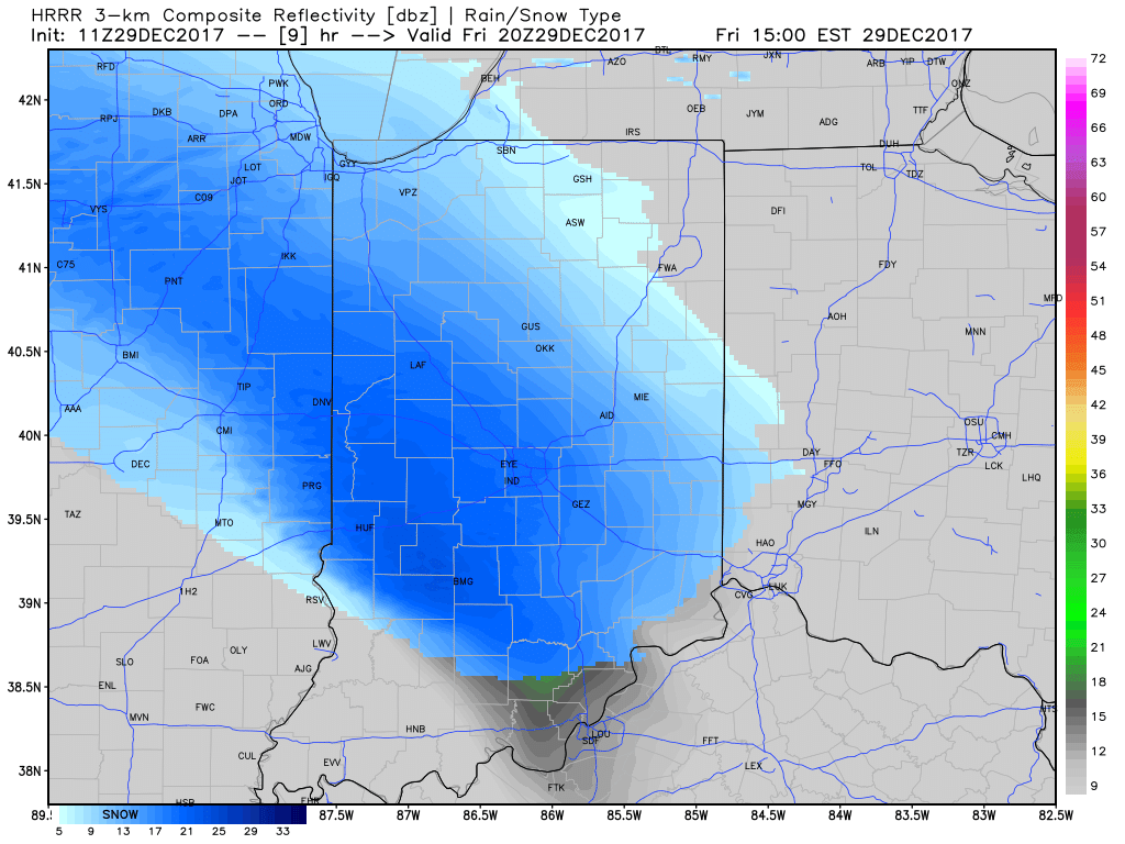
 At times, we expect moderate snow to be falling across central Indiana and this will, unfortunately, make for a messy evening commute. Plan for snow covered and snow packed roads and slick conditions. Leave extra time to reach your destination.
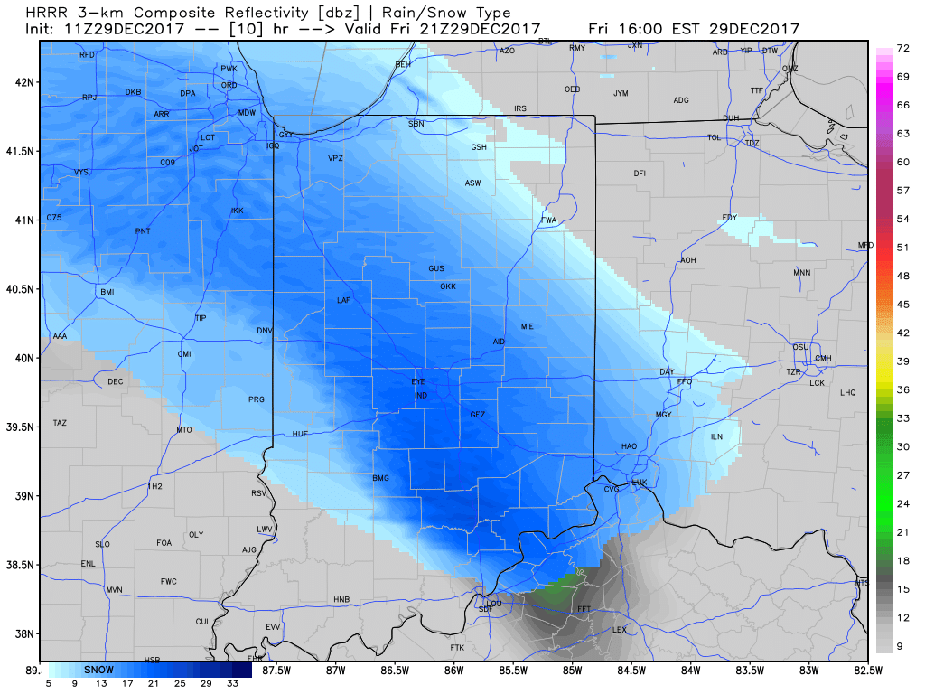
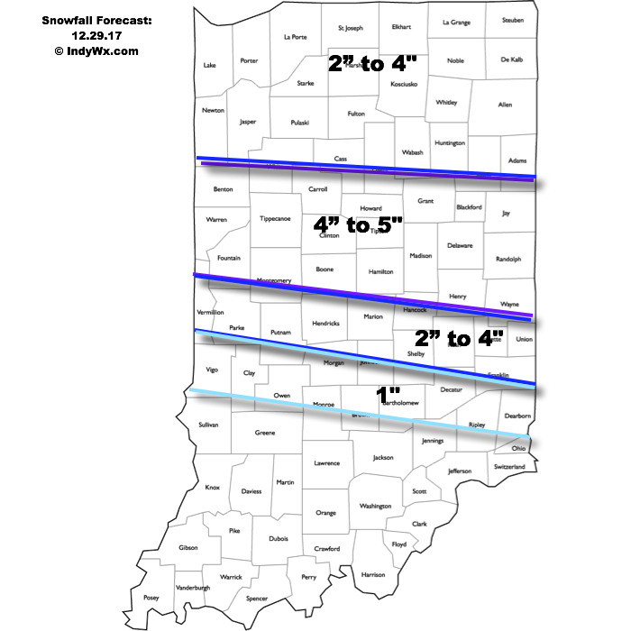
While snow showers will continue Saturday morning, most of the accumulating snow will fall before sunrise Saturday and here’s our updated accumulation forecast:
 Attention once to Saturday will shift to the problems associated with blowing and drifting snow as winds increase and temperatures tumble. Strong and gusty northwest winds will continue into early next week and not only will this lead to continued issues with blowing and drifting, but will also drive dangerously cold air into the area.
Here’s a look at our forecast lows over the next few mornings:
- Saturday morning (12.30.17): 13° (falling through the day)
- Sunday morning (12.31.17): 4° below zero
- Monday morning (01.01.18): 6° below zero
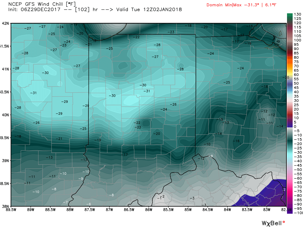
- Tuesday morning (01.02.18): 10° below zero
Not only will we have to deal with an extended stretch of subzero lows, but winds will combine to add further danger to the extreme weather. Most of central and northern portions of the state will have to deal with 25° to 35° below zero wind chill values Tuesday morning. Plan and prepare now.
Permanent link to this article: https://indywx.com/plowable-snow-event-gives-way-to-dangerous-cold/
Dec 27
VIDEO: Early Accumulation Idea Friday Night-Saturday; Bitterly Cold Open To 2018…
You must be logged in to view this content. Click Here to become a member of IndyWX.com for full access. Already a member of IndyWx.com All-Access? Log-in here.
Permanent link to this article: https://indywx.com/video-early-accumulation-idea-friday-night-saturday-bitterly-cold-open-to-2018/