
You must be logged in to view this content. Click Here to become a member of IndyWX.com for full access. Already a member of IndyWx.com All-Access? Log-in here.
Category: Forecast Models
Permanent link to this article: https://indywx.com/video-sunday-morning-showers-give-way-to-afternoon-sunshine/
May 16
VIDEO: Late Week Storms And Much Cooler Next Week…
You must be logged in to view this content. Click Here to become a member of IndyWX.com for full access. Already a member of IndyWx.com All-Access? Log-in here.
Permanent link to this article: https://indywx.com/video-late-week-storms-and-much-cooler-next-week/
May 11
Front Settles South…
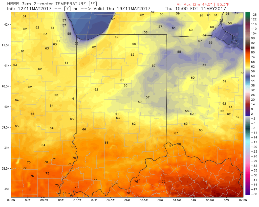
A cold front will settle south today and lead to quite the temperature gradient across the state. Cooler north breezes will result in slowly falling or steady temperatures across the northern half of the state (upper 50s to lower 60s), while southern portions of Indiana rise into the lower and middle 70s this afternoon.
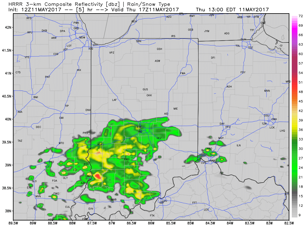
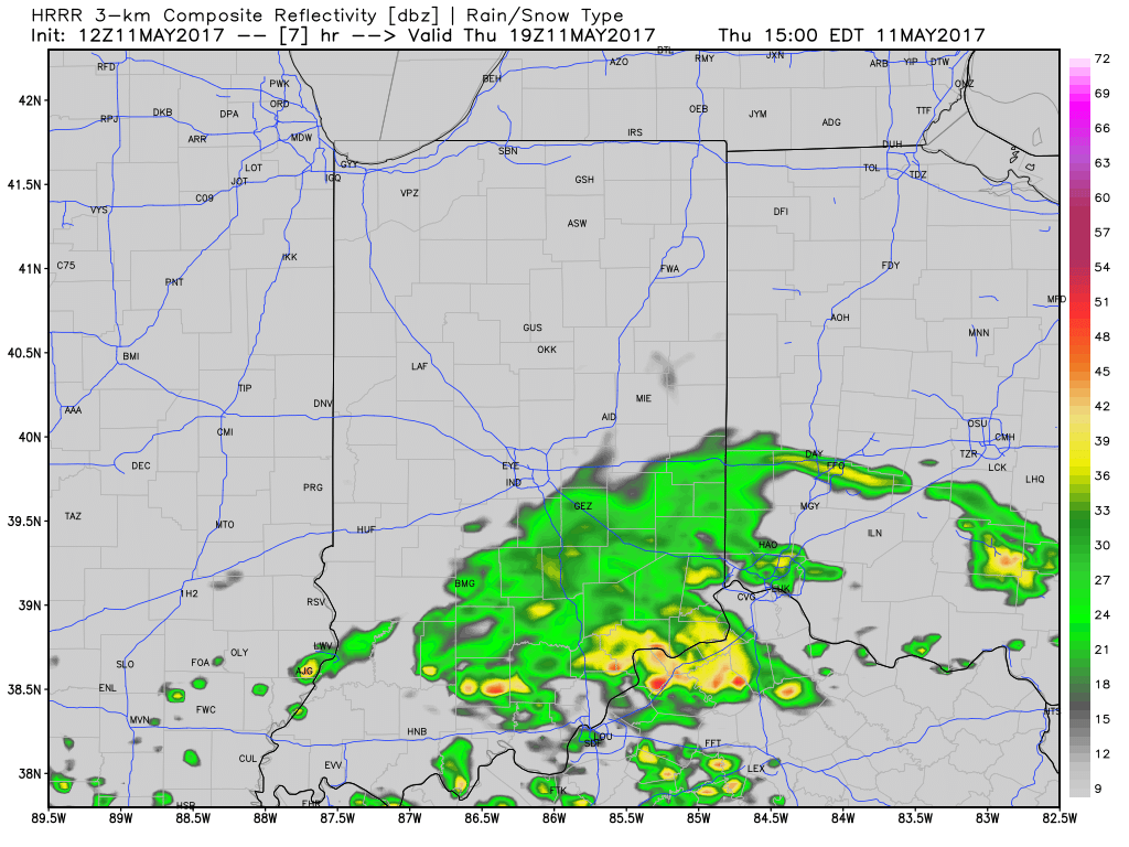
 A new batch of showers will ride east and impact areas mainly along and south of I-70 as we move into late morning and early afternoon. While some embedded thunder is possible, severe weather isn’t expected today.
 Drier and cooler air wins out for all tonight and paves way for a gorgeous weekend ahead. High pressure will support plentiful sunshine and comfortable conditions. More on the weekend and next week’s weather later today in an updated 7-day!

Permanent link to this article: https://indywx.com/front-settles-south/
Apr 27
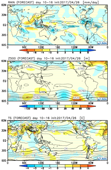
Reviewing The Latest JMA Weeklies…
The new JMA Weeklies paint a wet and active picture for Week 1, but begin to suggest we get into a milder, drier pattern as we push into the middle and latter portions of May…
Week 1:
The “mean” upper air pattern places coastal ridges with a cool trough settling into the central. The end result will be a wet and active regime, locally, this weekend into next week. Though we’ll see a “spike” in temperatures Sunday, the overall theme is a chilly one as we open the month of May. In fact, temperatures will trend significantly cooler than average as we push into next week.
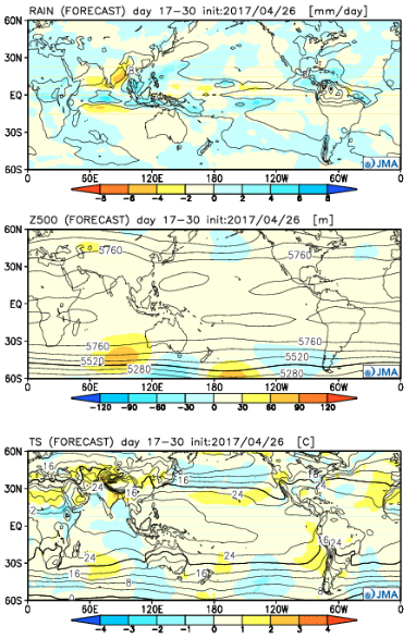
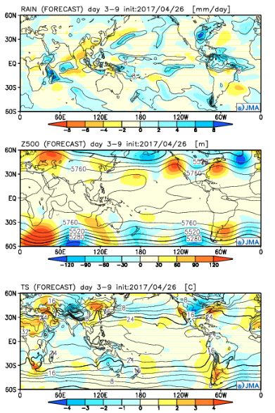 Week 2:
While it still looks chilly (compared to average), the JMA Weeklies suggest a “calmer” weather pattern moving in. Wet anomalies are noted through the Rockies and Central, but a drier trend across the east, including the Ohio Valley.
 Weeks 3-4:
Wet times remain across the Central and spread into more of the southern tier, as well. Slightly cooler than normal temperatures are also forecast across the Southeast. Budding warmth seems to develop over the West.
Permanent link to this article: https://indywx.com/reviewing-the-latest-jma-weeklies/
Apr 26
VIDEO: Stormy Wednesday Evening For Some; Weekend Flood Threat…
You must be logged in to view this content. Click Here to become a member of IndyWX.com for full access. Already a member of IndyWx.com All-Access? Log-in here.
Permanent link to this article: https://indywx.com/video-stormy-wednesday-evening-for-some-weekend-flood-threat/