
You must be logged in to view this content. Click Here to become a member of IndyWX.com for full access. Already a member of IndyWx.com All-Access? Log-in here.
Category: Forecast Models
Permanent link to this article: https://indywx.com/video-gorgeous-weather-continues-another-cool-shot-awaits/
Aug 06
VIDEO: Wet And Cool Sunday On Tap…
You must be logged in to view this content. Click Here to become a member of IndyWX.com for full access. Already a member of IndyWx.com All-Access? Log-in here.
Permanent link to this article: https://indywx.com/video-wet-and-cool-sunday-on-tap/
Aug 04
Catching Up On A “Crisp” August Evening…
One sure would be hard-pressed to find an August evening that is more fall-like than today. Heck, a check of temperatures even at the 3 o’clock hour across central IN revealed levels more typical of early October. – Your’s truly isn’t complaining.  As I write this post just before 10p Friday evening, I’m fireside with a temperature in the upper 50s in Whitestown. Call me crazy, but I’ll take it- even if it is a couple months early!
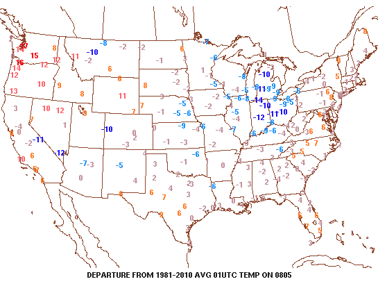
All across the Midwest temperatures are running 10° to 15° below normal at the 9p hour.
 As we look ahead, Saturday is certainly the pick of the weekend. Mixed clouds and sun will be with us for the balance of the day before we turn increasingly overcast late. While temperatures will remain significantly below normal, it’ll be a very refreshing day and feel more like early-September (mid-upper 70s).
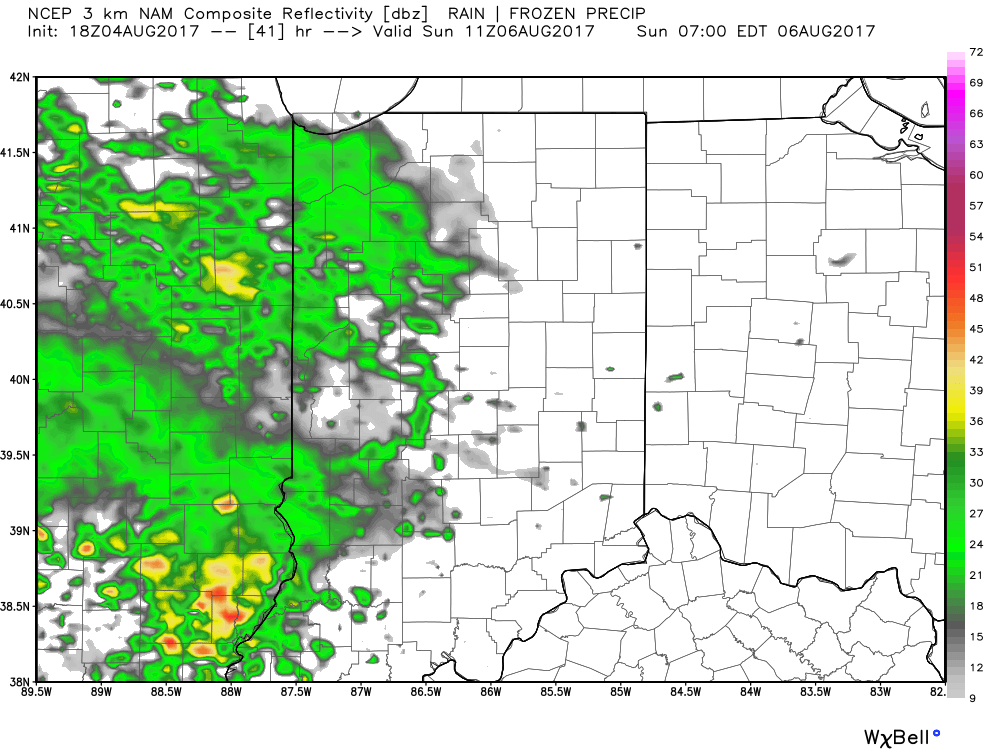
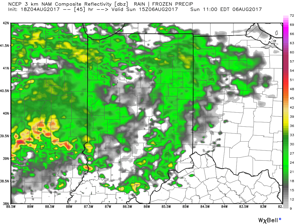
As mentioned, clouds will increase, lower, and thicken Saturday evening and widespread rain will follow. This is all in association with our next approaching storm system that promises to result in a rather damp and unseasonably cool second half of the weekend. Forecast radar timestamps Sunday morning into the afternoon show the overall widespread coverage of rain showers and embedded thunder. We suggest indoor weekend plans Sunday.
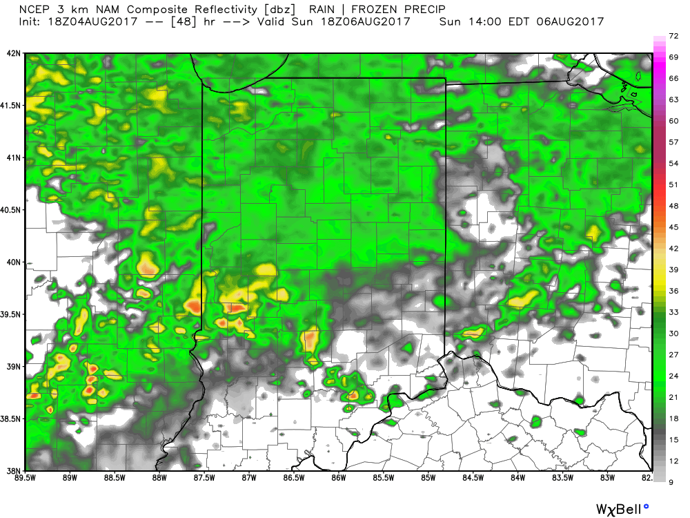 Unsettled weather will continue into early Monday across the state. By the time all is said and done, rainfall totals of 1″-1.5″ can be expected, including locally heavier amounts where thunderstorms develop. Additionally, with the clouds and wet weather Sunday, temperatures will likely remain in the 60s most of the day.
As we push into the new work week, drier air will regain control of our region and high pressure should provide a stretch of pleasant (unseasonably cool) conditions through midweek.
 Rain and storm chances will increase once again during the second half of next week as our next storm system approaches. While we’ll moderate back to seasonal levels late-week, data suggests another blast of refreshing air will blow into town next weekend. It’s far too early to signal “summer over,” but the early blasts of fall-like air do have to “raise an eyebrow” for what autumn may provide the region. We’re in the camp of believing central IN is in position for earlier than normal frost risks… Much more on that later.
Reinforcing cool air establishes itself in the 8-10 day period.
Permanent link to this article: https://indywx.com/catching-up-on-a-crisp-august-evening/
Aug 03
VIDEO: Storms Arrive Tonight And We Turn Much Cooler Friday…
You must be logged in to view this content. Click Here to become a member of IndyWX.com for full access. Already a member of IndyWx.com All-Access? Log-in here.
Permanent link to this article: https://indywx.com/video-storms-arrive-tonight-and-we-turn-much-cooler-friday/
Aug 01
Tuesday Morning Rambles: Shower Chances Return Today…
1.) 2017 continues to fly along. August features 3.13″ of rain during the month and temperatures that start out with an average high and low of 84°/ 65° and 83°/ 62° to end the month. Needless to say, temperatures this weekend will feature well below normal conditions that will feel more like it should jumping forward 6 weeks, or so.
2.) Moisture returns today and results in scattered shower coverage this afternoon and Wednesday. Most of both days will remain rain-free, but don’t be surprised by a passing shower at times.
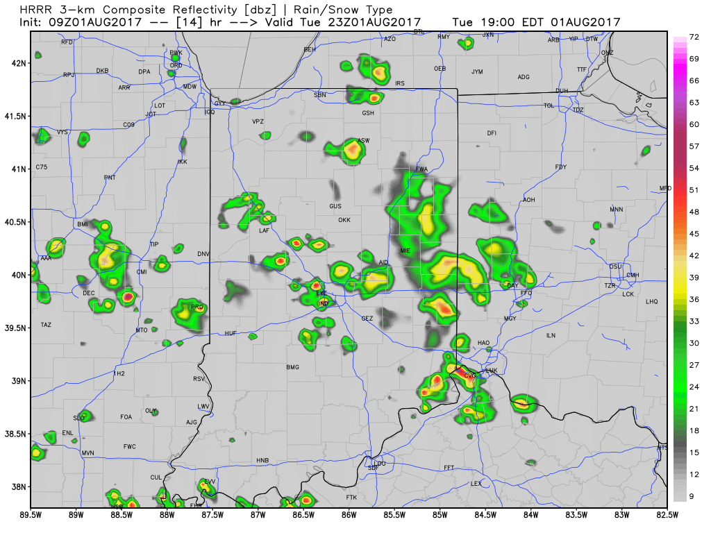
Scattered showers return this evening across central Indiana.
3.) More widespread coverage of showers and thunderstorms arrive Thursday afternoon into Friday morning as a strong cold front presses into the state. Localized heavy rain is possible and rainfall totals of 0.50″-1.00″ can be expected (with locally heavier amounts under stronger storms) between now and Friday.
 4.) As surface low pressure wraps up over the Great Lakes Friday, it’ll help pull unseasonably cool air south into the state, along with gusty northwest winds. In fact, temperatures will remain steady or slowly fall as we move through the day Friday. It sure won’t feel like the first weekend of August as temperatures tumble into the 50s area-wide Saturday morning.
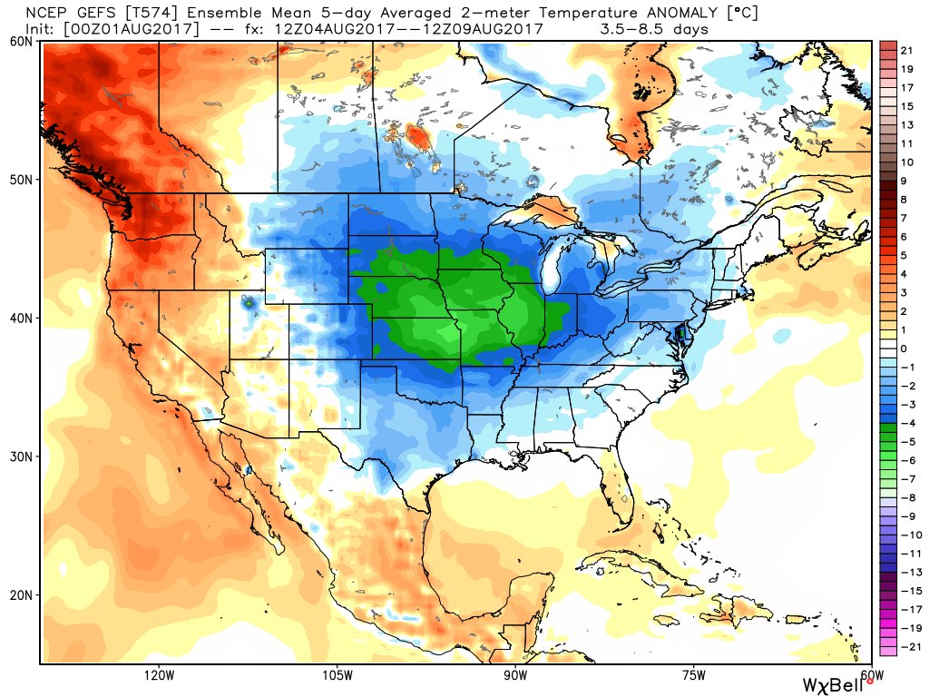
Temperatures will feel more like late-September this weekend.
Permanent link to this article: https://indywx.com/tuesday-morning-rambles-shower-chances-return-today/