Category: Forecast Models

As #Harvest19 Kicks Off, Timing Out Storms Into Mid-October…

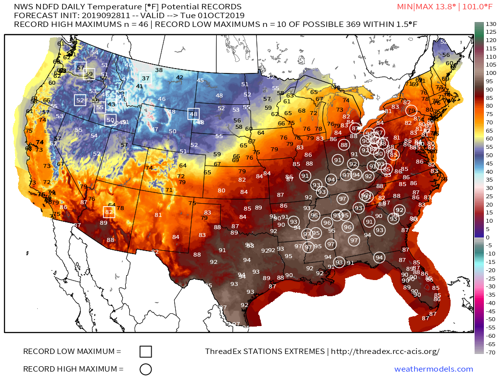
Today is the day of a significant and more permanent transition from our “bonus” summer to a cooler journey ahead.

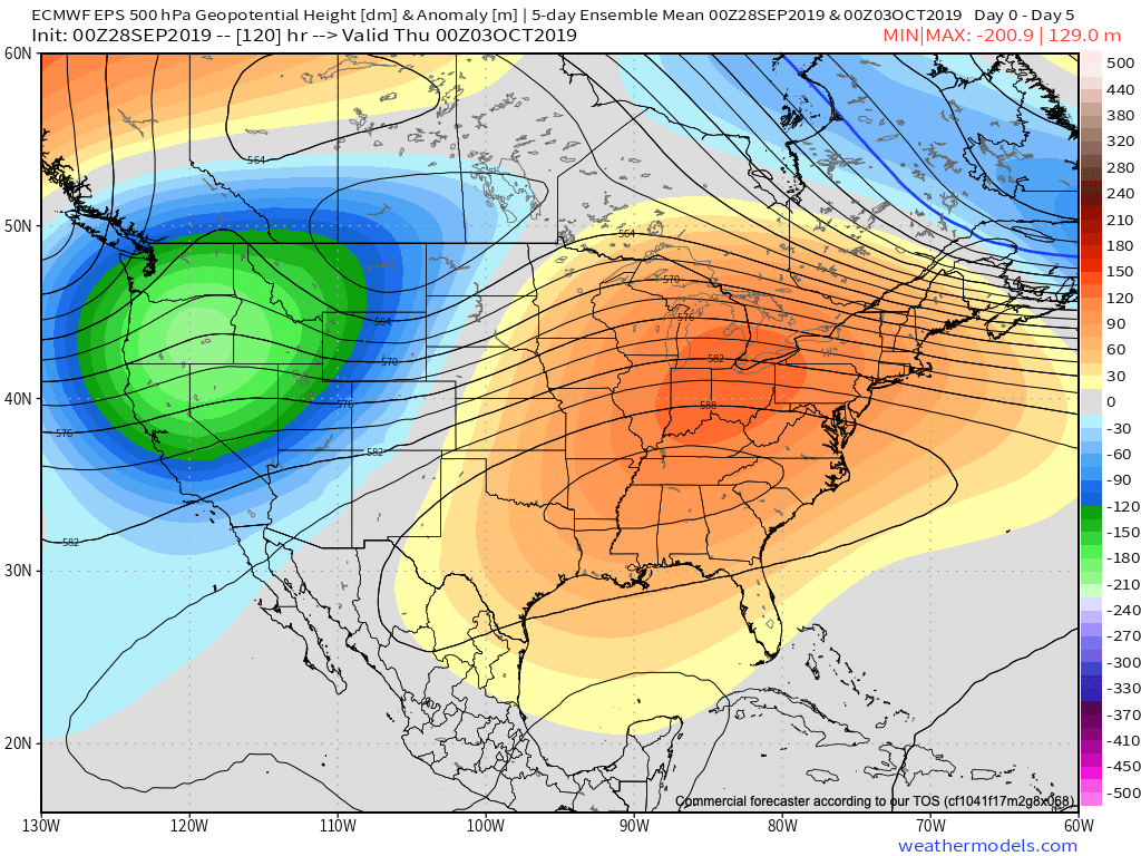
The ‘mean’ upper air pattern will feature a trough over the eastern portion of the country and associated temperature pattern more like we’d expect for early to mid October.

Days 3-8
Days 8-13

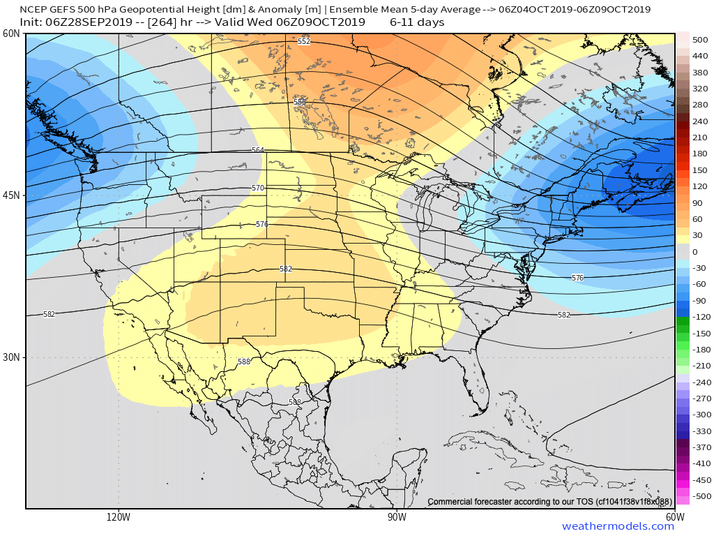
With the cooler air, we’ll also notice a more active pattern, as well. A model blend paints the potential of 0.50″ to 1.50″ of rain over the upcoming 10-day stretch. More specifically, we’re targeting dates for frontal passages on the following:

I. Thursday, 10.3

II. Sunday, 10.6

III. Friday, 10.11

The Sunday frontal passage and late Week 2 cold front will offer up better chances of more widespread precipitation.

Permanent link to this article: https://indywx.com/as-harvest19-kicks-off-timing-out-storms-into-mid-october/

VIDEO: Winds Of Change On The Doorstep…

You must be logged in to view this content. Click Here to become a member of IndyWX.com for full access.  Already a member of IndyWx.com All-Access?  Log-in here.

Permanent link to this article: https://indywx.com/video-winds-of-change-on-the-doorstep/

Evening VIDEO: Much Cooler Changes On The Horizon; Early Week 2 Storm?

You must be logged in to view this content. Click Here to become a member of IndyWX.com for full access.  Already a member of IndyWx.com All-Access?  Log-in here.

Permanent link to this article: https://indywx.com/evening-video-much-cooler-changes-on-the-horizon-early-week-2-storm/

VIDEO: Summer Heat Gives Way To A Classic Fall Feel…

You must be logged in to view this content. Click Here to become a member of IndyWX.com for full access.  Already a member of IndyWx.com All-Access?  Log-in here.

Permanent link to this article: https://indywx.com/video-summer-heat-gives-way-to-a-classic-fall-feel/

Summer Gives Way To Fall; Keeping An Eye On The MJO And EPO…

A hot start to the work week awaits! An expansive upper level ridge will dominate the 2nd half of the weekend into the first couple days of the work week.

Near record to record heat will surge north into the Ohio Valley through the early week stretch. The dry to droughty Deep South continues to bake through the period and won’t see nearly the relief we’ll enjoy later on in the period…

Changes loom by midweek as a cold front sinks south into the Ohio Valley. While we’re not overly excited about beneficial widespread rainfall, significant cooling will take place for the 2nd half of the work week and next weekend.

Temperatures will actually trend below average Thursday through the weekend with highs in the 60s and lows in the 40s to lower 50s.

As we look ahead, we’ll keep close tabs on the MJO and EPO for clues of the overall October pattern. Not surprisingly, the signals contradict themselves. The MJO supports above normal temperatures returning while the EPO favors seasonable to chillier than average temperatures. Stay tuned…

Our official October Outlook will be online over the weekend…

Permanent link to this article: https://indywx.com/summer-gives-way-to-fall-keeping-an-eye-on-the-mjo-and-epo/