Updated 02.15.22 @ 7:37a
You must be logged in to view this content. Click Here to become a member of IndyWX.com for full access. Already a member of IndyWx.com All-Access? Log-in here.

Feb 15
Updated 02.15.22 @ 7:37a
You must be logged in to view this content. Click Here to become a member of IndyWX.com for full access. Already a member of IndyWx.com All-Access? Log-in here.
Permanent link to this article: https://indywx.com/video-heavy-rain-maker-moves-through-late-wednesday-night-and-thursday/
Feb 14
Updated 02.14.22 @ 7:19a
You must be logged in to view this content. Click Here to become a member of IndyWX.com for full access. Already a member of IndyWx.com All-Access? Log-in here.
Permanent link to this article: https://indywx.com/video-cold-now-but-warmer-days-ahead/
Feb 13
Updated 02.13.22 @ 2:25p
You must be logged in to view this content. Click Here to become a member of IndyWX.com for full access. Already a member of IndyWx.com All-Access? Log-in here.
Permanent link to this article: https://indywx.com/video-late-week-storm-chatter-spring-fling-to-close-out-feb-and-open-march/
Feb 13
Updated 02.13.22 @ 7:42a
Only a couple weeks “officially” remain in meteorological winter. Perhaps it’s appropriate that the pattern is hinting at a vastly different look in the 10-15 day period (much warmer), and for good reason:
Perfect alignment between the MJO and teleconnections.
The MJO is forecast into Phase 4 as we put a wrap on February. Analogs show the eastern ridge that typically takes up residence in Phase 4.

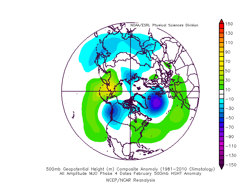
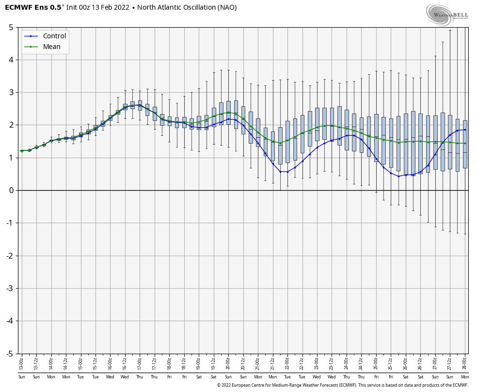
All of the primary teleconnections (including the NAO- remember it’s now time to start keying in on the NAO) are in phases that also argue for above average temperatures.


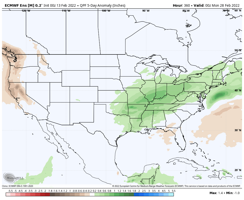
To no surprise, modeling sees a warm, wet (compared to normal, of course) stretch ahead to close February and open March.
European ensemble


GFS ensemble
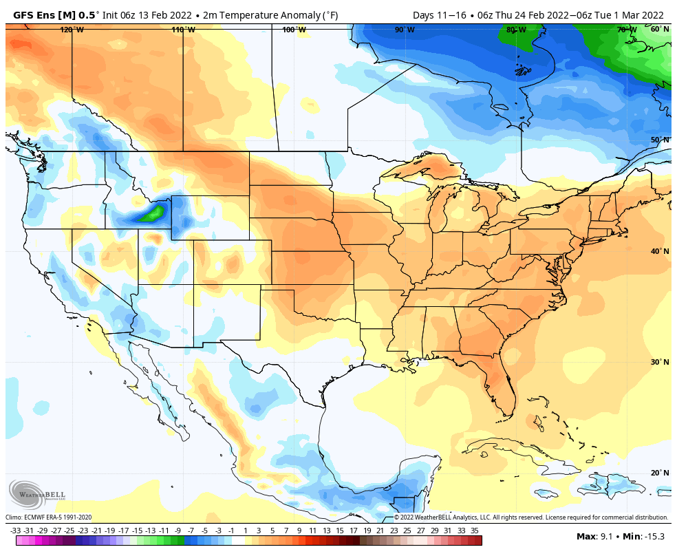
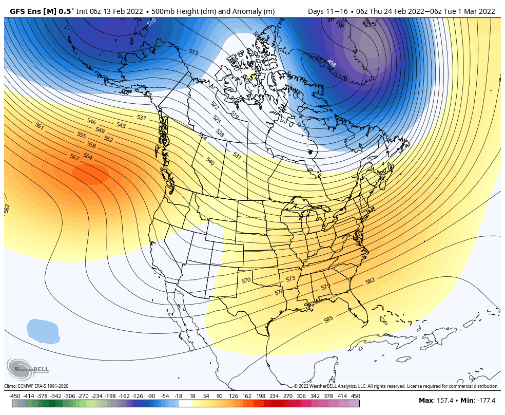

Given the blue print laid out above, I’d personally lean more towards the GFS solution (more widespread above normal conditions) over the Euro.
Permanent link to this article: https://indywx.com/mjo-teleconnections-show-the-way/
Feb 12
Updated 02.12.22 @ 10:07a
You must be logged in to view this content. Click Here to become a member of IndyWX.com for full access. Already a member of IndyWx.com All-Access? Log-in here.
Permanent link to this article: https://indywx.com/video-tracking-light-snow-into-monday-bigger-storm-looms-later-this-week/