
You must be logged in to view this content. Click Here to become a member of IndyWX.com for full access. Already a member of IndyWx.com All-Access? Log-in here.
Category: Flooding
Permanent link to this article: https://indywx.com/video-heavy-rain-moves-in/
Feb 19
Near Record Warmth & More Heavy Rain…
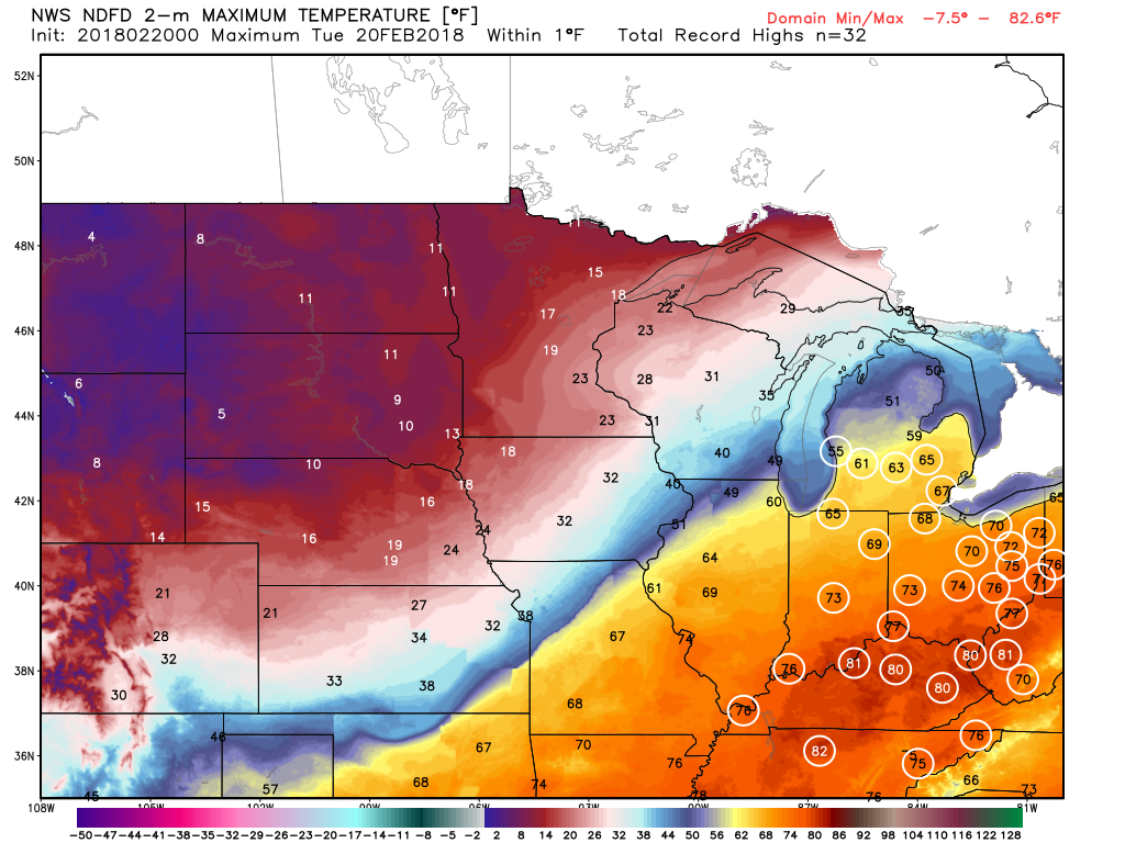
The big weather story Tuesday across central Indiana will be the near-record warmth. Typically it’s not until mid-May that average high temperatures climb into the lower to middle 70s, but we’re going to get an early taste of May tomorrow afternoon. Several records are in jeopardy of falling across the Ohio Valley Tuesday.
 Steadiest rains will fall across the northern third of the state Tuesday with scattered downpours through the morning and afternoon hours across central Indiana.

Forecast radar 12p Tuesday.
Heavier rain will overspread central Indiana late Tuesday night into Wednesday morning as the cold front settles south.
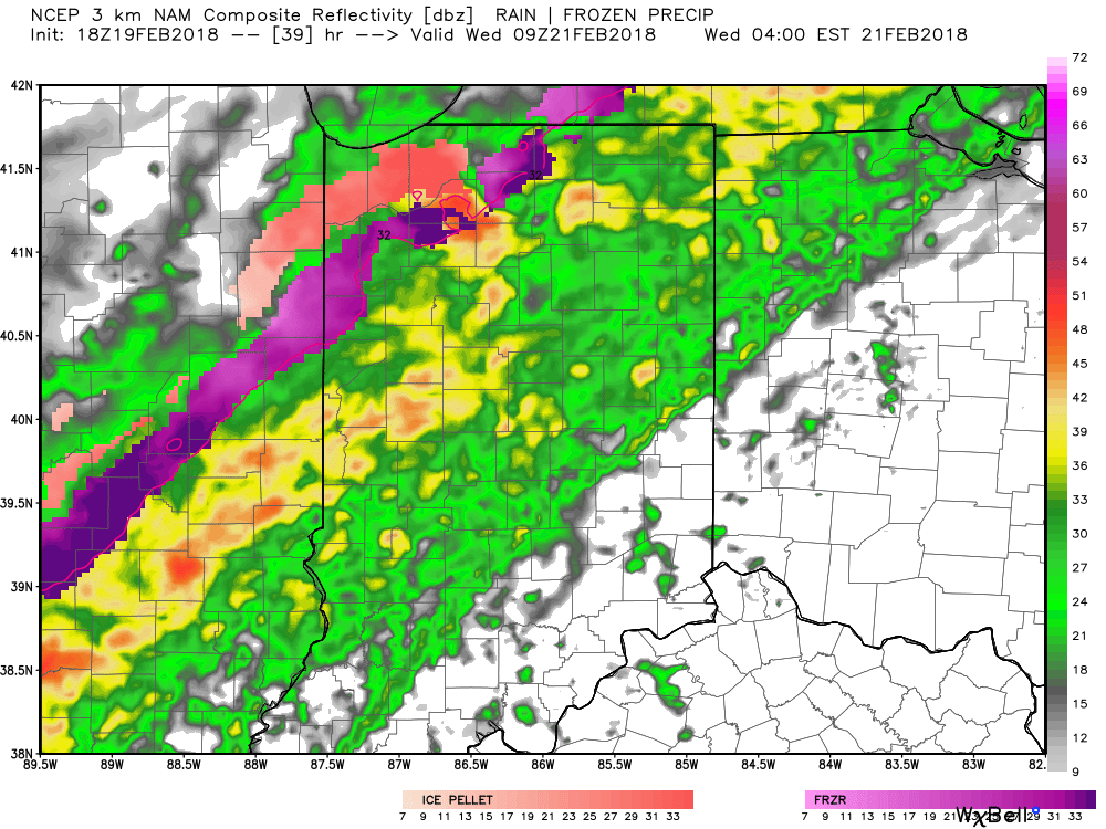
Forecast radar 4a Wednesday.
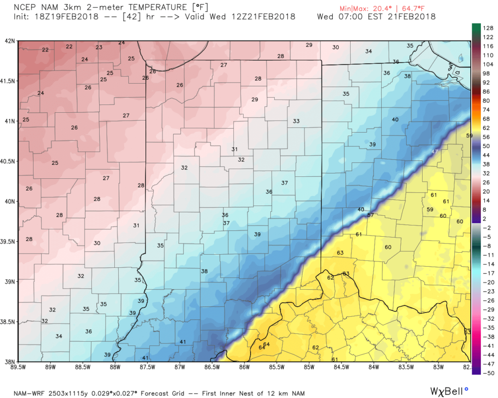
As the front continues to sink south, much colder air will quickly overspread the area. By the rush hour, many neighborhoods north of Indianapolis will already be around freezing. As moisture continues to stream northeast, areas of freezing rain will be possible on elevated and exposed surfaces Wednesday morning into the afternoon hours. With the recent warm, wet conditions, we don’t expect significant travel issues across central Indiana.
 After a quieter time of things most of Thursday, we’re tracking three additional waves of moisture Friday and through the weekend. At times, rain will be heavy, and we’ll certainly have to be on guard for water rise and increasing flooding issues as the weekend arrives.
 By the time all is set and done Monday morning, we forecast additional widespread 3.5″ to 5″ rainfall totals with locally heavier amounts.
Permanent link to this article: https://indywx.com/near-record-warmth-more-heavy-rain/
Feb 18
VIDEO: Heavy Rain This Week; Looking Ahead Towards March…
You must be logged in to view this content. Click Here to become a member of IndyWX.com for full access. Already a member of IndyWx.com All-Access? Log-in here.
Permanent link to this article: https://indywx.com/video-heavy-rain-this-week-looking-ahead-towards-march/
Feb 17
Saturday Morning Rambles: Periods Of Heavy Rain Early Next Week…
I. A weak weather maker will help spread a mixture of light rain and snow across the state later today, particularly this afternoon and evening. Precipitation amounts will remain light and insignificant, but serve as a nuisance as you go about your weekend plans.
 II. We’re hopeful for much needed sunshine Sunday as we’ll be in between storm systems, however any sun that we see won’t last long.
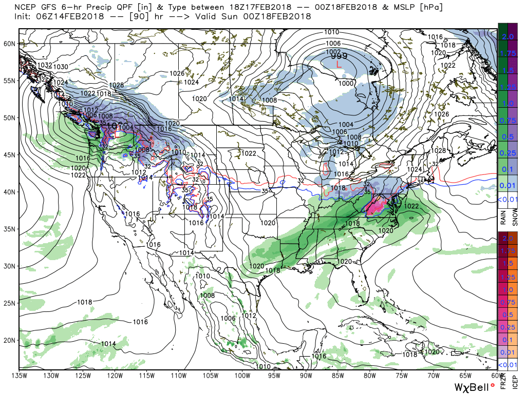
A rather ominous setup for heavy rain will take place Monday into Wednesday. This will include a combination of ingredients as a strong southeast ridge will prevent much forward motion of a “wavy” front that will drape itself across the Ohio Valley region. Additionally, the subtropical jet will transport moisture-rich air northward into the area (true Gulf of Mexico connection).
 While this is an unseasonably warm pattern (we forecast highs of 50°, or above, 5 out of 7 of the upcoming days, and at least 2 60°+ days), it’s one that will likely result in periods of heavy rain not only next week, but in waves over the upcoming 10 days.
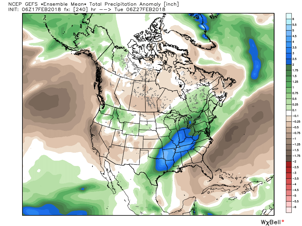 Widespread 10-day rainfall numbers of 3″ to 4″ will be likely in this setup, including locally heavier amounts of 5″ to 6″ in spots. Certainly, if you live near waterways we suggest having a plan in place as it’s not a matter of if, but when flooding takes place in spots across the region with such a setup.
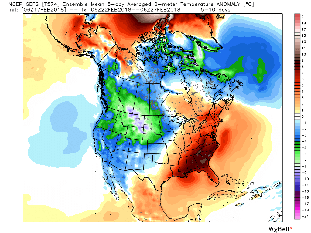
III. Longer-term, we still need to be wary of the potential of a colder pattern returning as we get into March. That forecast deep negative arctic oscillation (AO) has to raise an eyebrow for the possibility of making up for lost time in the cold weather department before we can signal “all clear” on winter…

Permanent link to this article: https://indywx.com/saturday-morning-rambles-periods-of-heavy-rain-early-next-week/
Feb 14
Wednesday Morning Notebook: Thursday Storm Threat; Heavy Rain Next Week…
I. Scattered light showers will impact the southern half of the state today, but these won’t be a big deal and more of just a nuisance for our Valentine’s Day. Temperatures will remain in the 40s for most of the afternoon before rising overnight.
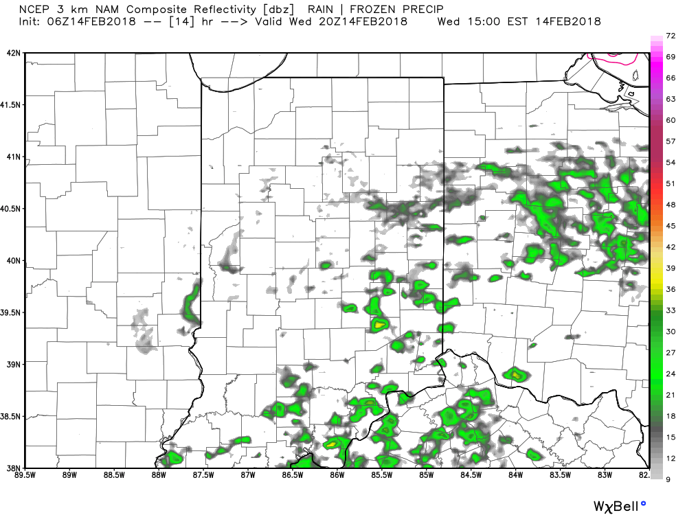
Forecast radar today at 3p shows scattered light showers around.
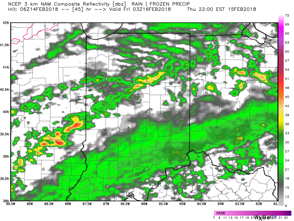
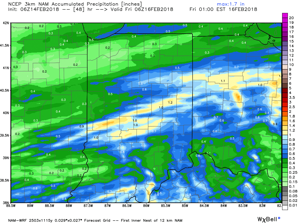
II. A cold front will drop in Thursday evening and this will deliver more widespread heavier rainfall and even a couple of thunderstorms Thursday night. In general, we expect 0.50″ to 1″ of rain to fall.
 III. We’ll turn briefly colder to close the work week. A couple of light snow showers are possible Friday morning and a wave of low pressure will “try” to push moisture into the cold air Saturday. As of now, we remain unimpressed with the prospect of impactful wintry weather Saturday, but have included the potential of wet snow in our Saturday forecast. Precipitation appears to be very light. Nonetheless, we’ll continue to keep an eye on things.
 IV. The pattern continues to scream and warm and wet next week as a big ole southeast ridge remains in place. This will direct the steering current into the TN and OH Valley regions and multiple waves of rain, occasionally heavy, will result beginning early next week and continuing into the middle and latter portions of the week. Widespread 2″ to 3″ totals with locally heavier amounts seems to be a good bet next week.
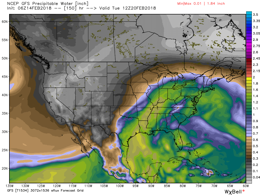
We note a true Gulf connection and precipitable water values that will exceed 300% of normal at times. Parts of the Ohio Valley will deal with flooding, but it’s premature to get more specific than that from this distance. If you live near waterways, plan to keep a close eye on future updates and forecasts.
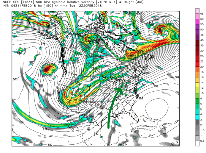
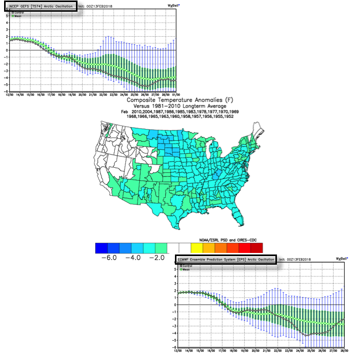
 V. We note data continues to suggest a colder period looms as we close out the month of February and head into March. Note how the GEFS and EPS continues to tank the Arctic Oscillation (AO). Winter’s not over, not by a long shot…
Permanent link to this article: https://indywx.com/wednesday-morning-notebook-thursday-storm-threat-heavy-rain-next-week/