Prolonged Hot, Muggy Stretch…
You must be logged in to view this content. Click Here to become a member of IndyWX.com for full access. Already a member of IndyWx.com All-Access? Log-in here.
You must be logged in to view this content. Click Here to become a member of IndyWX.com for full access. Already a member of IndyWx.com All-Access? Log-in here.
You must be logged in to view this content. Click Here to become a member of IndyWX.com for full access. Already a member of IndyWx.com All-Access? Log-in here.
After we get rid of the morning fog, a mostly dry weekend is in store for central Indiana. The potential is present for a widely scattered shower for southern and eastern areas (mainly south of the city), but most of the immediate region will remain rain-free through the weekend.
Attention is now focused on a storm system that will deliver a return of unsettled weather to open the work week, followed by a “taste” of fall for midweek:
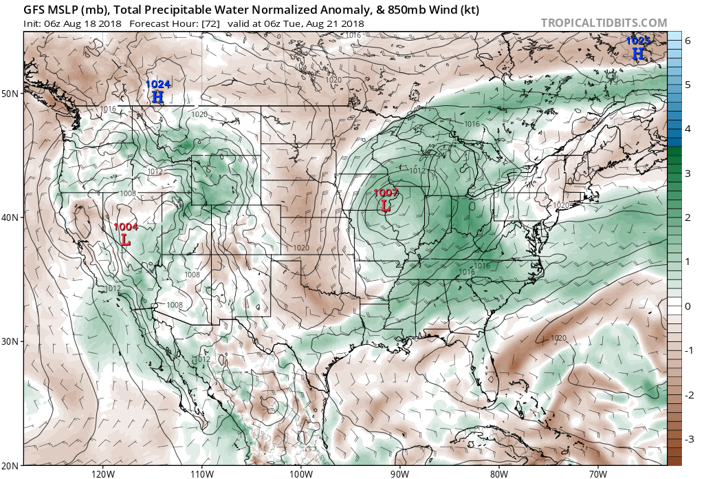
A surface low will move out of Iowa Monday evening into the Great Lakes region Tuesday. A trailing cold front will sweep through the state Tuesday evening.
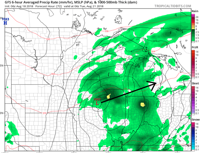
 Scattered thunderstorms will return as early as Monday afternoon, but more widespread shower and thunderstorm activity is expected Tuesday. While not a textbook set-up for widespread severe weather by any means, enough ingredients are in place to at least raise an eyebrow for a few severe storms ahead of the cold frontal passage. Don’t be surprised if the ‘marginal’ risk is upgraded to a ‘slight’ risk for Tuesday in future updates from the Storm Prediction Center.
 Once the cold front moves through, a rather abrupt wind shift will drive a much drier and cooler air mass southeast and it’ll feel like early autumn around these parts as we progress through the second half of the work week. Not only will the significant drop in humidity be nice, but some outlying areas away from the city will likely fall into the 40s for overnight lows Thursday and Friday mornings. Highs will only top out in the mid to upper 70s.
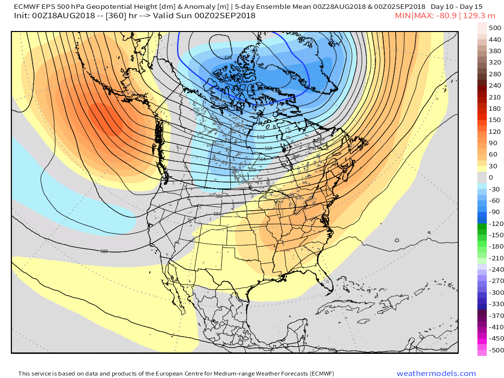
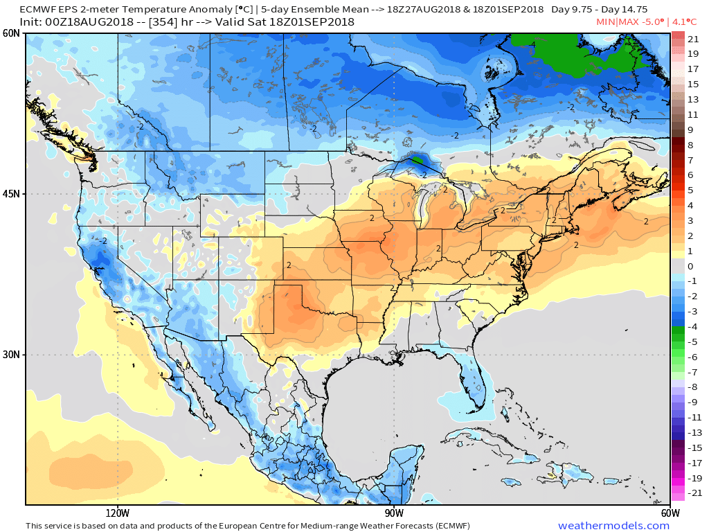
 Looking longer term, summer isn’t finished just yet. Ridging will return for the Labor Day weekend and support building warmth as we put a wrap on August and open September.
As the calendar turns from July to August, we really begin to increase the amount of research into the upcoming winter season. While still a couple months out from publishing our official Winter Outlook, we did want to touch base on a couple of items.
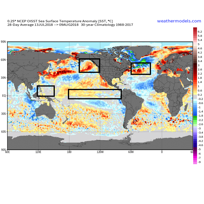 The early “baseline” of our ideas focuses on the likelihood of El Nino returning for the upcoming winter season. As we’ve stated many times in the past, each Nino event is different from one another and other ingredients (highlighted above) can play a significant role in ultimately determining the eventual outcome.
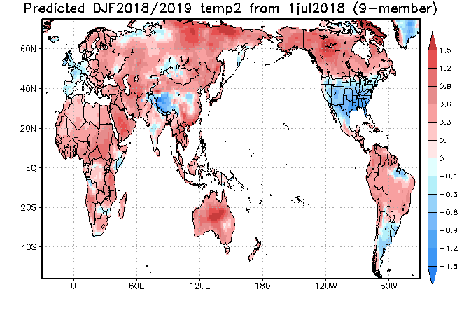
Somewhat of a surprise is that the majority of longer range, seasonal data is aligning for a cold, stormy eastern winter. Included in the cold, stormy camp are the JAMSTEC, European, and CanSIPS. A few snap shots are included below…

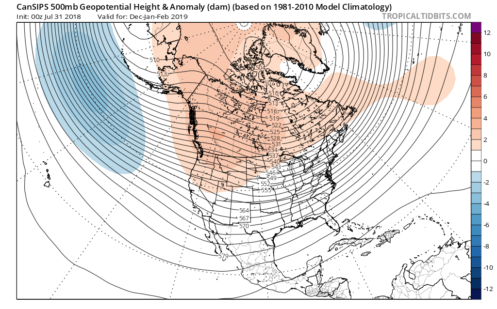
The CFSv2 is siding with a warmer winter, but it appears as if the model is struggling with the coming Nino and “over-hyping” things. Accordingly, the model results in a blow torch winter. Again, remember, we’re leaning towards a weak, central-based event.

 That sea surface temperature configuration in the northern Pacific argues for western Canada ridging and downstream troughiness such as the JAMSTEC, European, and CanSIPS would imply.
Just wanted to touch base briefly on our early thinking before we release our official 2018-2019 IndyWx.com Winter Outlook in October.
You must be logged in to view this content. Click Here to become a member of IndyWX.com for full access. Already a member of IndyWx.com All-Access? Log-in here.