
2019 is absolutely flying by! Before you know it, we’ll be releasing our 2019-2020 Winter Outlook. Kidding- sort of. 😉
Is a blazing hot summer in store for central Indiana, or perhaps wet and cool? Let’s dig in to the details…
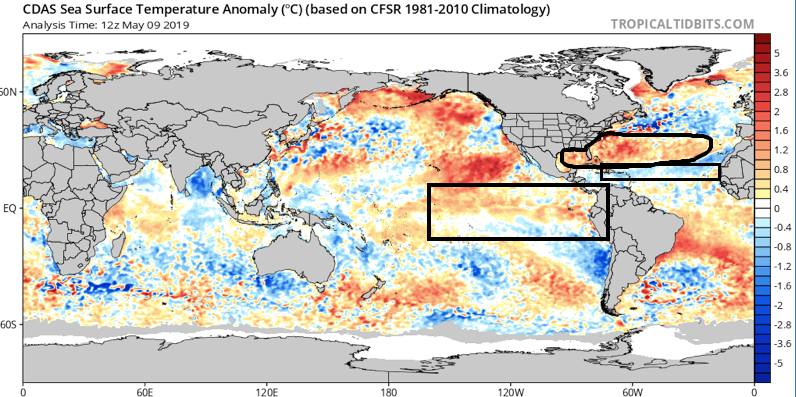
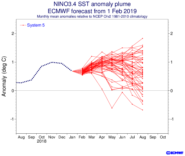
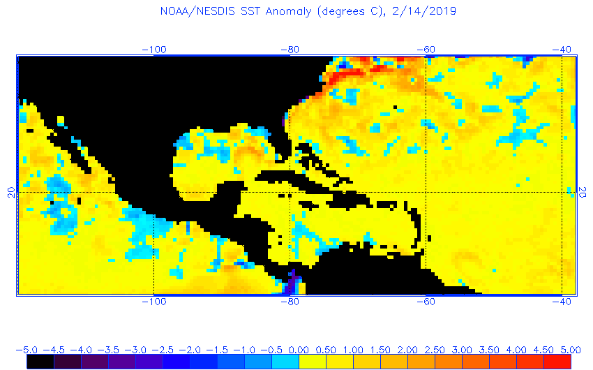
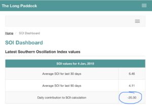
As we look at current sea surface temperature anomalies, a few items stand out:
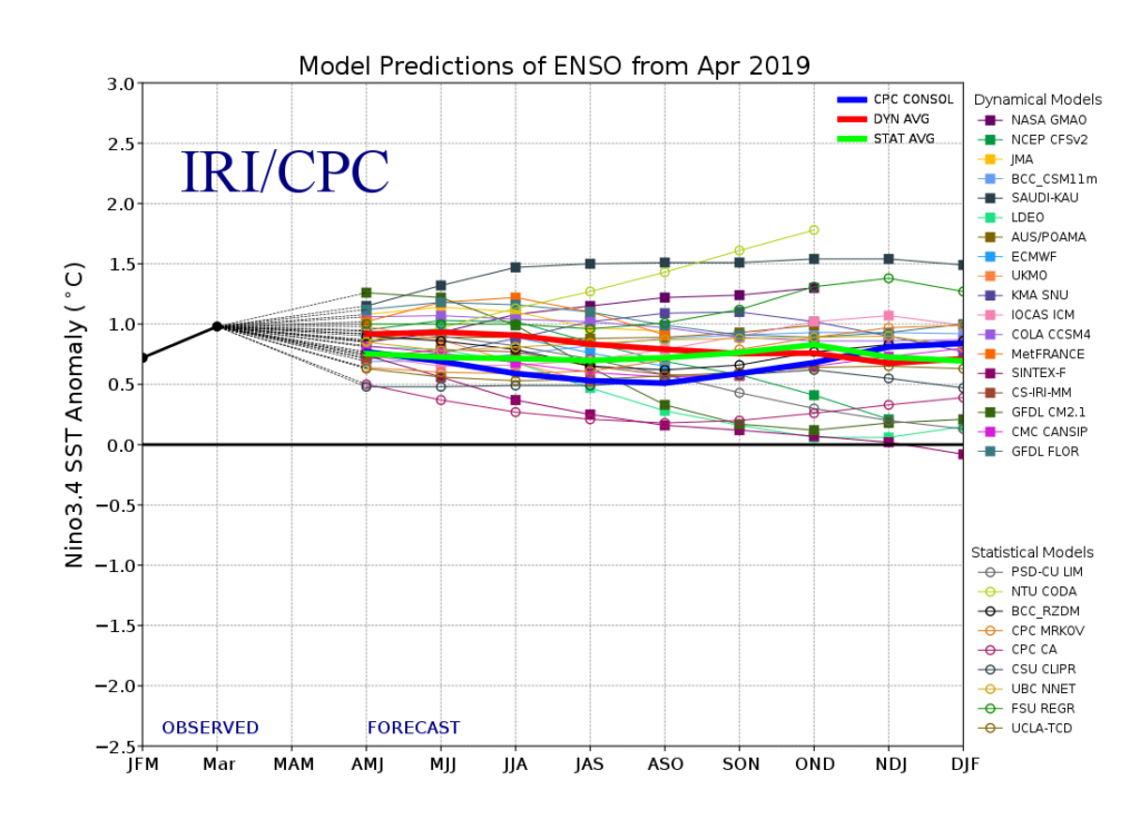
I. We expect a weak El Nino to continue through meteorological summer (June through August), and perhaps even into next winter.
II. MDR (Main Development Region for tropical entities) is running cooler than normal and would suggest an overall “less busy” hurricane season from a long-track perspective
III. SSTs are running much warmer than normal in the Gulf of Mexico and off the East Coast. This is important as while the long-track tropical systems may not be as frequent, we’ll have to remain on guard for the potential of active times closer to home this season. Additionally, these warmer anomalies tend to lead us to believe precipitation will run above normal across coastal areas into the Deep South this summer.
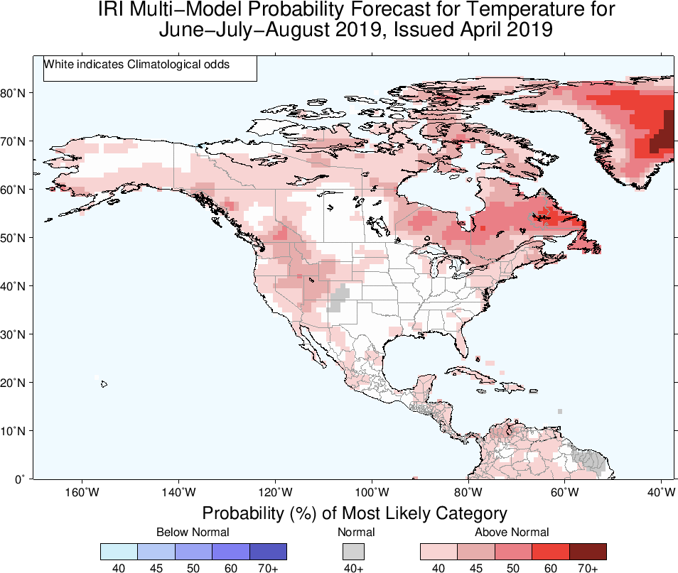
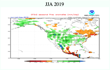
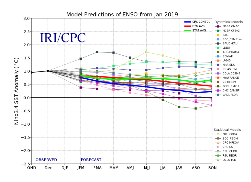
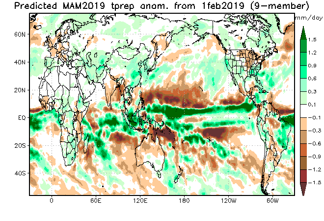
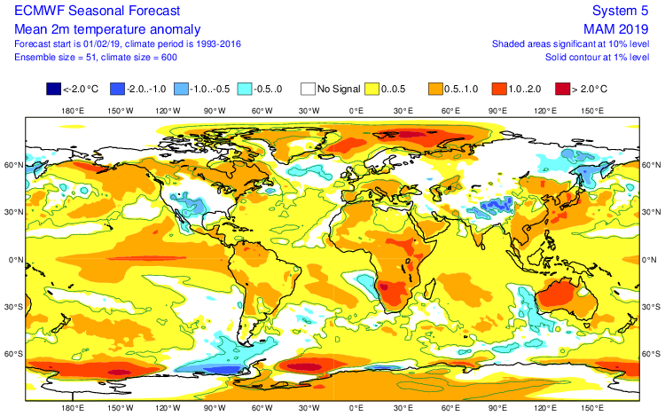
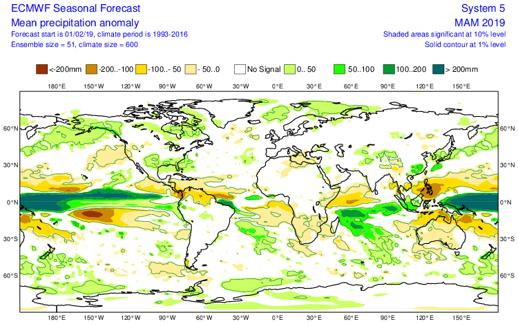
Let’s look at some of the climate computer model data for the summer season:
The latest IRI model (International Research Institute) shows relative warmth along the coastal areas and the west with greatest wet anomalies across the Northwest.

The CFSv2 is leaning towards an anomalously wet summer across a widespread portion of the country (exception being New England).

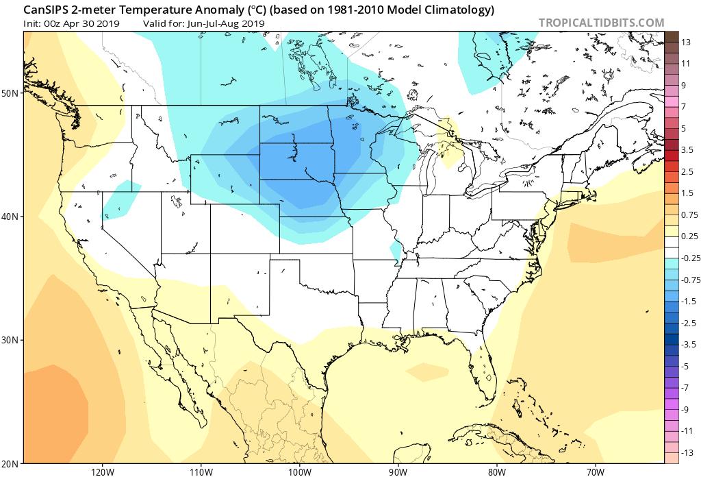
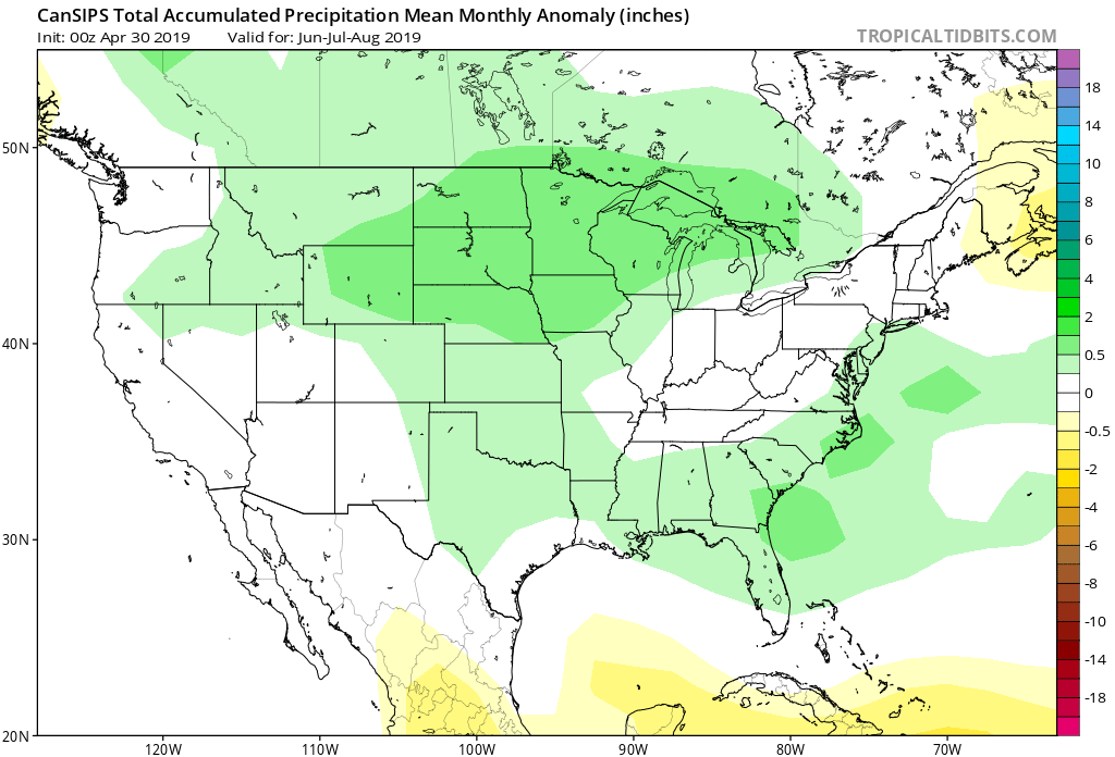
As we review the CanSIPS, it likes the idea of a cool, wet summer across the Heartland with warmth along the coasts.
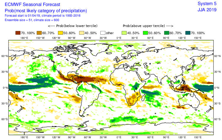
The European Seasonal Forecast has a seasonal summer for most of the country with warmth along the coasts, and a reflection of wetter anomalies across the northern Plain into the Northwest.

(The JMA Seasonal hadn’t updated as of this post).
After taking into account the various seasonal model data above (which is in remarkable overall agreement for a LR forecast idea), along with the current SST configuration, and analog data, this is how we see the Summer of 2019 playing out.

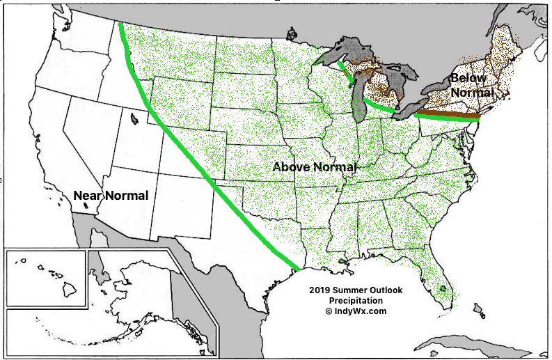
Specific to central Indiana, we’re forecasting a rather wet and cooler than average summer. Frequent storm systems should keep things active around these parts for the balance of the summer season, with the temperature scale tipping a touch cooler than normal.
While the number of named storms should be down compared to normal (highlighted by the Euro seasonal precipitation idea), we’ll have to keep close tabs on the Gulf of Mexico and off the Southeast coast for the potential of “last minute” development. Those warmer than normal sea surface temperatures lurking off the coast does warrant concern for at least the threat of another active year from a landfall perspective.


 Speaking of warmth, 2016 has been a very warm year.
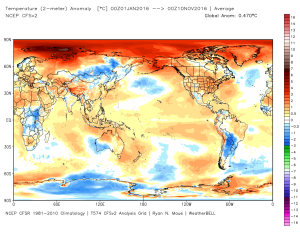 (The cold of 2014 seems so long ago…)
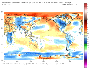 Back to present. We’ve targeted the middle part of November to finally beginning “bucking” the recent warm trend. This won’t happen overnight and will be a battle of back and forth, initially. Thus, the “step-down” label. To be clear, November, as a whole, will finish much warmer than average. It’s virtually impossible to counter the incredibly warm start. That said, we do anticipate “jabs” of colder air working in here over the next couple weeks. For instance, this weekend will feature lows in the 20s for most and highs not making it out of the 40s Saturday afternoon. (The average low and high at IND Saturday are 37 and 54).
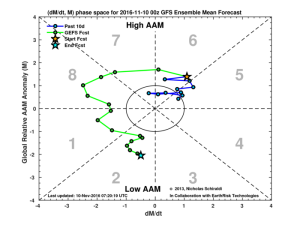
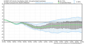
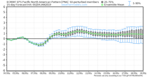
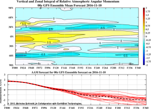 When we look at the AAM forecast (above), we note the westerlies may begin to slow (indicative of the negative values) in the 8-10 day period. This is crucial and, simply put, has to happen for the pattern to begin shifting into more of a position to allow sustained cold to enter the equation. We want to reiterate that this, in and of itself, doesn’t create the cold, but instead allows the pattern to begin shifting away from the Nino-like (warm) regime into more of a La Nina pattern, as a whole. – Hey, you have to start somewhere.
 Additionally, the EPO is forecast negative off the GEFS and EPS. (Images courtesy of Weatherbell.com).
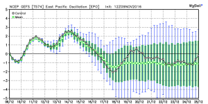
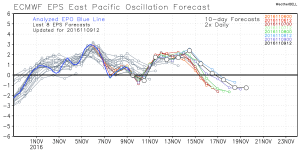
 Again, this is a cold signal. (Image courtesy of Madusweather.com).
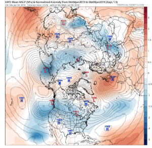
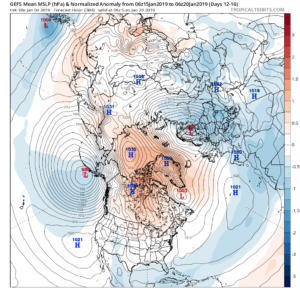
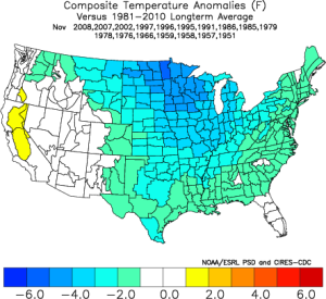 The ensemble data is also beginning to key-in on higher heights (blocking) developing over the top. Notice the significant changes in the overall look to the pattern between now and days 11-16. (Images courtesy of Weatherbell.com).
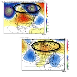 In summary, and in the face of *most* seasonal data that is screaming warm, warm, warm, we still don’t have any significant changes to our overall thinking of “step-down” mid-November giving way to more sustained wintry-like conditions in the overall sense from the Thanksgiving-Christmas period. Time will tell and only the Good Lord knows what the future holds, but we’ve done far too much work and research to throw the “game plan” in the trash before the game even begins…