Updated 12.10.23 @ 8:45a We’re going to be socked in with mostly cloudy and unseasonably chilly temperatures today. A few snow flurries may also accompany the cold. Otherwise, a mostly…
You must be logged in to view this content. Click Here to become a member of IndyWX.com for full access. Already a member of IndyWx.com All-Access? Log-in here.
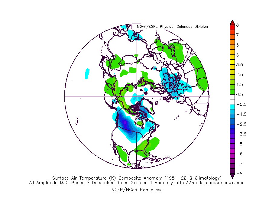
As we hone in on the late December and early January pattern, there remains little if any change in the thought here that a more widespread cold pattern will evolve across the eastern 1/3 of the country. We note the Madden Julian Oscillation (MJO) is still showing that it wants to progress out of the traditionally warm December phases we’re in now into the colder phases post 12/20.
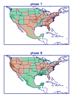
Temperature Anomalies: MJO Phase 7 December
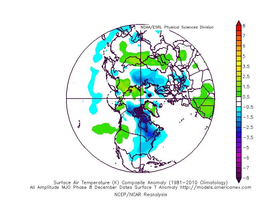
Temperatures Anomalies: MJO Phase 8 December
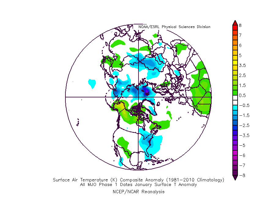
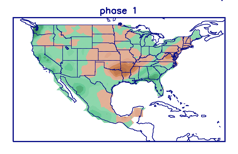
Temperatures Anomalies: MJO Phase 1 January
While we fully anticipate a more sustained colder than normal pattern to evolve in the 12/20 to 1/10 timeframe, I think this should be more of a situation that’s slightly colder than normal versus some sort of major arctic blast. All the same, as we get into the time of year when averages are close to their lowest, that will speak volumes given where we’ve been up to that point through the majority of December.
From a precipitation standpoint, these respective phases usually produce below normal precipitation across our neck of the woods, at least until we get into Phase 1 in January (interesting with the expected colder regime in place by that time period, heh?).
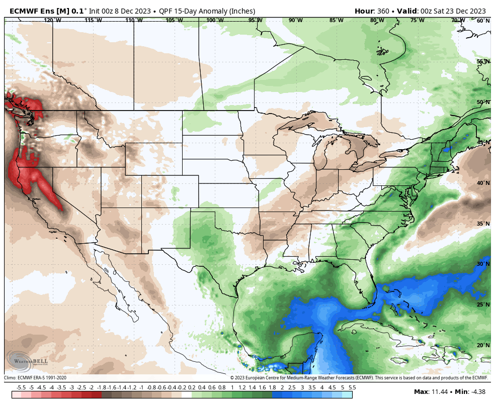
When we go look at the latest European ensemble precipitation anomalies over the next couple weeks (ending Dec. 22nd), the dry theme is alive and kicking. Frankly, it a very El Nino-like look (drier here while wetter across the Southeast and eastern seaboard) and shouldn’t come as a surprise.
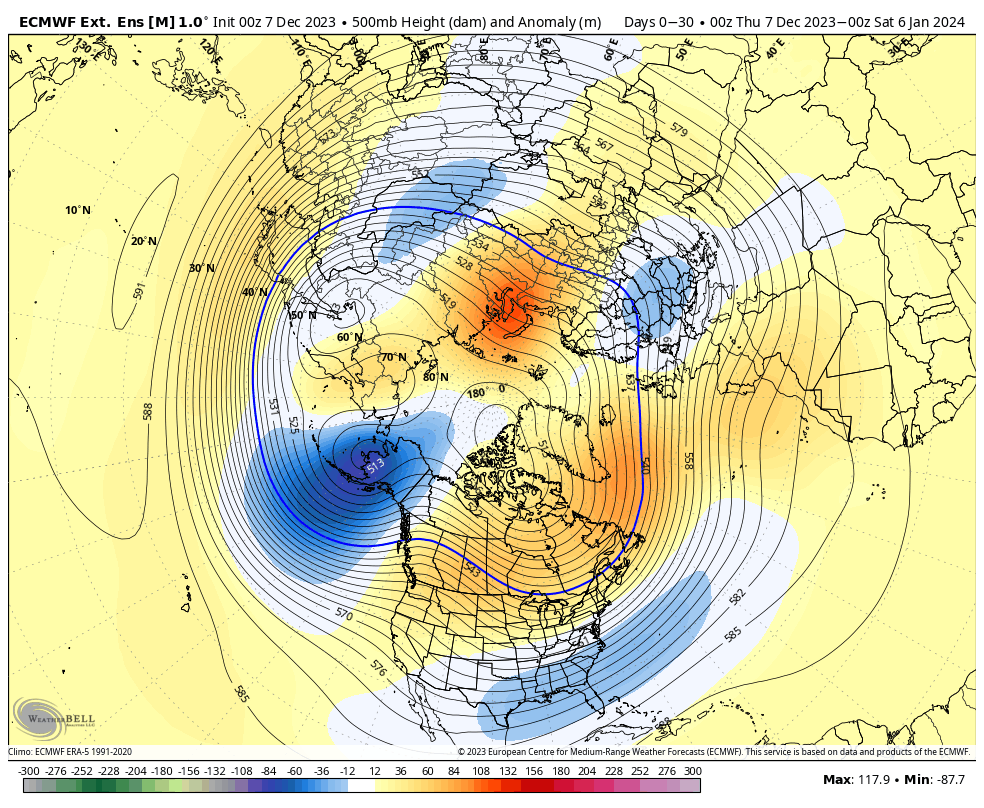
Also of interest is the way the longer range weekly modeling shows the trough becoming more prevalent and sustained out in that post December 20th timeframe, continuing into early January.
European Weeklies: Winter wx fans also have to like all of the high latitude blocking on this run while the trough expands and sustains itself. Immediate take-away from yesterday’s run? Chilly and stormy close to the year and open to ’24.
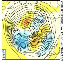
JMA Weeklies: In similar fashion to the Euro, the model really expands and deepens the eastern trough Weeks 3-4. Again, it’s a chilly and stormy look.
In closing, we see no reason to deviate from our long standing idea of a pattern shift to chillier than normal around Christmas that should carry us into the first couple weeks of January. By that point, we’ll have to start monitoring other teleconnections (along with the MJO, of course), such as the NAO, to gain more clarity on the regime as we push into the 2nd half of meteorological winter.
You must be logged in to view this content. Click Here to become a member of IndyWX.com for full access. Already a member of IndyWx.com All-Access? Log-in here.
You must be logged in to view this content. Click Here to become a member of IndyWX.com for full access. Already a member of IndyWx.com All-Access? Log-in here.
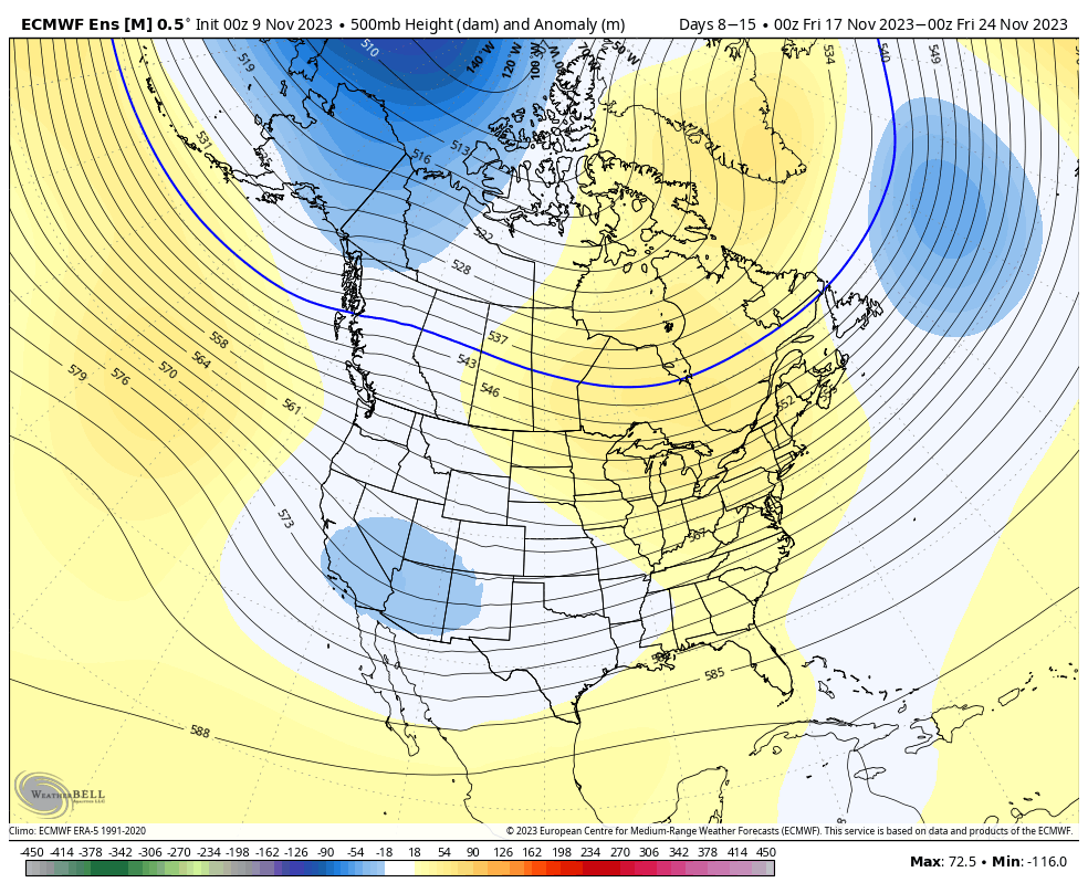
With Thanksgiving only 2 weeks from today (incredibly hard to believe), we’re able to start to get a better idea on the overall weather pattern as the “official” kickoff to the holiday season nears. The first point we want to drive home is that we should begin to see a much more active regime evolve during this 2 week period. From a temperature perspective, the pattern overall continues to look milder than average, but there will be a couple opportunities for transient pops of colder air, potentially around the all-important Thanksgiving holiday, itself.
Note how modeling sees the more active pattern evolving over the next 3-4 weeks (green represents above normal precipitation). – A significant change not only for our neck of the woods but certainly for our friends and neighbors down south (badly needed for a region suffering an expanding drought. Speaking of which, all of the dry/ droughty southern tier should reverse in significant fashion as the active Nino storm track gets going over the coming months. As the pattern continues to evolve into the ‘24 spring and summer, the south-central severe drought will be erased.
Despite attempts of troughs to roll into the Ohio Valley, they will struggle with staying power over the next 3-4 weeks. The latest JMA Weekly product and Euro/ GFS ensemble blend looks very solid given where the pattern drivers currently reside.
Week 1
Week 2
Weeks 3-4
The pattern drivers of a primarily positive EPO, negative PNA, and MJO in 8/1 (all unchanged from our post earlier this week) all suggest a predominant eastern ridge, western trough placement over the upcoming 2-3 weeks.
We’ll continue to keep close tabs on the regime, especially centered on 11/22 – 11/26.
Make it a great Thursday!
Side note: Confidence is increasing that this Nino will evolve into a central-based event which will up the chances of colder/ snowier prospects come late December and on into January. More on that later next week in a more extensive update specific to this transition.