
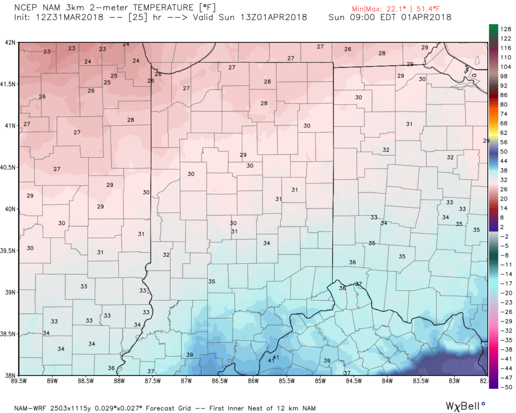
A cold front will blow through central Indiana this evening and colder air will spill into the region overnight. We’ll wake up with temperatures in the upper 20s to lower 30s Easter morning with dry conditions in place.
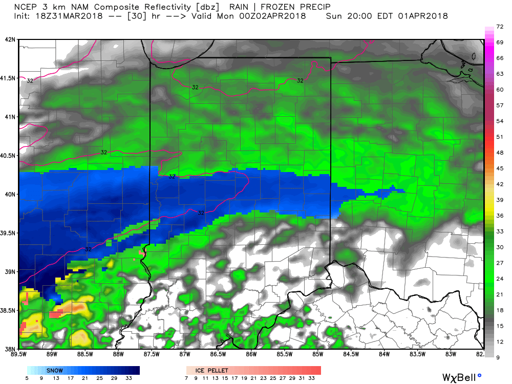
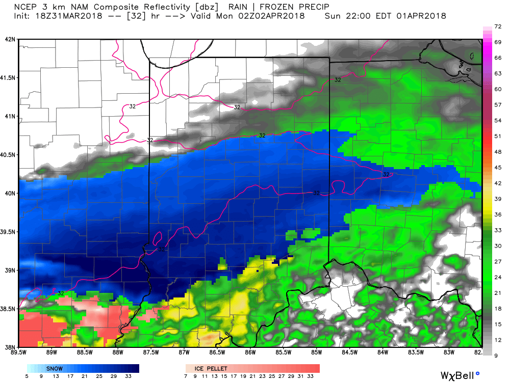
 Most of the daytime Easter Sunday will feature dry conditions. Clouds will increase, lower, and thicken through the afternoon ahead of an area of low pressure that will track through the lower Ohio Valley Easter night. This will spread precipitation into central Indiana towards 5p-6p. Initially, precipitation is likely to begin as a cold rain, but we expect a rather quick transition to wet snow shortly after the onset. Periods of moderate to heavy snow will fall into the nighttime across the I-70 corridor. This will lead to reduced visibility and slick travel as snowfall rates will (once again) overcome marginally cold surface and pavement temperatures. If you must travel tomorrow night and early Monday, expect roadways to be slick at times- including being slush and snow covered.
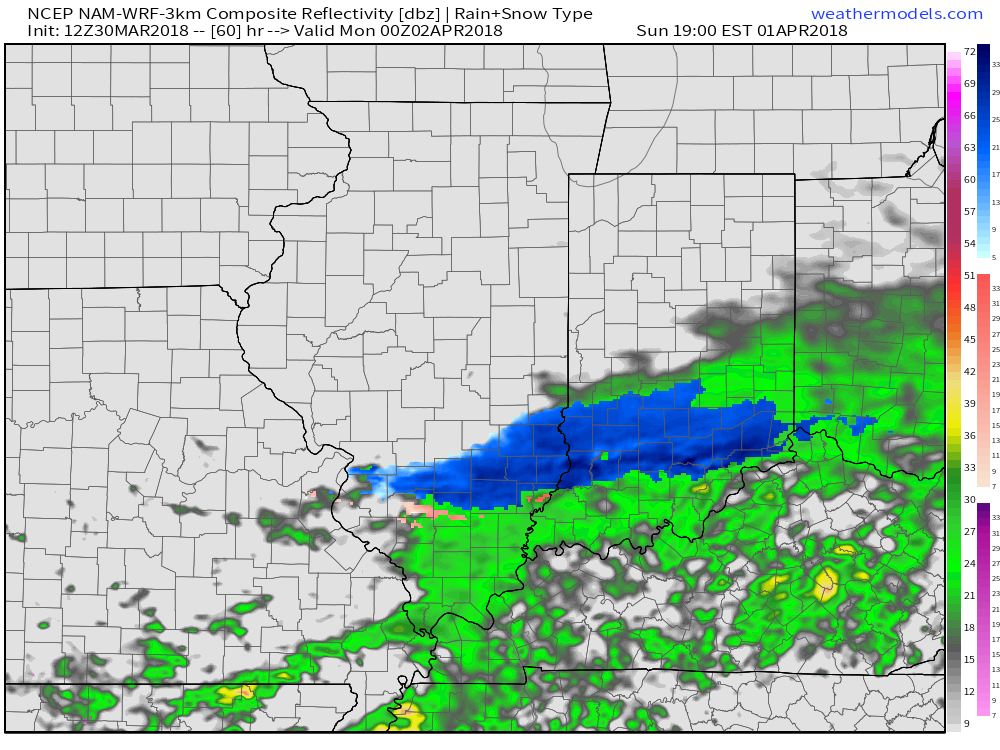
Here’s an idea of what the radar may look like tomorrow night, courtesy of weatherbell.com:
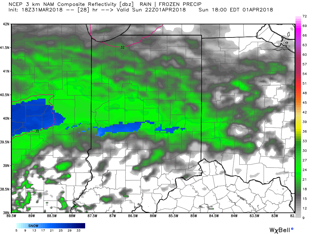
6p forecast radar
8p forecast radar
10p forecast radar
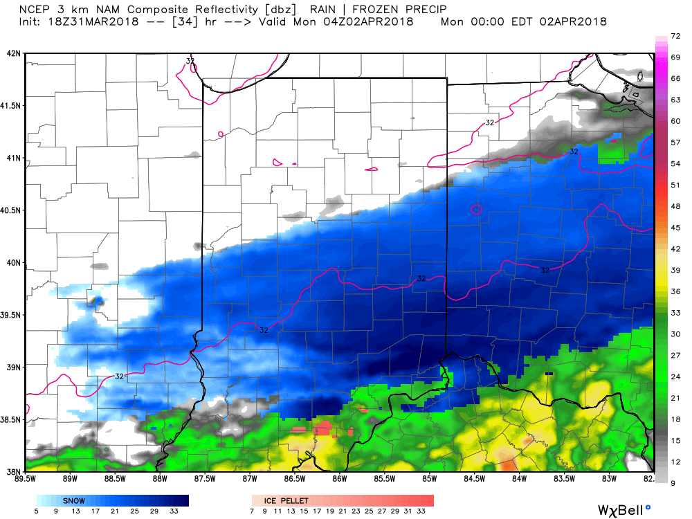
12a forecast radar Monday
This will be a rather quick-hitting event, but “thump” potential is written all over it, including localized intense banding. These localized bands could result in a couple of reports of 4″+ in spots. We think heaviest snow falls in the 6p-midnight window.
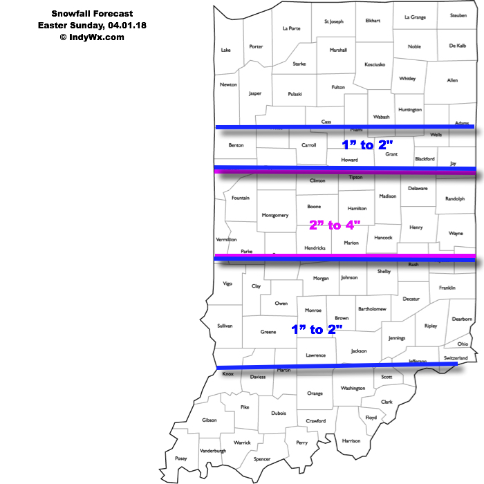
Our current snowfall forecast:
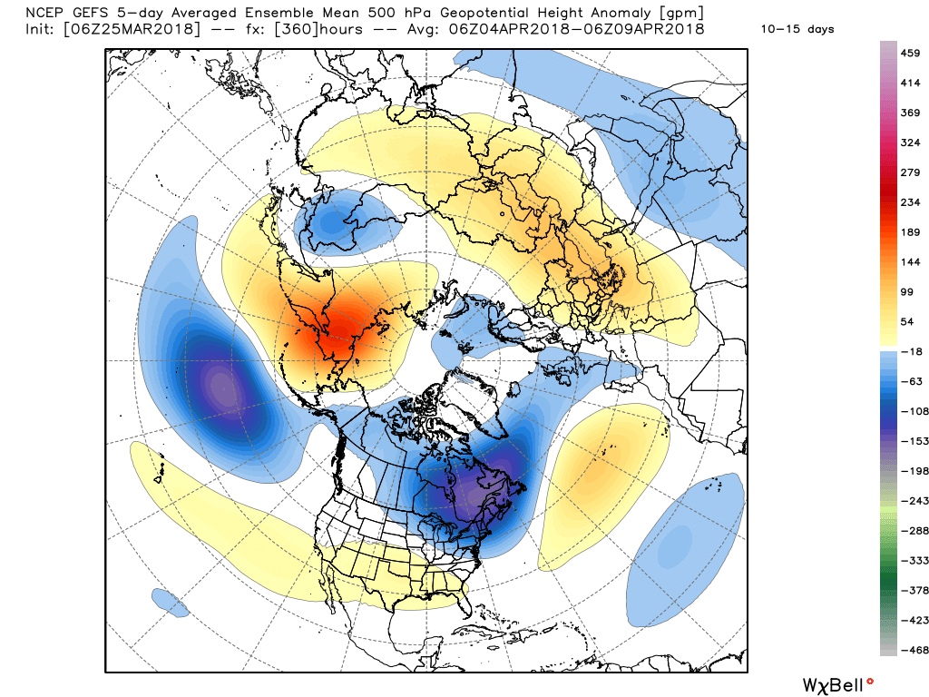
 Another winter event is possible next weekend, including the potential of additional accumulating snow. Should we get snow down, the possibility of near-record cold is present with the late season blast of arctic air next weekend. Lows in the 10s aren’t out of the question at least one night next weekend- likely Sunday.
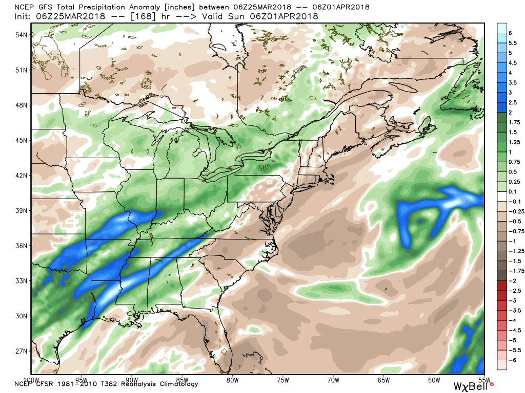
 As we look ahead, a wet week is in store for the region. Periods of widespread rain, heavy at times, will come at us in waves:
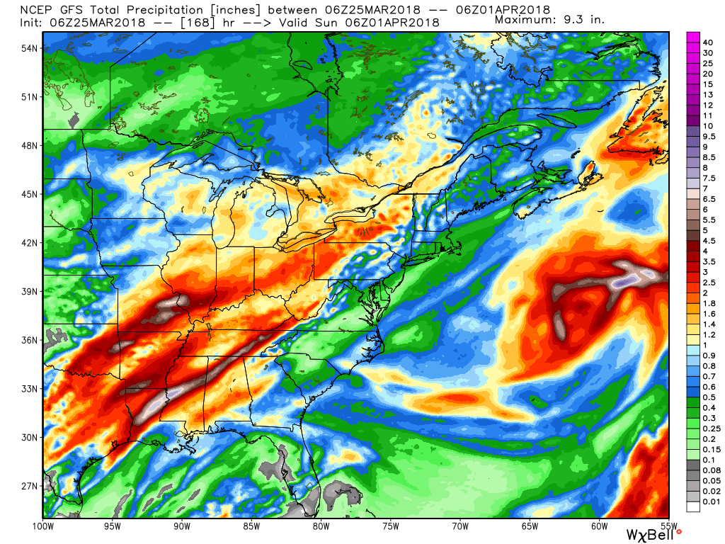
 After a brief relaxation in the unseasonably cold regime, well below average temperatures are expected to return as we move through early April. It’ll feel more like winter than spring through the better part of the first half of the month.
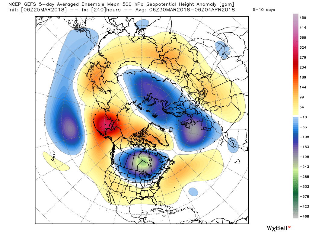
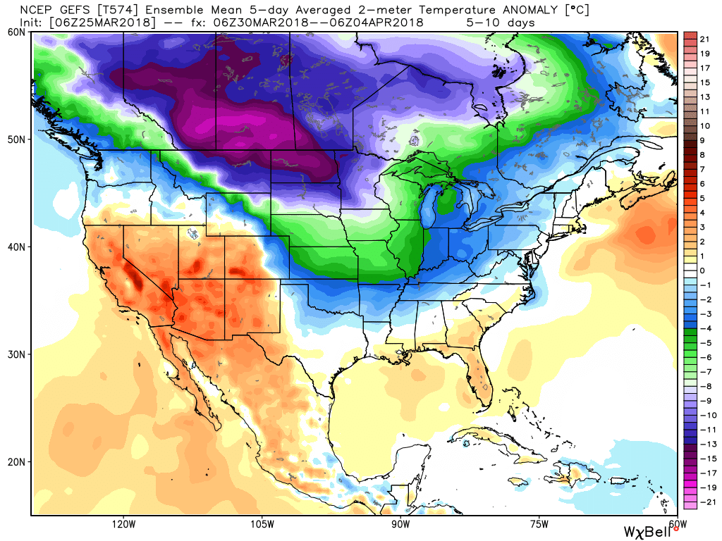
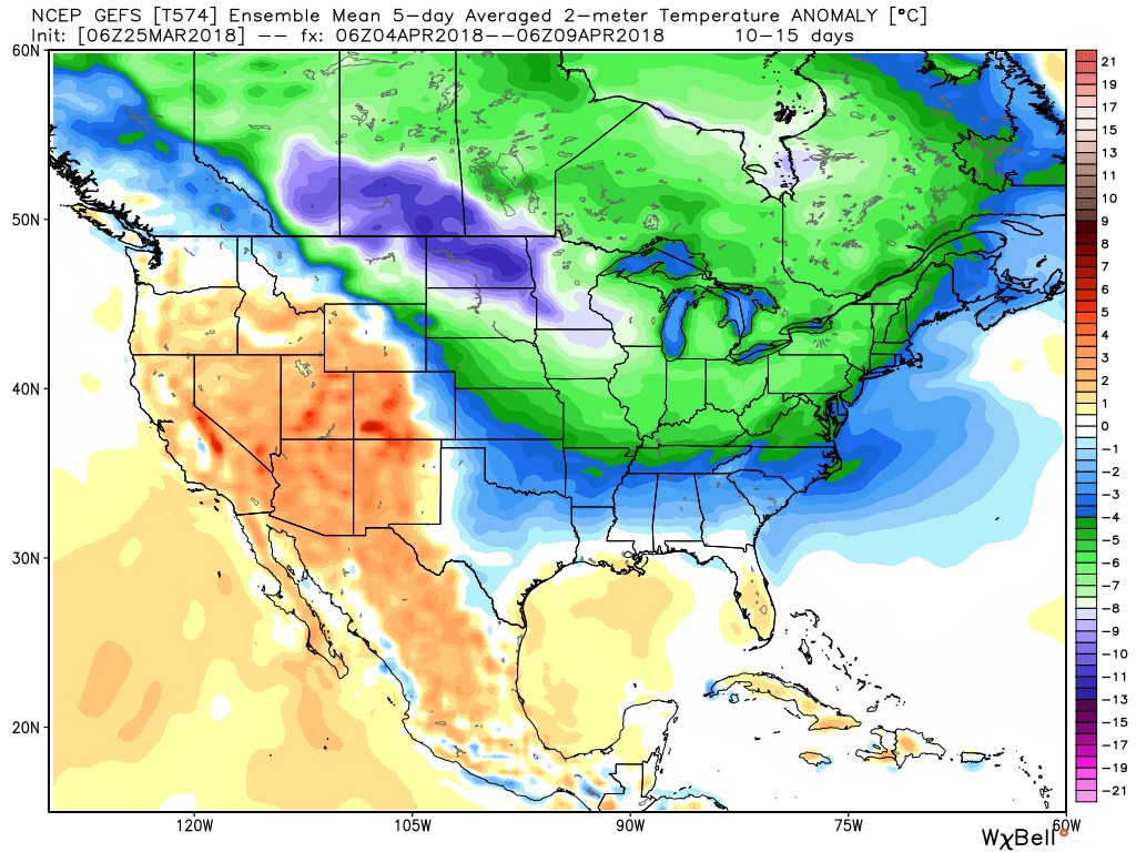 It’s also too early to think about yesterday as the last snow of the season. Given the early April look, it wouldn’t surprise us if an additional snow event or two came along…