Easter Snow Is No April Fool’s Joke For Parts Of The Region…
A cold front will blow through the state Saturday evening (accompanied by showers and gusty winds) before becoming stationary across the Tennessee Valley region on Easter Sunday. At the same time, a relatively flat wave will scoot east out of the Plains and across the southern Ohio Valley Sunday afternoon and night. This will spread moisture across the southern half of Indiana Sunday evening. With unseasonably cold air in place, most, if not all, of the precipitation will fall in the form of snow Sunday evening into the wee morning hours Monday.
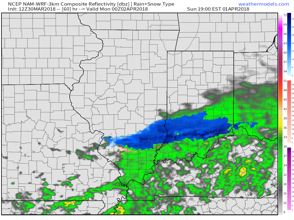
While we still have another 24-36 hours to monitor the modeling, confidence is rather high from this distance that the southern half of the state (especially south of the I-70 corridor) will experience at least a light accumulation of snow Sunday evening and night- potentially a 1″ to 3″ type event. This won’t be anything like central parts of the state dealt with last weekend, but considering the time of the year, this will serve as a reminder that winter isn’t giving up without a fight this year.
Speaking of that, don’t look now, but another attempt at an accumulating snow event may be on the table next weekend. Sigh…
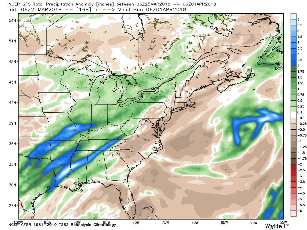
 As we look ahead, a wet week is in store for the region. Periods of widespread rain, heavy at times, will come at us in waves:
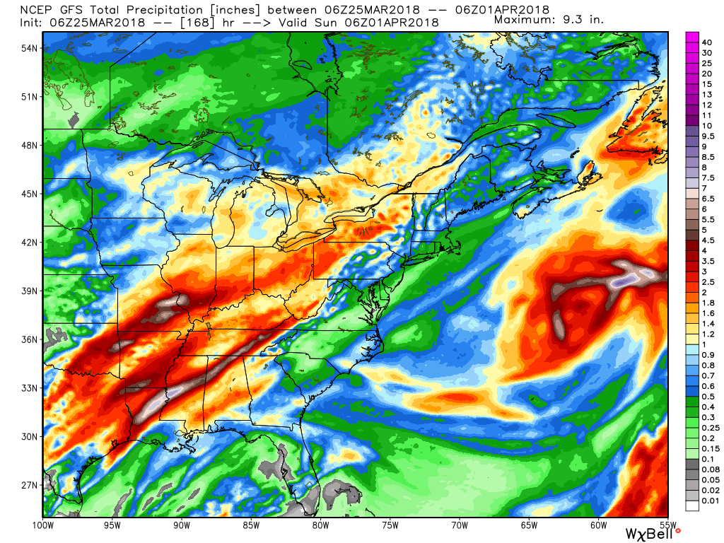
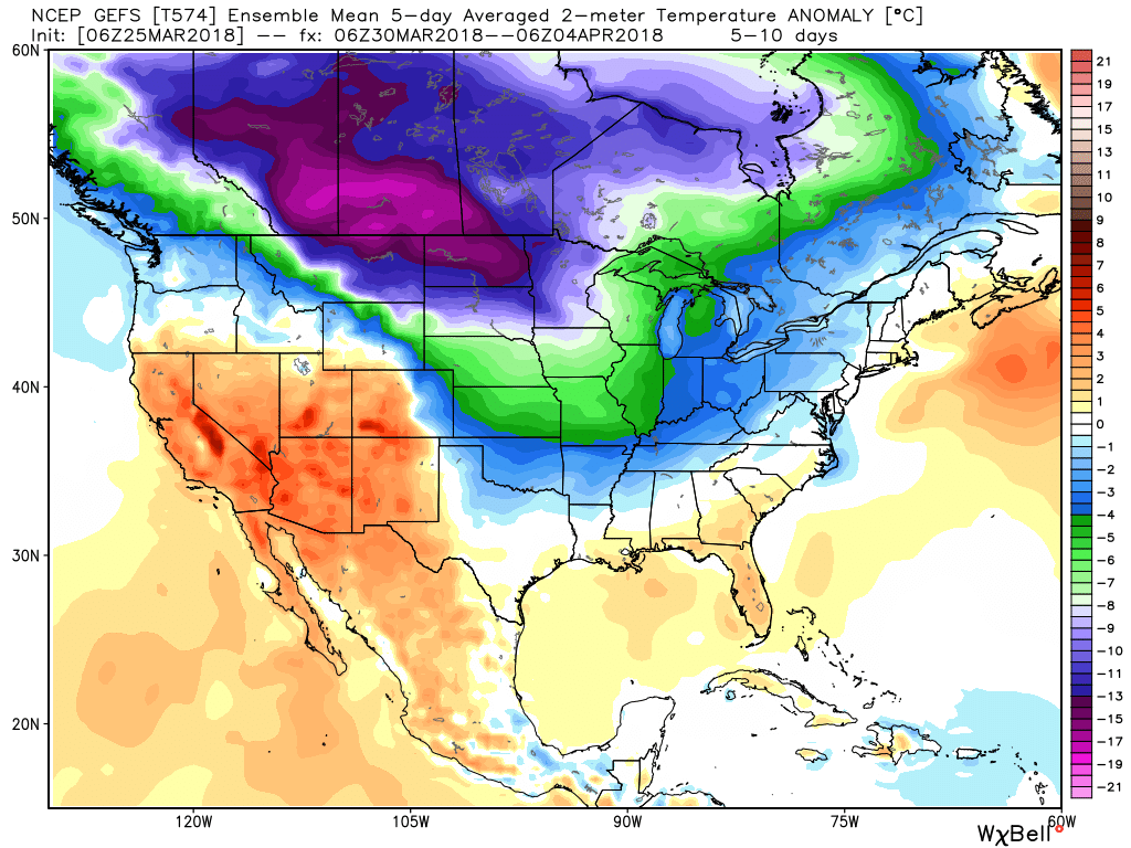
 After a brief relaxation in the unseasonably cold regime, well below average temperatures are expected to return as we move through early April. It’ll feel more like winter than spring through the better part of the first half of the month.
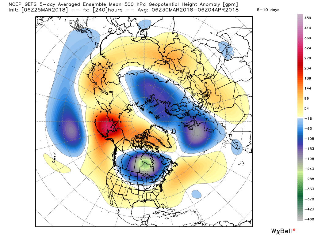
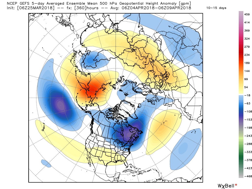
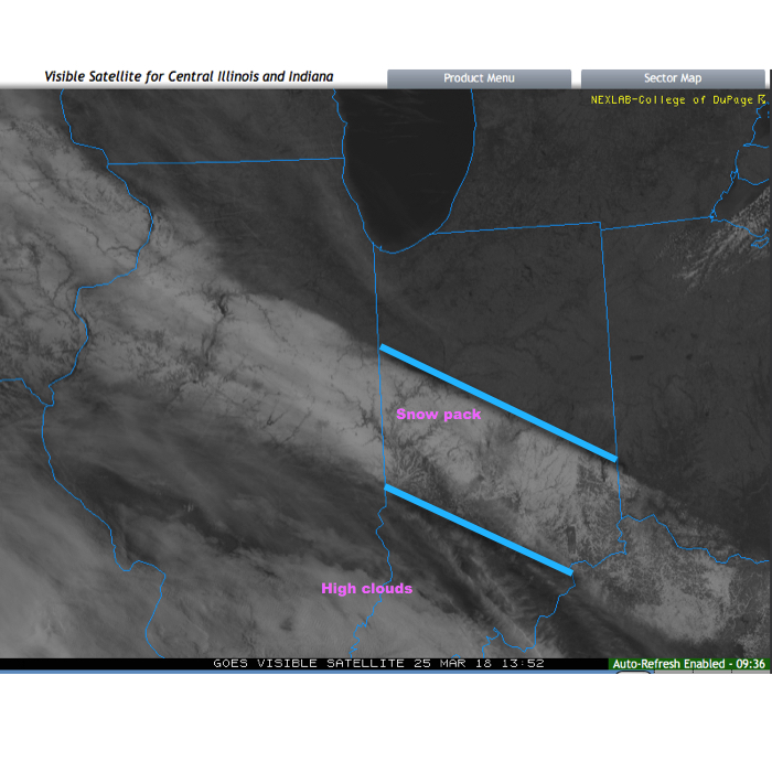
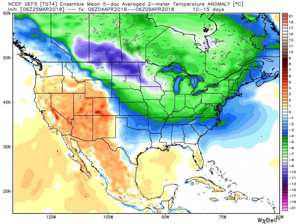 It’s also too early to think about yesterday as the last snow of the season. Given the early April look, it wouldn’t surprise us if an additional snow event or two came along…