
 Highlights:
- Increasingly hot and humid
- Isolated storm coverage becomes more widespread
- Relief next week
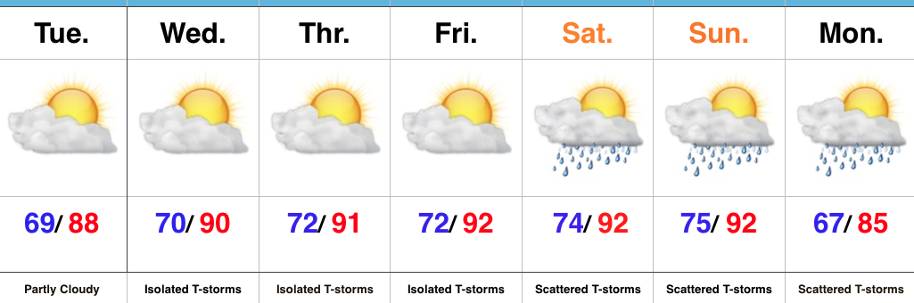
Air You Can Wear…The big weather story will be the increasingly hot and humid feel as we progress through the week and on into the weekend. The combination of dew points in the 70s and wet soils across the state should “beat back” the heat from getting to where it otherwise could (mid-upper 90s), but it’ll feel oppressive, nonetheless. Plan to hydrate and wear cool, lightweight clothing if you plan to be outdoors for any length of time.
While we can’t completely rule out a renegade storm through Friday, most neighborhoods will remain free of any rain through the remainder of the work week. Better coverage of showers and thunderstorms will increase over the weekend into early next week as the transition from hot, humid weather begins to give way to a more pleasant feel.
Upcoming 7-Day Precipitation Forecast:
- Snowfall: 0.00″
- Rainfall: 0.50″ – 1.00″
 Highlights:
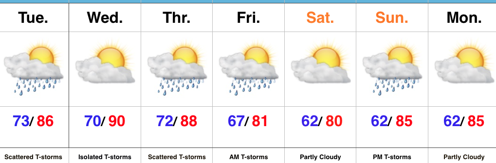 Highlights:
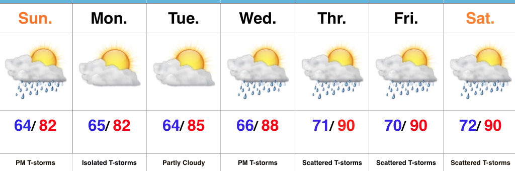
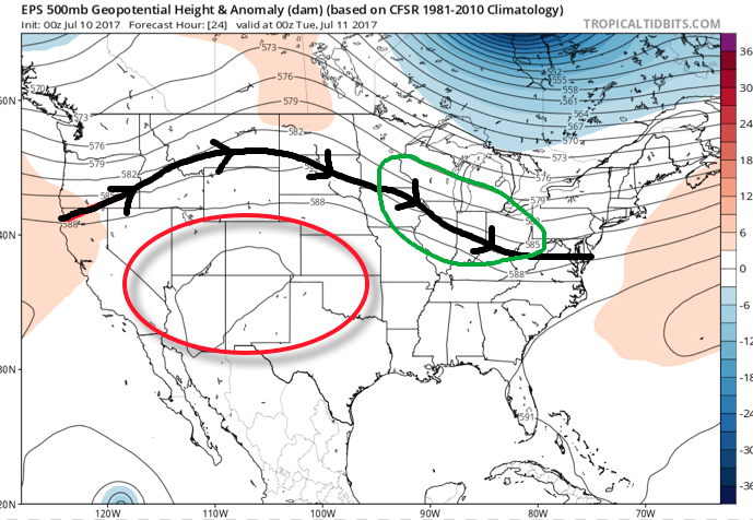 A quick step outside this morning will tell the story on just how different it feels. Gone is the refreshing air mass we enjoyed over the weekend and in return we’ve transitioned to an oppressive, tropical feel. Dew points will remain in the 70s through the majority of the work week and precipitable water values will reach 2″+ at times. With such a moisture laden air mass in place, flash flooding will likely result for some communities as the storms continue to track over the same areas this week.
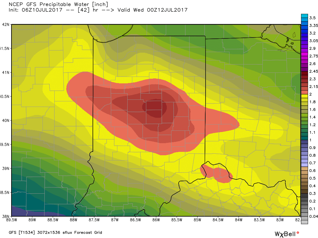 Additional waves of thunderstorms will impact the region through mid-and-late week before we advect some drier air into the state Friday evening into the weekend. Despite the lower dew points and cooler air, we still can’t rule out a shower or thunderstorm this weekend as a secondary front settles south.
 The Gulf of Mexico is boiling warm (running 1°-3° C above normal) and this will aid in transporting moisture-rich air north. As storms eject out of the Rockies and Plains, one would tend to believe anomalously warm dew points and precipitable water values will be available.
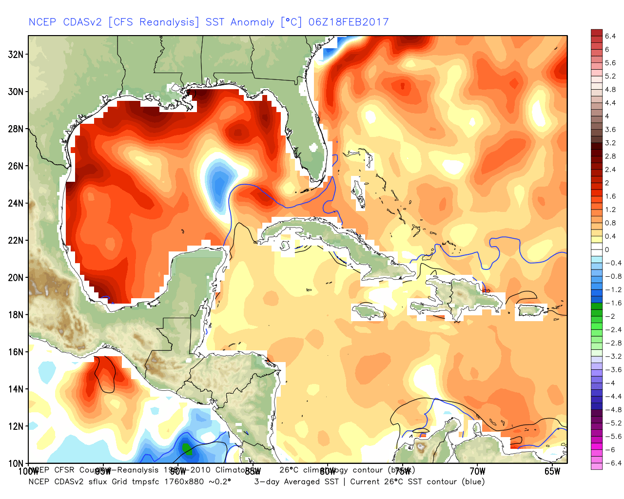 The JMA Weeklies show an active stretch developing as we progress through the next few weeks.
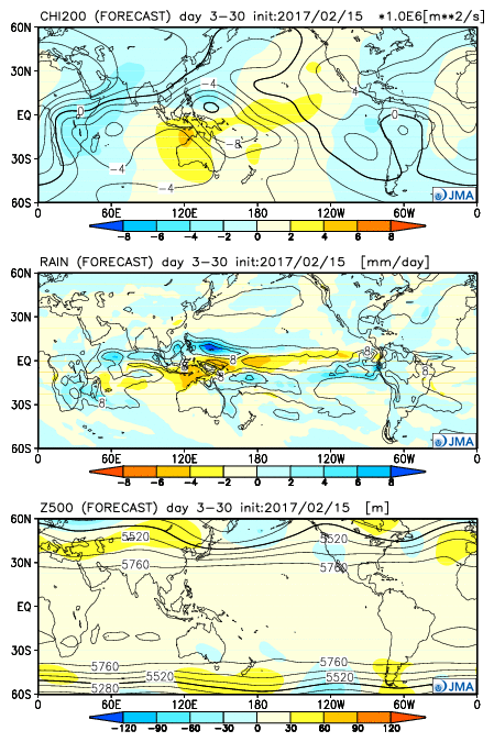 As we rumble deeper into the spring months, the mean trough position should be located across the west. The end result should be a mean storm track that runs into the Ohio Valley- courtesy of resistance from an eastern ridge (that warm water in the Gulf and East Coast screams the mean ridge position should be located across the east coast). Confidence is greater than normal on a busy severe weather season.