VIDEO: Stunning Sunday; Midweek Rumbles…
Updated 07.09.23 @ 8:40a
You must be logged in to view this content. Click Here to become a member of IndyWX.com for full access. Already a member of IndyWx.com All-Access? Log-in here.
Updated 07.09.23 @ 8:40a
You must be logged in to view this content. Click Here to become a member of IndyWX.com for full access. Already a member of IndyWx.com All-Access? Log-in here.
Updated 07.07.23 @ 7:31a
You must be logged in to view this content. Click Here to become a member of IndyWX.com for full access. Already a member of IndyWx.com All-Access? Log-in here.
Updated 07.03.23 @ 7:34a
For most, the long holiday weekend continues on for another couple days. Thankfully, after round upon round of rain and storms, a drier trend will develop today and for Independence Day, itself. While we can’t totally rule out a passing shower today (case in point north and northeast of the city this morning), coverage and intensity of precipitation the next 48 hours will be significantly reduced. I think any sort of rain Tuesday will be very hard to come by (“isolated” coverage at best).
A new frontal boundary will push into the state Wednesday and the Storm Prediction Center has already included a Slight Risk of severe weather by Wednesday afternoon into the evening.
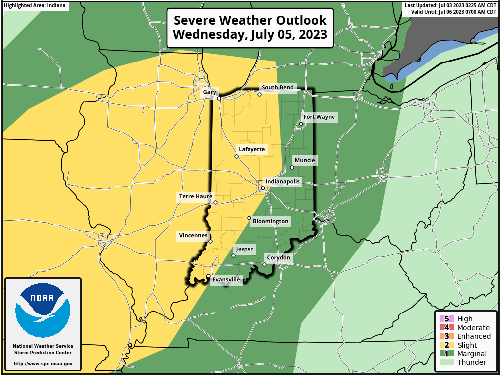
In addition to a damaging wind threat, localized flash flooding is possible as the cold front pushes through the region.
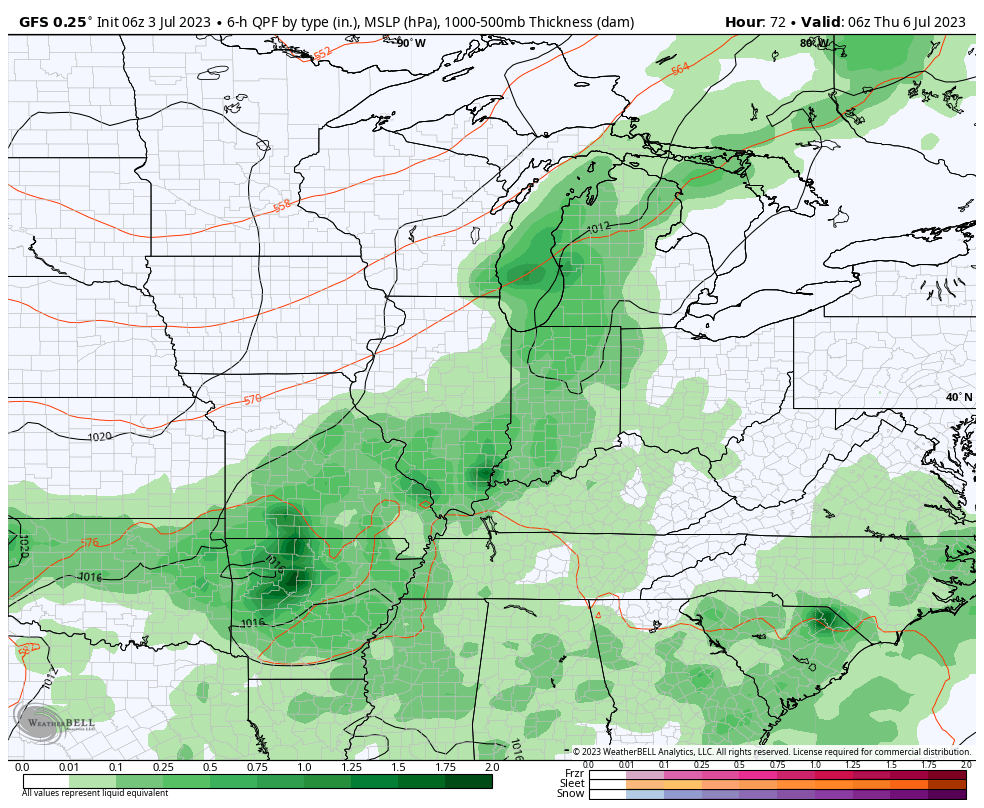
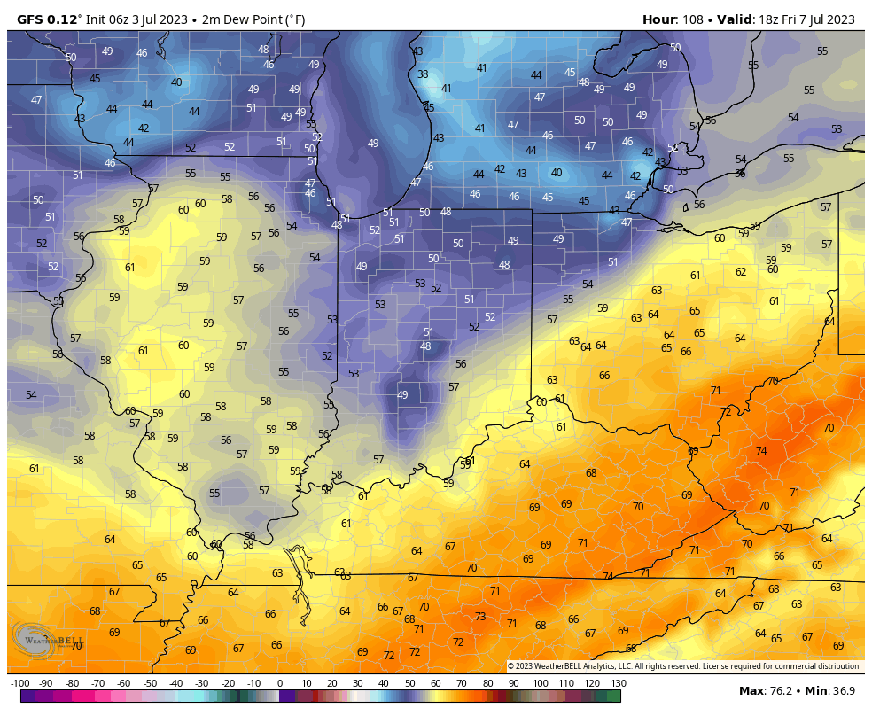
Thereafter, yet again, “timing” will be on our side as a much drier airmass filters into the region just in time for the weekend. Both Friday and Saturday appear dry and comfortable with significantly lower humidity.


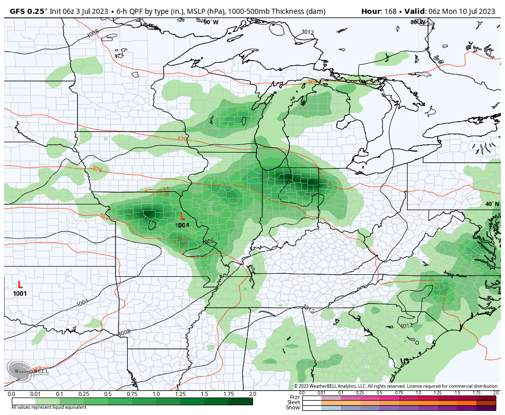
A renewed wet, stormy pattern kicks off for the 2nd half of the weekend into next week. Buckle up.
Updated 06.30.23 @ 7:40a
You must be logged in to view this content. Click Here to become a member of IndyWX.com for full access. Already a member of IndyWx.com All-Access? Log-in here.
Updated 06.28.23 @ 7:45a
You must be logged in to view this content. Click Here to become a member of IndyWX.com for full access. Already a member of IndyWx.com All-Access? Log-in here.