Client Brief: Updates On The Latest With Saturday’s Rain/ Wind…

Type: Heavy Rain & Strong Wind
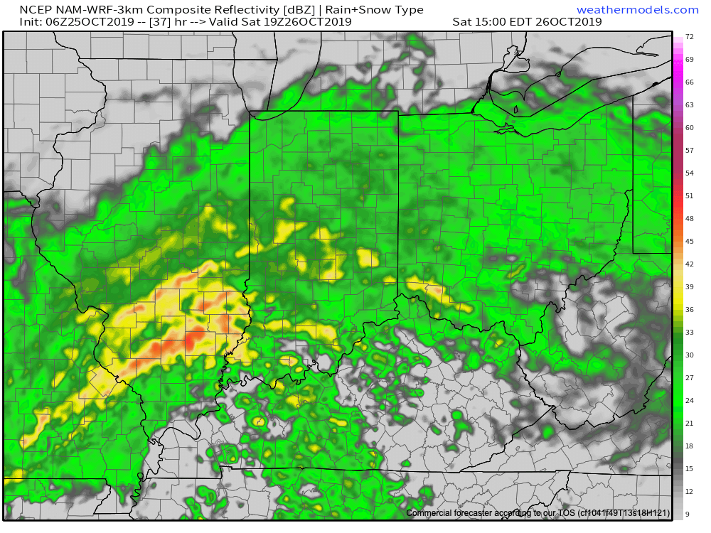
Rain will lift north across the Ohio Valley overnight into Saturday.

What: Heavy rain and gusty winds

When: Saturday

Rain Amounts: 1″ to 2″

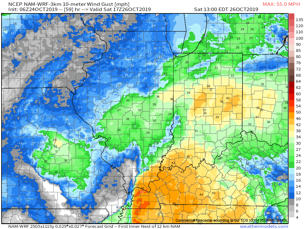
Wind: Variable 15-30 MPH with gusts to 45 MPH
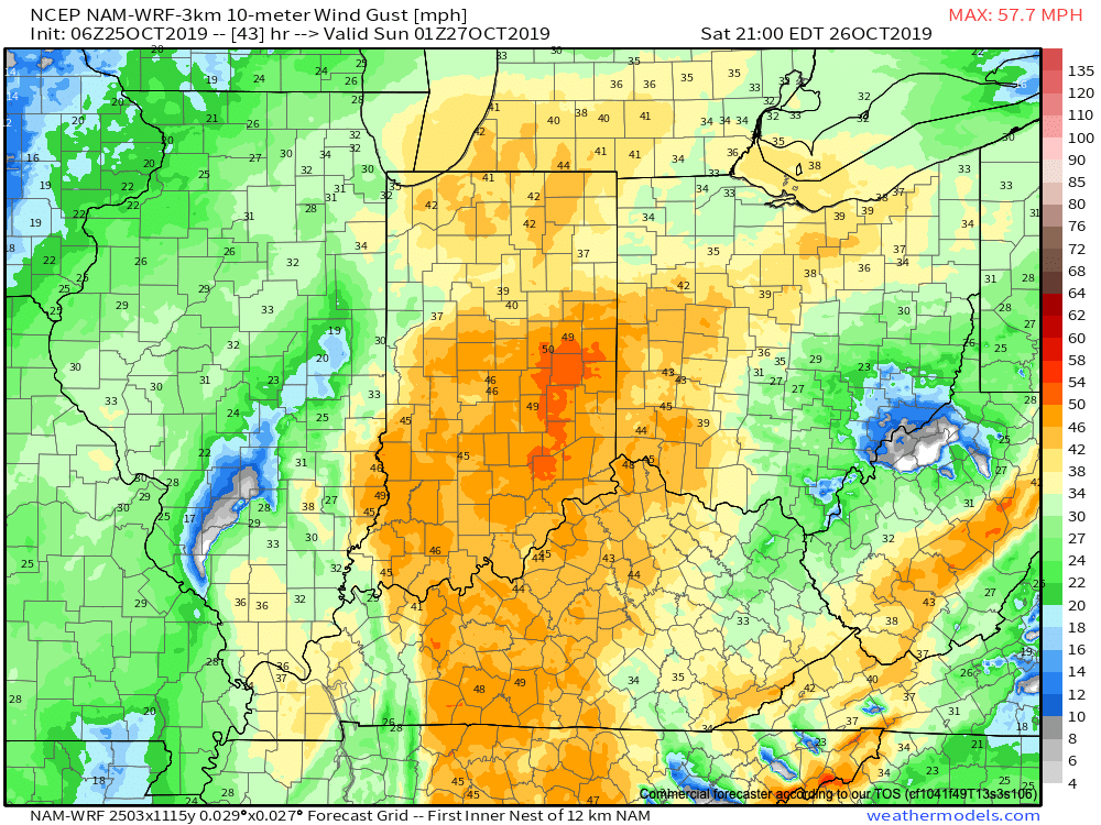
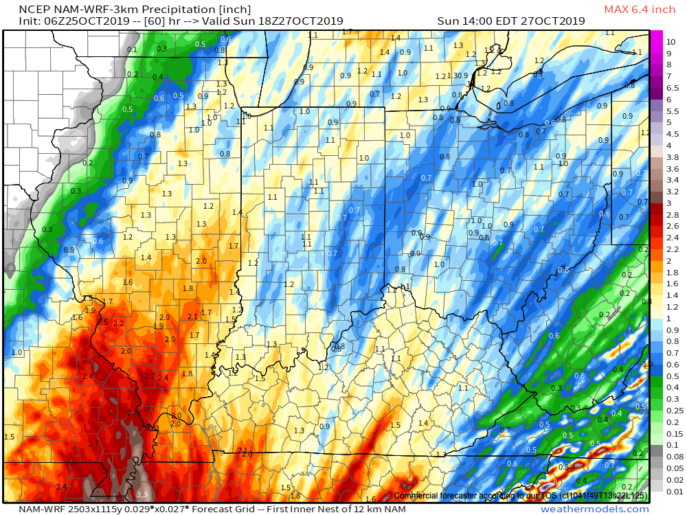
It continues to look like a significant rain and wind maker wants to take up residence across the Ohio Valley this weekend. Focusing more specific to central Indiana, Saturday is the day for the biggest impacts. A rather expansive rain shield will lift north across the state late tonight into Saturday morning, becoming heavy at times during the day Saturday. The other item to focus on is the wind. East winds will become strong and gusty during the day Saturday before shifting to the southeast, south, and eventually southwest as the area of low pressure moves very close to overhead. During this timeframe, winds may gust to 45 MPH Saturday night. Once the area of low pressure moves to our northeast, winds will shift around to the west Sunday morning and diminish. Overall, storm total rainfall amounts across central Indiana continue to look like they will check-in between 1″ and 1.5″ for most with a few locally heavier reports. The last of the rain will exit to the northeast before sunrise Sunday.
Client Brief: Heavy Rain Saturday

Type: Heavy Rain

What: Heavy rain and gusty winds

When: Overnight Friday through Saturday

Rain Amounts: 1″ to 3″- see below on current thoughts

Wind: East 10-20 MPH with gusts to 30 MPH+

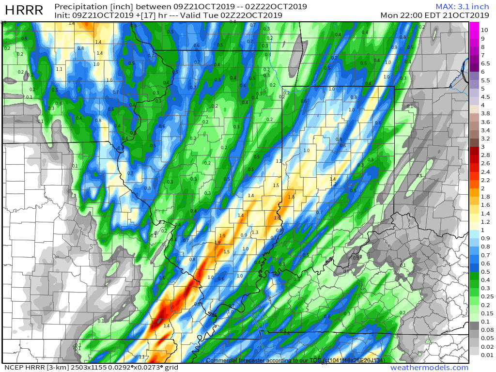
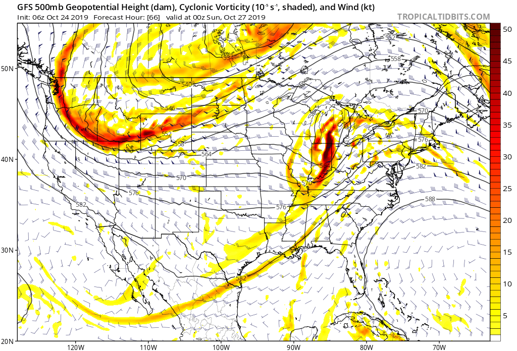
After a fairly quiet close to the work week, a vigorous upper low will track east out of OK, across northern AR, and northeast into the Ohio Valley. In response, a surface low will develop across the MS Valley Friday night, moving northeast into OH by Saturday night. The end result will be close to a (24) hr period of steady rain, at times heavy, across all of central Indiana. Additionally, we anticipate a period of gusty easterly winds Saturday morning into the afternoon hours. Widespread 1″ to 1.5″ rainfall can be expected with locally heavier amounts across central Indiana. Meanwhile, southern and southeastern Indiana can expect rainfall totals of 2″ to 3″ with locally heavier amounts. Rainfall coverage and intensity will diminish from southwest to northeast Saturday night.

Heavy rain will overspread central Indiana Saturday.

Wet, Windy, And Stormy Day Ahead…

A cold front will push across the Ohio Valley today. Ahead of the front, widespread showers and thunderstorms are expected. A few of these storms may become strong to severe with damaging straight line winds being the biggest concern.

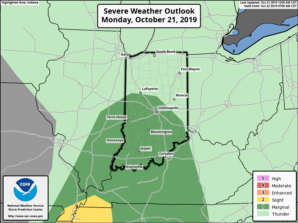
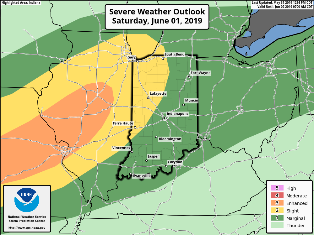
The Storm Prediction Center now includes portions of central Indiana in a ‘marginal’ risk for severe weather.

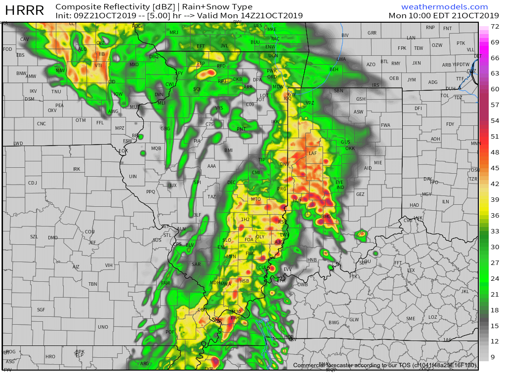
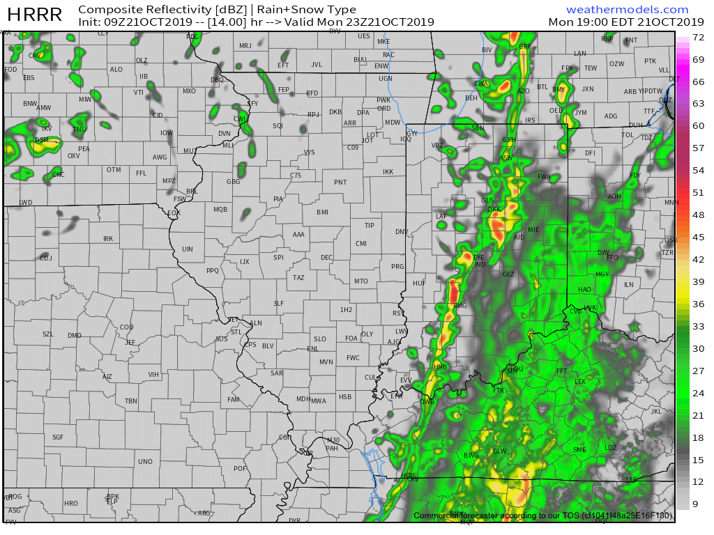
We expect a couple of rounds of storms today- one mid to late morning followed by another this evening directly ahead of the cold front.

Forecast radar 10a
Forecast radar 7p

Rain will end from west to east during the evening as the cold front sweeps across the state. Before that, some area rain gauges may accumulate around an inch of rain today (a few locally heavier totals possible).

The other headline today will be strong and gusty winds (originally out of the southwest before shifting to west this evening). Even outside of thunderstorms, gusts in excess of 40 MPH can be expected.

Drier and cooler air will arrive Tuesday through Thursday before another chilly, wet weather maker blows into town Thursday evening into Friday.

Fall-Like Conditions Set To Be Replaced By Periods Of Heavy Rain…

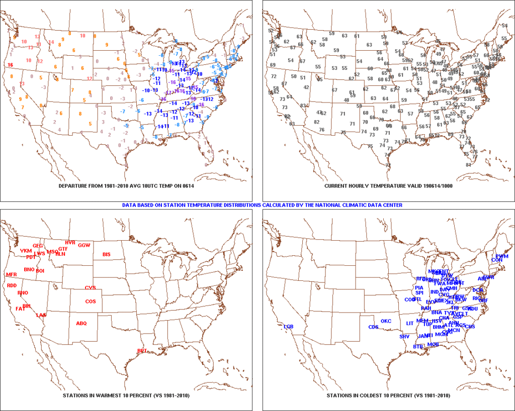
Temperatures are in the 40s area-wide this morning across central Indiana. Speaking of the 40s, they extend all the way south into the north Georgia mountains as we start our Friday. (Hard to believe for mid June). Widespread below normal temperatures continue to dominate the eastern portion of the country.

High pressure will remain in control of our weather today and help feature dry conditions with plentiful sunshine and pleasant temperatures. Highs today will top out in the middle 70s after the crisp start to the day.

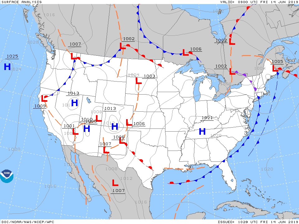
Unfortunately, the cool, dry conditions will quickly give way to an increasingly moist airmass overnight into Saturday morning and rain will follow. The reason? We’ll be on the backside of the area of high pressure with a southwest flow aloft helping transport moisture northeast into the Ohio Valley. At the same time, a series of warm fronts will pass over the weekend, featuring periods of more concentrated storms and associated heavy rainfall. Finally, a cold front will push south Sunday into Monday before stalling out just south of our area Tuesday.

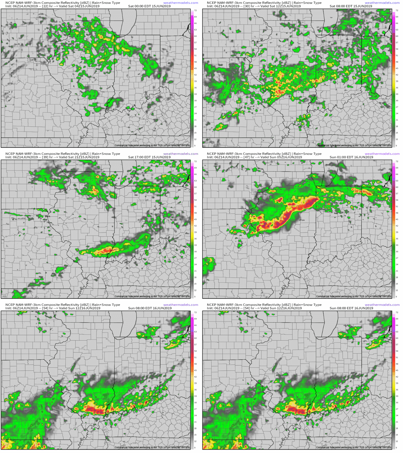
While this may provide a briefly drier period Tuesday, we’ll have to contend with periods of heavy rain and storms before hand. More specific around timing, we think rain may begin as early as 11p to midnight this evening before becoming more widespread and heavier Saturday morning. We’d suggest having a Plan B for outdoor activities this weekend as more time than not, it’ll likely be raining across central Indiana.

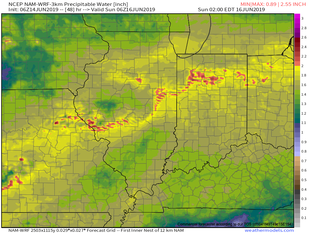
As mentioned earlier, we’ll replace the cool, dry air mass with more of a tropical feel this weekend and at times precipitable water values (PWATs) will approach 2″. This raises our confidence in the potential and likelihood of heavy rainfall.

Widespread 1″ to 2″ rainfall totals can be expected across central Indiana this weekend, with locally heavier amounts. After a briefly drier period Tuesday, rain will return by the middle of next week. Unfortunately, widespread 7-day totals (ending Thursday night) will likely be in the 2.5″ to 3.5″ range across central Indiana…

Gusty Storms Blow Into Town Saturday PM…

The Storm Prediction Center has pulled the “Slight” Risk area more into Indiana with their most recent update for Saturday and we believe this may encompass more of the immediate area with subsequent updates.

The biggest concern has to do with straight line wind potential with one, or multiple lines of storms that will rumble through the state Saturday afternoon and evening.

The day will dawn bright and sunny with pleasant temperatures, but as the morning gives way to afternoon, conditions will destabilize and we’ll have our eyes focused to the northwest for thunderstorm initiation early afternoon across northern Indiana and Illinois. We then anticipate these individual storms to morph into a couple of lines of storms and push south into central Indiana during the mid and late afternoon/ early evening hours.

If you have outdoor plans tomorrow, please plan to have a means of receiving the latest information around potential severe thunderstorm watch/ warning information that may be required.

The 2nd half of the weekend will include fantastic weather (drier, less humid, and cooler) that will carry us into the first couple of days of the work week!