Wednesday Morning Video Update: Heavy Rain & Severe Threat Give Way To Much Colder Air And A Potential Late Weekend Winter Event…

You must be logged in to view this content. Click Here to become a member of IndyWX.com for full access.  Already a member of IndyWx.com All-Access?  Log-in here.

Pre Super Bowl Rambles: Stormy Pattern Shifts To A Return Of Significant Cold?

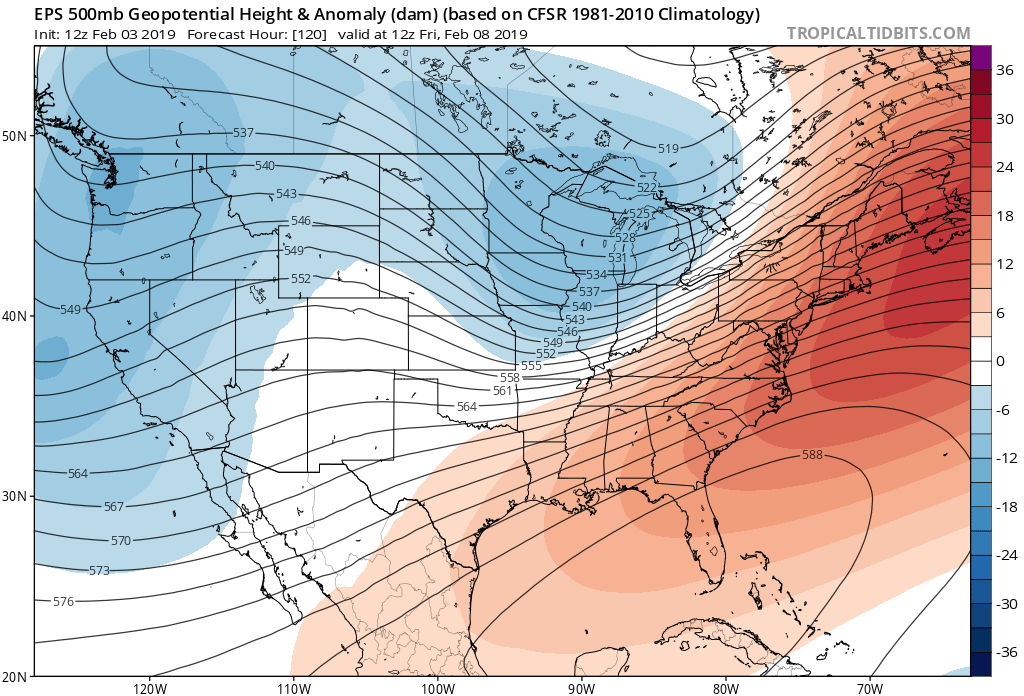
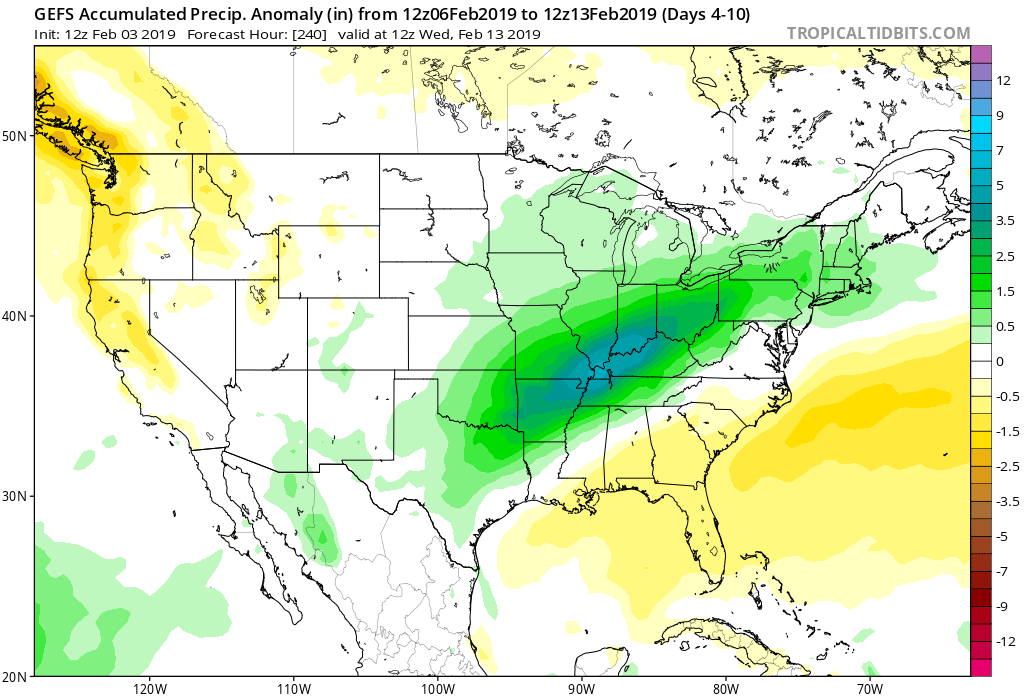
In the short-term, there’s no getting around the very active pattern in place. As we’ve been discussing, we’ll find ourselves “smack dab” in the middle of a battle ground between a stubborn southeast ridge and building cold to our northwest. The fight in between will yield well above normal precipitation over the next couple of weeks.

Over the upcoming (10) days, expect a roller coaster ride in the temperature department as the battle takes place. While the most anomalous warmth is taking place now (IND is on pace to set a new record high temperature before the end of the day), relative warmth will continue to dominate into midweek before colder air presses and wins out.

After Monday’s light rain, we’re targeting (3) opportunities for significant precipitation across the region:

I. Tuesday night-Wednesday (still may include a risk of freezing rain across north-central communities).

II. Wednesday night-Thursday morning

III. Thursday night-Friday morning (ending as light snow)

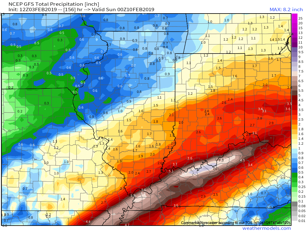
When all is said and done, model data is in agreement on significant rainfall totals across central Indiana (2″ to 3″ amounts will be common by Friday).

Thereafter, confidence is high on colder air returning as we close the week and head into next weekend.

Guidance suggests that we still need to remain abreast of the potential of a more widespread wintry event late next weekend and this is something we’ll continue to keep close tabs on as we progress through the upcoming week. As of now, this doesn’t appear to be a major event, but stay tuned.

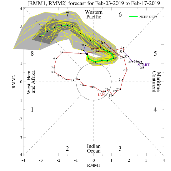
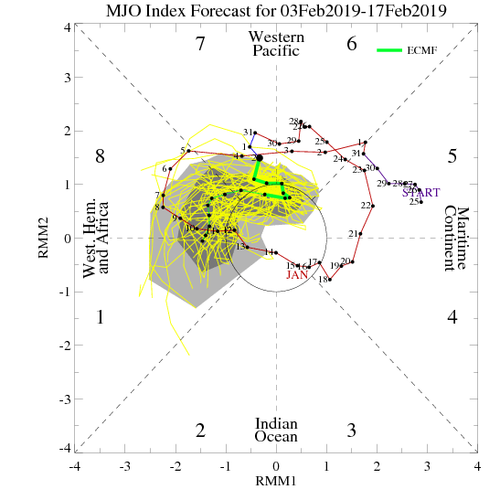
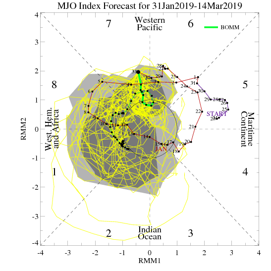
As we look ahead, we’ll have to continue keeping a close eye on the MJO. Today’s update shows the majority of data swinging things into Phase 8 by mid to late month. Should that come to fruition, prospects of another significant cold spell loom large…

Fun times ahead- no matter how you look at it! 🙂

Enjoy the game!
6-10 Day Update: Active Times Ahead…

While we’re in the process of pulling out of the bitterly cold air mass, there’s no shortage of action when we look ahead at the upcoming couple of weeks.

Confidence remains high that the upcoming short-term period (Days 2-6) will flip to much warmer than average. A couple days that at least flirt with the 60 degree mark can be expected Sunday and Monday.

While rain will return to the forecast Monday, the milder air sure will be a nice change of pace from the bitterness of the past several days. Enjoy it!

With that said, there are continued indications that the warmth won’t hold.

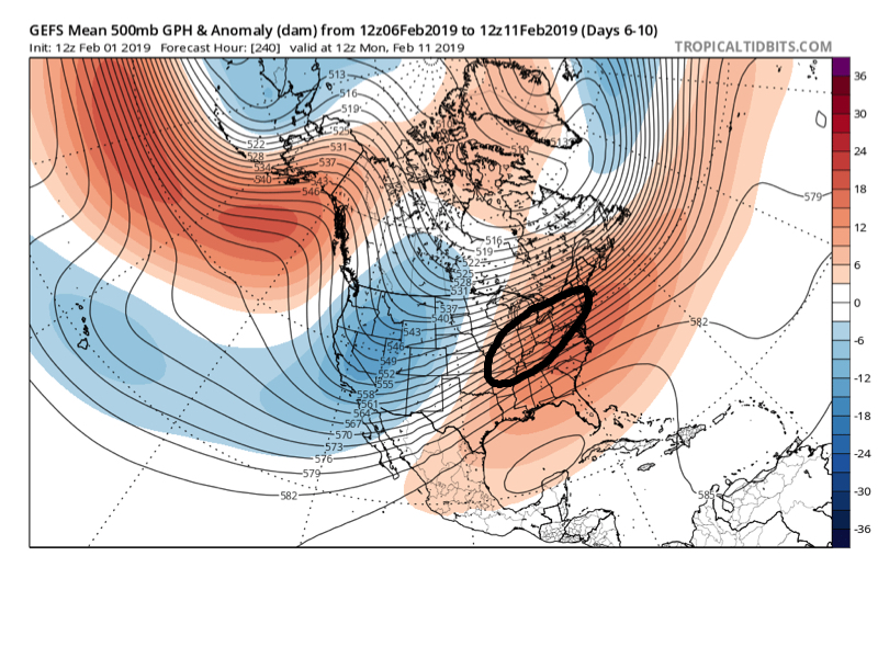
As we look at the latest medium range ensemble guidance (Days 6-10), the GEFS and EPS are in relatively good agreement.

We note this is a pattern conducive for above normal precipitation during the period. With cold air likely to be “pressing” towards the region, it’s a pattern that has to raise an eyebrow for at least the potential of a wintry threat during this time frame. There should be plenty of low level cold air available late next week and next weekend. With the resistance shown from the SE ridge, potential “fun and games” are on the table during this timeframe as waves of energy likely ride along a slow (at times stalled) frontal boundary.

Keep an eye on the 2/7 through 2/10 window for possible wintry impacts, locally…

Snowy Thursday Night-Early Friday Morning On Tap…

Brief: Accumulating Snow

Forecaster: McMillan


What: Accumulating snow

When: This evening into the predawn hours Friday

Temperatures: 15 to 18 F

Wind: ESE 5-15 MPH

Blowing/ drifting: Minimal

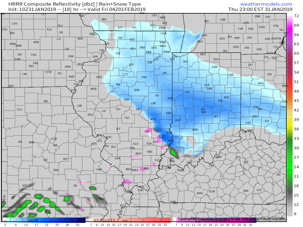
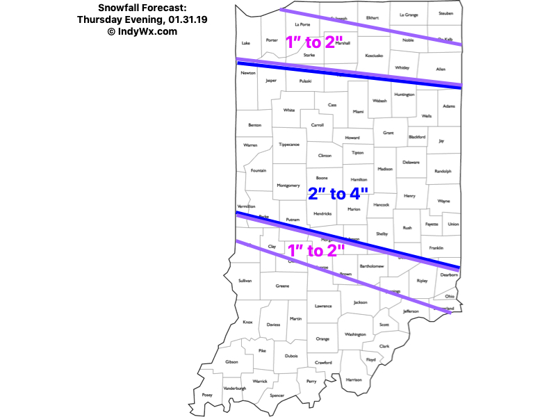
Attention will shift from the dangerous cold to an accumulating snow event across central and north-central Indiana this evening into the predawn hours Friday. We expect snow to begin reaching the surface (may take a little longer than models suggest due to the dry air in place initially) in western portions of the viewing area between 6p-7p and into central Indiana between 8p and 9p. Heaviest snow still looks to fall during the hours of 10p and 3a. Banding may result in periods of moderate to heavy snow during this time frame. Light snow will be ongoing across southeast Indiana around 7a Friday before departing the state shortly thereafter.

Confidence: High

Next Update: 6:30p Thursday