You must be logged in to view this content. Click Here to become a member of IndyWX.com for full access. Already a member of IndyWx.com All-Access? Log-in here.
Category: Client
Permanent link to this article: https://indywx.com/video-frosty-weekend-talking-wpac-typhoon-impacts-downstream/
Oct 06
Harvest ’19: Weekly AG And Severe Weather Update…
Forecast Period: 10.06.19 through 10.13.19
7-Day Precipitation: Average precipitation is expected through the period.

7-Day Temperatures: Between some wide swings in the temperature department over the upcoming week, things should “balance out” right around seasonal norms when all is said and done.
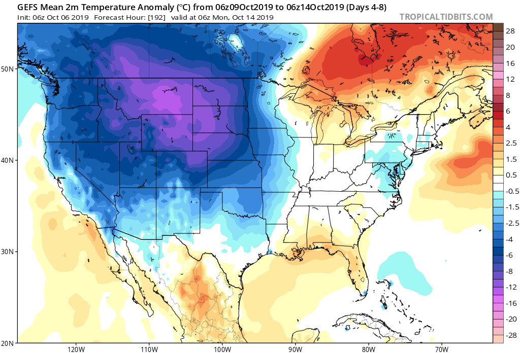
Severe Weather: We’ll continue to monitor the possibility of a few strong storms Thursday evening into Friday as a potent cold front pushes across the region. A strong southerly flow will help to briefly pull a warmer and moist air mass north across the Ohio Valley and southern Great Lakes and could be sufficient enough to promote strong-severe storms directly ahead of the boundary. We’ll have to fine tune timing in the days ahead, but target the period between late Thursday and Friday afternoon for now.
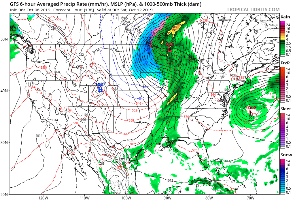
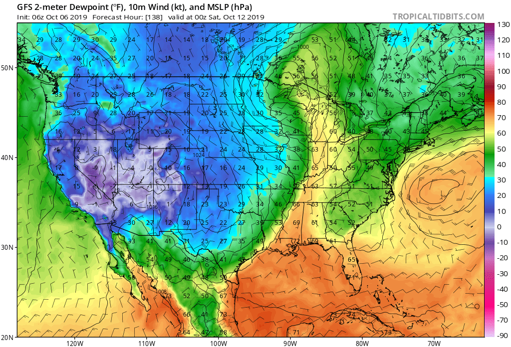
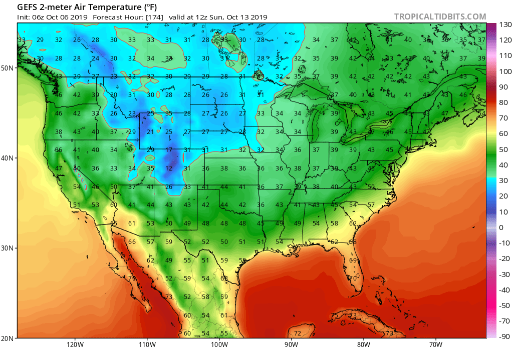
Frost/ Freeze: A killing freeze will put an end to the growing season across the Plains by late week and the season’s first frost will likely occur for many across the central and northern Ohio Valley next weekend.
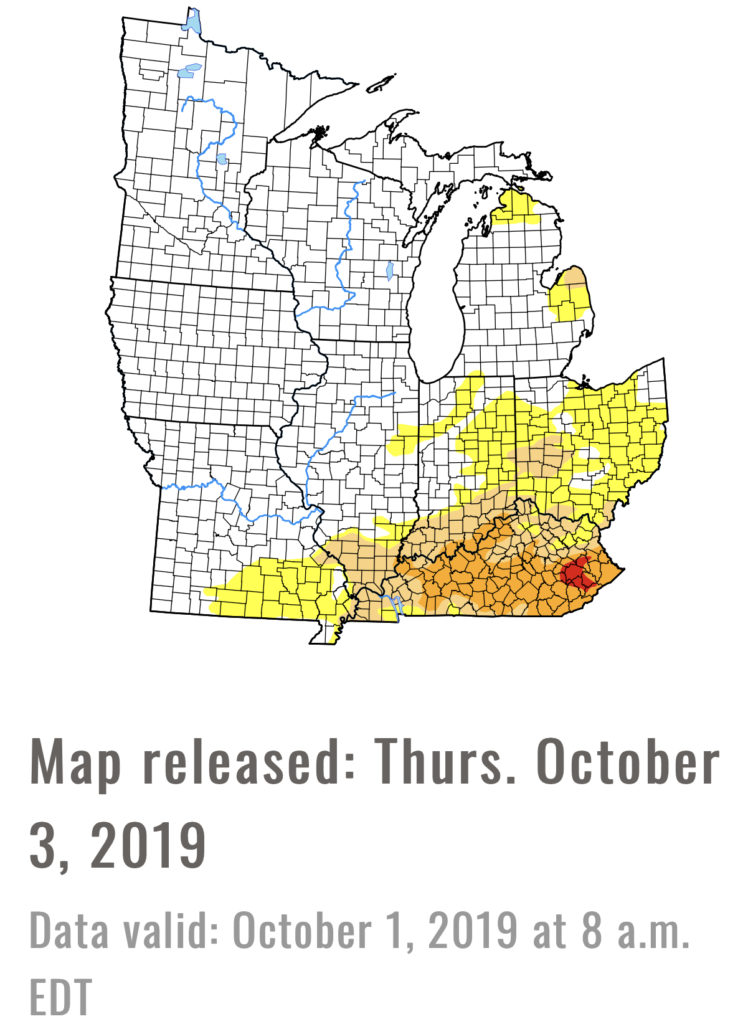
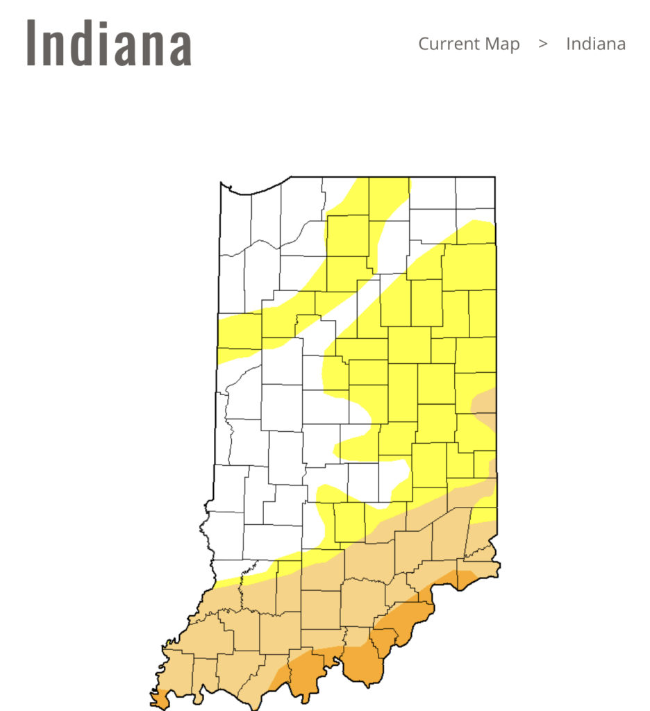
Drought Monitor: Abnormally dry areas are still present across portions of east-central IN into Ohio with more widespread droughty areas across KY. Today’s weather system into early Monday will help our friends across southern IN and KY pick up beneficial rainfall.
Summary: A cold front will move through the area today into Monday morning with needed moisture, especially across southern areas of the viewing area. Cooler, drier air will settle into the state as we move through the early portion of the work week before things turn potentially stormy late week ahead of the next strong cold front. The coolest air so far this autumn season will arrive next weekend, including the potential of the first frost for some…
Permanent link to this article: https://indywx.com/harvest-19-weekly-ag-and-severe-weather-update/
Oct 05
Saturday Morning Rambles…
I. Our Saturday will get off to a stunning start. Despite some patchy fog here and there, look for plentiful sunshine and chilly temperatures in the low-mid 40s rising into the low-mid 70s for afternoon highs with increasing clouds.
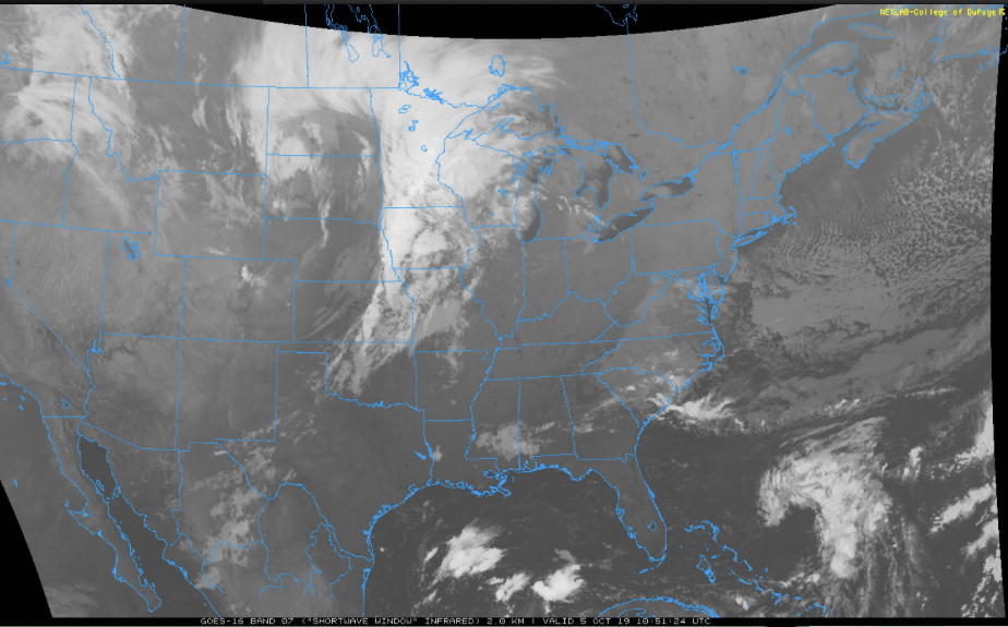
II. Those increasing clouds will deliver showers by tonight across central Indiana and then more concentrated heavier rain downstate Sunday evening into the predawn Monday. Southern Indiana is needing a good soaking in a bad way and this system will at least help things slowly begin to improve…


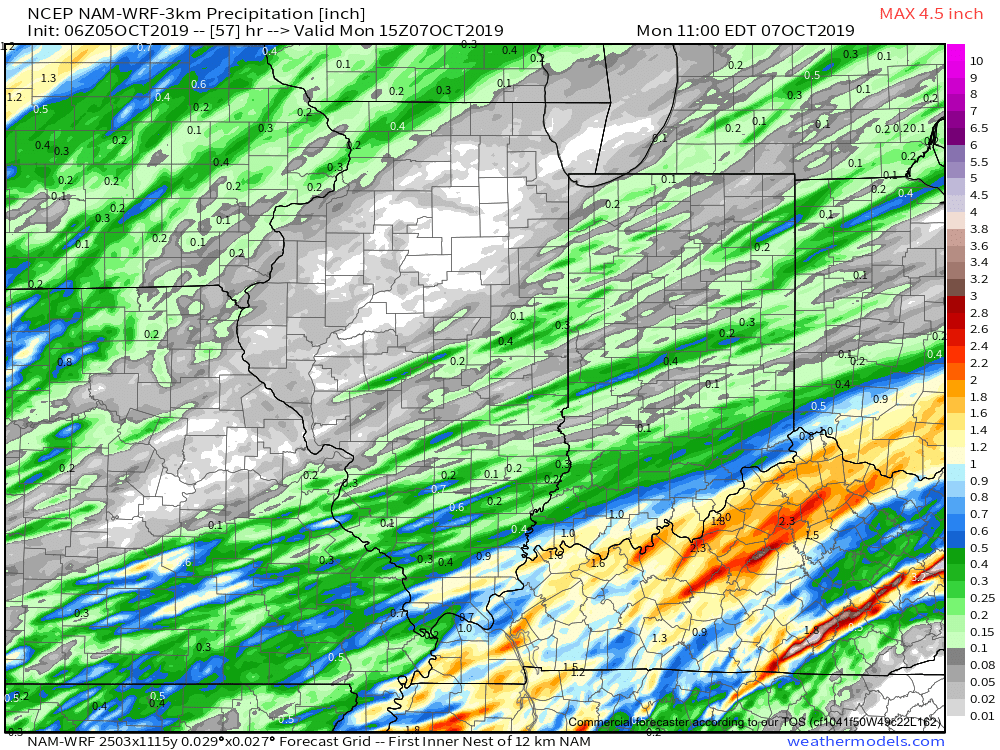
Rainfall totals with this system across central Indiana should accumulate to the tune of 0.20 to 0.40 for most with heavier amounts approaching 1” across the IN-KY border.
Note this is where things are driest across the state per Thursday’s drought update.
III. Our next storm system will swing through here late in the work week. We’re timing Thursday PM into early Friday for a round of showers and potentially gusty thunderstorms as a cold front pushes through.
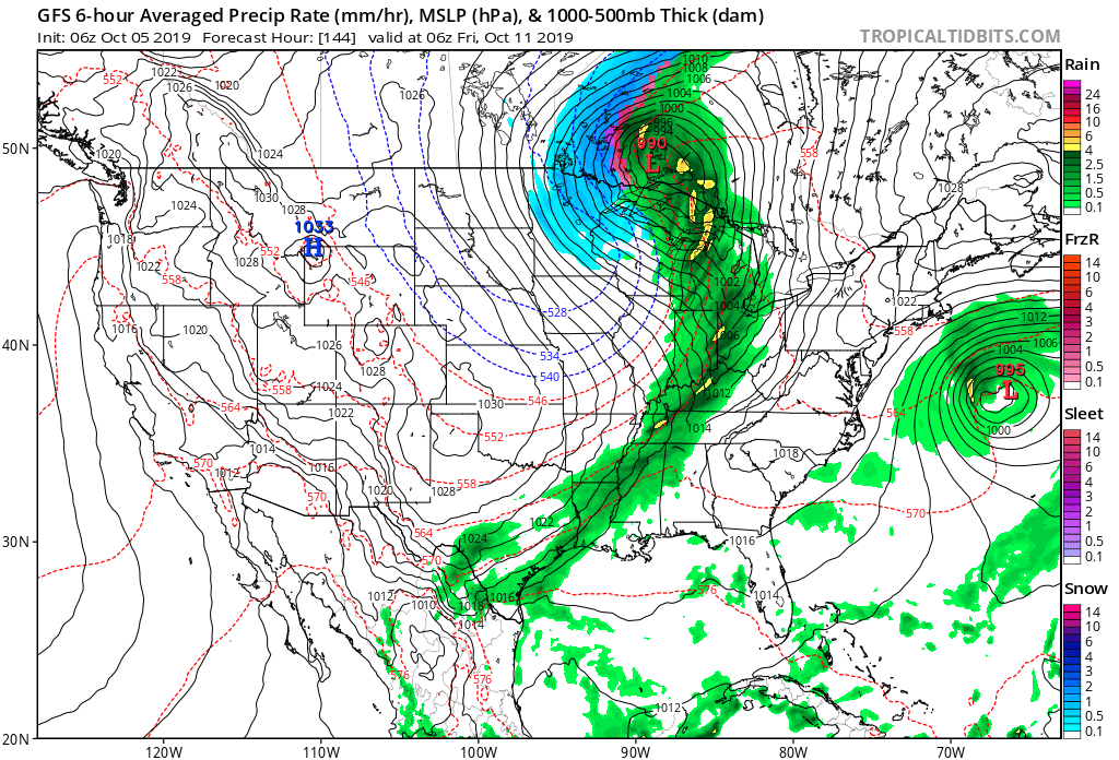
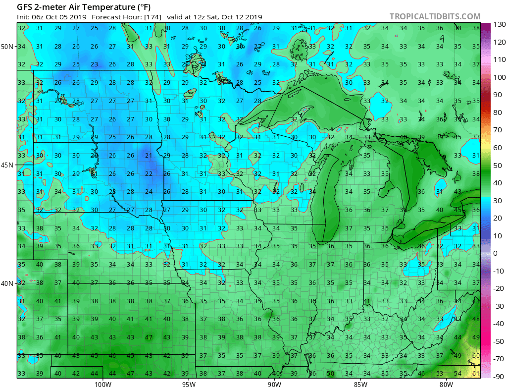
Behind this boundary, the coldest air of the fall so far will blow into town. We’re continuing to think many of the area can expect the first frost of the season next weekend.
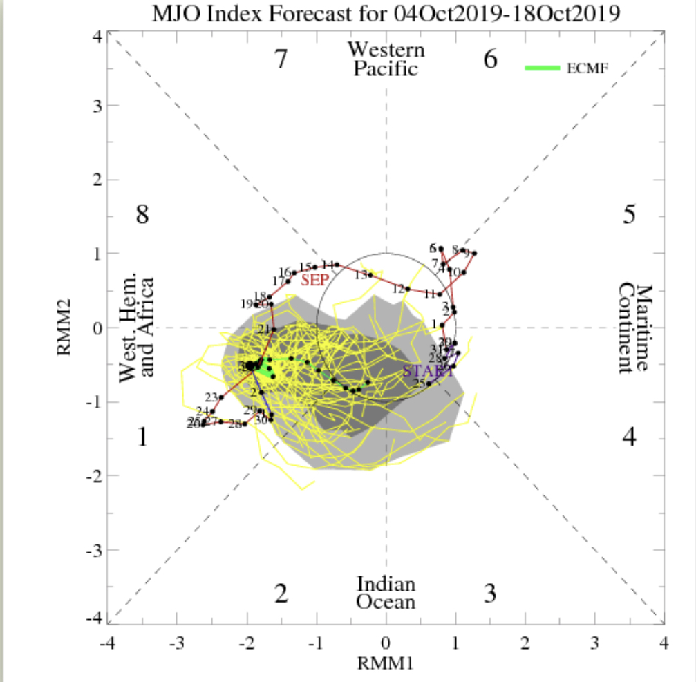
IV. As we look ahead, it’s time to start putting more stock into other tools in the box. Case in point, the MJO is showing signs of less amplitude over the upcoming couple weeks followed by a strongly positive PNA. This supports colder signals in the period. We’ll dig in further in the days ahead.

Permanent link to this article: https://indywx.com/saturday-morning-rambles-10/
Oct 03
VIDEO: This Is More Like It; Talking Frost Potential Next Week Along With Lake Effect…
You must be logged in to view this content. Click Here to become a member of IndyWX.com for full access. Already a member of IndyWx.com All-Access? Log-in here.
Permanent link to this article: https://indywx.com/video-this-is-more-like-it-talking-frost-potential-next-week-along-with-lake-effect/
Oct 03
As #Harvest19 Kicks Off, Timing Out Storms Into Mid-October…
Today is the day of a significant and more permanent transition from our “bonus” summer to a cooler journey ahead.
The ‘mean’ upper air pattern will feature a trough over the eastern portion of the country and associated temperature pattern more like we’d expect for early to mid October.


With the cooler air, we’ll also notice a more active pattern, as well. A model blend paints the potential of 0.50″ to 1.50″ of rain over the upcoming 10-day stretch. More specifically, we’re targeting dates for frontal passages on the following:
I. Thursday, 10.3
II. Sunday, 10.6
III. Friday, 10.11
The Sunday frontal passage and late Week 2 cold front will offer up better chances of more widespread precipitation.

Permanent link to this article: https://indywx.com/as-harvest19-kicks-off-timing-out-storms-into-mid-october/
