Category: Christmas/ Thanksgiving

A Lot Of Weather To Talk About…

Mother Nature seems determined to put us weather forecasters to hard work as we get set to head into the Christmas season and welcome in 2014.  We’re tracking a major flood situation that will unfold across central Indiana over the upcoming weekend, followed by a reload of the cold and potentially a storm with a more wintry component as we get closer to the New Year.

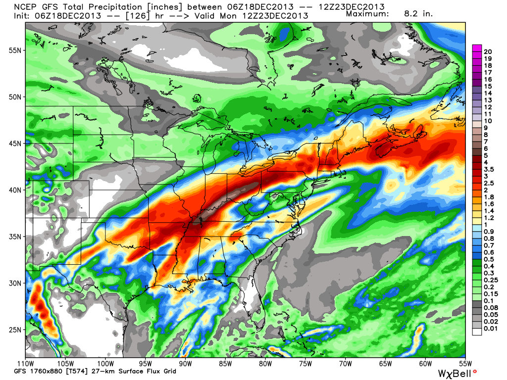
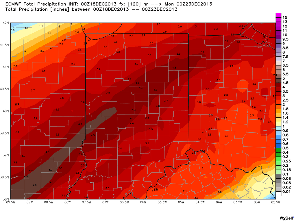
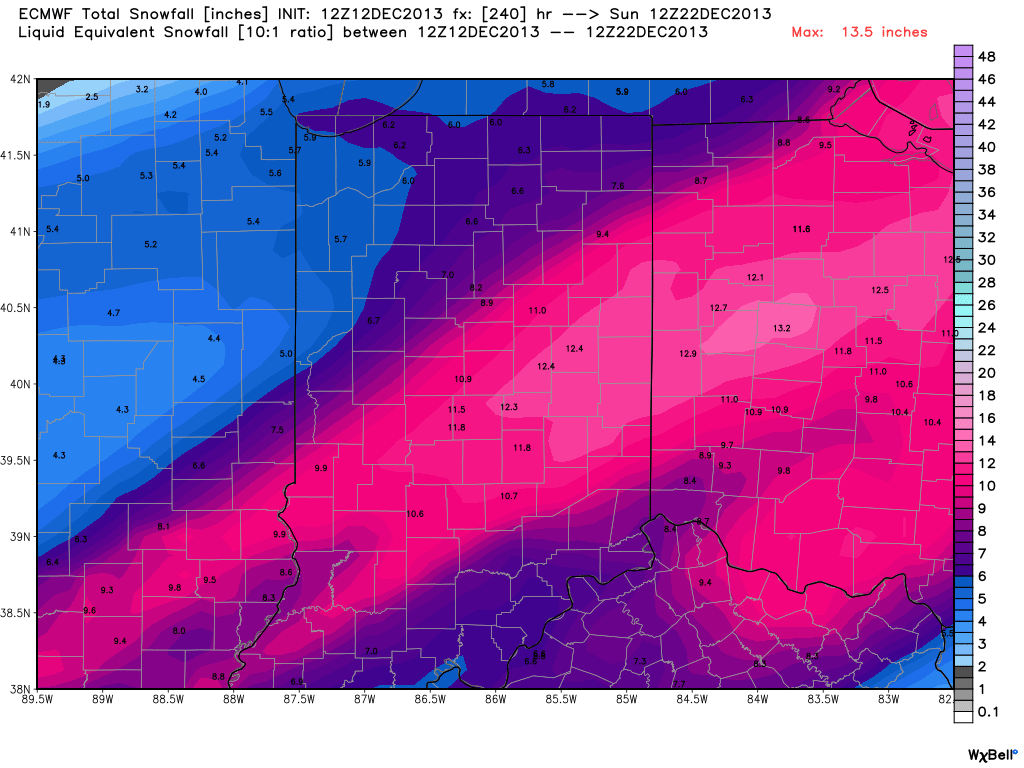
First things first and that’s the significant flood threat in the short-term period.  Without trying to go into scare tactic mode, current model data would result in a downright dangerous flooding event for many low lying and flood prone areas this weekend.  Rainfall numbers are extremely impressive with this event and with a deep tropical connection, widespread 3-4″ totals are certainly likely, including some localized higher amounts.  Note the latest European chart, courtesy of the model suite off Weatherbell Analytics.  Needless to say, the Gulf of Mexico is officially “open for business” and will help contribute to excessive rainfall totals and, as stated above, potentially a dangerous flooding event this weekend across central Indiana.

ecmwf_uvz850_noram_16

Latest numbers averaged off a variety of computer models would place just under 4″ of rainfall down by noon Sunday, most of which falls between Friday and Sunday morning.  We note (2) waves of enhanced rainfall intensity set to impact the region.  As of now we’re targeting Saturday afternoon and again late Saturday night/ Sunday morning for extremely heavy rain, shown below.

ecmwf_slp_precip_mc_14ecmwf_slp_precip_mc_17

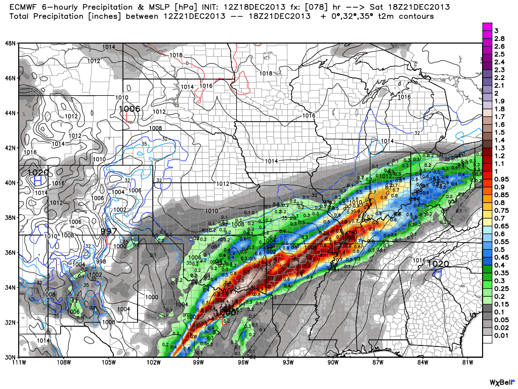
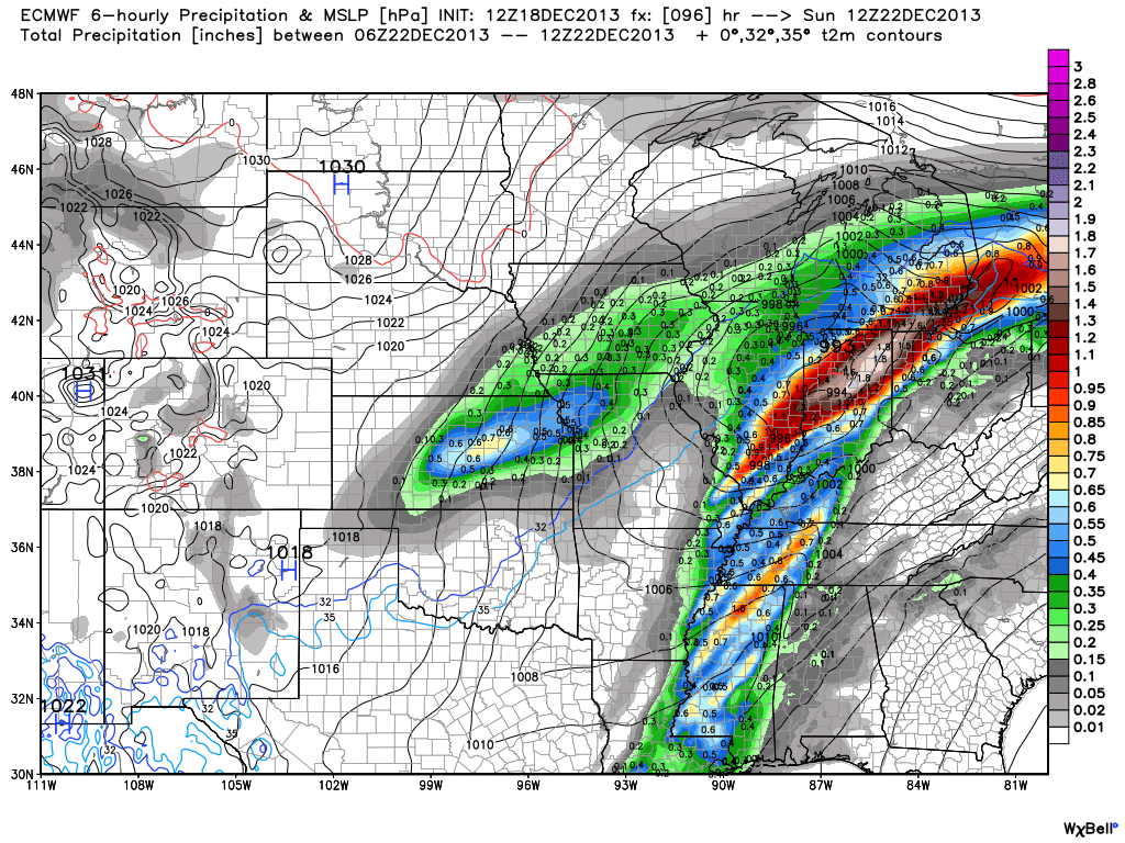
We still have time to watch the data and monitor the track of the storm.  It’s possible the “heaviest of the heavy” axis of rain shifts somewhat in the days ahead,  but it’s also important to note that even a light to moderate rain event combined with a frozen ground and a solid snow pack still in place will lead to flooding problems here across central Indiana.  The question of whether or not we’ll deal with flooding here this weekend shouldn’t be asked, but instead the question that remains is just how severe will the flooding be?  Stay tuned and if you live or work in a flood prone area, we would recommend preparing now for flooding.

Now, as we look ahead and focus on the Christmas to New Years period our thoughts will shift from a flood threat in the near term to one that’s more wintry.  We’ll turn dramatically colder Sunday afternoon behind the big rain storm and that will set the stage for a colder-than-average run up to Christmas. In fact, latest raw numbers off some forecast model guidance has some frigid readings ahead next week (upper single digits not ruled out for lows).

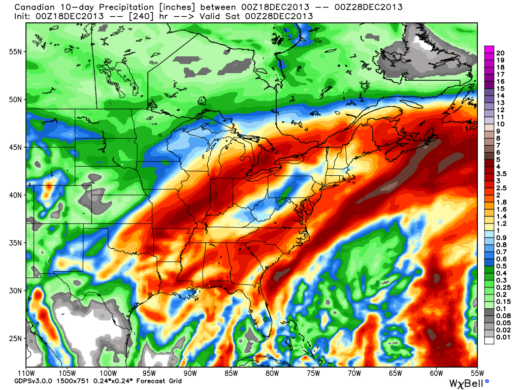
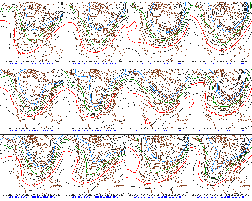
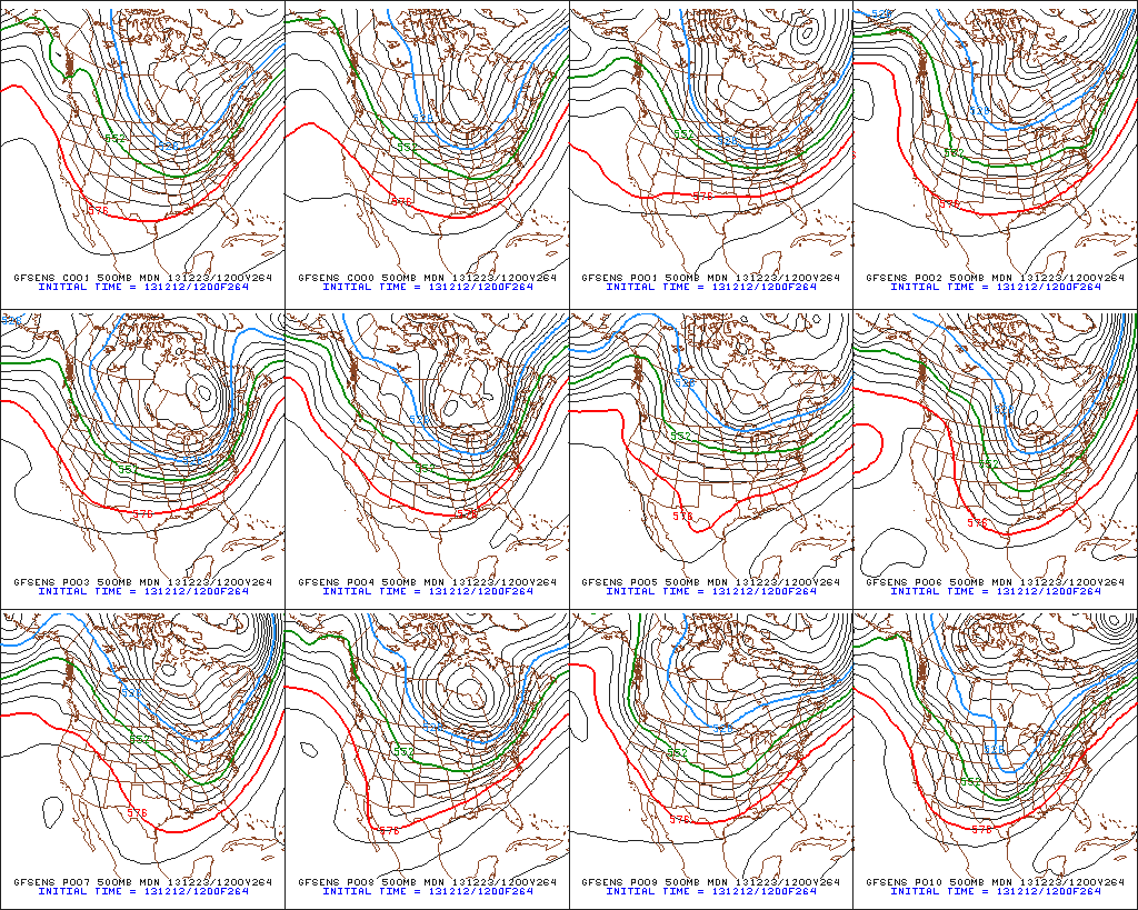
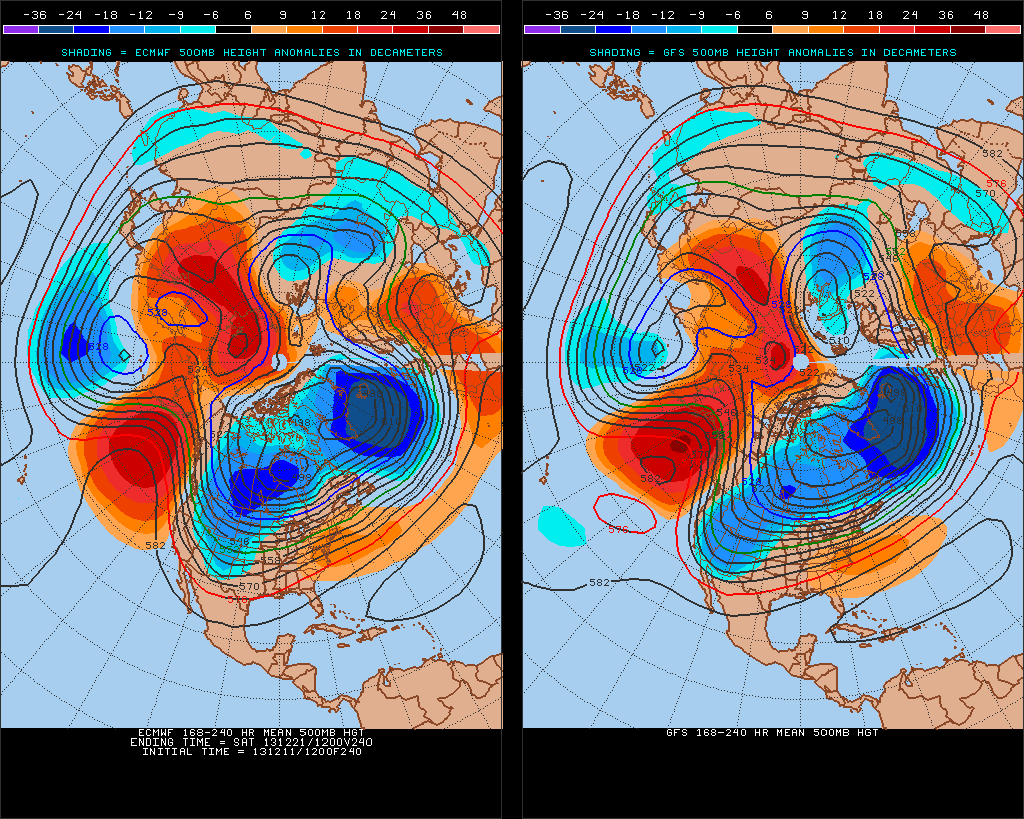
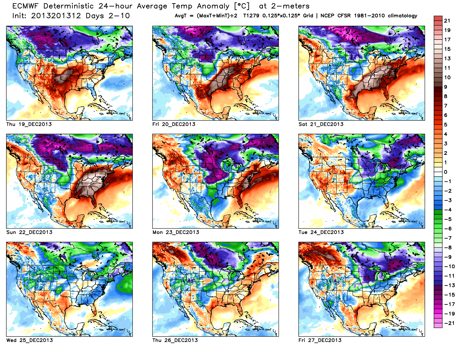
The upcoming 10 days off the European forecast model charts show an interesting scenario with the coming thaw, but the key word is brief.  Note days 6-10 are back into a colder-than-normal regime.

tavg_anom_ecmwf_conus_1

Additionally, we think we’ll have to deal with another storm prior to the New Year period and with the colder air back in place, there’s the threat we could have to contend with a wintry side to the next storm.  The details with storm number two will have to wait until we finish dealing with the first storm and associated serious flood threat it’s presenting.

Permanent link to this article: https://indywx.com/a-lot-of-weather-to-talk-about/

Significant Flood Situation Ahead…

Your latest 7-Day video forecast can be found in the video player to the right of this post.

We’ve known for over a week now that we’ll have to deal with a pre-Christmas storm. Latest guidance suggests our region undergoes a 3-4 day thaw with a decidedly warmer southwest flow ahead of this storm.  Additionally, with the more northern track of the surface low, we’re looking at nearly all of the precipitation associated with this storm falling as rain.  Combine our frozen ground with a significant early-season snow pack and multiple inches of rain ahead in the Thursday night through Sunday time period and the stage is set for a significant flood situation this weekend.

Here’s a look at what the latest forecast models show.  We’ve posted the GFS, Canadian, and European models below to display total rainfall between Thursday through Sunday.  The majority of this rain falls in two waves- Friday and again late Saturday into early Sunday.

gfs_total_precip_east_22cmc_precip_by10_east_1ecmwf_tprecip_indy_21

If the rainfall numbers are even half of what is projected above, we’re looking at a significant flood situation.  Needless to say, if your property is in a low-lying area, or one that is prone to flooding, I would begin to prepare now for major water rise in the days to come.

Much more later!

Permanent link to this article: https://indywx.com/significant-flood-situation-ahead/

Old Man Winter Jabbing Now, But Is The Knock-Out Punch Coming?

Before we discuss what may lie ahead closer to Christmas, our going forecast for Friday night and Saturday’s snow storm hasn’t change…4-5″ for the greater Indianapolis region by late Saturday morning.

Since really back in the middle of October we noted a distinct pattern change that has resulted in a colder than normal regime around these parts ever since.  As we look ahead, there really aren’t any indicators that would suggest we’ll deal with warmer than normal air for any period of significant time through the remainder of the year.  Furthermore, there are multiple computer models hinting that we’ll have to deal with a significant winter storm and potentially a shot of brutal cold as we rumble closer to the busy Christmas week.

It’s very important to note that we still have several days to watch the goings on for Christmas week, but the stage has at least been set for the possibility of a storm of “importance” being around the region as we near that particular time period.

Confidence is growing on brutal cold (most likely record-breaking) initially dumping into the Plains states towards the latter portion of next week.  With time, we think this cold slugs it’s way east.  Before the arctic intrusion gains control of the Mid West and Ohio Valley, we think this is the area that stands the greatest chance of dealing with a major winter storm.  We have strong ensemble support (pictured below) of the evolution of the overall pattern, but we caution that the precise details will have to be ironed out.

Ensemble1Ensemble2Ensemble3

The “sensible” weather that would ensue here across central Indiana could vary wildly from a significant full-blown winter storm with all of the precipitation falling in the form of a wintry variety (i.e. snow, sleet, freezing rain) to a situation that features a western track with briefly milder air surging north into portions of the region and leading to a rain-to-snow situation.  The accumulation ideas would swing from a significant, plowable, snow storm to as little as a coating with arctic air blowing in behind the rain to snow scenario.

At the end of the day right now we’re confident on two things: 1.) a major winter storm around the Mid West/ Ohio Valley as we near Christmas week and 2.) brutal arctic air swinging into the area around Christmas.  Questions will have to be answered as we move ahead to determine the precise precipitation amounts and type.

In closing, just for fun, we thought we’d provide a look at the latest European forecast model data.  Here’s a look at the upcoming 10 day European model snowfall forecast.  Of course, these amounts account for the 4-5″ expected here tomorrow night and Saturday,  but (2) additional systems also add to the potential growing snow pack…a clipper system Monday and the “more important” system next weekend.  Stay tuned.

Euro1

Permanent link to this article: https://indywx.com/old-man-winter-jabbing-now-but-is-the-knock-out-punch-coming/

Snow Talk And A Look Ahead Towards Christmas Week…

Latest data in house still suggests a plowable snow is ahead for most of central Indiana this weekend.  We think wintry precipitation expands northeast to encompass all of the region between 7pm-9pm Friday evening (southwest to northeast).  This wintry precipitation still appears to take the form of all snow for IND and points north, but we caution that south-central Indiana communities will have to deal with a mixed bag of precipitation, including sleet and perhaps some freezing rain along with the snow.  The primary snow zone will have no trouble seeing snow amounts of 4-5 inches, but for south-central Indiana neighborhoods, snowfall accumulations appear to be closer to 2 inches, with additional accumulations of sleet also possible.  Needless to say, we feel pretty good about our initial snowfall forecast posted last night in our 7-Day forecast video (always available to the right of these posts in the video player).  The limiting factor, in our opinion, of even higher snowfall totals will be due to the speed of the system.  We think this is primarily a quick 6-8 hour “thump and go” type snow storm followed by some lingering light snow/ snow showers and gusty winds Saturday PM.  The sunshine returns for Sunday along with another surge of bitterly cold air with highs in the 20s.

Friday night-Saturday Snow Storm Highlights:

  • Wintry precipitation arrives between 7p-9p Friday across central Indiana.
  • Primarily all snow from Indianapolis and points north
  • Mixed precipitation south of IND will include sleet and freezing rain
  • Snowfall accumulations of around 2″ south-central Indiana, increasing to 4-5″ amounts along and north of the I-70 corridor.
  • Accumulating snow tapers off late Saturday morning.

Our attention then turns to what may lie ahead Christmas week.  After the chance of some brief “relaxation” from the current bitterly cold pattern, we look to reload the cold with authority around Christmas week.  In fact, if latest data comes to fruition, the current cold would pale in comparison to what lies ahead.  Additionally, a rather significant storm system could precede the arctic blast.  It’s far too early to talk specifics on precipitation type or amounts, but don’t be surprised if a storm of “significance” is on the maps as we approach Christmas week…

The latest ensemble plot from the GFS and European (below) agree on first class cross-polar flow setting up shop, which will help refrigerate the Lower 48 with some seriously bitter air just in time for Christmas.  Stay tuned…

test8

Permanent link to this article: https://indywx.com/snow-talk-and-a-look-ahead-towards-christmas-week/

A Closer Look At Two Winter Weather Events.

Your updated, custom-built, Thursday video forecast can be found to the right of this post in the video player.  We typically update our video forecast during the evening.

Good Morning and happy Thursday!  We continue to monitor the latest data for our upcoming winter weather events.  It’s a busy time of things and by the looks of the overall pattern, I’ll have to stock up on the coffee for the weeks ahead.  Quite honestly, a very cold and snowy pattern appears to be setting up shop now through the end of the month.  Anyone dreaming of a white Christmas? 😉

Here are some quick bullet points for the upcoming few days:

  • Snow/ sleet overspreads the region this evening
  • (2) waves of snow/ sleet move through the region between this evening and Friday
  • Saturday will be a very cold and dry day
  • Renewed snow and potentially freezing drizzle move in Sunday
  • We continue to forecast a total of 3-6″ of snow between tonight and Monday morning

Latest forecast models continue to suggest temperatures fall through the day with a mixture of snow and sleet overspreading the region as early as 3-5pm from southwest to northeast.  We anticipate a rather rapid transition from sleet to snow, especially from IND and points north.  Here’s a look at the latest HRRR simulated radar data, valid tonight at 6 o’clock:

hrrr_ref_indy_15

Here’s a look at the GFS model.  (We think this particular model has a much better handle on things now that we’re closer to the event).  Note the “waves” of wintry precipitation forecast and we agree with this.  Wave #1 arrives for the evening rush with wave #2 arriving Friday morning into the afternoon.

GFS1GFS2GFS3

Additionally, after a very cold and dry Saturday, renewed accumulating snow will overspread the region Sunday, potentially ending as a mixture of light freezing rain or freezing drizzle atop the fresh snow Sunday afternoon.

GFS4GFS5

Permanent link to this article: https://indywx.com/a-closer-look-at-two-winter-weather-events/