Category: Christmas/ Thanksgiving

VIDEO: Welcoming In A Much More Active Weather Pattern Through Mid-December…

The days of not having much to track on the local weather charts are about to be long gone. The pattern has a look that will yield a much more…

You must be logged in to view this content. Click Here to become a member of IndyWX.com for full access.  Already a member of IndyWx.com All-Access?  Log-in here.

Permanent link to this article: https://indywx.com/video-welcoming-in-a-much-more-active-weather-pattern-through-mid-december/

VIDEO: Not That There Isn’t Chill Available, But Sustainability Is Severely Lacking. We Explain Why…

It’s not that there isn’t any cold to speak of, but instead the lack of sustained chill moving ahead. This morning, we discuss why we believe that is with the…

You must be logged in to view this content. Click Here to become a member of IndyWX.com for full access.  Already a member of IndyWx.com All-Access?  Log-in here.

Permanent link to this article: https://indywx.com/video-not-that-there-isnt-chill-available-but-sustainability-is-severely-lacking-we-explain-why/

Long Range Update: Christmas to New Year’s Period On The Horizon…

December certainly has opened on a cold note. Through the 1st few days of the month, IND is running more than 6° below normal. Our short-term products will continue to handle the quiet times through the upcoming week. As is typical on Thursday, we’ll look ahead to some longer range items of interest in this evening’s post.

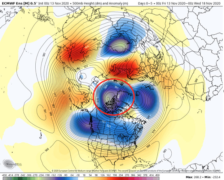
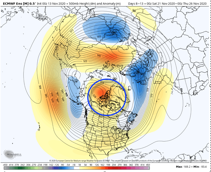
To start, let’s dig in to the pattern drivers. Initially, the PNA and AO are aligned in a manner that supports the chill. As we go into mid-month, we lose the positive PNA (in my opinion, it was this feature that’s responsible for the cold start to Dec and subsequent OHV snow event). The EPO remains unfavorable for durable cold.

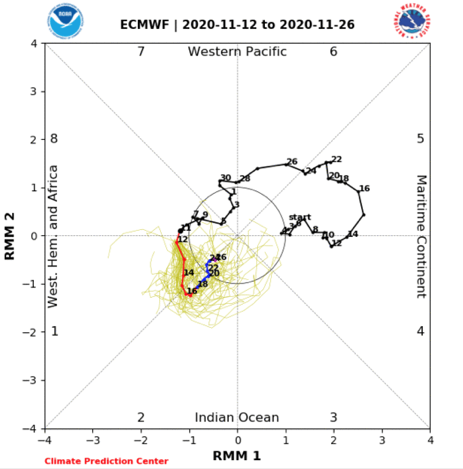
The latest European Monthly MJO plot keeps things in the “null” phase. To me, this says we need to continue to lean more heavily on the teleconnections in the shorter to medium range period. We’ll continue to monitor for the MJO to become more amplified down the road. Once this takes place, the MJO should drive things for the majority of the winter.

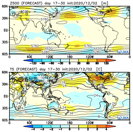
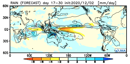
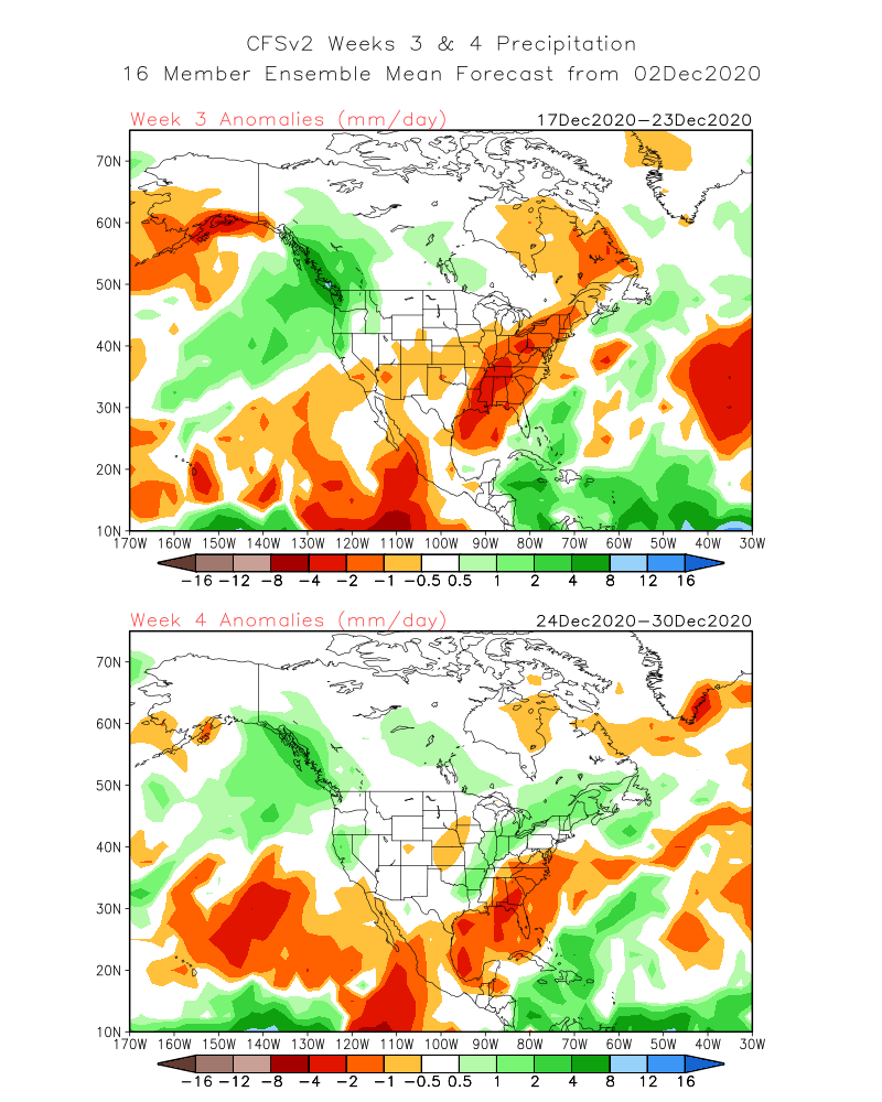
Seeing as how 2/3 major teleconnection drivers trend warmer by mid-month and the MJO remains a relative non-factor, it’s no surprise to see the longer range modeling warming things up mid and late month.

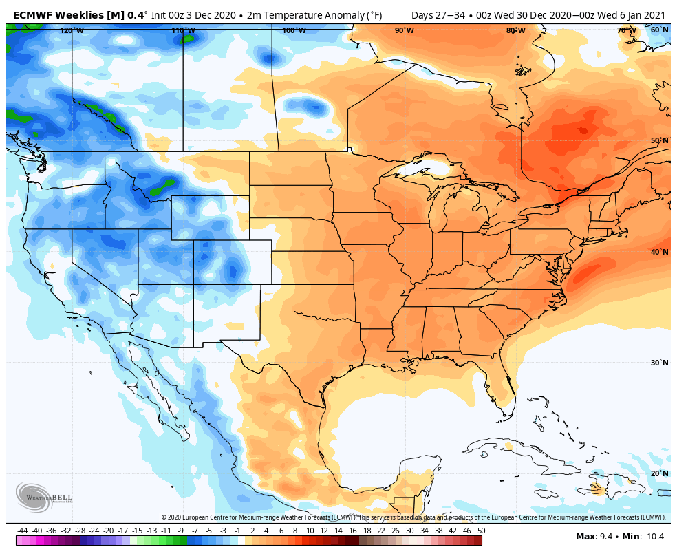
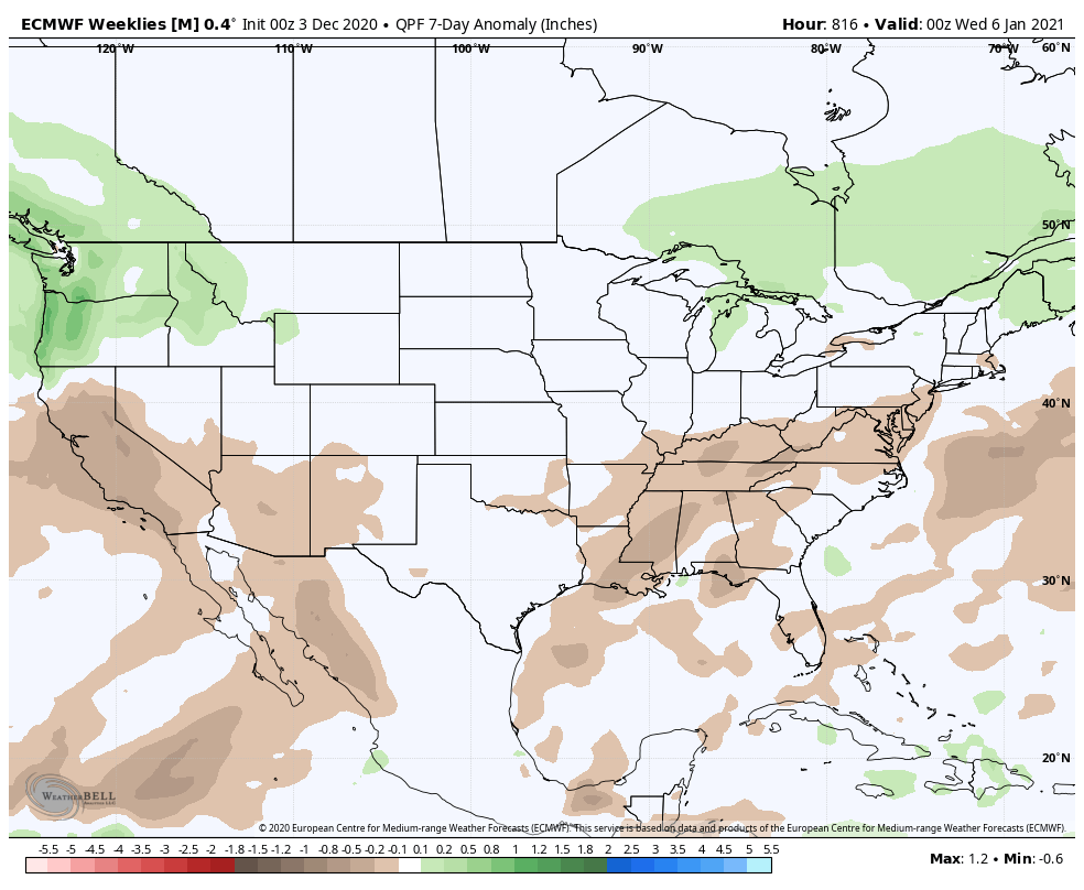
Today, the 3 primary long range models we look at all show warmth carrying the day to wrap up the month. Additionally, they continue the drier than normal theme into early parts of January.

JMA Weeklies:

CFSv2 Weeklies:

European Weeklies:

While shots of chill will continue to impact the region (after the more sustained chilly regime in the immediate term), there’s little reason to buy into any chance of durable, sustained cold to wrap up the month and head into the early parts of January.

Permanent link to this article: https://indywx.com/long-range-update-christmas-to-new-years-period-on-the-horizon/

VIDEO: Strong Storm Potential Tomorrow Afternoon; In-depth December Pattern Breakdown…

You must be logged in to view this content. Click Here to become a member of IndyWX.com for full access.  Already a member of IndyWx.com All-Access?  Log-in here.

Permanent link to this article: https://indywx.com/video-strong-storm-potential-tomorrow-afternoon-in-depth-december-pattern-breakdown/

Thanksgiving Nears: Now All We Can Do Is Watch Things Play Out…

We continue to watch substantial changes in the high latitudes and the modeling (on a daily basis) is being forced to correct towards more of a blocky look by Thanksgiving week. My suspicion is this has to do with Phase 2 of the MJO.

This morning, note the changes highlighted from now (image 1) to the 2 positives beginning to combine (image 2) to eventually form more of a high latitude ridge, or block (image 3).

Lack of any sort of blocking observed presently. As such, the chilly air masses that do impact the region are very transient.
Changes begin taking place next week as 2 separate areas of high pressure form over AK and Baffin Bay/ Greenland.
That then forms a more “mature” high latitude block by Thanksgiving.

By the time we get to Thanksgiving, note how there’s a totally different look and a pattern has ‘suddenly’ developed that can drive cold air (in more of a sustained manner) south into the Lower 48- particularly eastern portion of the country.

This doesn’t just happen overnight, but what we should begin to see on the modeling is more substantial cold shots for the last 10 days of November, including the threat of some sort of wintry “fun and games” from the Plains, stretching out to the Great Lakes and interior Northeast around Thanksgiving, itself. (Too soon to call for the OHV).

My suspicion is this is all thanks to the MJO. Note how the European continues to slow things in Phase 2 (a cold phase this time of year for our portion of the country).

The question then becomes “can we take things back into Phase(s) 7, 8, and 1 in December (all traditionally cold phases).

Or do we roll right into Phases 3, 4, 5, and 6 (all big time warm phases). That’s what our December forecast hinges on and we’ll keep a very close eye on things. Stay tuned.

Permanent link to this article: https://indywx.com/thanksgiving-nears-now-all-we-can-do-is-watch-things-play-out/