Category: Christmas/ Thanksgiving

Sunday Morning Rambles: Tropics About To Wake Up? New Model Data In For Fall – Winter…

Updated 08.07.22 @ 8:44a

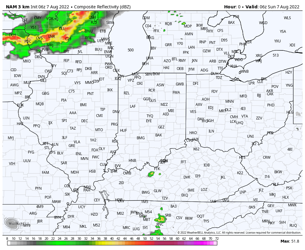
1.) In the short-term, a much cooler and less humid airmass awaits on deck this week. 2 frontal systems will pass through the state between Tuesday night and Thursday. We’ll notice an uptick in coverage of showers and thunderstorms starting this afternoon/ evening and repeating itself once again Monday afternoon/ and evening as the 1st front slowly sags south. Some gusty winds are possible with these lines of storms, as well as heavy rain. In fact, most areas in/ around Indianapolis and points north should cash in on 1″ to 2″ of rain (locally heavier totals) by Tuesday morning.

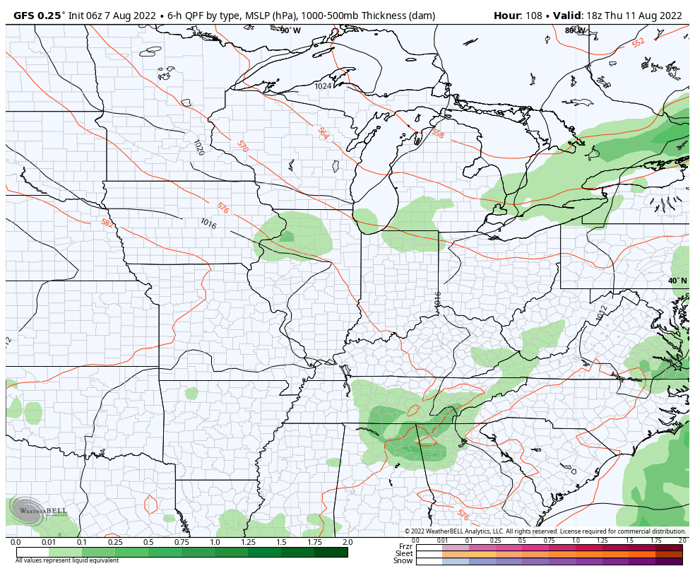
2.) The secondary cold front won’t have as much moisture to work with so coverage of showers and storms isn’t expected to be as widespread Thursday (“widely scattered” at best from this distance).

Thereafter, an even drier and cooler air mass is scheduled to arrive just in time for the weekend. Look for lower humidity levels, sunshine, and refreshing temperatures (even should dip into the 50s for overnight lows).

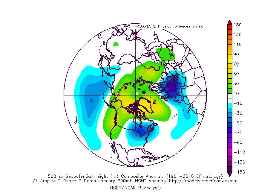
3.) After a quiet time in the tropics, there are signs we’re on the cusp of heading into busier days (should the MJO swing into Phase 2, then things could get very busy and in rather quick fashion). We note the National Hurricane Center (NHC) is monitoring a tropical wave that’s just now emerging off the African coast. There’s the potential the environment will become more conducive for gradual development of this feature over the next few days.

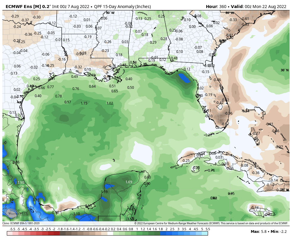
Also of interest is the precipitation pattern in the Gulf of Mexico over the next couple weeks. Additional trouble lurking here? It’s getting to be that time of year…

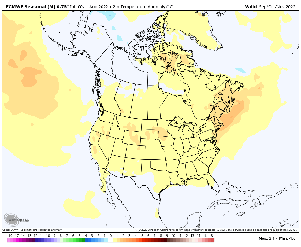
4.) Finally, new seasonal modeling is in for the upcoming fall and winter. The European seasonal model suggests that potentially our idea of a fast start to the upcoming winter (after a warmer than average fall overall) is on the right track.

Meteorological fall (Sept through Nov):

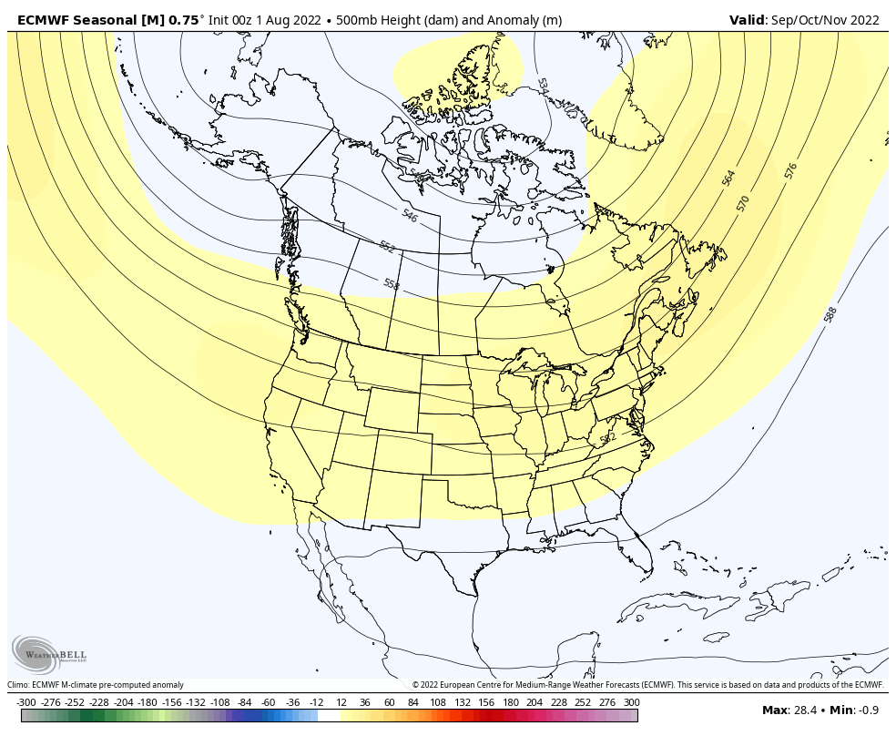
Note how the ridge builds in western Canada come December (reflection of a trough over the East). Candidly, for a model that struggles to ever really see cold, this is a bullish look. We’ll have to keep an eye on things as we get closer as I suspect cold to begin to show with more authority given the 500mb setup. Cold, wintry Christmas season in the works this year?

December:

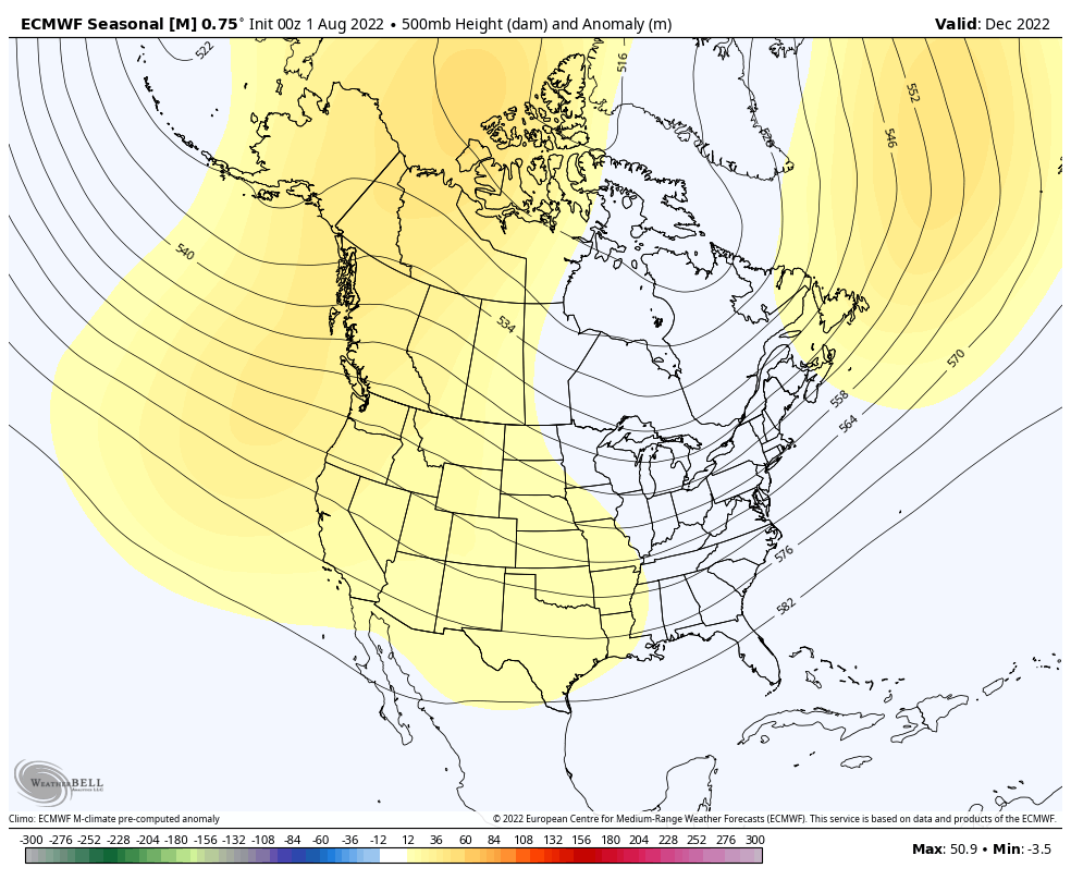
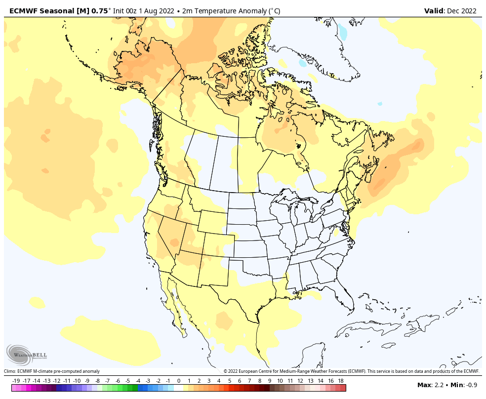
The pattern is shown to remain favorable for additional colder than normal weather, locally, into the new year:

January:

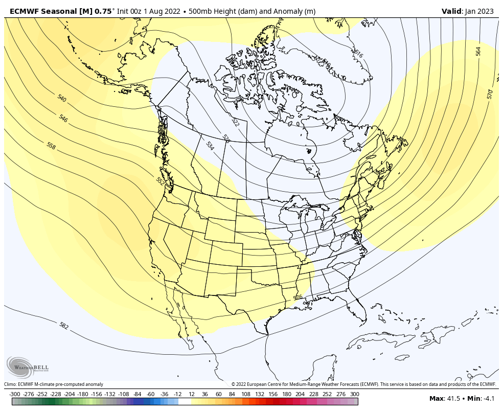
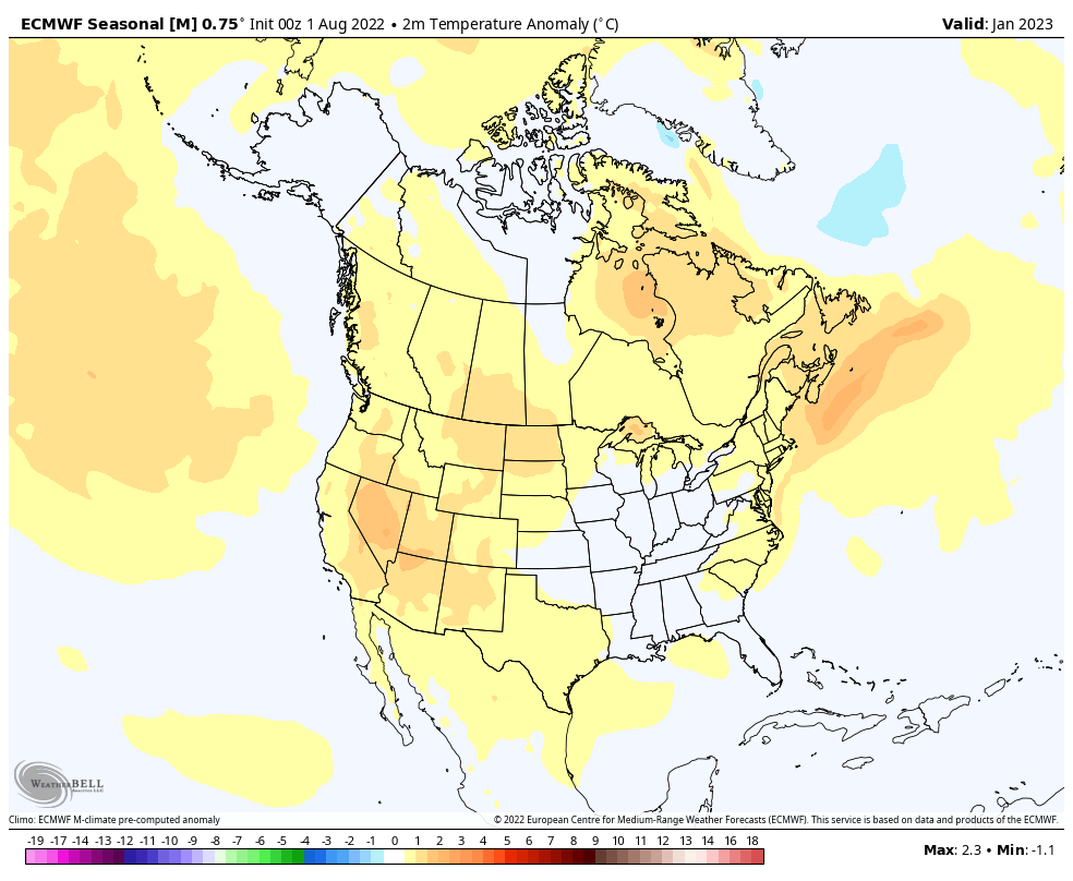
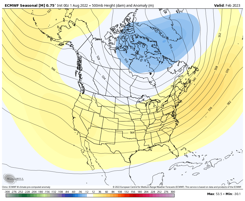
Very interesting as this fits our early research (triple dip Nina). Also of interest is how things break down and are modeled to end on a warmer than normal note (would agree with this idea as well) as we finish off meteorological winter.

February:

Permanent link to this article: https://indywx.com/sunday-morning-rambles-tropics-about-to-wake-up-new-model-data-in-for-fall-winter/

For Now, It’s A Tale Of The MJO And PNA…

Updated 12.26.21 @ 7:38a

Over the past couple of weeks, several of the teleconnections (EPO, AO, and NAO) have been in favorable phases for cold air to take up residence in our neck of the woods. However the combination of Phase 6 of the MJO (image 1 below) and a deeply negative PNA (image 2 below) have fought off any sustained or significant cold.

As we look ahead, there are changes in both of these critical pattern drivers. First, the MJO looks to continue progressing deeper into Phase 7. This is significant as today, though while officially in 7, we’re really still feeling the effects of 6. There’s a lean from guidance that Phase 8 is also within reach as we get towards mid-January, but we won’t get greedy. 🙂 If we can at least get deeper into 7, that will greatly lessen the influence of the warmth that continues to linger with Phase 6.

Note how the trough likes to settle into the eastern portion of the country during these phases.

That then brings us to the PNA. Guidance is trending things closer to neutral towards Day 10. This is significant as it would allow the southeastern ridge to at least get beaten down (not totally squashed as long as we remain negative), but certainly enough to allow the cold currently bottled up out west to bleed east.

This can be illustrated best by looking at the 500mb pattern evolution over the next couple weeks per the latest GFS ensemble below.

To summarize, while we still have warm days ahead of us, there does at least appear to be a couple trends heading in the right direction for all of those longing for colder and potentially more wintry times as we get past the new year.

Hang in there you snow lovers. It’s far too early to jump off the ship…

Permanent link to this article: https://indywx.com/for-now-its-a-tale-of-the-mjo-and-pna/

Harbinger Of Things To Come?

Updated 12.25.21 @ 11:27a

First and foremost, from our family to yours, we want to wish you a very merry Christmas and the warmest of holiday wishes during this season!

A line of rain and embedded thunder continues to plague portions of central Indiana late Christmas morning. Localized training of heavy downpours has led to this being an “overachiever” in spots across the region (closing in on 2” in a narrow strip from Frankfort over to Elwood, for example).

Radar at 11:32a

The trend should be a drier one through the afternoon as temperatures slowly begin to fall (how weird was it to walk outside on Christmas morning with temperatures in the lower and middle 60s?!).

Rain will push southeast of the area this afternoon.

With that said, the damp theme this Christmas morning can serve as a hint to what lies ahead as we put a bow of 2021 and open up the new year. A very Niña-like pattern will force the storm track into the Ohio Valley, leading to multiple storms of significance as we go through the upcoming week to 10 days.

Sunday night into Monday, Monday night and Tuesday, followed by next Saturday into Sunday all appear to provide a good soaking to central Indiana.

Storm #2 comes along Sunday night into Monday
Storm #3 arrives Monday night into Tuesday
Storm #4 rolls in New Year’s Day

Certainly by the time all is said and done, widespread hefty totals are likely. We’ll have to hone in on specific numbers as we get closer, but it’s safe to say amounts in local rain gauges may approach 3”+ by Jan. 2nd. The heaviest rain appears slated with the storm Tuesday and again next Saturday.


Permanent link to this article: https://indywx.com/harbinger-of-things-to-come/

VIDEO: Busy Short-Term Pattern; Drivers Behind The Regime Into Mid-January…

Updated 12.24.21 @ 7:35a

You must be logged in to view this content. Click Here to become a member of IndyWX.com for full access.  Already a member of IndyWx.com All-Access?  Log-in here.

Permanent link to this article: https://indywx.com/video-busy-short-term-pattern-drivers-behind-the-regime-into-mid-january/

VIDEO: Very Active Pattern To Close Out The Year…

Updated 12.23.21 @ 5:32a

You must be logged in to view this content. Click Here to become a member of IndyWX.com for full access.  Already a member of IndyWx.com All-Access?  Log-in here.

Permanent link to this article: https://indywx.com/video-very-active-pattern-to-close-out-the-year/