Early Fall-Like Weather Continues…
Highlights:

  • Early fall-like feel
  • Shower chance to open the work week
  • More humid late week

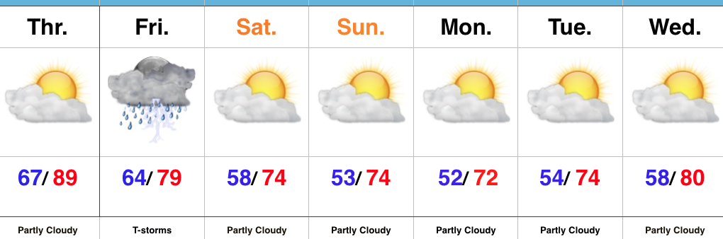
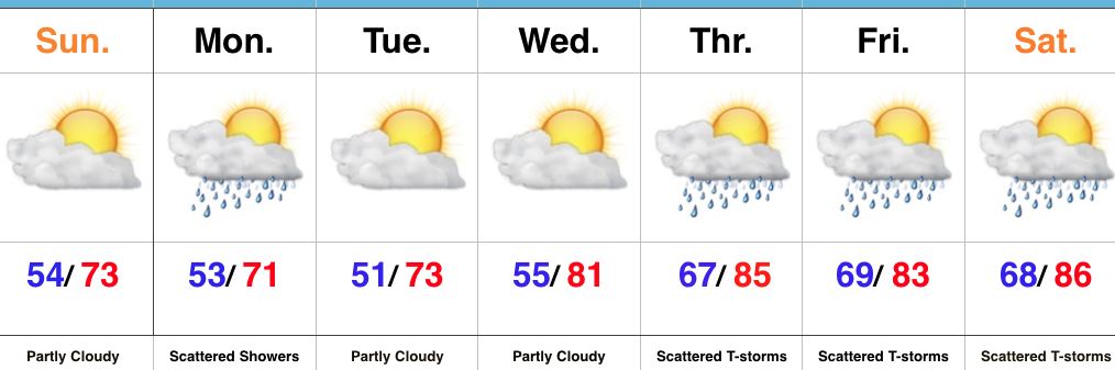
Beautiful Weather Continues…To help put this weather into perspective- our average low and high in late September falls in the lower 50s with highs in the lower to middle 70s.  For the next few days, an early fall-like feel will grip central Indiana, and you won’t hear many folks complaining about it!  (Personally, I say let’s skip right to those crisp late September days and football season :-))!  Despite a weak upper level disturbance creating a shower chance Monday, we’re dry through midweek.

A return southwesterly air flow will arrive on the scene by late week and this will serve to help boost temperatures and humidity levels, along with assist in creating a better chance of scattered to numerous showers and thunderstorms late week into next weekend.  Let yours truly worry about that and you be sure to enjoy this rare late June air!

Upcoming 7-Day Precipitation Forecast:

  • Snowfall: 0.00″
  • Rainfall: 1.00-1.50″

Friday Squeeze Play; Much Cooler Air Coming…

Highlights:

  • Breezy, warm Thursday
  • Heavy rain Friday
  • Drier and much cooler air on deck

Heavy Rains Likely Friday…A warm front is draped to our north this morning and this is helping spark a few showers across northern portions of the state.  Here on the “home front,” with the exception of an isolated shower or storm, most should remain rain-free through the day, locally.  Things begin to change late tonight into Friday as the region feels the effects of a “squeeze play” between Cindy’s remnant tropical moisture tracking through the TN Valley and an approaching cold front to our north.  The combination of the two will promote the development of showers and thunderstorms across central IN.  With a tropical nature to the airmass Friday, some of these storms will produce locally heavy rainfall.  Most widespread rain and storm coverage should occur Friday morning into the afternoon before a drying trend develops from northwest to southeast Friday evening.

Our cold front will push southeast and clear the state Friday night which will allow a much drier and cooler air mass to settle in for the weekend, continuing into next week.  You’ll be hard pressed to find anyone complaining about our weather through the period as a stretch of beautiful summer conditions take on an almost early fall-like feel through Tuesday.  While we’ll have to keep an eye on a sneaky disturbance riding into the region on the fast northwest flow (could spark a quick passing shower), most of the period should remain rain-free.  Eventually our air flow will shift to a southwesterly direction by the middle of next week and this will help transport an increasingly moist feel back into the region.

Upcoming 7-Day Precipitation Forecast:

  • Snowfall: 0.00″
  • Rainfall:  1.00″ – 2.00″ 

Periods Of Rain; T-storm Chance Tonight…

screen-shot-2016-11-28-at-7-57-02-amHighlights:

  • Rain turns heavy tonight; Storm threat, too
  • Trending colder to open December
  • Next storm arrives over the weekend

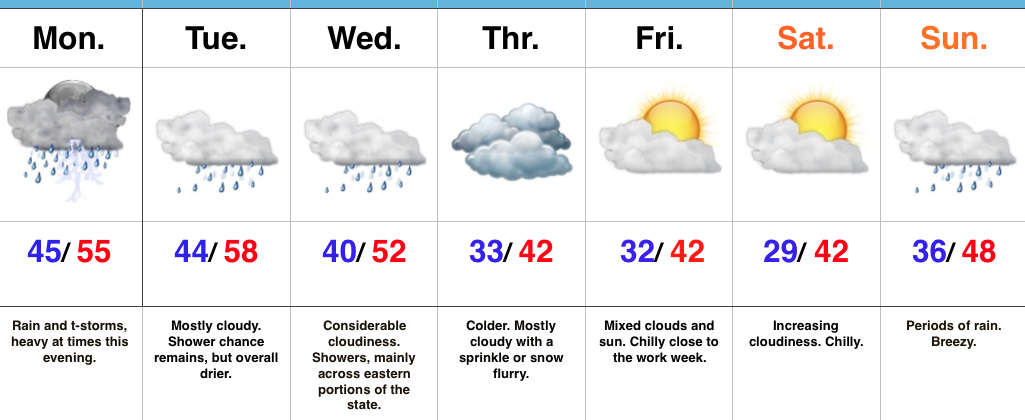
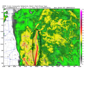
A Wet Kick-Off To The Work Week…Moisture is streaming northeast over the Hoosier state this morning and this is really just the beginning of a wet and, eventually, stormy open to the work week.  We may see a brief “lull” in the rain around the lunchtime hour, but heavy rain will increase in coverage this evening and continue into tonight.  Additionally, we’ll introduce thunder into the mix this evening.  In fact, some of the higher resolution, short-term, forecast models hint at a skinny line of thunderstorms that may impact central IN tonight.  Strong wind gusts are of biggest concern with this line.  Here’s an idea of what the radar may look like around 8p.

8phrrrConsiderable cloudiness will remain Tuesday and Wednesday, but both days will be much drier than today.  A secondary wave of low pressure will move northeast along a pressing cold front Wednesday.  Best rain chances Wednesday will fall across eastern sections of the viewing area.
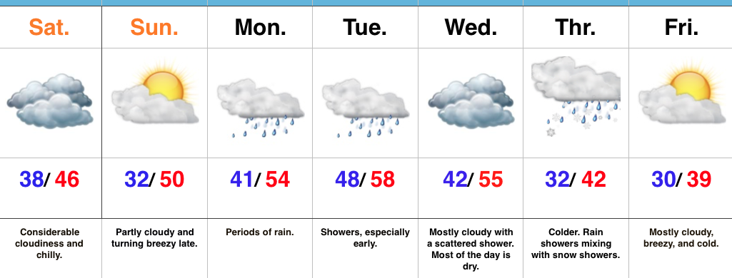
The second half of the week will trend colder.  A sprinkle or flurry is possible Thursday.  The next storm we’re tracking will arrive over the weekend.  Clouds increase Saturday and Sunday offers up the next good chance of rain.  Though details are sketchy at this point, the prospects of a storm system with more wintry significance may arrive just beyond the 7-day period.  Stay tuned.  December is looking quite active and wintry…

Upcoming 7-Day Precipitation Forecast:

  • Snowfall: Trace
  • Rainfall: 1.50″ – 2.00″

Sunshine Returns This Weekend; Heavy Rain Event Looms…

screen-shot-2016-11-26-at-8-16-29-amHighlights:

  • Sunshine finally returns
  • Big time rain maker early next week
  • Trending colder to open December

Sunshine Slowly Returns…We’ve been socked in with clouds, chilly conditions, and overall gloomy weather for the past several days.  Thankfully, sunshine will eventually return this weekend.  Today has started with overcast skies, but slow improvements should provide an increasingly sunny sky as the day wears on.  Seasonable temperatures can be expected today.

The second half of the weekend will feature more in the way of sunshine, but our next storm system will be awaiting on deck by this point.  Southwest winds will turn increasingly breezy by the PM and clouds will quickly increase yet again.  Those clouds will yield rain as early as the wee morning hours Monday (well before sunrise).  Periods of heavy rain can be expected Monday and even a thunderstorm by afternoon/ evening.

Most of the heavy rain will fall Monday, but we’ll maintain mention of showers in our forecast Tuesday and Wednesday. A second wave of low pressure will develop along a pressing front the middle of next week and spread moisture northeast. The “leader” storm system is much easier to forecast than the “follower” in this scenario.  The details are muddy at this point concerning the extent of how far west precipitation can make it.  Know that we’re keeping a close eye on things.  For the sake of this particular forecast, we’ll include mention of rain showers mixing with snow showers as colder air moves in Thursday.  Stay tuned.

The end of the week will feature a colder trend as we usher in December.

One final item on the agenda this morning- with this being Iron Bowl Saturday, we can’t leave you without wishing you an energetic WAR EAGLE!

Upcoming 7-Day Precipitation Forecast:

  • Snowfall: Trace
  • Rainfall: 1.25-1.75 (locally heavier totals)