Tuesday Evening Rambles: Wintry Weather And More Christmas Week Chatter…
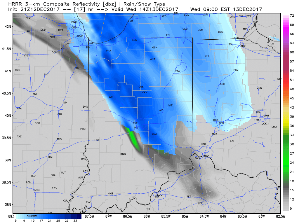
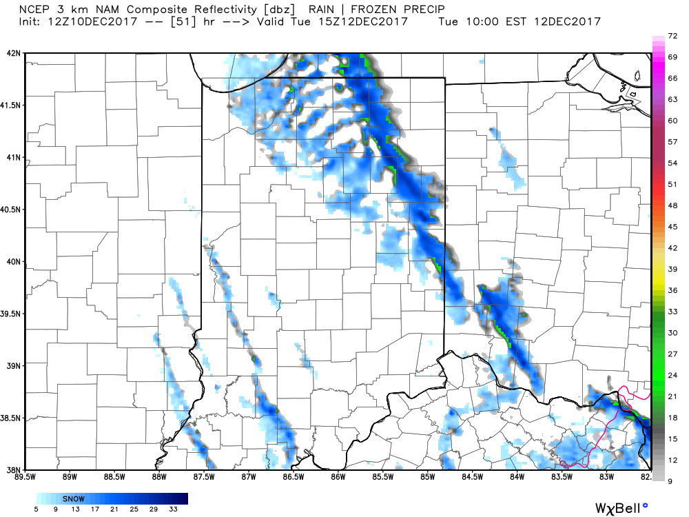
I.) The pattern we’re currently dealing with is one that presents multiple challenges in the near term. East-central and northeastern portions of the state have gotten in on the snow act today, but, so far, most of central Indiana has missed out on the snowy goods. With such a fast-paced northwest flow, we have to remain on guard for potential “surprises” in this pattern. Perhaps the HRRR is beginning to pick up on this. Latest runs want to deliver a “pop” of snow Wednesday morning, associated with “warm” air advection (WAA). We’ll monitor tonight.
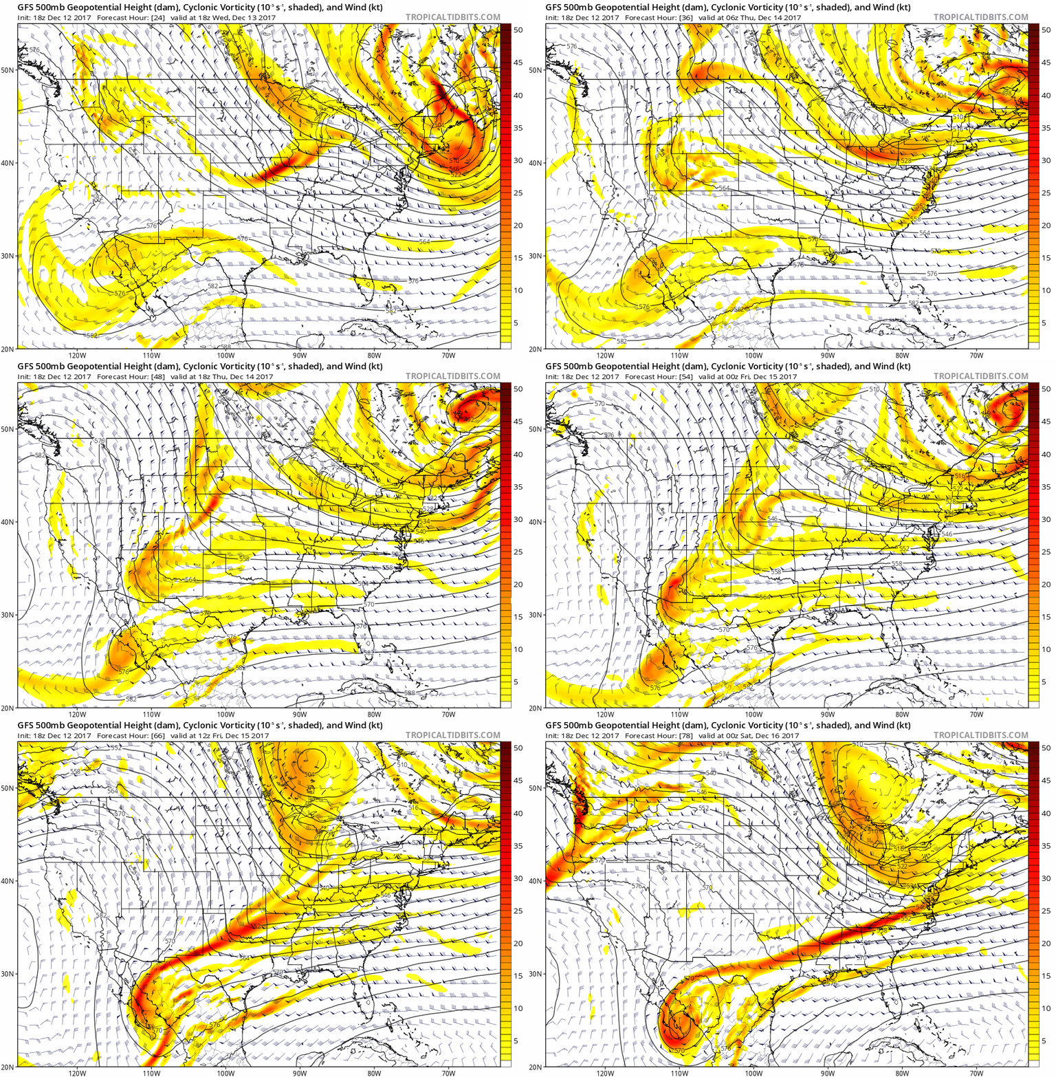
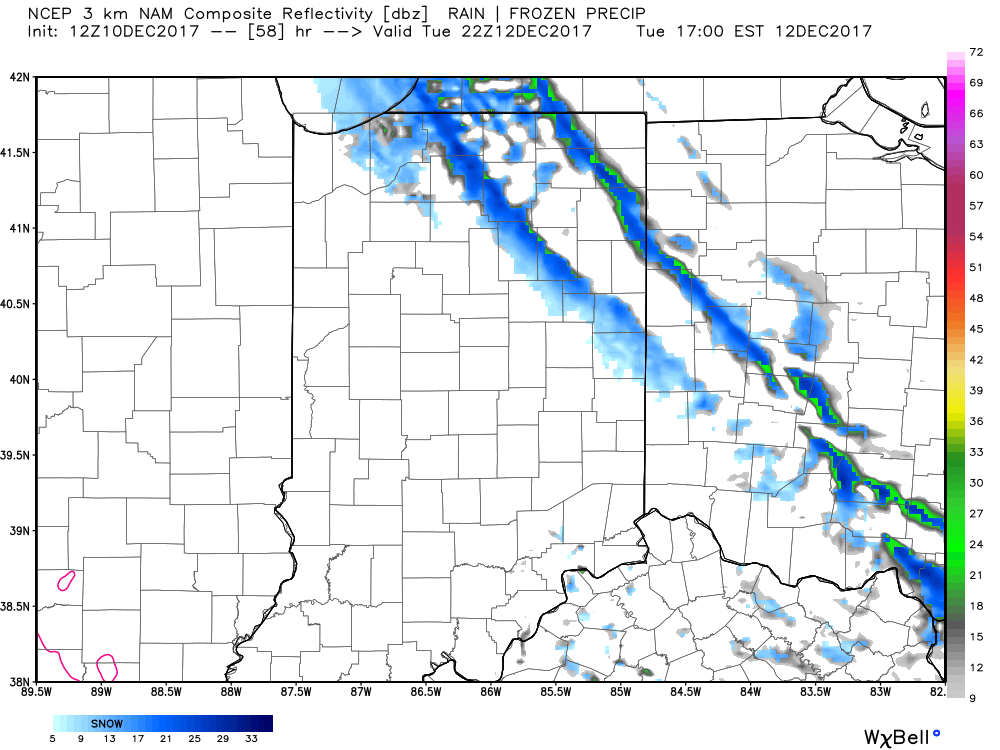
II. The northwest flow will continue to provide disturbances plenty capable of producing periods of snow again Wednesday evening through the end of the week. Are these monster storms? Hardly, but they can “suddenly” become sufficient enough to create travel problems given the pattern. For those who live across the northern half of the state, plan to keep close tabs to local forecasts if you have travel plans through the end of the week.
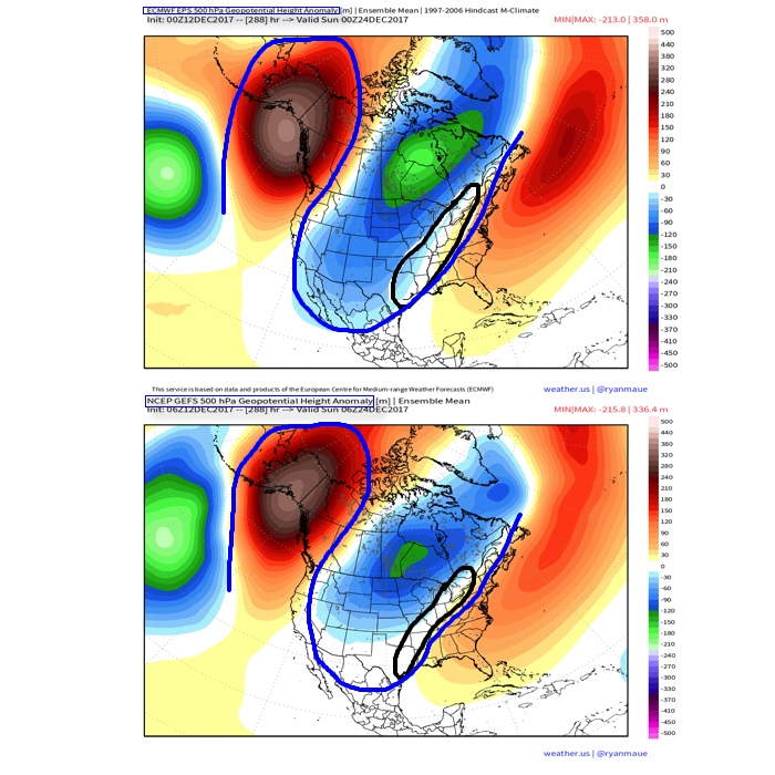
 III. A period of brief moderation will come in this pattern early Christmas week, but all eyes continue to focus on the period between December 22nd through December 26th for the potential of impactful weather across our region. For model “worshipers” out there, we suggest paying more attention to overall trends, and a blend of ensemble data, as opposed to specifics associated with operational runs. It’s a “jailbreak” pattern of sorts as true arctic air will be pouring down the Plains while the southeastern ridge tries to fight for a time. The resistance from the southeastern ridge and associated tight thermal gradient should promote a very stormy regime for the interior (Ohio Valley into the interior northeast) as we head into the true holiday/ Christmas stretch. As of now, we favor the idea of multiple waves along the pressing arctic boundary, as opposed to one big storm. Looking back through the records shows some of the heaviest snows at IND have come from similar set-ups. Understanding each set-up is unique, the overall pattern does have to raise an eye brow for potential of wintry weather in, or around, our region as Christmas approaches…
 This will keep highs in the middle 20s Tuesday with wind chill values in the single digits and teens most of the day.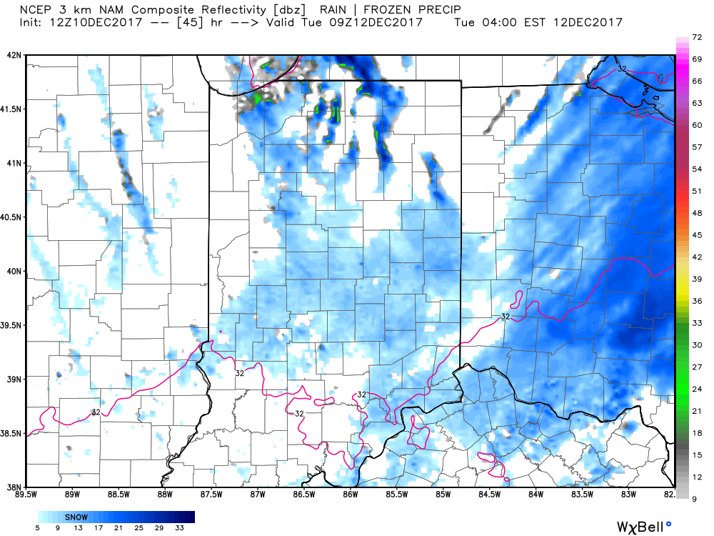
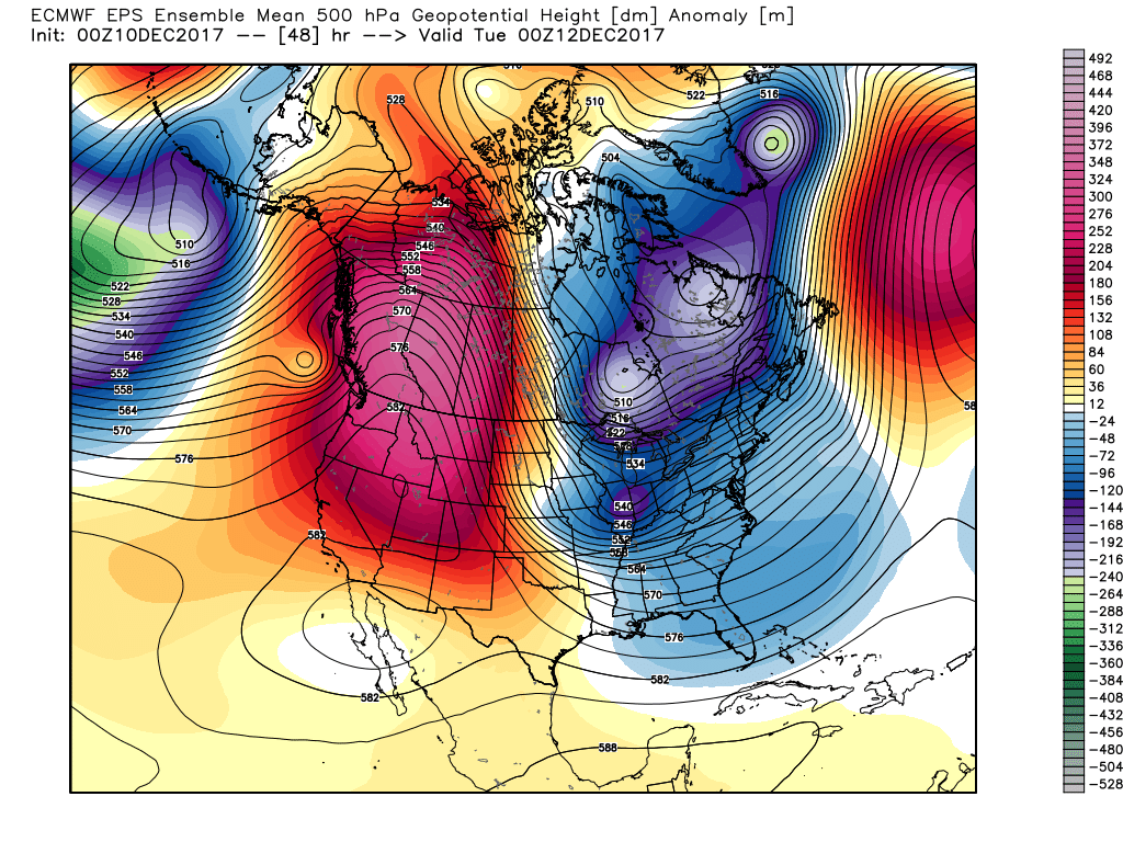
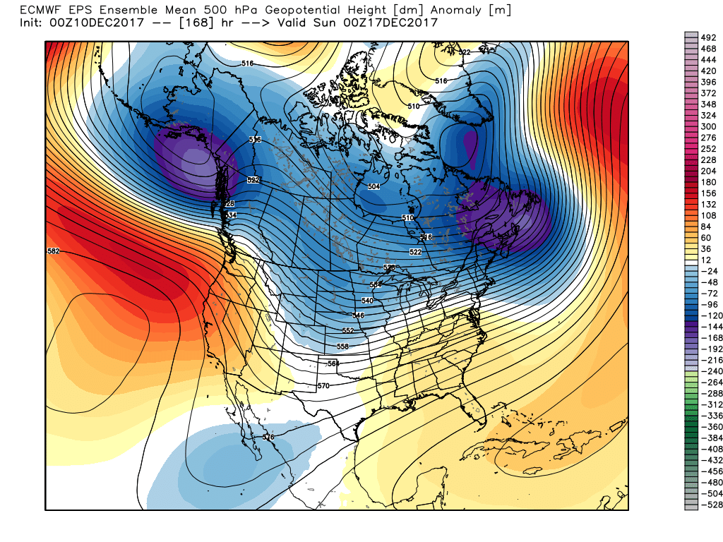 This doesn’t last long as the pattern begins to reload as Christmas week approaches. As the evolution to a fresh cold pattern takes place, there’s a window of opportunity present for a more significant wintry system to potentially impact the Ohio Valley into the Mid Atlantic region. Notice the relatively “flat” ridge across the southern tier and associated tight thermal gradient. This look suggests we need to be on guard for the chance of a storm system to ride the thermal gradient in a west-to-east fashion, and has wintry implications for our region. Far too early for specifics; just know the possibility looms of a wintry event, locally, as Christmas week nears.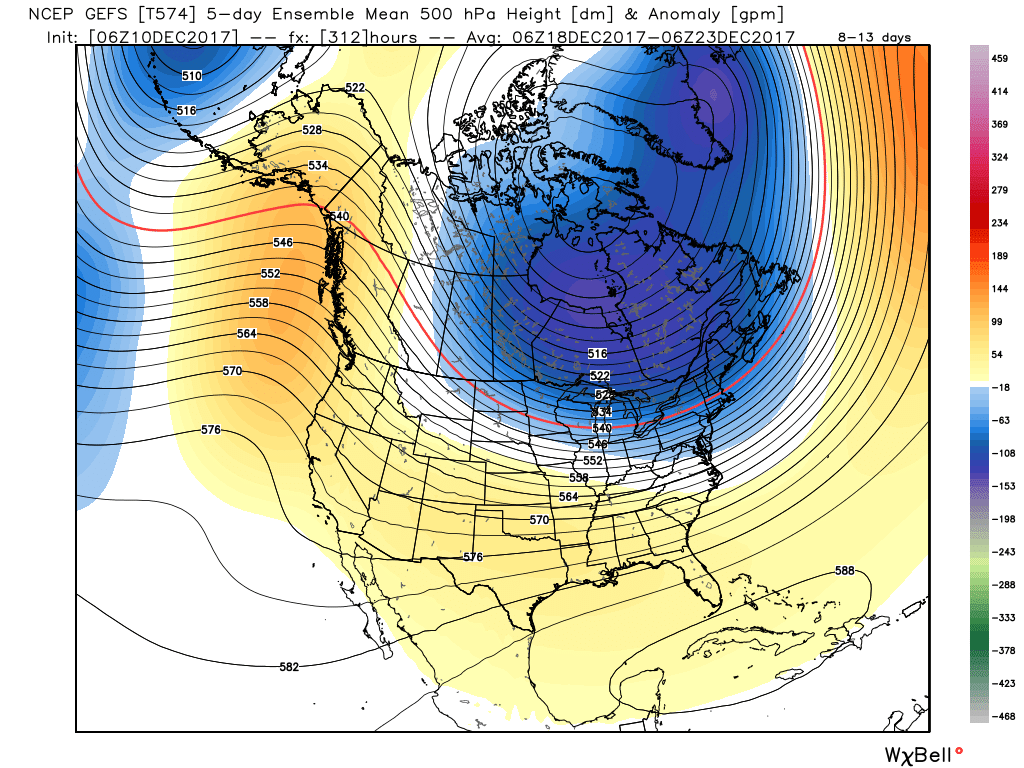
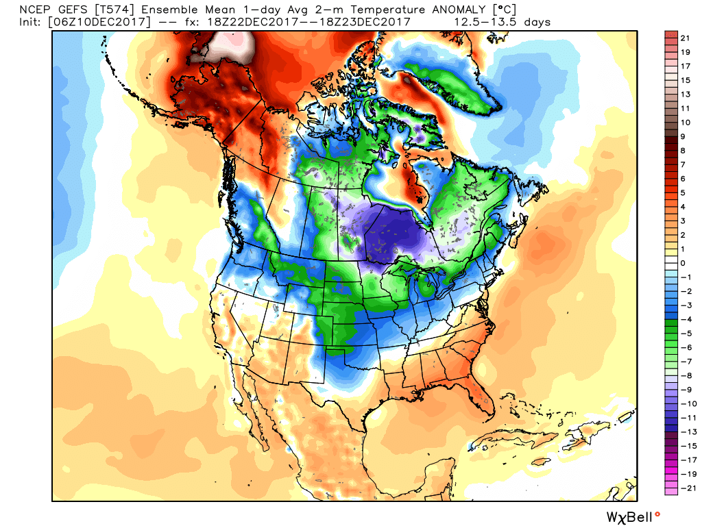 Speaking of Christmas, it sure appears as if cold will overwhelm the pattern for Christmas, itself, and the overall cold regime doesn’t show signs of letting up (with the exception of potentially a day or two) into the new year.
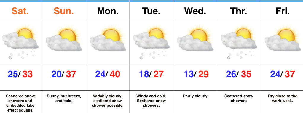 Highlights:
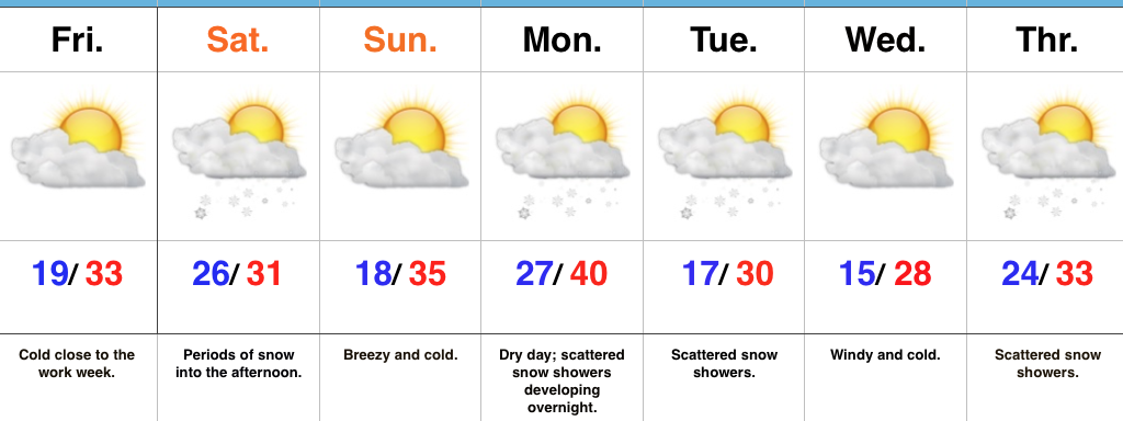 Highlights: