 Highlights:
- Falling temperatures Tuesday
- Much colder
- Active northwest flow
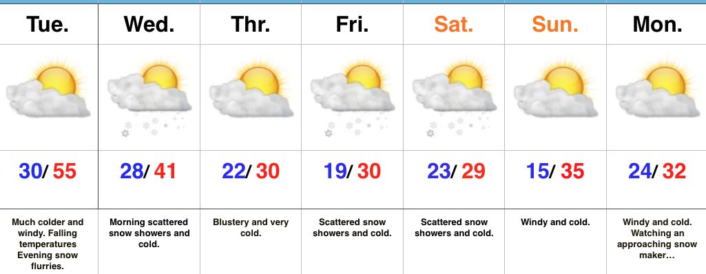
Winter Engaged…Showers and embedded thunderstorms will rumble across the state during the overnight as a cold front draws closer. This is a “game changer” of a cold front, separating anomalous warmth over the past few days to a locked and loaded winter pattern. Temperatures will fall through the day Tuesday and just enough wrap around moisture will be present to support mention of evening flurries.
Morning scattered snow showers will continue early Wednesday before a reinforcing blast of arctic air blows into town at night. This will set up a frigid close to the work week and feature a fast paced northwest flow pattern into the upcoming weekend. We’ll have to remain very focused on upper level energy over the weekend. Models have been struggling (as expected given the pattern) on the specifics and we know this type regime can overachieve in the snow department. As things stand now, a period of snow showers with light accumulation still seems like a good bet Friday into Saturday.
Another (potentially more significant) snow event looms early next week…
Upcoming 7-Day Precipitation Forecast:
- Snowfall: 1″
- Rainfall: 0.25″ – 0.75″
 Highlights: