Arctic Hammer Drops Down Around Christmas…
While the evolution of how things transpire from a snow perspective are “murky,” at best, confidence continues to run very high on the prospects of a nasty period of bitter air arriving around Christmas.
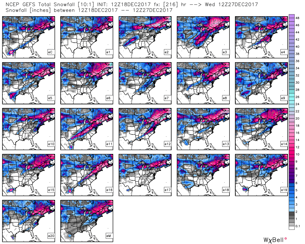
Before we dig into the cold details, the pattern is one that still screams “trouble” from a wintry perspective in the December 23rd-Christmas Eve period. We posted over the weekend of the PNA-EPO going to battle Christmas weekend, and before the cold overwhelms, a consensus of the data continues to paint an interesting scenario as resistance will be present initially from the southeastern ridge. Modeling will continue to struggle with this evolution over the next few days, but we’re hopeful we’ll begin to gain more clarity by late in the work week. Needless to say, a stripe of impactful wintry precipitation should fall in a southwest-northeast fashion given the pattern, but whether that’s to our northwest, over our region, or off to our southeast is simply impossible to call from this distance. A glance at the individual ensemble members (GEFS shown below) shows this nicely, as well. The European ensemble members also paint a similar picture.
 Hang in there as we continue to sort through the data over the next few days. Once confidence increases (for or against an event), you’ll be the first to know! 🙂
Now to the ugly stuff: Bitterly cold air of true arctic origin will be dislodged southeast late week and encompass more of the country by Christmas weekend. Eventually, this arctic air will make it across the Appalachians and reach the East Coast just after Christmas.
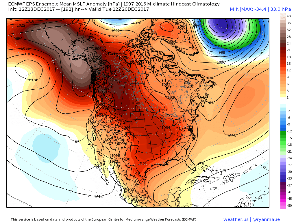 Recent operational data (GFS and Canadian included) has suggested a sprawling high in the range of 1050mb+ descending into the eastern slopes of the northern Rockies. Such a regime would be plenty capable of spreading sub-zero temperatures east into the Ohio Valley (with or without snow on the ground). Add in a biting north wind and wind chill values would drop to levels of dangerous and deadly levels if any length of time was spent outdoors. Some of the latest data paints a picture similar to shades of the famous ’13-14 winter (20° to 30° below zero chill factor). If you have travel plans over the Christmas holiday, please plan in advance to have a winter survival kit packed and loaded. It absolutely never hurts to be prepared.
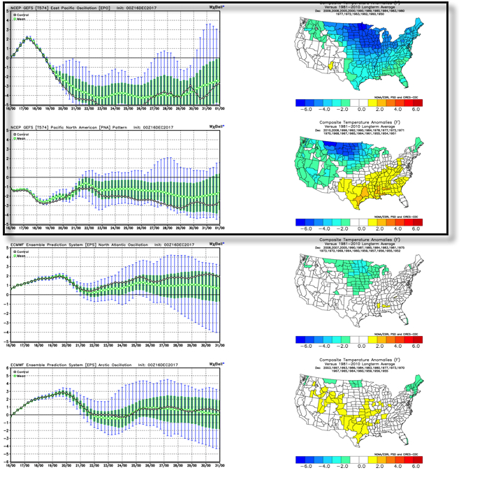 As we’d expect, as these two fight it out, a battle will ensue across the central and eventually eastern portion of the country. The negative EPO is a widespread cold pattern, while a negative PNA favors south-central and southeastern ridging (a warmer pattern).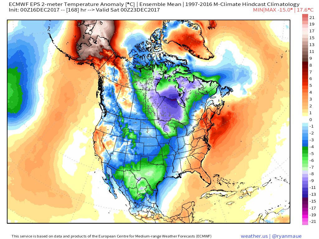
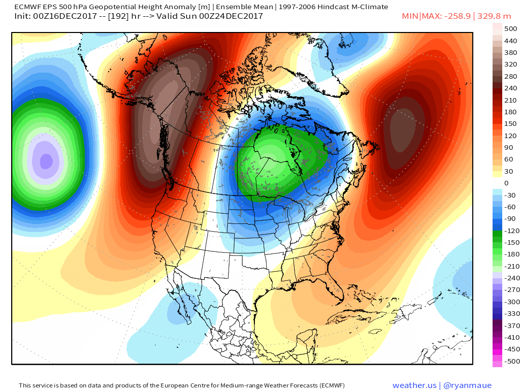 Eventually, we expect the deeply negative EPO to take control and overwhelm the pattern with cold. However, as this transition of power takes place, the negative PNA won’t go down without a fight and will likely play a role in the weather leading up to Christmas.
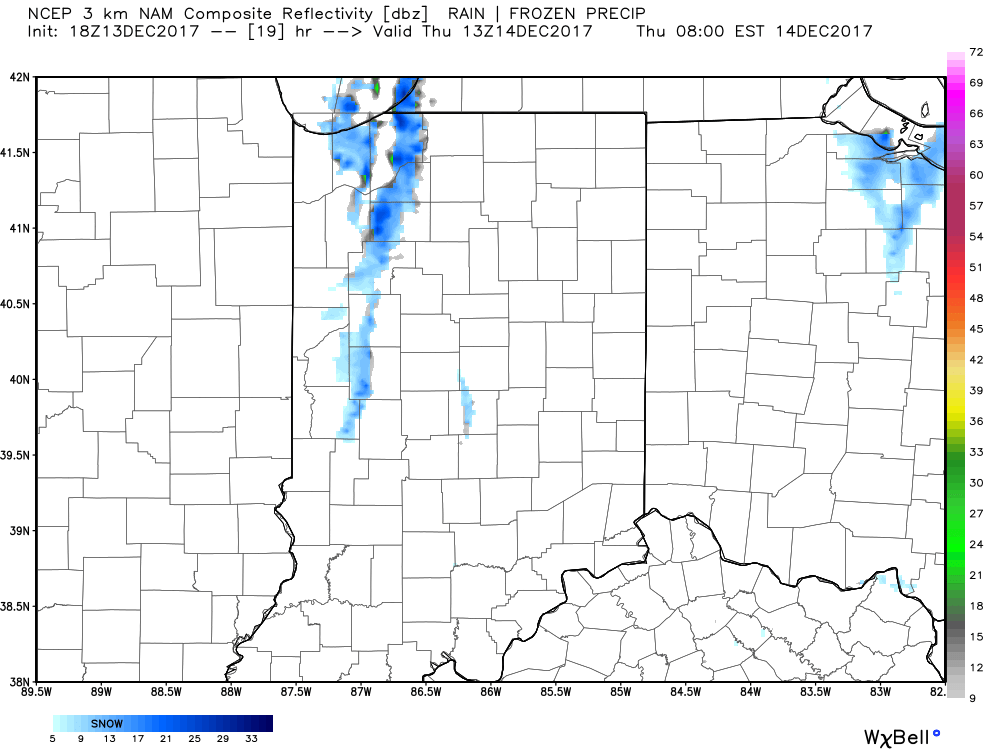
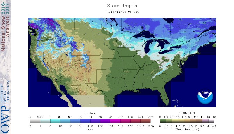 II. While the sticking snows will miss us this go around, scattered snow showers will impact central IN overnight into early Thursday morning. There’s also still the potential of a skinny lake effect snow band to impact a narrow portion of western and north-central IN early Thursday.
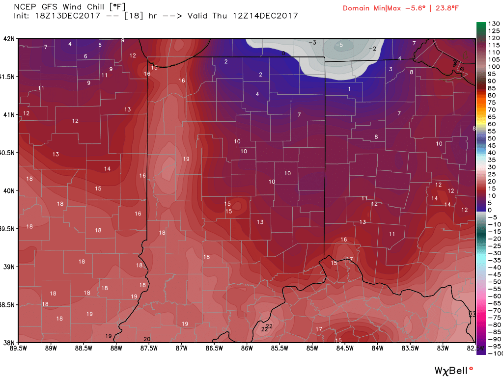
 III. Reinforcing cold air will plunge south Thursday. Highs will remain below freezing along with wind chill values in the 10s most of the day.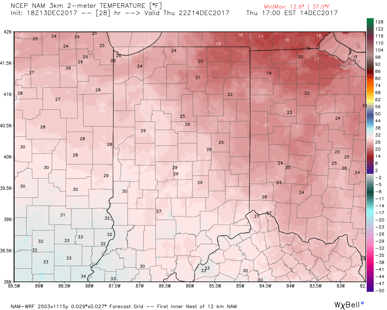
 IV: A milder southwesterly air flow will result in slightly “warmer” temperatures this weekend (mid 40s for highs Saturday) before showers arrive to close the weekend. Despite the slight relaxation of the cold, this will come with a gusty breeze over the weekend.