Clouds will lower and thicken Wednesday morning and give way to an expanding rain shield late morning into the early afternoon hours. Initially this rain won’t be heavy, but will begin to increase in overall coverage and intensity as we progress into the nighttime hours.

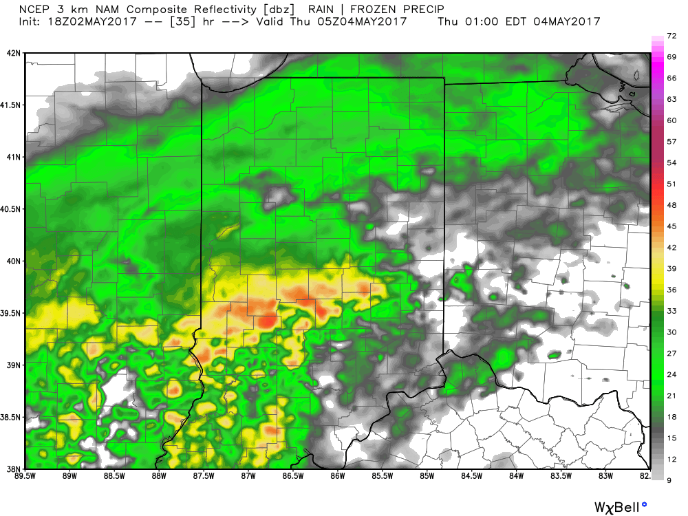
Forecast radar around lunchtime shows rain increasing across central IN.
Rain becomes heavy Wednesday night.
The culprit behind this new heavy rain maker is a deepening surface low pressure system that will slowly track from Arkansas (Wednesday night) northeast along the Ohio River (Thursday) and into Ohio (Friday). Not only will this spread heavy rain across central Indiana, but will also result in strong and gusty easterly winds Thursday into Friday, and unseasonably cold air. In fact, temperatures Friday will likely remain in the 40s across central IN with wind chills in the 30s. Add in that wind-driven rain and we have the makings for an UGLY day.
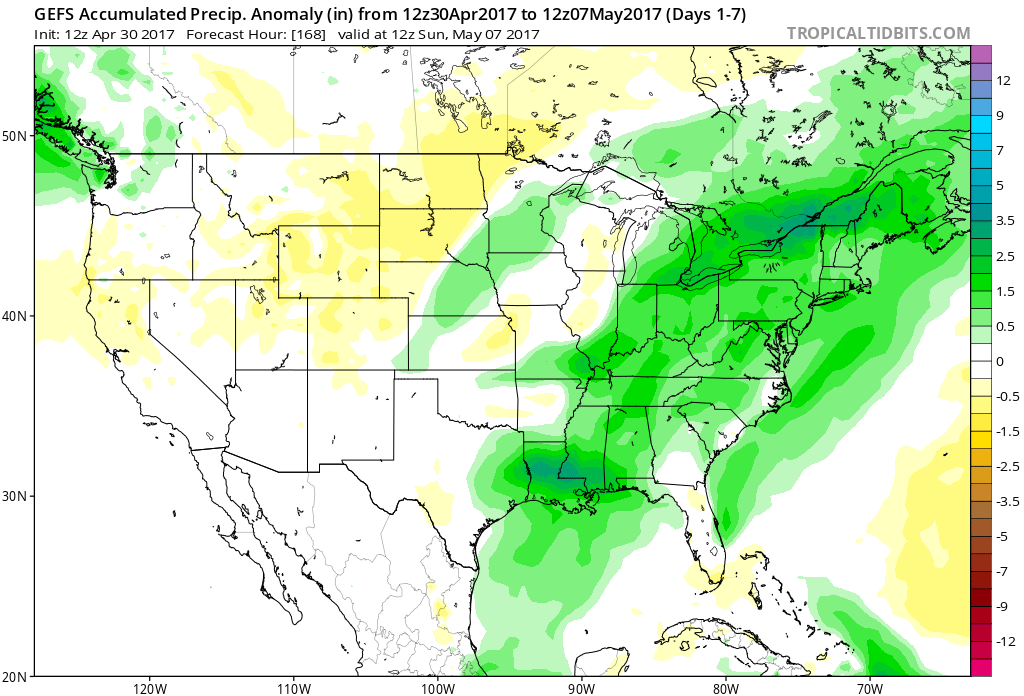
Periods of heavy rain will fall on the region Wednesday night into Friday and by the time all is said and done (Saturday night) widespread rainfall of 3″ is likely across most of central Indiana. Locally heavier totals will be possible where the most persistent heavy rain bands set-up shop.
 We’ll begin to dry things out Saturday night into Sunday, but unseasonably chilly air will remain. Lows over the weekend into early next week will grow cold enough to allow patchy frost to develop in outlying communities. We think low to mid 30s will be common across the region Sunday and Monday mornings.

 The individual GFS ensemble members are truly concerning, especially given just how wet we currently are. We note some members suggest additional 3″-4″ totals- with over 50% of that coming from our midweek storm.
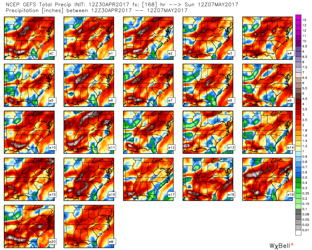 We’ll keep a close eye on model data over the next couple of days, but as of now, we suggest planning for additional hefty rain totals in the Wednesday night through Friday time frame. Also of interest will be the extreme cool associated with this storm. As previously mentioned, the majority of the day Thursday will be spent in the 40s (more like early-March than early-May). Factor in a gusty easterly breeze and we’ll have the makings for a truly “raw” weather day across the region.
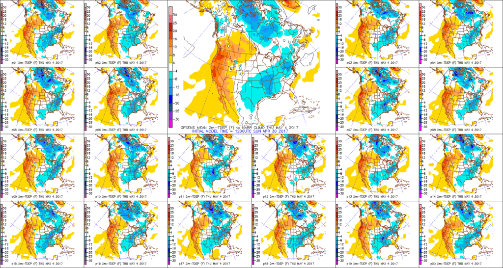
 Week 2:
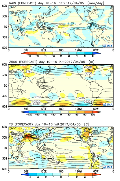 Weeks 3-4:
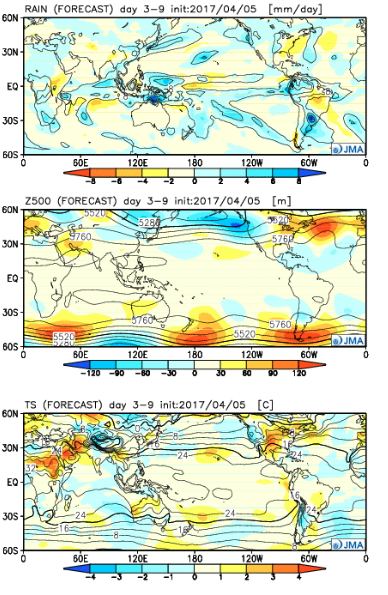
 The big picture is one that shows a drier pattern developing across the East during Week 1, but we caution that this drier regime doesn’t look to “lock” in. Data suggests we get back to an active pattern between Week’s 2-4, biased wetter than normal in the Mid West and Plains. The other screaming message is that a busy severe season should continue through the period. Cold sets up across the Pacific Northwest, associated with the “mean” trough position, while spring-like warmth continues to build across our region in overall terms. We know what that means as storms eject off the Rockies and track east…
 Precipitation is running above normal, locally, to the tune of nearly 1″ month-to-date. Heaviest rains have fallen across southeastern Indiana over the past (30) days.
 A look at precipitation anomalies across the mid west, month-to-date:
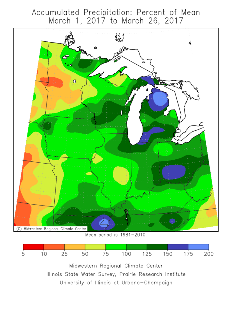 As we progress through the upcoming (10) days, a transient weather pattern will persist. This will keep forecasters busy, but it should also be stressed it’s not all a “doom and gloom” type pattern, either. There will be plenty of dry time over the upcoming period, including drier conditions building in tomorrow (Tuesday) into a good chunk of Wednesday.
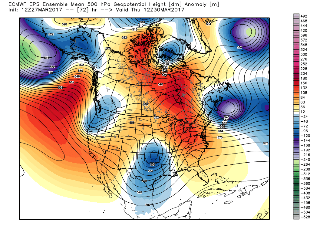
 However, timing is our friend this go around as upper ridging develops over the upcoming weekend. Not only will we dry out, but we’ll also enjoy increasing sunshine as the weekend progresses.
 That said, looking further down the pipe line, another (potentially more significant) storm system looms during the 8-10 day period. This would fall in the April 3rd-4th time frame. From this distance, models are bullish on hefty rainfall totals with this storm system and we’ll keep a close eye on things as time draws closer.
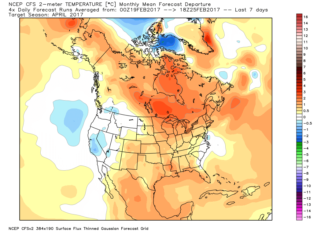
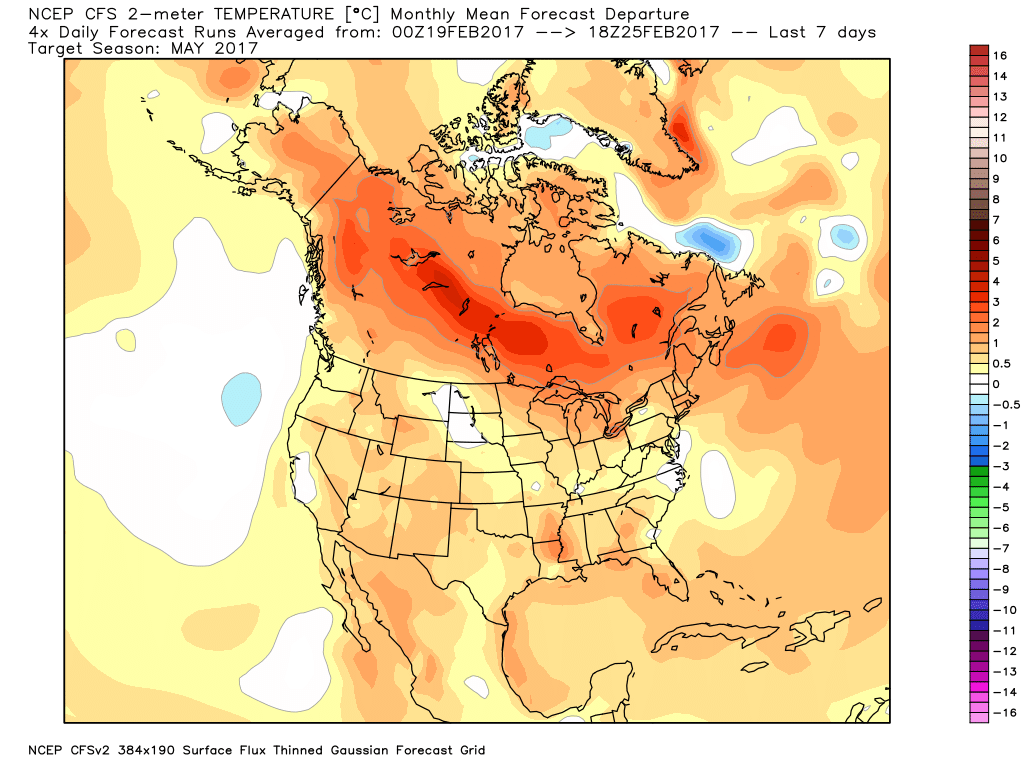
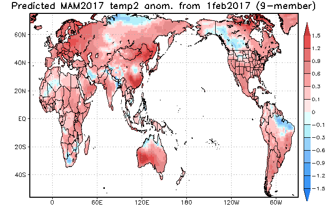
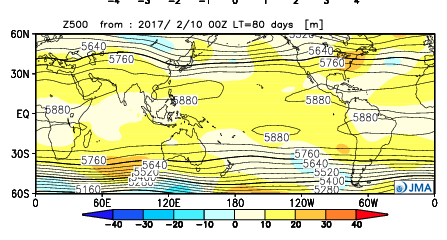
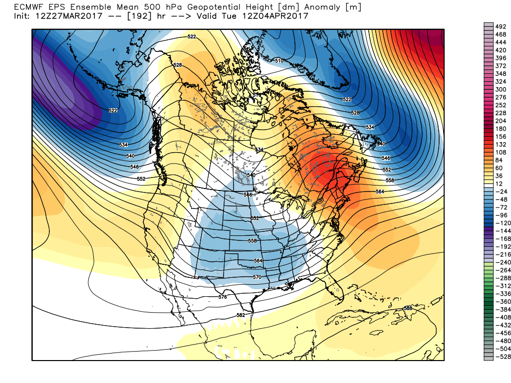 Speaking of April, our overall thoughts for the fourth month of the year (where does time go?) would imply a warmer than average month and active (wetter than average). Relative to average, we feel we still may have some chill to traverse early month, but there’s also some indication we could bust into an early summer-like feel mid and late month. With the mean trough position west and ridging east, we’ll have to also be mindful for the potential of an active severe weather month- especially mid and late month. Overall, the CanSIPS idea below is one we would agree with from a mean 500mb perspective.