
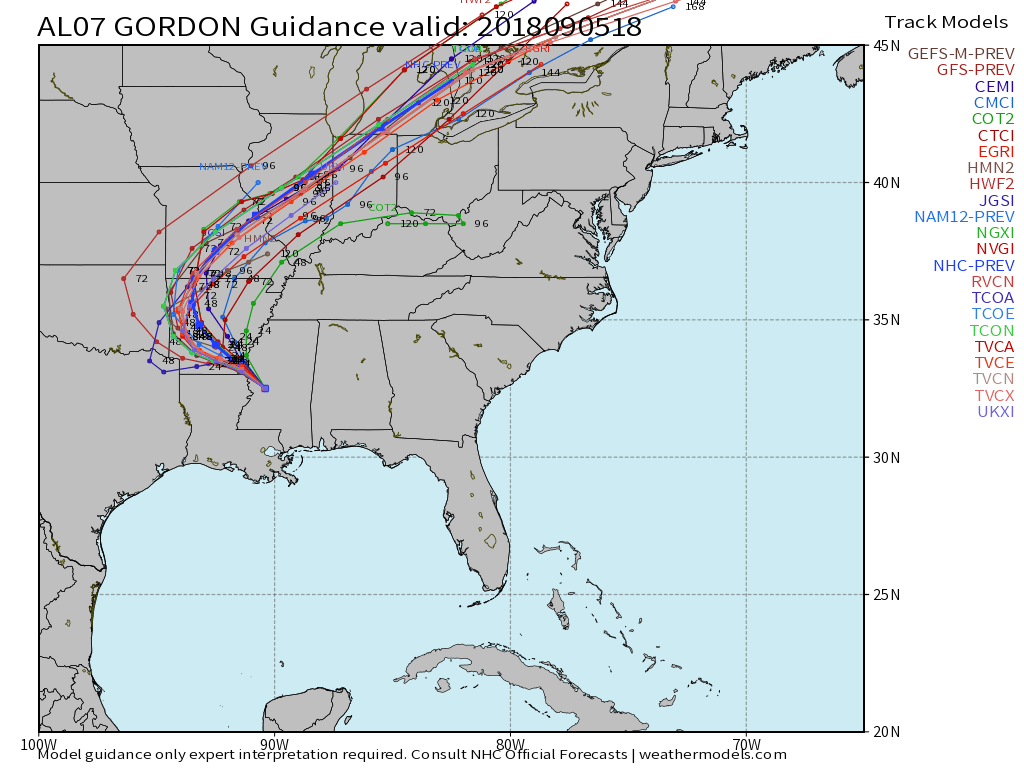
Gordon’s remnant moisture will claim headlines through the weekend.
I. A cold front will approach Indiana Thursday and result in increased cloudiness AND a better chance of scattered showers and thunderstorms- especially during the afternoon and evening hours. Though still warm and humid, temperatures will begin a “step down” process to eventually MUCH cooler readings this weekend.
II. Unsettled weather will continue Friday into Saturday as the surface front settles south. As an increasingly blustery easterly flow takes hold across central Indiana, cooler air will continue to “ooze” into the state. Highs shouldn’t make it out of the 70s Friday with considerable cloudiness and showers around.
III. Unseasonably cool air will be with us Saturday (most of the afternoon will be spent in the 60s for the majority of central IN, especially north of I-70). A stiff easterly flow and showers will continue.
IV. The remnant moisture of Gordon will creep closer to the region Saturday PM before setting up shop Saturday night into Sunday evening. This is the most concerning period for potentially excessive rainfall rates and localized flooding. We still have time to watch things unfold, but the idea here is that widespread 2″ to 4″ totals are likely with locally heavier totals. This is “beefed up” from this morning’s call of 2″ to 3″. Stay tuned, especially if you live near water ways.
V. Finally, the tropical moisture will surge northeast Sunday night and Monday and a cold front will sweep through the region. This will set up a much drier and very pleasant period as we open up the new work week.
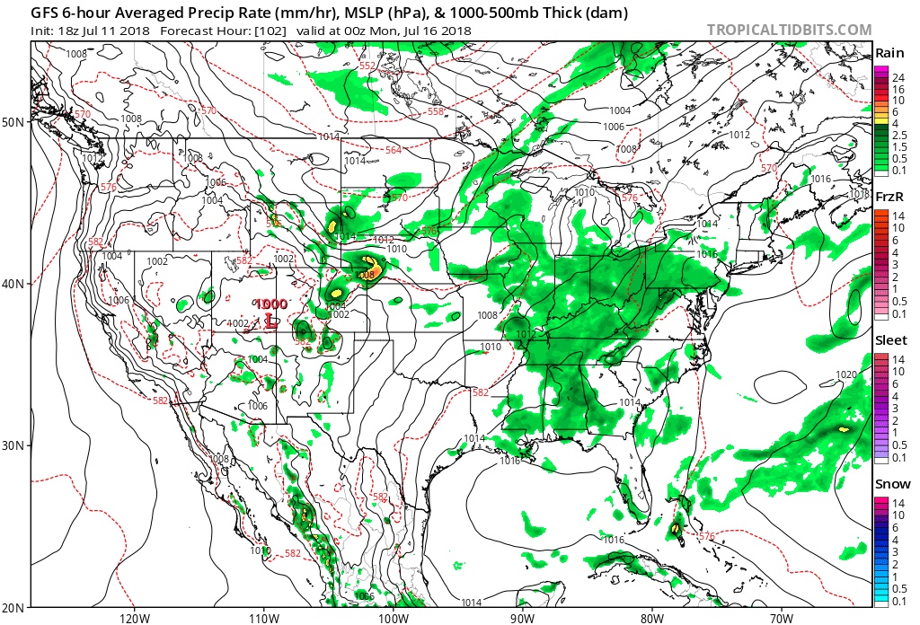
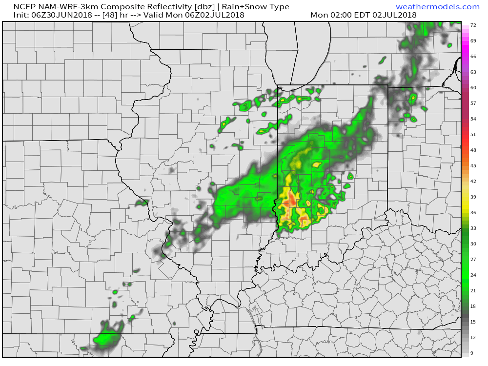
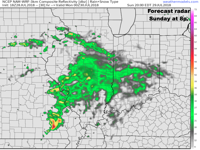 Rain and embedded thunder will likely be rather widespread early Monday, especially across the southern half of the state.
 Data continues to point towards the greatest coverage of rainfall arriving Monday night and Tuesday. We still expect a widespread 1″ to 2″ rain for central Indiana before things begin to wind down mid to late week. There will be locally heavier totals.
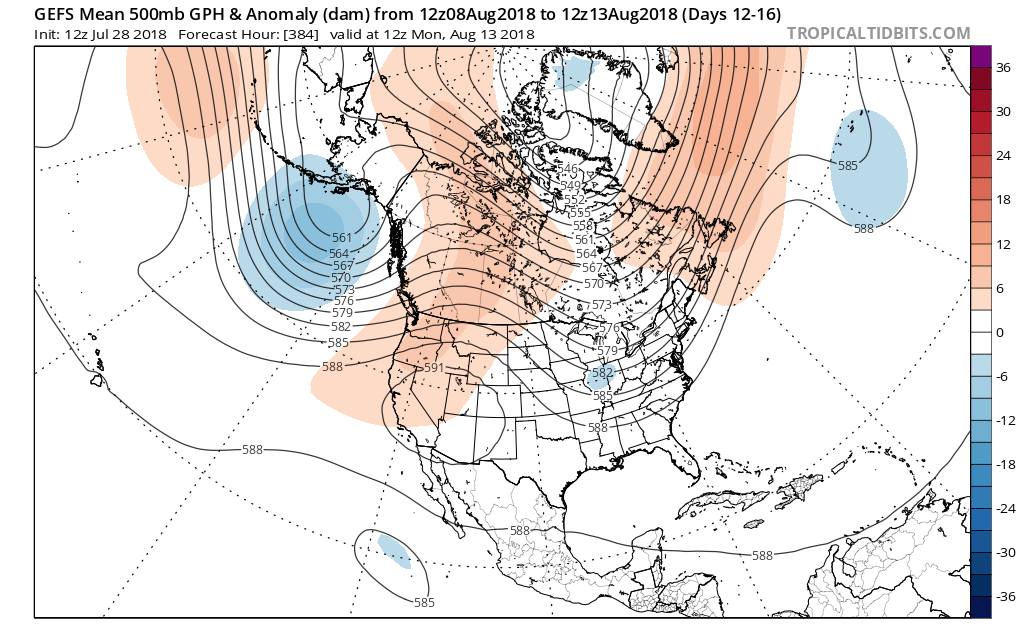
 The model has support of a return to wetter times as noted from the latest JMA Weeklies, CFSv2, and European ensemble.
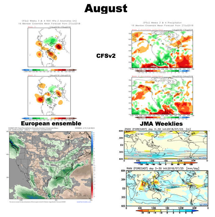 While the cool will relax as we rumble past the first couple days of the month (we’re in the “dog days” after all), I still think the worst of the heat is over for the summer and the headline for August will likely be a situation where we begin to make up for lost time in the precipitation department. That upper ridge centered to our west in the means will likely result in a continuation of rather active times from a precipitation perspective through the month and our idea is that we finish August with above normal precipitation across central Indiana for the first time since April…
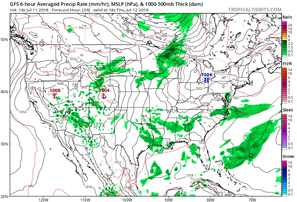

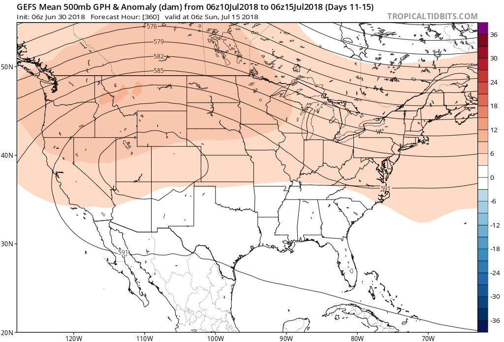
 Our latest 7-day forecast reflects this slightly cooler air mass and the associated “pull back” in humidity over the midweek stretch.
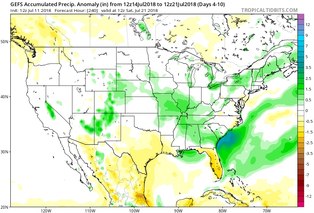
 Heat and humidity will then build again during the late week period ahead of an approaching cold front that will likely offer up more in the way of scattered to numerous storms next weekend. Note the “ups and downs” over the upcoming 7-10 day period. While sustained heat isn’t expected, there will be a few hot days thrown in the mix for good measure as the overall pattern works through its’ transition.
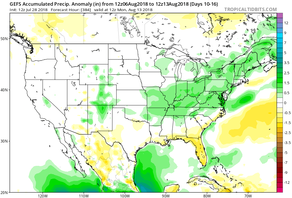
 Again, along with the expected cooler shift, the model is painting a wet pattern emerging as we put the wraps on the month of July. With the developing northwest flow aloft, it’s tough to disagree with this overall more active look.
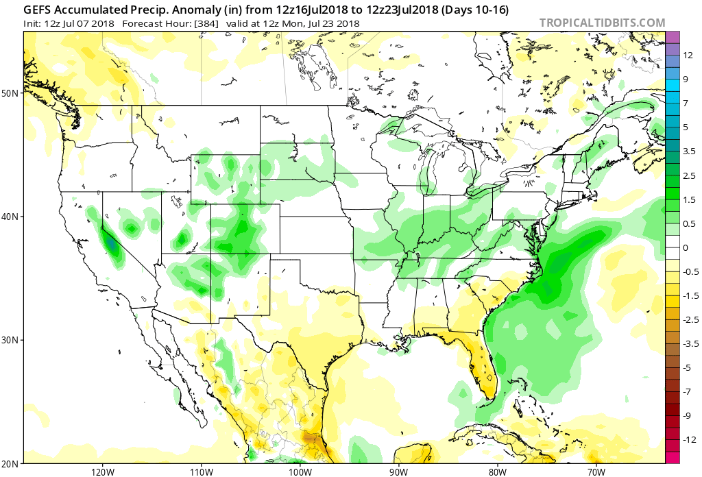 Enjoy this pleasant early-July weather and have a great weekend! Additional updates will arrive here and on our social media outlets throughout the weekend.
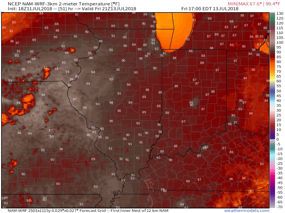
 More specific to central Indiana, daily highs in the lower to middle 90s and overnight lows in the lower to middle 70s will continue into late next week. For the most part, this is a dry pattern, as well, BUT there will be a few exceptions.
 Thereafter, additional isolated to widely scattered storm coverage is possible- primarily during the afternoon and evening hours, but more than not will remain rain-free. 7-day precipitation totals check in this morning in the 0.25″ to 0.75″ range.
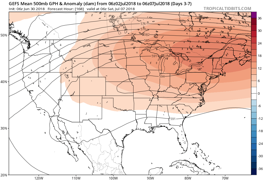

 Not only will this likely lead to a cooler second half of July, but should also offer up an increasingly active and wetter northwesterly flow for our immediate region.