Bitter Weekend; Changeable Weather Next Week…
 Highlights:
- Bitterly cold weekend
- Big shift in temperatures next week
- Icy set-up late next week?
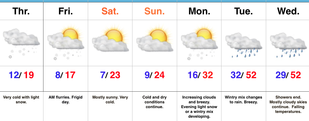
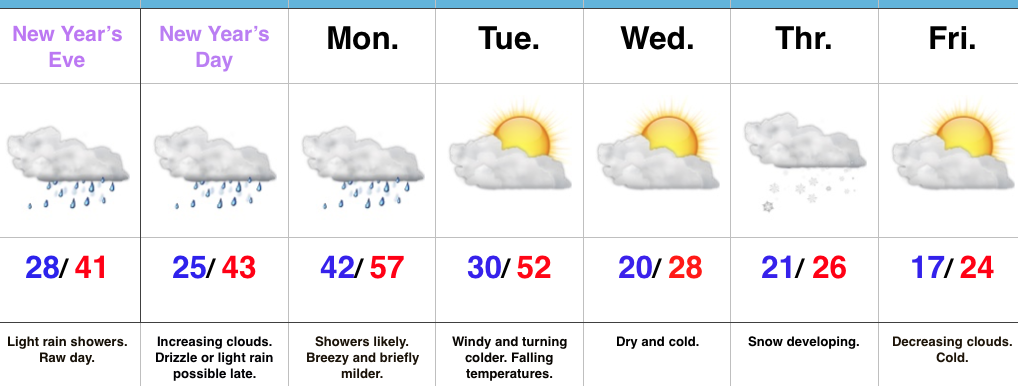
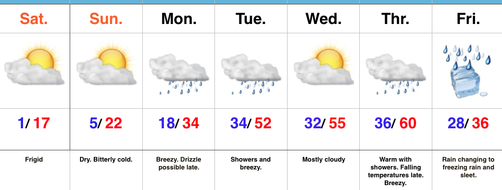
Heavy Winter Gear Required…We’ll watch a significant winter storm impact the southern states this weekend with heavy snow and ice accumulations. Here on the home-front, expect bitterly cold conditions with dry skies. Clouds tonight should keep most areas around zero. That’s frigid in and of itself, but should skies clear, temperatures will easily fall below zero. Very cold conditions remain Sunday.
We’ll back our air flow around to the southwest early next week and this will help give temperatures a big boost by the mid week period. Gusty southwest winds and showers will be with us, as well.
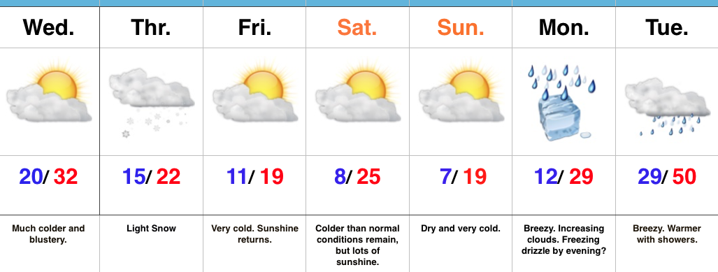
A complex weather pattern will set up to close out the week. The clash of air masses between a sprawling strong arctic high and an equally impressive southeast ridge will be fun to watch, but not to forecast. It’s very possible unseasonably warm conditions of Thursday give way to much colder weather going into next weekend as the arctic high helps “ooze” dense, shallow, cold air south. At the same time, waves of low pressure will move along the pressing arctic front and periods of heavy precipitation will result. Conditions should grow cold enough by Friday into Saturday for the precipitation to fall as an icy mixture of sleet and freezing rain across portions of central Indiana. Stay tuned.
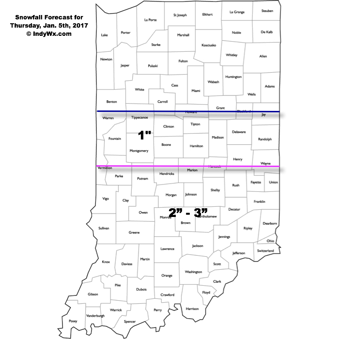
Upcoming 7-Day Precipitation Forecast:
- Snowfall: Trace
- Rainfall: 1.50″ – 2.50″