Thursday Morning Rambles…
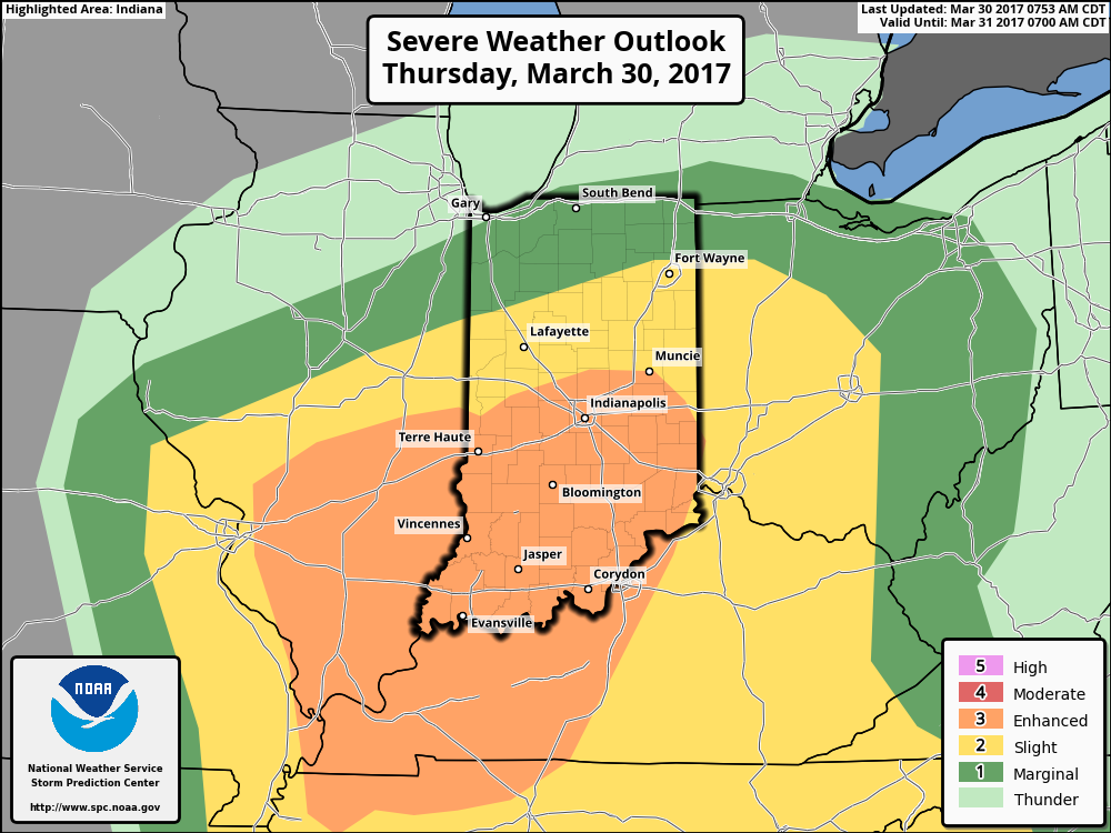
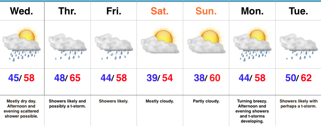
1.) Morning showers and thunderstorms continue to impact north-central Indiana this morning and given the look to downstream trends on radar and satellite, it would seem like it’s going to be tough to get into any sort of significant sunshine this afternoon. This is great news as it’ll limit severe potential. That said, we still can’t rule out a severe thunderstorm this evening with large hail and damaging straight line winds of greatest concern. The updated (9a eastern) outlook from the Storm Prediction Center continues the “enhanced risk” for the southern half of Indiana.
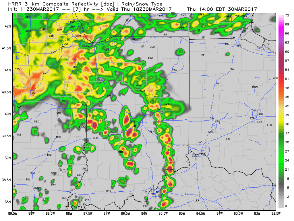
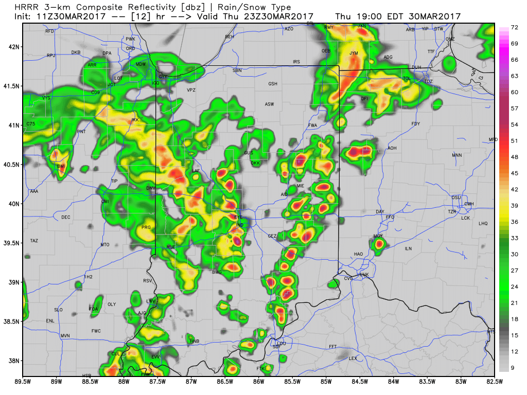
 2.) We bracket the hours of 2p-8p (couple hours earlier from yesterday’s thinking) as the period of potential most widespread strong to severe thunderstorms across central Indiana, and the HRRR forecast radar shows what the radar may look like this evening. Have a means of getting the latest warnings.
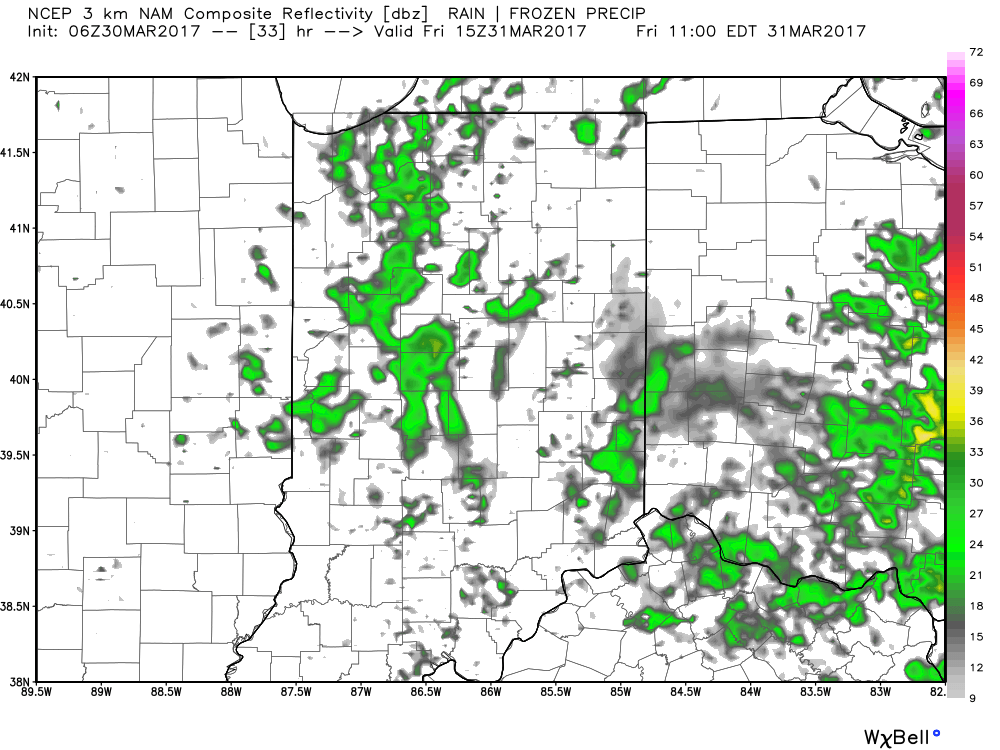
 3.) Scattered showers will continue into Friday morning before drier air arrives during the evening hours.
 4.) This drier trend Friday PM is one that will continue into the weekend. High pressure will supply mostly dry weather through the entire weekend (small shower chances return Sunday evening), including sunshine.
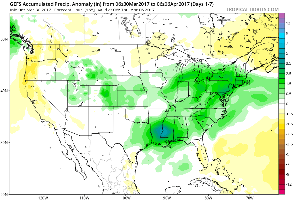
 5.) Another active period of weather awaits next week, including multiple rain chances early and late week. The latter storm looks to be the bigger event with heavy rain and thunderstorm potential Wednesday into Thursday. 7-day rain numbers check in between 1.5″-2″ with locally heavier amounts.
 6.) The story becomes a chilly one next weekend, and models suggest central Indiana may be dealing with frost and freeze conditions by next Saturday or Sunday morning.
 Highlights:
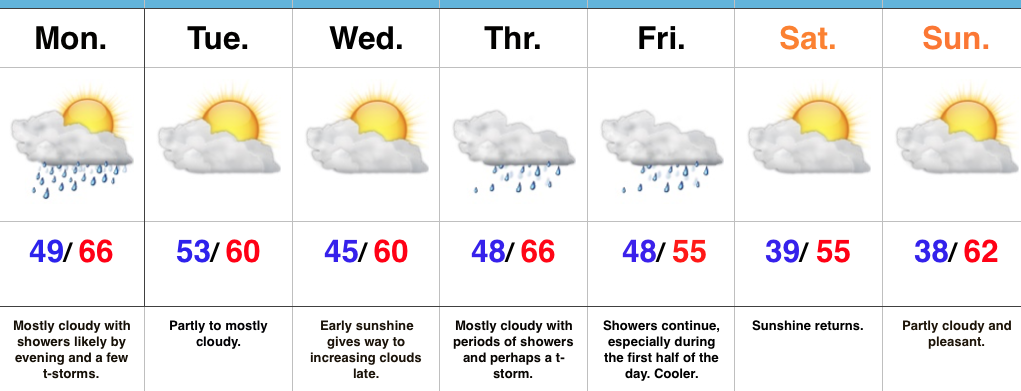 Highlights:
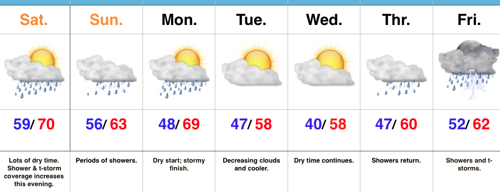 Highlights:
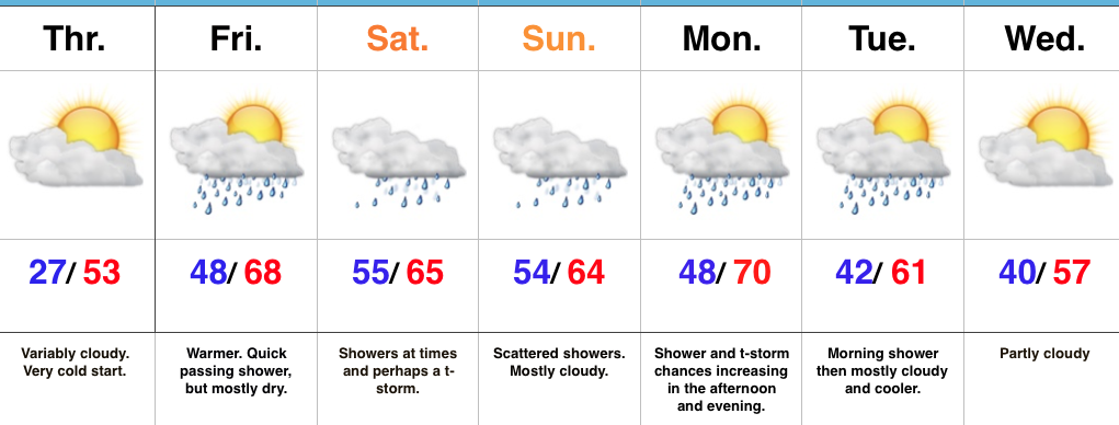 Highlights: