Pleasant Weather As We Close May…
 Highlights:
- Pleasant weather ahead
- Storm chances return to close the week
- Drier trend this weekend
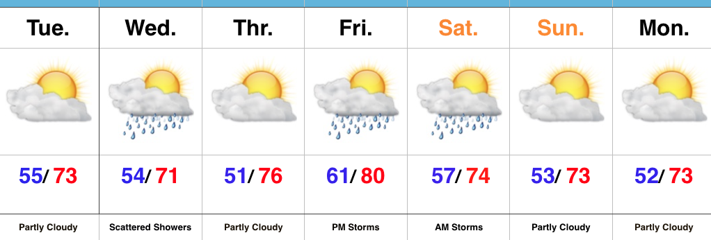
Happy Memorial Day…Before we look forward to the rest of the week, a secondary cold front will pass this evening and a couple of showers could bubble up as sunset nears. These won’t be a big deal and should be quick movers with cooler, drier air building in overnight. That will set the stage for a very pleasant midweek stretch, temperature-wise. Another round of showers are possible Wednesday, but more dry time can be expected than wet.
More widespread showers and thunderstorms will return as we close the work week and open the weekend. A cold front will push southeast Saturday morning and we’ll turn briefly warmer and more humid Friday with increasing thunderstorm chances during the back half of the day. Once the front slides to our south, drier and cooler air will quickly return. From this distance the weekend doesn’t look bad, at all. Unseasonably cool, dry air will continue next week.
Upcoming 7-Day Precipitation Forecast:
- Snowfall: 0.00″
- Rainfall: 0.50″ – 1.00″
 Highlights:
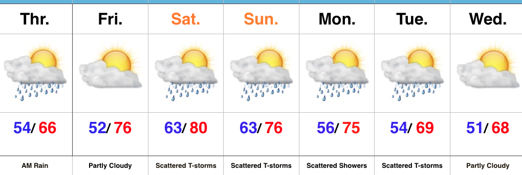 Highlights:
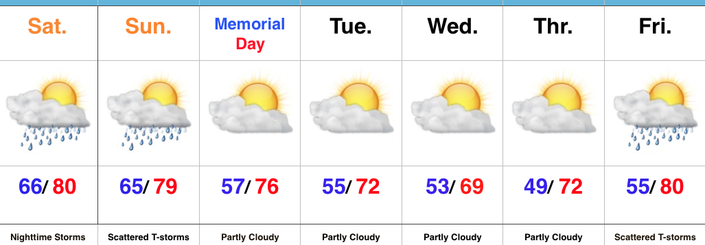
 While we can’t completely rule out an afternoon shower or storm Sunday, the most widespread activity should occur during the morning hours- before race time. Stay tuned. We’ll turn cooler early next week…
 Highlights: