Another Pleasant Day Then It’s Time To Sweat…
 Highlights:
- Another pleasant day ahead!
- Dry weather continues.
- The heat is on!
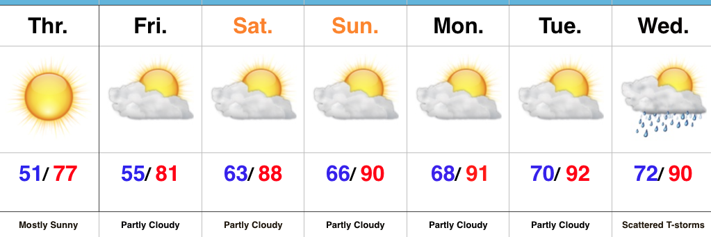
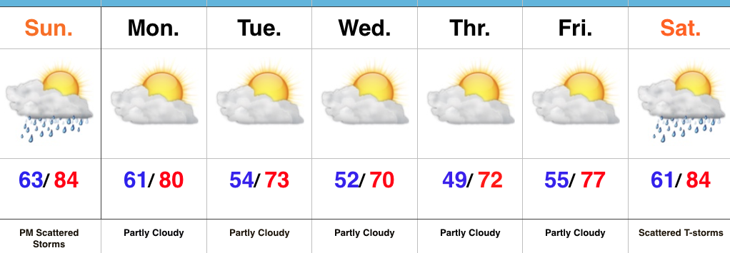
Dry Weather Continues; Summer Feel Develops…We’ll enjoy one more very pleasant and refreshing day Thursday, including plentiful sunshine, low humidity, and below normal temperatures. Many central Indiana neighborhoods will begin the day in the mid to upper 40s away from the city. Enjoy the pleasant weather while we’ve got it!
As we progress into the weekend, temperatures and humidity will begin to increase. By this time next week, overnight lows will be closer to today’s official (IND) high of 72°. One word: YUCK.
A couple of showers and thunderstorms are possible Friday afternoon, but most, if not all, of these look to remain confined to the northern third of the state. That’s the only chance of moisture until we rumble into the middle of next week. In addition to the continued bone dry conditions, unseasonably hot weather will build in over the Mid West and result in highs of 90°, or higher, Sunday into early next week.
Looking into the longer range, a more active and increasingly wet regime looks to return just past mid-month. While the early season heat and dry weather will be significant, thankfully it doesn’t look like it’ll last…
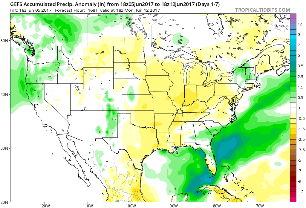
Upcoming 7-Day Precipitation Forecast:
- Snowfall: 0.00″
- Rainfall: 0.10″ – 0.25″
 In fact, we forecast highs Wednesday to only top the upper 60s, and this will be a good 10°-15° below average for June 7th. Lows each morning through Friday will start out in the lower-middle 50s for the city, itself, but some outlying neighborhoods will fall deep into the 40s. Very refreshing, indeed, for early June!
 High pressure will dominate our weather through late week, continuing the overall drier than normal theme.
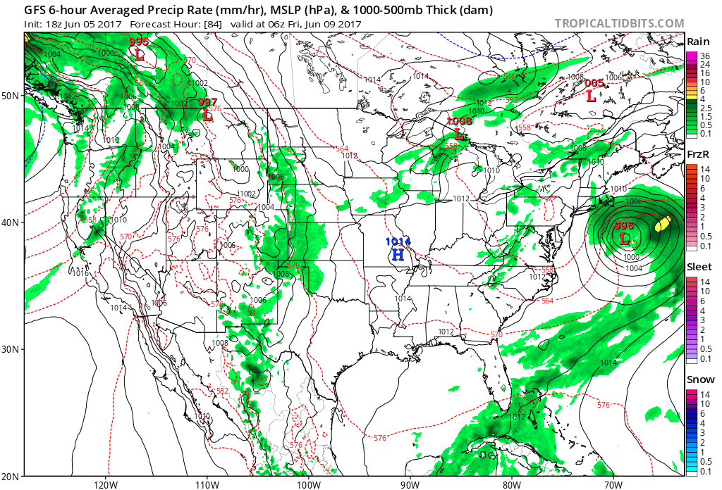
 Models slowly begin to increase moisture levels as we move into the weekend and an isolated shower or thunderstorm could develop, but widespread rains of significance aren’t anticipated for the foreseeable future.
 Highlights:
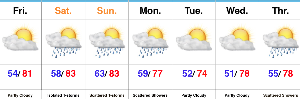 Highlights:
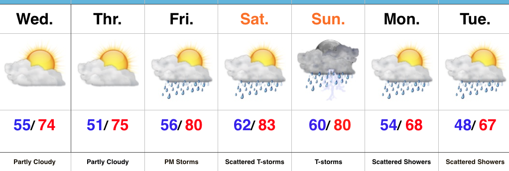 Highlights: