Unsettled Weather Returns; Feeling Like Late September By The Weekend…
 Highlights:
- Dry start to the work week
- Shower and storm chances return
- Much cooler by the weekend
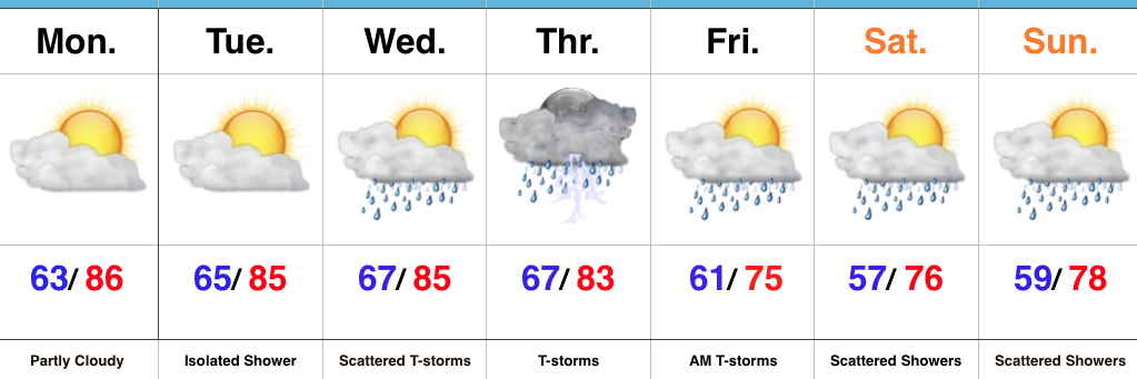
Welcome To A New Work Week…As we open the new work week, we’ll continue to deal with the same weather pattern that provided us the delightful weather over the weekend. High pressure will grudgingly give up control Tuesday into Wednesday with moisture returning. Initially, coverage of showers will be “spotty” at best, but better coverage of showers and thunderstorms will return as we progress into midweek. Thursday appears to be the wettest day as a cold front pushes closer to the region.
That cold front will sweep through the state Friday morning and result in a MUCH cooler air mass filtering into the region as we close the work week and head into the weekend. While we’ll certainly notice the much cooler air, we have to maintain mention of a passing shower over the weekend thanks to lingering upper level energy. Despite scattered showers around the region, most of the weekend will be rain-free. The bigger story will be the late-September like air over the weekend.
Upcoming 7-Day Precipitation Forecast:
- Snowfall: 0.00″
- Rainfall: 0.50″ – 1.00″
 Highlights:
 Highlights:
 Highlights:
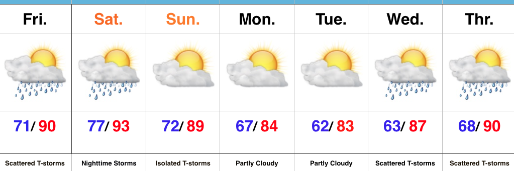 Highlights: