Gorgeous Weekend; Humidity Returns Next Week…
 Highlights:
- Beautiful weekend dialed up
- Humidity returns
- Scattered storms late week
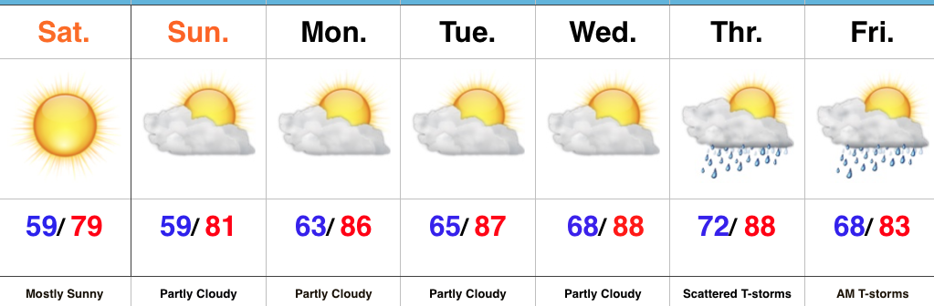
Refreshing Conditions Continue…A cold front settled south of the region last night, allowing drier and slightly cooler air to filter in during the overnight. That sets the stage for the weekend as we can expect dry and refreshing conditions, along with below average temperatures.
Dry skies will continue into the new work week, but humidity will slowly begin to increase once we get to midweek. A southwesterly air flow will develop ahead of our next storm system that will deliver scattered thunderstorms by Thursday. Shower and thunderstorm chances will continue Friday morning, however, early indications suggest next weekend is also dry.
Upcoming 7-Day Precipitation Forecast:
- Snowfall: 0.00″
- Rainfall: 0.25″ – 0.75″
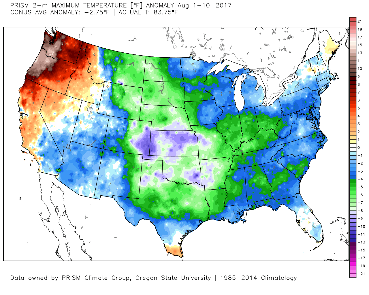
Cool August: The month has opened impressively cool with a CONUS average anomaly of – 2.75° through the 10th. More specifically to Indianapolis, we’re running 3° below normal through the 11th.
 Highlights:
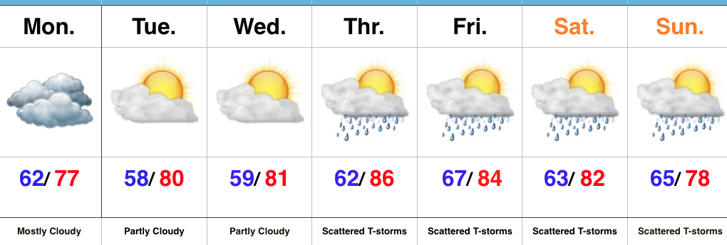 Highlights:
 Highlights:
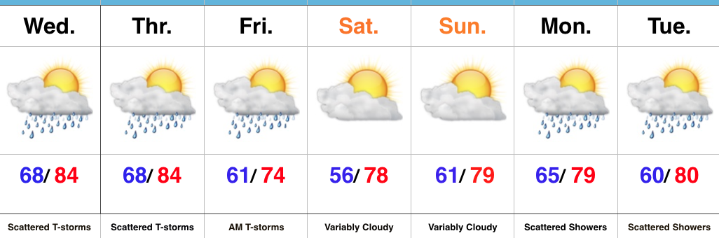 Highlights: